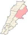
Haouch Tall Safiyeh
Appearance
(Redirected from Haush Tell Safiyeh)
Haouch Tall Safiyeh
حوش تل صفية | |
|---|---|
Village | |
| Coordinates: 34°01′30″N 36°08′23″E / 34.02500°N 36.13972°E | |
| Country | |
| Governorate | Baalbek-Hermel Governorate |
| District | Baalbek District |
| Area | |
• Total | 1.95 sq mi (5.05 km2) |
| Elevation | 3,363 ft (1,025 m) |
| Population | |
• Total | 2,000 |
| Time zone | UTC+2 (EET) |
| • Summer (DST) | +3 |
حوش تل صفية | |
| Location | 3km southwest of Yaate near Baalbek |
|---|---|
| Region | Bekaa Valley |
| Type | Tell |
| History | |
| Cultures | Neolithic |
| Site notes | |
| Excavation dates | 1933, 1954, 1957, 1966 |
| Archaeologists | A. Jirku, A. Kuschke, Lorraine Copeland |
| Condition | Ruins |
| Public access | Yes |
Haouch Tall Safiyeh or Haouch Tal Safiya (حوش تل صفية) is a village and an archaeological site 3 km southwest of Yaate near Baalbek in Baalbek-Hermel Governorate. It dates at least to the Neolithic period.[1] The village is mostly Shiite, with 499 Shiite voters, 171 Maronites and 14 Sunnis.[2]
History
[edit]In 1838, Eli Smith noted Haush Tell Safiyeh as a Metawileh village in the Baalbek area.[3]
References
[edit]- ^ Université Saint-Joseph (Beirut; Lebanon) (1969). Mélanges de l'Université Saint-Joseph, p.82. Impr. catholique. Retrieved 25 March 2011.
- ^ "Haouch Tall Safiyeh | Drupal". www.libandata.org. Retrieved 2023-03-14.
- ^ Robinson, Edward; Smith, Eli (1841). Biblical researches in Palestine, Mount Sinai and Arabia Petraea : a journal of travels in the year 1838. Robarts - University of Toronto. Boston : Crocker. p. 145.


