
Milford, Connecticut
Milford, Connecticut | |
|---|---|
| File:M281.jpg | |
 Seal | |
| Nickname: A Small City with a Big Heart | |
| NECTA | Bridgeport-Stamford |
| Region | South Central Region |
| Named | 1640 |
| Incorporated (city) | 1959 |
| Government | |
| • Type | Mayor-council |
| • Mayor | James L. Richetelli, Jr. |
| Population (2005) | |
| • Total | 54,802 |
| Time zone | UTC-5 (Eastern) |
| • Summer (DST) | UTC-4 (Eastern) |
| ZIP code | 06460, 06461 |
| Website | http://www.ci.milford.ct.us/ |
Milford is a city in New Haven County, Connecticut, United States. The population was 50,594 at the 2000 census. The city contains the Borough of Woodmont (a separate incorporated place within the city). The current mayor of Milford is James L. Richetelli, Jr.
The city has grown noticeably over the years, including rapid revitalization of the downtown and retail growth along Route 1, and today Milford faces the typical modern issue of deciding how much land to develop and how much to keep natural, especially in light of the city's location at the mouth of the Housatonic River. Laws favoring the preservation and restoration of older homes have helped maintain a traditional New England town ambience.
Further information: Economic development of Milford, Connecticut
History
Early history

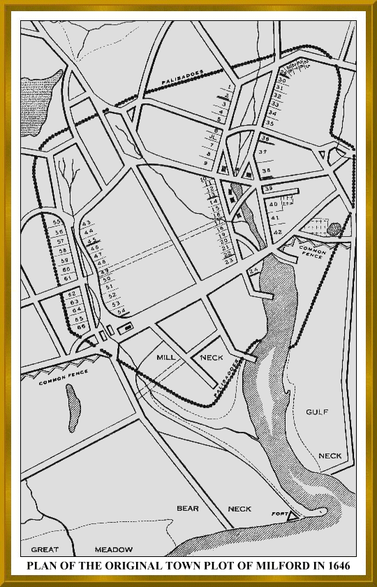
The land which today comprises Milford, Orange and West Haven, Connecticut was purchased on February 1, 1639 from Ansantawae, chief of the local Paugusset tribe by English settlers affiliated with the contemporary New Haven Colony. Originally, the area was known as "Wepawaug", after the small river which runs through the town, and which has given its name to several streets in both Milford and Orange.
During the Revolutionary War the Milford section of the Boston Post Road, a vital route connecting Boston, New York and other major coastal cities, was blockaded by Continental forces and Fort Trumbull was constructed to protect the town. The site of the blockade is commemorated by the Liberty Rock monument.
By 1822, the town had grown large enough that residents in the northern and eastern sections of Milford chartered their own independent course as the town of Orange. During the next century and a half, the remaining section of Milford was known for shipbuilding, farming and oystering, although a small subset of industrial facilities also developed in town. During this time, Milford also became known as a beach resort for residents of New Haven and Bridgeport.
Interestingly, the boundaries of the final town charter granted by the State of Connecticut in 1899 to Laurel Beach are contained entirely within Milford. Residents of Laurel Beach must therefore pay taxes to both Laurel Beach as well as Milford, and all mail to Laurel Beach residents is mailed to Milford.
In 1915 a portion of the town was incorporated as the borough of Woodmont. In 1959, the remainder of the town of Milford was incorporated as the City of Milford.
Post-World War II development
In the post-World War II period, Milford -- like many other New England towns -- underwent significant suburbanization. Interstate 95 was routed through town and the Milford section was completed by 1960.
The 1960s and '70s witnessed the construction of the Westfield Connecticut Post Mall, one of the state's largest shopping malls, and the extensive commercial development of the town's stretch of the Boston Post Road.
The city also became host to several headquarters of multinational corporations, including the Subway fast-food corporation. The town also hosts the headquarters of the BIC Corporation, which has in recent years moved most of its operation outside of the city.
On the National Register of Historic Places
- Buckingham House — 61 North St. (added August 25, 1977)
- Eells-Stow House — 34 High St. (added July 17, 1977)
- Hebrew Congregation of Woodmont — 15 and 17 Edgefield Ave. (added August 21, 1995)
- Housatonic River Railroad Bridge — Amtrak right-of-way at Housatonic River (added July 12, 1987)
- Milford Point Hotel — Milford Point Road (added February 22, 1988)
- River Park Historic District — Roughly bounded by Boston Post Road, Cherry St. and Amtrak, and High St. (added September 14, 1986)
- St. Peter's Episcopal Church — 61, 71, 81 River St. (added September 21, 1979)
- Taylor Memorial Library — 5 Broad St. (added September 21, 1979)
- US Post Office-Milford Main — 6 W. River St. (added October 25, 1986)
Principal communities of Milford
- Bayview
- Devon
- Morningside
- Rivercliff
- Walnut Beach
- Wildermere Beach
- Woodmont borough
Culture

Every year in August, Milford celebrates its annual Oyster Festival, which serves as a combination of a typical town fair with a culinary celebration of the town's location on historically shellfish-rich Long Island Sound. This festival is held on the Milford Green, in the center of town, and features a wide variety of events including canoe and kayak races, musical performances, and classic car shows.
Milford is home to a substantial art community. The Milford Cultural Center, operated by the Milford Council for the Arts, offers various events throughout the year. The Firehouse Art Gallery was recently opened in Devon.
The beach resort quality of the town lives on, with several beaches, Silver Sands State Park, the Audubon Coastal Center, Charles Island, two golf courses, and numerous other recreational facilities available for residents and tourists, while the proximity to New Haven, rail transport to New York City, a good school system, and a shuttle bus service that traverses the town supply some urban conveniences.
Geography and the environment
According to the United States Census Bureau, the balance has a total area of 61.5 km² (23.7 mi²). 57.7 km² (22.3 mi²) of it is land and 3.8 km² (1.5 mi²) of it (6.15%) is water.
Milford's Devon neighborhood is located at the mouth of the Housatonic River near Stratford, and is possessed of an Audubon Center overlooking the estuary.
A large portion of Milford's shoreline forms the Silver Sands State Park. Charles Island, also a part of the park, is a protected nesting ground.
Demographics
| Historical population of Milford[1][2] | |
| 1756 | 1,633 |
| 1774 | 2,127 |
| 1782 | 2,195 |
| 1790 | 2,098 |
| 1800 | 2,417 |
| 1810 | 2,674 |
| 1820 | 2,785 |
| 1830 | 2,256 |
| 1840 | 2,455 |
| 1850 | 2,465 |
| 1860 | 2,828 |
| 1870 | 3,405 |
| 1880 | 3,347 |
| 1890 | 3,811 |
| 1900 | 3,783 |
| 1910 | 4,366 |
| 1920 | 10,193 |
| 1930 | 12,660 |
| 1940 | 16,439 |
| 1950 | 26,870 |
| 1960 | 41,662 |
| 1970 | 50,858 |
| 1980 | 50,898 |
| 1990 | 49,938 |
| 2000 | 52,212 |
| 2002 | 53,472 (estimate) |
As of the census² of 2000, there were 52,212 people, 20,138 households, and 13,613 families residing in the balance. The population density was 876.8/km² (2,270.7/mi²). There were 21,145 housing units at an average density of 366.4/km² (949.0/mi²). The racial makeup of the balance was 93.55% White, 1.91% African American, 0.13% Native American, 2.36% Asian, 0.03% Pacific Islander, 0.88% from other races, and 1.14% from two or more races. Hispanic or Latino of any race were 3.34% of the population.
There were 20,138 households out of which 29.3% had children under the age of 18 living with them, 54.7% were married couples living together, 9.7% had a female householder with no husband present, and 32.4% were non-families. 26.3% of all households were made up of individuals and 10.3% had someone living alone who was 65 years of age or older. The average household size was 2.49 and the average family size was 3.04.
In the balance the population was spread out with 22.4% under the age of 18, 5.9% from 18 to 24, 31.7% from 25 to 44, 25.0% from 45 to 64, and 14.9% who were 65 years of age or older. The median age was 39 years. For every 100 females there were 93.6 males. For every 100 females age 18 and over, there were 90.0 males.
The median income for a household in the balance was $51,167, and the median income for a family was $61,175. Males had a median income of $48,368 versus $36,770 for females. The per capita income for the balance was $28,773. About 2.4% of families and 3.8% of the population were below the poverty line, including 4.1% of those under age 18 and 5.4% of those age 65 or over.
| Voter Registration and Party Enrollment as of October 25, 2005[1] | |||||||||||||||||||||||||
|---|---|---|---|---|---|---|---|---|---|---|---|---|---|---|---|---|---|---|---|---|---|---|---|---|---|
| Party | Active Voters | Inactive Voters | Total Voters | Percentage | Democratic | 7,806 | 411 | 8,217 | 24.84% | Republican | 7,238 | 419 | 7,657 | 23.14% | Unaffiliated | 16,152 | 1,003 | 17,155 | 51.86% | Minor Parties | 47 | 7 | 54 | 0.16% | |
| Total | 31,243 | 1,840 | 33,083 | 100% | |||||||||||||||||||||
Notable residents, past and present
- Milford was the home and final resting place of Peter Pond, the first explorer of the Athabasca region of North America in the 1780s.
- Local legend has it that Captain Kidd buried treasure on Charles Island. No treasure has ever been found. The island does contain the ruins of an abandoned Catholic monastery.
- Milford is also the birthplace of American actress Christy Carlson Romano.
- Milford is also home to its own Jazz musician, Jay Rowe
- Chris Bruno and brother Dylan Bruno, actors: both born in Milford
- Frank J. Sprague (1857–1934) inventor who helped develop the electric motor, electric railways, and electric elevators.
- Justin Maher, football star at Divisino 1 AA powerhouse College of the Holy Cross, has been reported to be dating Hollywood Starlet Keira Knightley
Movies filmed in Milford
Full-length feature and documentary movies filmed at least in part in Milford, in reverse chronological order:
- Save the Forest (2005)
- Daylight (1996)
- Man on a Swing (1974)
- Candy (1968)
Source: Internet Movie DataBase Web site's page for Milford, Connecticut
MSNBC/CT Post Top Stories
References
- ^ "Registration and Party Enrollment Statistics as of October 25, 2005" (PDF). Connecticut Secretary of State. Retrieved 2006-10-02.
External links
- City of Milford official Web site
- History of Milford, CT
- Milford Oyster Festival official site
- http://www.woodmontucc.org/
- Cities and boroughs of Connecticut with dates of incorporation
- 1646 Map of Milford, CT
- Irish Heritage Society of Milford official site
- Village of Devon Official Web Site