List of cities in West Virginia
Appearance


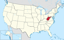
West Virginia is a state located in the Southern United States. The following is a list of cities in West Virginia, arranged by population.
List by population
| 2014 Rank | City | 2014 Estimate[1] | 2010 Census[2] | Change | County |
|---|---|---|---|---|---|
| 1 | Charleston †† | 50,404 | 51,400 | −1.94% | Kanawha |
| 2 | Huntington | 48,807 | 49,138 | −0.67% | Cabell |
| 3 | Morgantown | 31,073 | 29,660 | +4.76% | Monongalia |
| 4 | Parkersburg | 30,981 | 31,492 | −1.62% | Wood |
| 5 | Wheeling | 27,790 | 28,486 | −2.44% | Ohio |
| 6 | Weirton | 19,362 | 19,746 | −1.94% | Hancock |
| 7 | Fairmont | 18,740 | 18,704 | +0.19% | Marion |
| 8 | Martinsburg | 17,743 | 17,227 | +3.00% | Berkeley |
| 9 | Beckley | 17,238 | 17,614 | −2.13% | Raleigh |
| 10 | Clarksburg | 16,242 | 16,578 | −2.03% | Harrison |
| 11 | South Charleston | 13,214 | 13,450 | −1.75% | Kanawha |
| 12 | St. Albans | 10,835 | 11,044 | −1.89% | Kanawha |
| 13 | Vienna | 10,562 | 10,749 | −1.74% | Wood |
| 14 | Bluefield | 10,448 | 10,447 | +0.01% | Mercer |
| 15 | Moundsville | 8,891 | 9,318 | −4.58% | Marshall |
| 16 | Bridgeport | 8,358 | 8,149 | +2.56% | Harrison |
| 17 | Oak Hill | 8,175 | 7,730 | +5.76% | Fayette |
| 18 | Dunbar | 7,749 | 7,907 | −2.00% | Kanawha |
| 19 | Elkins | 7,286 | 7,094 | +2.71% | Randolph |
| 20 | Nitro | 6,837 | 7,178 | −4.75% | Kanawha |
| 21 | Hurricane | 6,396 | 6,284 | +1.78% | Putnam |
| 22 | Princeton | 6,359 | 6,432 | −1.13% | Mercer |
| 23 | Charles Town | 5,706 | 5,259 | +8.50% | Jefferson |
| 24 | Buckhannon | 5,679 | 5,639 | +0.71% | Upshur |
| 25 | Keyser | 5,264 | 5,439 | −3.22% | Mineral |
| 26 | New Martinsville | 5,254 | 5,366 | −2.09% | Wetzel |
| 27 | Grafton | 5,199 | 5,164 | +0.68% | Taylor |
| 28 | Ranson | 4,830 | 4,440 | +8.78% | Jefferson |
| 29 | Point Pleasant | 4,284 | 4,350 | −1.52% | Mason |
| 30 | Westover | 4,173 | 3,983 | +4.77% | Monongalia |
| 31 | Weston | 4,079 | 4,110 | −0.75% | Lewis |
| 32 | Lewisburg | 3,939 | 3,830 | +2.85% | Greenbrier |
| 33 | Ravenswood | 3,834 | 3,876 | −1.08% | Jackson |
| 34 | Summersville | 3,513 | 3,572 | −1.65% | Nicholas |
| 35 | Ripley | 3,242 | 3,252 | −0.31% | Jackson |
| 36 | Philippi | 3,233 | 2,966 | +9.00% | Barbour |
| 37 | Pleasant Valley | 3,185 | 3,149 | +1.14% | Marion |
| 38 | Kenova | 3,096 | 3,216 | −3.73% | Wayne |
| 39 | Williamson | 3,051 | 3,191 | −4.39% | Mingo |
| 40 | Madison | 2,968 | 3,076 | −3.51% | Boone |
| 41 | Kingwood | 2,956 | 2,939 | +0.58% | Preston |
| 42 | Williamstown | 2,936 | 2,908 | +0.96% | Wood |
| 43 | Follansbee | 2,911 | 2,986 | −2.51% | Brooke |
| 44 | Wellsburg | 2,725 | 2,805 | −2.85% | Brooke |
| 45 | Hinton | 2,556 | 2,676 | −4.48% | Summers |
| 46 | Paden City | 2,540 | 2,633 | −3.53% | Wetzel |
| 47 | Granville | 2,529 | 781 | +223.82% | Monongalia |
| 48 | Chester | 2,527 | 2,585 | −2.24% | Hancock |
| 49 | Petersburg | 2,451 | 2,467 | −0.65% | Grant |
| 50 | White Sulphur Springs | 2,441 | 2,444 | −0.12% | Greenbrier |
| 51 | Spencer | 2,234 | 2,322 | −3.79% | Roane |
| 52 | Shinnston | 2,178 | 2,201 | −1.04% | Harrison |
| 53 | Welch | 2,154 | 2,406 | −10.47% | McDowell |
| 54 | Mannington | 2,072 | 2,063 | +0.44% | Marion |
| 55 | Richwood | 2,001 | 2,051 | −2.44% | Nicholas |
| 56 | McMechen | 1,866 | 1,926 | −3.12% | Marshall |
| 57 | St. Marys | 1,860 | 1,860 | 0.00% | Pleasants |
| 58 | Romney | 1,788 | 1,848 | −3.25% | Hampshire |
| 59 | Stonewood | 1,772 | 1,806 | −1.88% | Harrison |
| 60 | Ronceverte | 1,753 | 1,765 | −0.68% | Greenbrier |
| 61 | Logan | 1,682 | 1,779 | −5.45% | Logan |
| 62 | Montgomery | 1,607 | 1,638 | −1.89% | Fayette |
| 63 | Salem | 1,557 | 1,586 | −1.83% | Harrison |
| 64 | Mullens | 1,494 | 1,559 | −4.17% | Wyoming |
| 65 | Glen Dale | 1,483 | 1,526 | −2.82% | Marshall |
| 66 | Marmet | 1,469 | 1,503 | −2.26% | Kanawha |
| 67 | Parsons | 1,427 | 1,485 | −3.91% | Tucker |
| 68 | Ansted | 1,398 | 1,404 | −0.43% | Fayette |
| 69 | Ceredo | 1,395 | 1,450 | −3.79% | Wayne |
| 70 | Mabscott | 1,388 | 1,408 | −1.42% | Raleigh |
| 71 | Wayne | 1,385 | 1,413 | −1.98% | Wayne |
| 72 | Benwood | 1,378 | 1,420 | −2.96% | Marshall |
| 73 | Sistersville | 1,375 | 1,396 | −1.50% | Tyler |
| 74 | Mount Hope | 1,370 | 1,414 | −3.11% | Fayette |
| 75 | Pennsboro | 1,085 | 1,171 | −7.34% | Ritchie |
| 76 | New Cumberland | 1,076 | 1,103 | −2.45% | Hancock |
| 77 | Cameron | 915 | 946 | −3.28% | Marshall |
| 78 | Thomas | 564 | 586 | −3.75% | Tucker |
| 79 | Belmont | 903 | 903 | 0.00% | Pleasants |
| 80 | War | 793 | 862 | −8.00% | McDowell |
See also
- West Virginia
- List of towns in West Virginia
- List of villages in West Virginia
- List of census-designated places in West Virginia
References
- ^ "Annual Estimates of the Resident Population for Incorporated Places: April 1, 2010 to July 1, 2014". United States Census Bureau. Retrieved June 24, 2015.
- ^ "2010 Census Redistricting Data (Public Law 94-171) Summary File". American FactFinder2. U.S. Census Bureau, 2010 Census. Retrieved 23 August 2014.
