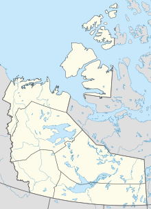
Mould Bay Airport
Appearance
Mould Bay Airport | |||||||||||
|---|---|---|---|---|---|---|---|---|---|---|---|
| Summary | |||||||||||
| Airport type | |||||||||||
| Operator | |||||||||||
| Location | Prince Patrick Island, Northwest Territories, Canada | ||||||||||
| Time zone | MST (UTC−07:00) | ||||||||||
| • Summer (DST) | MDT (UTC−06:00) | ||||||||||
| Coordinates | 76°14′21″N 119°19′07″W / 76.23917°N 119.31861°W | ||||||||||
| Map | |||||||||||
 | |||||||||||
| Runways | |||||||||||
| |||||||||||
Source: Canada Flight Supplement[1] | |||||||||||
Mould Bay Airport (IATA: YMD, ICAO: CYMD) was located on the Prince Patrick Island, Northwest Territories, Canada. It was built in 1948 as a joint effort between Canada and the United States to service the former Environment Canada weather station. The station was automated in 1997 which eliminated the need for an airport; however, the island is still occasionally visited by members of the Canadian Forces.[2]
References
- ^ Canada Flight Supplement. Effective 0901Z 16 July 2020 to 0901Z 10 September 2020.
- ^ Nuttall, Mark (2012). Encyclopedia of the Arctic. Routledge. p. 1696. ISBN 1579584365.
External links

