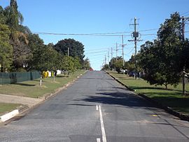
One Mile, Queensland
Appearance
| One Mile Ipswich, Queensland | |||||||||||||||
|---|---|---|---|---|---|---|---|---|---|---|---|---|---|---|---|
 Philip Street, 2016 | |||||||||||||||
| Population | 1,1993 (2011)[1] | ||||||||||||||
| Postcode(s) | 4305 | ||||||||||||||
| Location | |||||||||||||||
| LGA(s) | City of Ipswich | ||||||||||||||
| State electorate(s) | Electoral district of Ipswich West | ||||||||||||||
| Federal division(s) | Blair | ||||||||||||||
| |||||||||||||||
One Mile is a suburb of Ipswich, Queensland, Australia. At the 2011 Australian Census the suburb recorded a population of 1,993.[1]
The origin of the suburb name is from its approximate distance from the Ipswich CBD.[2]
References
- ^ a b Australian Bureau of Statistics (31 October 2012). "One Mile (State Suburb)". 2011 Census QuickStats. Retrieved 2016-06-30.
- ^ Place name details
External links
27°38′S 152°44′E / 27.633°S 152.733°E
