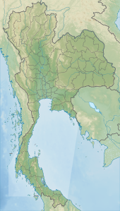
Phu Pha Man National Park
| Phu Pha Man National Park | |
|---|---|
| อุทยานแห่งชาติภูผาม่าน | |
| Location | Thailand |
| Nearest city | Khon Kaen |
| Coordinates | 16°44′38″N 102°0′4″E / 16.74389°N 102.00111°E |
| Area | 350 km2 (140 sq mi) |
| Governing body | Department of National Parks, Wildlife and Plant Conservation |
Phu Pha Man National Park (Template:Lang-th) is a national park in Thailand's Khon Kaen and Loei provinces. This forested park is home to caves, waterfalls and steep cliffs.
Geography
Phu Pha Man National Park is located about 100 kilometres (60 mi) west of the city of Khon Kaen in the Phu Pha Man and Chum Phae districts of Khon Kaen Province and Phu Kradueng District of Loei Province. The park's area is 350 square kilometres (140 sq mi).[1] Park elevations range from 200 metres (700 ft) to 800 metres (2,620 ft).[2]
Attractions
Klang Khao cave is notable for its large daily exodus of bats at dusk, making a formation about 10 kilometres (6 mi) long. Other park caves feature stalagmite and stalactite formations. The Lai Thaeng cave hosts rock paintings dating back up to 2,000 years.[1]
The park's highest waterfall is Tat Yai waterfall at 80 metres (260 ft) high. Tat Rong waterfall reaches 60–70 metres (200–230 ft) high. The black rock Pha Nok Khao cliff rises above the Phong river.[1]
Flora and fauna
The park's forest types are mostly evergreen and mixed deciduous. Plant life includes rattan, orchid and cogon grass. Park animal species include wild boar, barking deer and pangolin.[2]
References
- ^ a b c "Phu Pha Man National Park". Tourism Authority of Thailand. Retrieved 22 Dec 2015.
- ^ a b "Phu Pha Man National Park". Department of National Parks (Thailand). Retrieved 22 Dec 2015.

