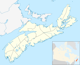
Port Clyde, Nova Scotia
Appearance
Port Clyde | |
|---|---|
| Coordinates: 43°36′18″N 65°28′05″W / 43.605°N 65.468056°W[1] | |
| Country | |
| Province | |
| County | Shelburne |
| Municipal district | Shelburne |
| Time zone | UTC-4 (AST) |
| • Summer (DST) | UTC-3 (ADT) |
| Postal code(s) | |
| Area code | 902 |
| Access Routes | |
Port Clyde is a community in the Canadian province of Nova Scotia, located in the Shelburne Municipal District of Shelburne County.[3]
The community was a notable producer of wooden sailing ships in the Age of Sail, including the schooner Codseeker which survived a famous shipwreck just after she was built in 1877.
See also
References
External links

