
Big Horn County, Montana
Big Horn County | |
|---|---|
 Location within the U.S. state of Montana | |
 Montana's location within the U.S. | |
| Coordinates: 45°26′N 107°29′W / 45.43°N 107.49°W | |
| Country | |
| State | |
| Founded | 1864 |
| Seat | Hardin |
| Largest city | Hardin |
| Area | |
| • Total | 5,015 sq mi (12,990 km2) |
| • Land | 4,995 sq mi (12,940 km2) |
| • Water | 20 sq mi (50 km2) 0.40% |
| Population (2010) | |
| • Total | 12,865 |
| • Density | 3/sq mi (1/km2) |
| Website | bighorn |
Big Horn County is a county located in the U.S. state of Montana. As of 2010, the population was 12,865.[1] The county seat is Hardin.Template:Geographic reference
History
The county, like the river and mountain range, were named for the bighorn sheep in the Rocky Mountains.[2]
Law and Government
The county has several jurisdictions, each with its own regulations and law enforcement agencies. The Crow and Northern Cheyenne Indian Nations are administered by the tribes. Little Bighorn Battlefield and the Big Horn Canyon National Recreation Area are regulated by the National Park Service. The remainder of the county falls under the State of Montana.
Geography
According to the U.S. Census Bureau, the county has a total area of 5,015 square miles (12,988.8 km2), of which 4,995 square miles (12,937.0 km2) is land and 20 square miles (51.8 km2) (0.40%) is water. Most of the county's land area comprises Indian reservations: The Crow Indian Reservation covers 64.2 percent of its area, while the Northern Cheyenne Indian Reservation covers another 6.37 percent.
The county is home to the Big Horn, Pryor and Wolf Mountain ranges.
Major highways
 Interstate 90
 U.S. Highway 87
 U.S. Highway 212
- Montana Highway 313
- Montana Highway 314
 Montana Highway 47
Adjacent counties
- Carbon County, Montana - west
- Yellowstone County, Montana - northwest
- Treasure County, Montana - north
- Rosebud County, Montana - northeast
- Powder River County, Montana - east
- Sheridan County, Wyoming - south
- Big Horn County, Wyoming - southwest
Places adjacent to Big Horn County, Montana | |
|---|---|
National protected areas
Economy
Coal Mining and Agriculture both play major roles in Big Horn County’s economy. Farms and ranches in the county produce mainly beef cattle, sugar beets, alfalfa, and small grains.[3]
Demographics
| Census | Pop. | Note | %± |
|---|---|---|---|
| 1920 | 7,015 | — | |
| 1930 | 8,543 | 21.8% | |
| 1940 | 10,419 | 22.0% | |
| 1950 | 9,824 | −5.7% | |
| 1960 | 10,007 | 1.9% | |
| 1970 | 10,057 | 0.5% | |
| 1980 | 11,096 | 10.3% | |
| 1990 | 11,337 | 2.2% | |
| 2000 | 12,671 | 11.8% | |
| 2010 | 12,865 | 1.5% |
As of the censusTemplate:Geographic reference of 2000, there were 12,671 people, 3,924 households, and 3,033 families residing in the county. The population density was 2 people per square mile (1/km²). There were 4,655 housing units at an average density of <1/km² (1/sq mi). The racial makeup of the county was 36.60% White, 0.04% Black or African American, 59.66% Native American, 0.22% Asian, 0.01% Pacific Islander, 0.68% from other races, and 2.79% from two or more races. 3.67% of the population were Hispanic or Latino of any race. 13.9% were of German ancestry according to Census 2000. 67.1% spoke English, 27.9% Crow, 2.5% Cheyenne and 1.3% Spanish as their first language.
There were 3,924 households out of which 42.40% had children under the age of 18 living with them, 54.00% were married couples living together, 17.60% had a female householder with no husband present, and 22.70% were non-families. 19.30% of all households were made up of individuals and 6.70% had someone living alone who was 65 years of age or older. The average household size was 3.17 and the average family size was 3.66.
In the county the population was spread out with 35.80% under the age of 18, 8.60% from 18 to 24, 26.50% from 25 to 44, 20.50% from 45 to 64, and 8.60% who were 65 years of age or older. The median age was 30 years. For every 100 females there were 97.30 males. For every 100 females age 18 and over, there were 91.00 males.
The median income for a household in the county was $27,684, and the median income for a family was $31,095. Males had a median income of $23,814 versus $18,884 for females. The per capita income for the county was $10,792. About 23.70% of families and 29.20% of the population were below the poverty line, including 37.00% of those under age 18 and 20.10% of those age 65 or over.
Communities
City
Town
Census-designated places
Other communities
See also
- List of cemeteries in Big Horn County, Montana
- List of lakes in Big Horn County, Montana
- List of mountains in Big Horn County, Montana
- National Register of Historic Places listings in Big Horn County, Montana
References
- ^ "Big Horn County, Montana". United States Census Bureau. Retrieved October 9, 2011.
- ^ Merrill, Andrea (1997). Montana almanac. Helena, Montana: Falcon Publishing. p. 7. ISBN 1-56044-493-2.
{{cite book}}:|access-date=requires|url=(help); Unknown parameter|coauthors=ignored (|author=suggested) (help) - ^ State of Montana. "Big Horn County" (PDF). Retrieved 31 May 2011.
External links
Municipalities and communities of Big Horn County, Montana, United States | ||
|---|---|---|
| City | 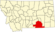 | |
| Town | ||
| CDPs | ||
| Other communities | ||
| Indian reservations | ||
| Footnotes | ‡This populated place also has portions in an adjacent county or counties | |