
Shimoga
This article needs additional citations for verification. (July 2012) |
Shimoga
Śivamogga Sihimoge | |
|---|---|
Shimoga city | |
 Tunga River | |
| Country | India |
| State | Karnataka |
| District | Shimoga District |
| Elevation | 569 m (1,867 ft) |
| Population (2011 census) | |
| • Total | 322,428 |
| Languages | |
| • Official | Kannada |
| Time zone | UTC+5:30 (IST) |
| PIN | 577201 - 577205 |
| Telephone code | 08182 |
| Vehicle registration | KA 14 |
Shimoga (known locally as Śivamogga) is a city in Shimoga District in the central part of the state of Karnataka, India. It lies on the banks of the Tunga River and is the administrative headquarters of the district.
The population of Shimoga is 322,428, consisting of 161,978 males and 160,450 females, as per 2011 census.[1]
History
The name of the city is derived from the term "Shiva-Mukha", meaning "Face of Shiva". An alternative etymology is that the name is derived from the term "Sihi-Moge", meaning "sweet pot". The district formed the southern tip of Emperor Ashoka's Mauryan Empire in the third century BC.[citation needed] It was ruled during later centuries by the Kadambas (4th century), Chalukyas (6th century), Gangas, Rashtrakutas (8th century), Hoysalas (11th century), and the Vijayanagara rulers (15th century). The city got an independent identity under the Keladi Nayaka rule during the 16th century[citation needed], reaching its pinnacle under the rule of Shivappa Nayaka. From the late 17th century onwards, the city was a part of the Kingdom of Mysore until the independence of India in 1947, when Mysore merged into the Republic of India.
On 1 November 2006, the government of Karnataka announced the renaming of Shimoga to "Shivamogga", along with nine other cities in the state, but the renaming is yet to get approval from the Central Government.[2]
Geography
According to the Shimoga City Municipal Corporation,[3] the city has a total area of about 50 km2 (19 sq mi). The climate is tropical wet and dry (Köppen climate classification) summer average temperature 20–35 °C (68–95 °F). This means that the winter and the early part of summer are typically dry periods. The majority of the rainfall occurs between June and early October. Shimoga is a part of a region known as Malnad (land of hills) in Karnataka. Most/all these hills are part of the Western Ghats, a region known for plentiful rainfall and lush greenery and declared during 2012 as a World Heritage site.
Tunga River flows through Shimoga and Bhadra river flows thorugh Bhadravathi.
Climate
| Climate data for Shimoga | |||||||||||||
|---|---|---|---|---|---|---|---|---|---|---|---|---|---|
| Month | Jan | Feb | Mar | Apr | May | Jun | Jul | Aug | Sep | Oct | Nov | Dec | Year |
| Mean daily maximum °C (°F) | 31 (88) |
31 (88) |
32 (90) |
32 (90) |
32 (90) |
28 (82) |
27 (81) |
27 (81) |
28 (82) |
30 (86) |
31 (88) |
31 (88) |
30 (86) |
| Mean daily minimum °C (°F) | 21 (70) |
22 (72) |
24 (75) |
25 (77) |
26 (79) |
24 (75) |
23 (73) |
23 (73) |
23 (73) |
23 (73) |
23 (73) |
22 (72) |
23 (73) |
| Average precipitation mm (inches) | 3 (0.1) |
3 (0.1) |
5 (0.2) |
38 (1.5) |
157 (6.2) |
942 (37.1) |
988 (38.9) |
597 (23.5) |
267 (10.5) |
208 (8.2) |
74 (2.9) |
13 (0.5) |
3,292 (129.6) |
| Source: Shimoga Weather | |||||||||||||
In summer (April-May), temperature crosses 36 degree centigrade at Shimoga.[4]
Education
Shimoga is an important center for high school and pre-university education (classes 11th and 12th) in Karnataka, along with many other major cities in Karnataka. Bhadravathi is also a major education centre of the district. Notable institutes in Shimoga for pre-university (PU) education include: Sri Aurobindo Pre-University (Ind.) college, PACE Ultra Modern PU College, Vidya Bharathi PU College, National College,JPN High School, Vidyanikethan College, Sacred Heart, Adichunchangiri P.U. College, DVS P.U. Independent college, DVS Composite College, PES P.U. College. The city gains its importance in part because of lack of good institutes in other parts of the district.
The village of Gajanur hosts a Jawahar Navodaya Vidyalaya (central school) which is a boarding school. Kuvempu University is located in Shankarghatta, at a distance of 20 km from Shimoga.
Notable schools of Shimoga are Enchara, Jnanadeepa, Saandeepani, Vikasa, Swami Vivekananda, Oxford, Adi Chunchanagiri, PES, Sarvodaya, Mary Immaculate, Vasavi, Sanjos,Sacred Heart, Loyola, Ramakrishna, Rotary, Educare, Mahaveer, DVS.
Shimoga Institute of Medical Sciences is the medical sciences college at Shimoga and managed by Government Departments.Sharavathi Dental College is also located in Shimoga. Shimoga also has two engineering colleges, Jawaharlal Nehru National College of Engineering and PES Institute of Technology and Management. Sahyadri College for Science, Commerce and Arts is one of the oldest in Karnataka, run by the Government. TAMES Ayurvedic medical is in nearby Bhadravathi. It has also a veterinary college, which is one among the 4 colleges present in Karnataka.
Arts
Shimoga is known as the cultural capital of Karnataka and is also called the 'Rice Bowl of Karnataka'.[5] It is a modern, progressive city with strong cultural roots and warmhearted people.
"Kuvempu Rangamandira" and "Karnataka Sangha" are the major venues of the city for cultural activities.
Yakshagana, a dance drama, is popular in Thirthahalli, Hosanagara, Sagar, and Sorab Taluks of the district and this art is also performed in Shimoga. There are some professional and amateur troupes from Malnad region, performing this dance drama across Karnataka.
Shimoga-Bhadravathi twin cities
Bhadravathi is 20 km from Shimoga and a four-lane road connects the twin cities. Both are well connected by Road and Rail.There is a 20-year-old plan to make Shimoga and Bhadravathi twin cities and to establish Shimoga-Bhadravathi Mahanagara Palike and thereby develop both cities.[citation needed] Bhadravathi can be called as industrial town and factories like Visvesvaraya Iron and Steel Limited, Mysore Paper Mills etc. are located in Bhadravathi. Bhadravathi-Shimoga Industrial area, established at Machenahalli, in between the twin cities hosts several Industries. Companies like Xchanging have opened their units in Shimoga.[6]
Demographics
The population of Shimoga is 322,428, consisting of 161,978 males and 160,450 females, as per 2011 census.[1] Males constitute 51% of the population and females 49%. Shimoga has an average literacy rate of 88.02 %, higher than the national average of 59.5%: male literacy is 91.32%, and female literacy is 84.70%.Total children (0-6) in Shimoga city are 31,626 as per figure from Census India report on 2011. There were 16,130 boys while 15,496 are girls. Child sex ratio of girls is 961 per 1000 boys. [1]
Languages spoken
Kannada is widely spoken in the city. Urdu is also spoken by some section of society.
Activities
Industries like Pearlite Industries and several other Industries are located in Shimoga. APMC of Shimoga is main marketing point of arecanut, the major commercial crop grown in the district and well as in neighbouring districts like Uttara Kannada. Shimoga has the biggest areca nut market, and known for procuring high quality areca nuts. Other agricultural produces like rice, chili, coconut etc. are also marketed in APMC.
Transportation
By road
From the state capital Bangalore, Shivamogga can be reached on road by on NH-206. (via Tumkur, Arsikere, Banavara, Kadur, Birur, Tarikere, and Bhadravathi.) KSRTC, the Karnataka State Road Transport Corporation, runs several buses from Bangalore,including Hitech and night services. Shimoga is around 274 km (170 mi) by road from Bangalore. From coastal side, Shimoga is accessible by bus or car. This route passes through Agumbe Ghat or Balebare Ghat roads. Sringeri,Dharmastala, Hubli are connected by Road to this city. Shimoga is better connected with roads from all directions and as such, it is an important bus junction.
Shimoga Bus Terminal
The new bus station is spacious and can cater to 882 departures per day and it is one of the biggest bus terminals in the state. It offers facilities like parking bays, waiting lounges, restaurants, etc. This terminal, spread over five acres, has police outpost, computerized reservation counter and waiting rooms.
By rail
Shimoga Town has a railway station, and there are trains that run to and from Bangalore and Mysore. Direct trains to Shimoga from other parts of India are non-existent. Birur Junction, which is well-connected to most parts of India by rail (especially from Mumbai), is approximately 70 kilometres (45 mi)* from Shimoga and can be used as an alternative. The most popular trains from Shivamogga to Bangalore are the Shimoga Express and the Inter City Express Connection train. Intercity train has been introduced between Mysore and Talaguppa via Sagar Town (about 98 km or 61 mi from Shimoga and about 12 km or 7.5 mi from famous Jog Falls).
By air
Shimoga Airport is under construction in Sogane, 6 km from Shivamogga.[7]
Places of importance in and around Shimoga
- Shivappa Nayaka's palace is located within the city.
- Jog Falls are a large series of waterfalls, located 105 km (65 mi) from Shimoga in Sagar taluk. The Sharavathi River takes a spectacular jump from a height of 292 metres (958 ft) in four distinct falls to form the highest waterfalls in India. The best time to visit is soon after the monsoon season during July and August.

Jog Falls - Agumbe, 90 km (56 mi) south-west, is notable for its foarests and sunset.
- Kodachadri is a beautiful hill station in the Western Ghats. It is 120 km (75 mi) from Shimoga.
- Gajanur dam lies 15 km or 9 mi to the southwest.
- Koodli lies 15 km away and is the place where the Tunga and Bhadra rivers meet and flow together as Tungabhadra.

Koodli - Tyavarekoppa Lion and Tiger Safari lies 12 km on the way to Sagara. Safari drives are conducted by forest department.
- B R P Dam is 28 km (17 mi) from the city on the way to Lakkavalli. It is built on the Bhadra river with a height of 186 feet (57 m).
- Kavaledurga is a trekking spot around 80 km or 50 mi from Shimoga. A fort built on the hill top and the enchanting view of the western ghats can be seen from this place.
- Mrugavadhe lies in Thirthahalli taluk and is famous for its Mallikarjuna Temple and its scenic beauty.
- Sigandooru is 108 km (67 mi) from Shimoga in Sagar taluk. This place is famous for Sigandhoor Sridevi temple and to reach this place one has to go in a launch (due to backwaters of river Sharavathi) run by the state government.
- Sringeri is 105 km or 65 mi from Shimoga. This place is famous for the Sharada Temple and Sringeri Mutt.
- Sakkare Bayalu, elephant training camp2 km away from Gajanur Dam on the way to Thirthahalli.
- Ikkeri near Sagara city is known for rock temple of Aghoreshwara.
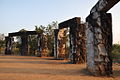
- Keladi also has rock temple; both of these temples belong to the Shivappa Nayaka period.

Rameshwara Temple in Keladi - Sagara town is known for wood carving articles, particularly of sandalwood.
- The village of Ambuthirtha is about 16 km or 10 mi northwest of Thirthahalli. The Sharavathi River originates here and a Shivalinga is installed at the spot.
- Kemmannagundi is a popular hill station near Shimoga which is in Chickmagalur district.
- Chibbalagude, Thirthahalli, is known for Siddhivinayaka Temple and fishs in Tunga river.
- A Shiva statue made of concrete,on river banks is installed at Harakere, near Shivamogga.
- Gudavi Bird Sanctuary is spread almost over an area of 0.7 km in Soraba Taluk of Shimoga District.
- Mandagadde Bird Sanctuary, near Thirthahalli is home to wide variety of water birds.
- Guddekal has Subrahmanya Temple near Tunga River on Holehonnur Road.
- Kuppalli, near Thirthahalli, is famous for its historic Kavishaila and Kavimane.
- Sharavathi Wildlife Sanctuary, in Sagara Taluk, is home to mammals, reptiles and birds.
- Nagara was the last capital of the Keladi rulers and known for Shivappa Nayaka Palace, Fort, Devaganga Tank, Neelakanteshwara Temple and Gudde Venkataramana Swamy Temple.
- Balligavi, 21 km (13 mi) from Shikaripura, was the capital of Banavasi rulers. It is also known as 'Dakshina Kedara' and it has many historic temples like the Kedareshwara temple made out of soap stone.
- Humcha, a renowned Jain pilgrimage centre has many Jain basadis, temples and mutts.


Accommodation
There are several hotels and guest houses of all categories in Shimoga, for a comfortable stay.
Notable persons from Shimoga District
- Kuvempu, Jnanpith Award winner
- U R Ananthamurthy, Jnanpith Award winner

U R Ananthamurthy - Girish Kasaravalli, well-known film director and national award winner
- B.S. Yeddyurappa, former Chief Minister of Karnataka
- Poorna Chandra Tejaswi, Kuvempu's son and writer
- M. K. Indira is a well-known novelist; many of her novels have been adopted for Kannada movies
- P. Lankesh, writer-journalist and tabloid publisher (Lankesh Patrike)
- Ha. Ma. Nayaka, well-known columnist and winner of Central Sahitya Academy Award (for his columns) and personally responsible for the development of Kannada department (Kannada Adhyayana Samsthe) at the University of Mysore. He was the vice chancellor of Gulbarga University.
- G. S. Shivarudrappa, well-known poet and professor, has won many awards and is renowned as 'Navodaya Poet'
- Gundappa Viswanath, former India cricket player
- K. V. Subbanna, Magsaysay award winner
- S. Bangarappa, former Chief Minister of Karnataka
- K.S. Eshwarappa, State BJP President
- J.H Patel, former Chief Minister of Karnataka
- Kadidal Manjappa, former Chief Minister of Karnataka
- Khadi Shankarappa, veteran Freedom Fighter
- Shantaveri Gopala Gowda, leader of socialist movement
- N. S. Lakshminarayan Bhat, poet, winner of Sahitya Academy Award
- Justice M. Rama Jois, former Judge of Supreme Court and former Governor of Jharkhand
- Shimoga Subbanna, Kannada Sugama Sangeetha singer and playback singer
- Sudeep, famous actor and director of Kannada cinema
- Diganth, the current heartthrob of Kannada cinema
- Bharat Chipli, cricketer, plays for Karnataka and Deccan Chargers
- G.V. Shivakumar, Kabbadi captain, Mysore Team-National Champions

Gallery
-
 Jog Falls during monsoon
 -
 Koodli - Sangameshwara Temple
 -
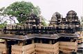
 Keladi - Rameshwara Temple
 -
 Hidlumane Falls near Nittur
 -
 Kuppalli - Kavishaila
 -
 Ikkeri - Aghoreshwara Temple
 -
 Balligavi - Kedareshwara Temple
 -
 Bhadra Reservoir Project Dam (B R P Dam)


See also
References
- ^ a b c census2011, co.in. "Shimoga City". Census of India 2011. Population census of India. Retrieved 29 July 2012.
{{cite web}}: CS1 maint: numeric names: authors list (link) - ^ "It's Bengaluru for Pranab". The Times Of India. 2009-07-07.
- ^ "Shimoga Municipal corporation".
- ^ World weather online, .com. "Shimoga weather". Retrieved 26 July 2012.
- ^ "Welcome to shimoga".
- ^ . 11-jul-2012 http://www.business-standard.com/india/news/xchanging-opens-global-delivery-centre-in-shimoga/178235/on.
{{cite news}}: Check date values in:|date=(help); Missing or empty|title=(help) - ^ The, Hindu (8 April,2006). "Airport at Shimoga likely to come up at Sogane". Bangalore: The Hindu. Retrieved 10 August 2012.
{{cite news}}: Check date values in:|date=(help); Cite has empty unknown parameter:|coauthors=(help); More than one of|author=and|last=specified (help)
- Sources
External links
- Profiles of all the Districts in Karnataka
- Shimoga Zilla Panchayat
- Shimoga Profile
- ShimogaOnline
- Western Ghats
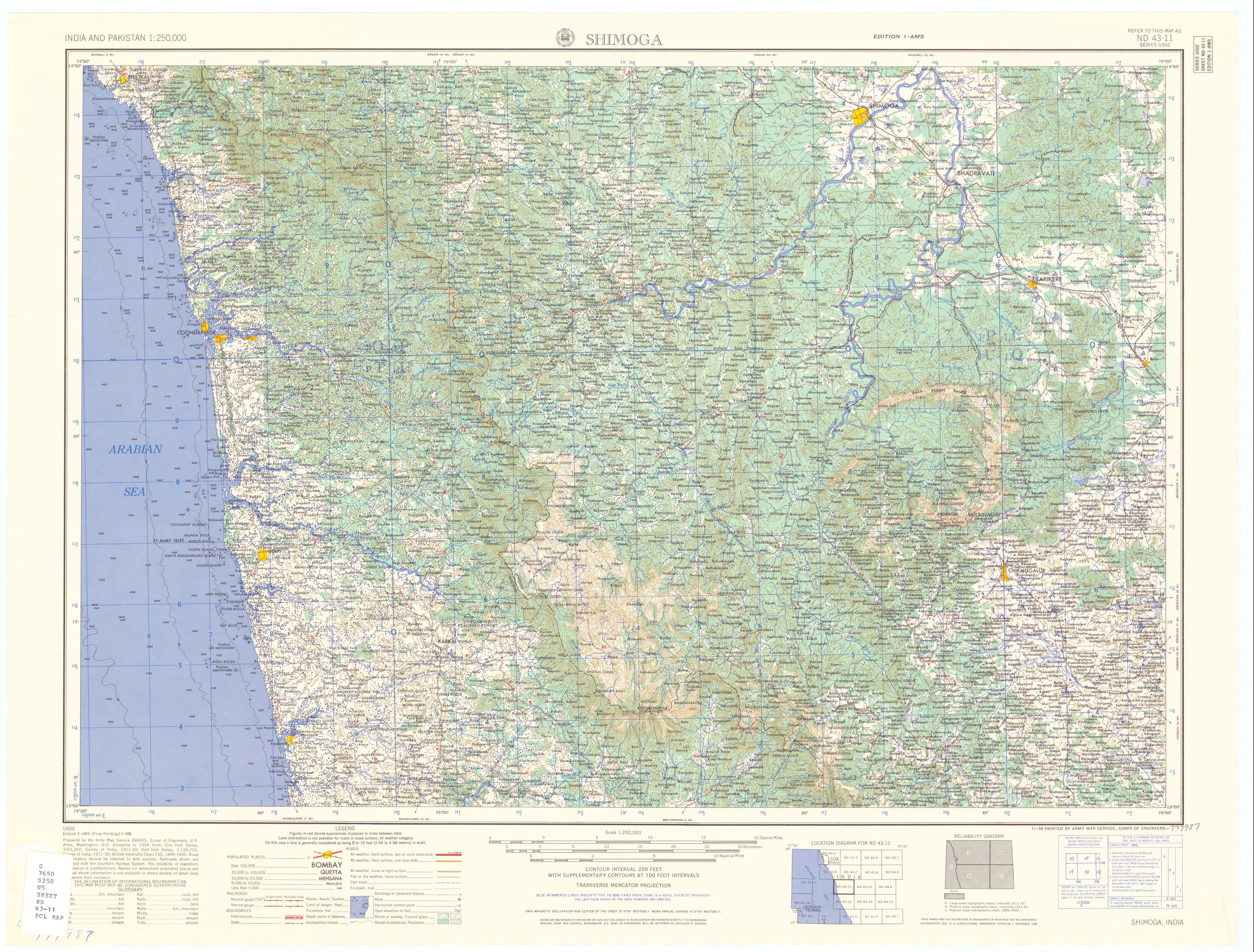
- Map of Shimoga District
- U.S. Army Corps of Engineers detailed map of Shimoga district 1959
- Shimoga City Website