
South Holland
South Holland
Zuid-Holland (Dutch) | |
|---|---|
 Coat of arms | |
| Anthem: Lied van Zuid-Holland | |
 | |
| Country | Netherlands |
| Largest city | Rotterdam |
| Capital | The Hague |
| Government | |
| • Queen's Commissioner | Jan Franssen |
| Area | |
| • Land | 2,818 km2 (1,088 sq mi) |
| • Water | 585 km2 (226 sq mi) |
| • Rank | 5th |
| Population (2011) | |
| • Land | 3,528,324 |
| • Rank | 1st |
| • Density | 1,300/km2 (3,200/sq mi) |
| • Rank | 1st |
| ISO 3166 code | NL-ZH |
| Religion (2005) | Protestant 20% Roman Catholic 15% Muslim 8% Hindus 2% |
| Website | www.zuid-holland.nl |

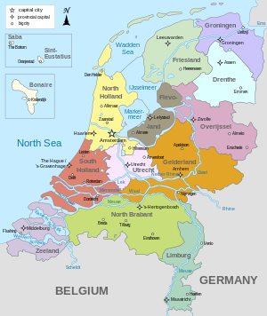
South Holland (Dutch: Zuid-Holland [ˈzœy̆t ˈɦɔlɐnt] is a province situated on the North Sea in the western part of the Netherlands. The provincial capital is The Hague and its largest city is Rotterdam.
South Holland is one of the most densely populated and industrialised areas in the world. With a population of 3,502,595 (30 November 2009) and an area of 3,403 km², the province has the highest population density in the Netherlands.
History
For more on the history of South Holland in the context of Dutch history, see the article on the "History of the Netherlands". The history of this province can also be found in the articles on its constituent elements (e.g. Rotterdam, The Hague, etc.) The information here pertains just to South Holland itself.[1]
Before 1795
For most of its history, the modern-day province of South Holland was an integral part of Holland.
From the 9th century to the 16th century, Holland was a county of the Holy Roman Empire, and was ruled by the counts of Holland. Some of the counts were powerful magnates who also ruled many other territories, culminating in a period of rule by the House of Habsburg which was terminated by the Dutch Revolt.
From the 16th century to 1795, Holland was the wealthiest and most important province in the United Provinces in the Dutch Republic. As the richest and most powerful province, Holland dominated the union. During this period a distinction was sometimes made between the "North Quarter" (Noorderkwartier) and the "South Quarter" (Zuiderkwartier), areas that roughly correspond to the two modern provinces.
The emergence of a new province (1795 to 1840)
The province of South Holland as it is today has its origins in the period of French rule from 1795 to 1813. This was a time of bewildering changes to the Dutch system of provinces. In 1795 the old order was swept away and the Batavian Republic was established. In the Constitution enacted on 23 April 1798, the old borders were radically changed. The republic was reorganised into eight departments (département) with roughly equal populations. Holland was split up into five departments named "Texel", "Amstel", "Delf", "Schelde en Maas", and "Rijn". The first three of these lay within the borders of the old Holland; the latter two were made up of parts of different provinces. In 1801 the old borders were restored when the department of Holland was created. This reorganisation had been short-lived, but it gave birth to the concept of breaking up Holland and making it a less powerful province.
In 1807, Holland was reorganised once again. This time the two departments were called "Maasland" (corresponding to the modern province of South Holland) and "Amstelland" (corresponding to the modern province of North Holland). This also did not last long. In 1810, all the Dutch provinces were integrated into the French Empire. Maasland was renamed "Monden van de Maas" (Bouches-de-la-Meuse in French). Amstelland and Utrecht were amalgamated as the department of "Zuiderzee" (Zuyderzée in French).
After the defeat of the French in 1813, this organisation remained unchanged for a year or so. When the 1814 Constitution was introduced, the country was reorganised as provinces and regions (landschappen). Monden van de Maas and Zuiderzee were reunited as the province of "Holland".
However, the division was not totally reversed. When the province of Holland was re-established in 1814, it was given two governors, one for the former department of Maasland (i.e. the area that is now South Holland) and one for the former department of Amstelland (i.e. the area that is now North Holland). Even though the province had been reunited, the two areas were still being treated differently in some ways and the idea of dividing Holland remained alive.
When the constitutional amendments were introduced in 1840, it was decided to split Holland once again, this time into two provinces called "South Holland" and "North Holland". The impetus came largely from Amsterdam in North Holland, which still resented the 1838 relocation of the court of appeal to The Hague in South Holland.
1840 to today
Since 1840, South Holland has ceded three municipalities to the province of Utrecht: Oudewater in 1970, Woerden in 1989, and Vianen in 2002.
In the period 2004 to 2006, there was a municipal reorganisation.
- On 1 January 2004 the municipalities De Lier, 's-Gravenzande, Monster, Naaldwijk and Wateringen were merged into a new municipality Westland, and Maasland and Schipluiden to another one, Midden-Delfland.
- On 1 January 2006 Sassenheim, Voorhout and Warmond were merged into Teylingen, and Rijnsburg and Valkenburg were merged into Katwijk.
- On 1 January 2007 Ter Aar and Liemeer were merged into Nieuwkoop, Bleiswijk, Berkel en Rodenrijs and Bergschenhoek were merged into a new municipallity Lansingerland and 's-Gravendeel was merged into Binnenmaas.
Municipalities
South Holland is divided into 72 municipalities. In the Netherlands a municipality (gemeente) may consist of a single city or town or it may consist of a number of smaller towns and villages.
Municipalities (with links to maps)
Municipalities (table)

| CBS-code | Municipality | Population | Land area (km2) | Population density (/km2)
Template:Do for every South Holland municipality code|} Islands of South Holland The islands are listed here alphabetically. A few of these islands bear the same name as a municipality (and are therefore linked to the information about the municipality).
Regions in South HollandSome of the regions in South Holland are official regional groupings artificially created for various administrative purposes. Other regions have developed their own identities for historical, geographic or other reasons. These regions are sometimes undefined and overlapping. The province is officially divided into four regions:
Another official region is the Zuidvleugel ("The South Wing"), which refers to the conurbation consisting of the southern wing of the Randstad. Some of the other regions in South Holland:
See also
Notes
External links
Links to maps
Entries for South Holland in worldwide gazetteers
| |||||||||
|---|---|---|---|---|---|---|---|---|---|---|---|---|---|

