Naikoon Provincial Park
Tools
Actions
General
Print/export
In other projects
Appearance
From Wikipedia, the free encyclopedia
This is an old revision of this page, as edited by Rosspotter (talk | contribs) at 06:56, 15 September 2022 (add link). The present address (URL) is a permanent link to this revision, which may differ significantly from the current revision.
Provincial Park in British Columbia
| Naikoon Provincial Park | |
|---|---|
 View of North Beach from Tow Hill | |
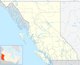
| Location | North Coast RD, British Columbia |
| Nearest city | Masset |
| Coordinates | 53°50′N 131°54′W / 53.84°N 131.90°W / 53.84; -131.90 |
| Area | 69,071 ha (266.68 sq mi) |
| Established | May 18, 1973 |
| Governing body | BC Parks |
| Website | bcparks |
Naikoon Provincial Park is a provincial park on northeastern Graham Island in the Haida Gwaii archipelago, British Columbia, Canada. It is the ancestral home of the Gwak'rala'chala people, one of the many tribes that form the native group Haida. While it is a popular destination for adventurous campers, it is also very secluded, being over 16 km (9.9 mi) away from Masset.
See also
References
- ^ "Naikoon Park". Protected Planet. Retrieved 2020-09-16.
- Ross, Matt. Haida Nation secures park management contract. Raven's Eye; Jun2003, Vol. 7 Issue 2, p12, 1/3p[dead link]
- Seattle Post-Intelligencer, July 4, 2007. Haida Country: It takes a certain ruggedness to live here
External links
Wikimedia Commons has media related to Naikoon Provincial Park.
- Official website

 Naikoon Provincial Park travel guide from Wikivoyage
- "Naikoon Park". BC Geographical Names.
- BritishColumbia.com - BC Parks - Naikoon Provincial Park, Queen Charlotte Islands
This article about a location on the Coast of British Columbia, Canada is a stub. You can help Wikipedia by expanding it. |

