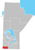
Rural Municipality of Whitewater
Appearance
The Rural Municipality of Whitewater is a former rural municipality (RM) in the Canadian province of Manitoba. It was originally incorporated as a rural municipality on December 22, 1883.[1] It ceased on January 1, 2015 as a result of its provincially mandated amalgamation with the RM of Cameron and the Town of Hartney to form the Municipality of Grassland.[2]
Communities
References
- ^ "Manitoba's Municipal History: Rural Municipalities and Local Government Districts". The Manitoba Historical Society. September 21, 2014. Retrieved January 2, 2015.
- ^ "Manitoba's Municipal History: Municipal Amalgamations (2015)". The Manitoba Historical Society. December 1, 2014. Retrieved January 2, 2015.
- Manitoba Historical Society - Manitoba Municipalities: Rural Municipality of Whitewater
- Map of Whitewater R.M. at Statcan
External links
- Regional Municipality of Whitewater (archived July 19, 2014)
This article needs additional citations for verification. (January 2012) |
49°26′37″N 100°06′17″W / 49.44361°N 100.10472°W

