Bambang, Taguig
Bambang | |
|---|---|
 Barangay hall | |
 Location of Bambang in Taguig | |
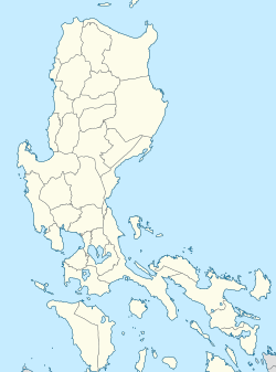
Location of Bambang within Metro Manila Location of Bambang within Luzon | |
| Coordinates: 14°31′32.69″N 121°4′22.49″E / 14.5257472°N 121.0729139°E | |
| Country | Philippines |
| Region | Metro Manila |
| City | Taguig |
| District | District 1 |
| Government | |
| • Type | Sangguniang Barangay |
| • Barangay Captain | Ryan Esteban |
| • Barangay Councilor |
|
| • Sangguniang Kabataan Chairperson | Adrian Sinues |
| Area | |
• Total | 0.92 km2 (0.36 sq mi) |
| Population (2020)[2] | |
• Total | 13,949 |
| Time zone | UTC+08:00 |
| Area code | 02[3] |
Bambang, officially Barangay Bambang, is one of the 38 barangays of Taguig, Metro Manila, Philippines. As of the 2020 census, the population was 13,949. Located near the Taguig River, it is one of the nine original barrios of the city when the latter was first established on April 25, 1587.
Etymology
[edit]The name "Bambang" is derived from the word bambang (Tagalog pronunciation: [bɐmˈbaŋ]), meaning the banks of a river, due to the barangay's location near the shores of Taguig River where it was established by early Tagalogs.[4]: 207 According to a legend, based on the barangay's profile posted on the official website of Taguig, the name is also derived from the word bamban (Tagalog pronunciation: [bɐmˈban̪]), meaning an egg with soft shell.[5]
History
[edit]During the Spanish rule of the Philippines, Bambang became one of the nine original barrios of Taguig,[6] a pueblo (town) that was established as part of the province of Manila on April 25, 1587.[4]: 28 When the country gained its independence from Spain on June 12, 1898, Isabelo Bautista was appointed as the village president (Filipino: pangulo ng nayon) of the barrio.[4]: 29 In February 1945, during the Japanese occupation of the Philippines, soldiers of the Imperial Japanese Army destroyed the concrete bridge connecting the barrio to Tuktukan and the wooden bridge connecting to Santa Ana to stall the impending arrival of American troops as they began to retreat to Kay-Patag Hills (present-day location of Camp Bagong Diwa). That month, American soldiers who had recaptured Fort William McKinley traversed Pateros and arrived at Bambang.[7] Bambang was later converted into a barangay by the virtue of Presidential Decree No. 557 signed by then-President Ferdinand Marcos on September 21, 1974.[8]
Geography
[edit]Bambang has a total land area of 0.92 square kilometers (92 hectares).[4]: 94 It has six adjacent barangays: Tuktukan and Ususan on the north, San Miguel (previously part of Hagonoy) on the south, Santa Ana and Wawa on the east, and Pinagsama (previously part of Western Bicutan) on the west.[4]: 207
Demographics
[edit]| Year | Population | ±% |
|---|---|---|
| 1903 | 380 | — |
| 1918 | 505 | +32.9% |
| 1960 | 1,427 | +182.6% |
| 1970a | 2,497 | +75.0% |
| 1975 | 2,722 | +9.0% |
| 1980 | 3,188 | +17.1% |
| 1985b | — | — |
| 1990 | 4,478 | — |
| 1995 | 4,623 | +3.2% |
| 2000 | 5,304 | +14.7% |
| 2007c | 6,199 | +16.9% |
| 2010 | 7,168 | +15.6% |
| 2015 | 10,010 | +39.6% |
| 2020 | 13,949 | +39.4% |
| a The Philippines began to conduct census every five years starting 1970 b No census was held in 1985 due to a political and economic crisis c Census was delayed from the original 2005 due to the reenacted budget that lasted until 2006 Source: United States Bureau of the Census (1903 census),[9] Census Office of the Philippine Islands (1918 census),[10] Bureau of the Census and Statistics (1960 census),[11] National Census and Statistics Office (1970,[12] 1975,[13] 1980,[14] and 1990[15] census), National Statistics Office (1995,[16] 2000,[17] 2007,[18] and 2010[19] census), and Philippine Statistics Authority (2015 and 2020 census)[2] | ||
As of the 2020 Philippine census, there were 13,949 residents of Bambang.[2]
Government
[edit]Floro Hernandez was the barangay captain (Filipino: kapitan ng barangay) of Bambang in 2002,[20] followed by Fernando Espiritu in 2007,[5] Danilo Manalo in 2010,[21] and Jaime Cruz in 2013.[22] Cruz was reelected in 2018 and served until 2023.[23] As of 2023, the incumbent barangay captain is Ryan Esteban, along with Manalo, Katherine Sta. Ana, Nenita Sinues, Ricardo Manalo Jr., Robin Bernardino, Francisco Esteban Jr., and Jezzer Ignacio as barangay councilors (Filipino: mga kagawad ng barangay), and Adrian Sinues as Sangguniang Kabataan chairperson.[1]
Landmarks
[edit]The churches that can be found in Bambang are San Juan de Sahagun Chapel of the Roman Catholic Church and a chapel of Iglesia ni Cristo.[4]: 207
References
[edit]- ^ a b Hicap, Jonathan (November 8, 2023). "Comelec releases list of winners in barangay, SK elections in Taguig". Manila Bulletin. Archived from the original on June 8, 2024. Retrieved July 8, 2024.
- ^ a b c "2020 Census of Population and Housing" (PDF). Philippine Statistics Authority. p. 70. Archived (PDF) from the original on April 9, 2024. Retrieved July 9, 2024.
- ^ "8-digit landline numbers in NCR to start in October". Philippine News Agency. July 24, 2019. Archived from the original on June 10, 2024. Retrieved July 8, 2024.
- ^ a b c d e f "Taguig City Comprehensive Land Use & Zoning Plan – Physical & Socio-Economic Profile". City Planning & Development Office. Archived from the original on June 11, 2024. Retrieved July 9, 2024 – via Scribd.
- ^ a b "Brgy. Bambang". taguig.gov.ph. Archived from the original on August 3, 2008. Retrieved July 8, 2024.
- ^ "9 Original Barrios of Taguig During Spanish Era". Lino Cayetano. June 19, 2019. Archived from the original on June 11, 2024. Retrieved July 9, 2024 – via Facebook.
- ^ Balderrama, Lito (January 4, 2019). "Araw ng Pagpapalaya Sa Taguig, Pebrero 23, 1945" [Taguig Liberation Day, February 23, 1945] (in Filipino). Taguig Heritage Society. Archived from the original on July 9, 2024. Retrieved July 9, 2024 – via WordPress.
- ^ Presidential Decree No. 557 (September 21, 1974), Declaring All Barrios in the Philippines as Barangays, and for Other Purposes, archived from the original on June 11, 2024, retrieved July 9, 2024
- ^ Census of the Philippine Islands: Taken Under the Direction of the Philippine Commission in the Year 1903. Vol. II. United States Bureau of the Census. 1905. p. 197. Retrieved July 9, 2024 – via Internet Archive.
- ^ Census of the Philippine Islands: Taken Under the Direction of the Philippine Legislature in the Year 1918. Vol. II. Census Office of the Philippine Islands. 1921. p. 235. Archived from the original on June 13, 2024. Retrieved July 9, 2024 – via University of Santo Tomas – Miguel de Benavides Library and Archives.
- ^ "1960 Census of Population and Housing of the Philippines – Rizal". Bureau of the Census and Statistics. 1963. Retrieved July 9, 2024 – via Internet Archive.
- ^ "1970 Census of Population and Housing – Rizal" (PDF). Philippine Statistics Authority. p. 4. Archived from the original (PDF) on June 12, 2024. Retrieved July 9, 2024.
- ^ "1975 Integrated Census of the Population and Its Economic Activities – Population Rizal" (PDF). Philippine Statistics Authority. p. 13. Archived from the original (PDF) on June 12, 2024. Retrieved July 9, 2024.
- ^ "1980 Population Count" (PDF). Philippine Statistics Authority. p. 51. Archived from the original (PDF) on June 27, 2023. Retrieved July 9, 2024.
- ^ "1990 Census of Population and Housing" (PDF). Philippine Statistics Authority. Archived (PDF) from the original on June 12, 2024. Retrieved July 9, 2024.
- ^ "Population Census". National Statistics Office. Archived from the original on February 11, 1998. Retrieved July 9, 2024.
- ^ "Census 2000". National Statistics Office. Archived from the original on April 5, 2002. Retrieved July 9, 2024.
- ^ "2007 Census of Population". National Statistics Office. Archived from the original on February 9, 2010. Retrieved July 9, 2024.
- ^ "2010 Census of Population and Housing" (PDF). Philippine Statistics Authority. p. 49. Archived (PDF) from the original on April 10, 2024. Retrieved July 9, 2024.
- ^ "Elected Officials". taguig.gov.ph. Archived from the original on March 16, 2005. Retrieved July 11, 2024.
- ^ "List of Punong Barangays as of September 29, 2011" (PDF). Department of Interior and Local Government. September 29, 2011. Archived from the original (PDF) on December 16, 2011. Retrieved July 8, 2024.
- ^ "List of Punong Barangays as of August 11, 2014". Department of Interior and Local Government. August 11, 2014. Archived from the original on January 18, 2017. Retrieved July 8, 2024.
- ^ "Masterlist of Officials – National Capital Region". Department of Interior and Local Government. June 28, 2021. Archived from the original on June 27, 2021. Retrieved July 8, 2024.
External links
[edit] Media related to Bambang, Taguig at Wikimedia Commons


