Fort Liard Airport
Appearance
Fort Liard Airport | |||||||||||
|---|---|---|---|---|---|---|---|---|---|---|---|
 Final runway 03 Fort Liard | |||||||||||
 Fort Liard Terminal building | |||||||||||
| Summary | |||||||||||
| Airport type | Public | ||||||||||
| Operator | Government of the Northwest Territories | ||||||||||
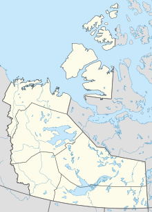
| Location | Fort Liard, Northwest Territories | ||||||||||
| Time zone | MST (UTC−07:00) | ||||||||||
| • Summer (DST) | MDT (UTC−06:00) | ||||||||||
| Elevation AMSL | 708 ft / 216 m | ||||||||||
| Coordinates | 60°14′08″N 123°28′12″W / 60.23556°N 123.47000°W | ||||||||||
| Map | |||||||||||
| Runways | |||||||||||
| |||||||||||
| Statistics (2010) | |||||||||||
| |||||||||||
Fort Liard Airport (IATA: YJF, ICAO: CYJF) is located adjacent to Fort Liard, Northwest Territories, Canada. North Cariboo Air offers charter services from the airport.[4]
References
- ^ Canada Flight Supplement. Effective 0901Z 16 July 2020 to 0901Z 10 September 2020.
- ^ Synoptic/Metstat Station Information Archived December 1, 2011, at the Wayback Machine
- ^ Total aircraft movements by class of operation
- ^ North Cariboo Air
External links
- Past three hours METARs, SPECI and current TAFs for Fort Liard Airport from Nav Canada as available.

