Hølonda
Hølonda Municipality
Hølonda herad Høilandet | |
|---|---|
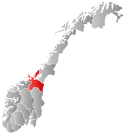
 Sør-Trøndelag within Norway | |
 Hølonda within Sør-Trøndelag | |
| Coordinates: 63°06′49″N 10°01′23″E / 63.11361°N 10.02306°E | |
| Country | Norway |
| County | Sør-Trøndelag |
| District | Gauldalen |
| Established | 1865 |
| • Preceded by | Melhus in 1865 |
| Disestablished | 1 Jan 1964 |
| • Succeeded by | Melhus in 1964 |
| Administrative centre | Korsvegen |
| Area (upon dissolution) | |
| • Total | 167 km2 (64 sq mi) |
| Population (1964) | |
| • Total | 1,428 |
| • Density | 8.6/km2 (22/sq mi) |
| Demonym | Hølonding[1] |
| Time zone | UTC+01:00 (CET) |
| • Summer (DST) | UTC+02:00 (CEST) |
| ISO 3166 code | NO-1651[2] |
Hølonda is a former municipality in the old Sør-Trøndelag county, Norway. The 167-square-kilometre (64 sq mi) municipality existed from 1865 until its dissolution in 1964. Hølonda encompassed the southwestern part of what is now the municipality of Melhus in Trøndelag county. The municipality was west of the river Gaula. The administrative centre was the village of Korsvegen. The main church for the municipality was Hølonda Church, near Gåsbakken.[3]
History
The municipality of Høilandet (later changed to Hølonda) was established in 1865 when it was separated from the old municipality of Melhus. The new municipality had an initial population of 1,818. During the 1960s, there were many municipal mergers across Norway due to the work of the Schei Committee. On 1 January 1964, the neighboring municipalities of Hølonda (population: 1,428), Horg (population: 2,560), Flå (population: 843), Melhus (population: 3,978), and the Langørgen farm (population: 11) in Buvik were all merged to form a new, larger municipality of Melhus.[4]
Name
The municipality (originally the parish) was named Hølonda (Old Norse: Høylandir). The first element is høy which means "high" and the last element is the plural form of land which means "land" or "district". Prior to 1889, the name was written Høilandet, then from 1889 until 1931 it was written Hølandet, and then from 1932 until its dissolution in 1964, it was spelled Hølonda.[5]
See also
References
- ^ "Navn på steder og personer: Innbyggjarnamn" (in Norwegian). Språkrådet.
- ^ Bolstad, Erik; Thorsnæs, Geir, eds. (2023-01-26). "Kommunenummer". Store norske leksikon (in Norwegian). Kunnskapsforlaget.
- ^ Thorsnæs, Geir, ed. (2017-09-12). "Hølonda – tidligere kommune". Store norske leksikon (in Norwegian). Kunnskapsforlaget. Retrieved 2018-01-28.
- ^ Jukvam, Dag (1999). "Historisk oversikt over endringer i kommune- og fylkesinndelingen" (PDF) (in Norwegian). Statistisk sentralbyrå.
- ^ Rygh, Oluf (1901). Norske gaardnavne: Søndre Trondhjems amt (in Norwegian) (14 ed.). Kristiania, Norge: W. C. Fabritius & sønners bogtrikkeri. p. 267.

