Gyeongsan
Gyeongsan
경산시 | |
|---|---|
| Korean transcription(s) | |
| • Hangul | 경산시 |
| • Hanja | 慶山市 |
| • Revised Romanization | Gyeongsan-si |
| • McCune-Reischauer | Kyŏngsan-si |
 | |
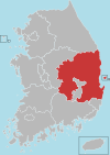
 Location in South Korea | |
| Country | |
| Region | Yeongnam |
| Administrative divisions | 2 eup, 6 myeon, 6 dong |
| Area | |
| • Total | 411.58 km2 (158.91 sq mi) |
| Population (September 2024[1]) | |
| • Total | 266,951 |
| • Density | 574.52/km2 (1,488.0/sq mi) |
| • Dialect | Gyeongsang |
| Area code | +82-53-8xx |
This article needs additional citations for verification. (August 2024) |
Gyeongsan (Korean: 경산; Korean pronunciation: [kjʌŋ.san]) is a satellite city in North Gyeongsang Province, South Korea. Its western border abuts the metropolitan city of Daegu, and much of Gyeongsan lies within the Daegu metropolitan area.
Numerous universities are located in Gyeongsan, such as Yeungnam University, Daegu University, Daekyeung University, Catholic University of Daegu, Daegu Haany University and Gyeongil University.
Gyeongsan was the host for the 38th International Chemistry Olympiad (2 July 2006 - 11 July 2006).[citation needed]
City symbols
[edit]The city flower is the magnolia which grows well even in poor soil conditions. The city bird is the magpie. Its clear song reflects the bright and hopeful spirits of citizens. The city tree is the ginkgo. It symbolizes the constant prosperity, perseverance and elegant traits of Gyeongsan citizens.[2]
Twin towns – sister cities
[edit] Gangdong (Seoul), South Korea
 Jōyō, Japan
 Sinan, South Korea
 Xihai'an, China
Administrative districts
[edit]
Gyeongsan is divided into 3 eup, 5 myeon and 7 dong. Amnyang was promoted to eup status on 1 January 2020.
| Name | Hangeul | Hanja |
|---|---|---|
| Hayang-eup | 하양읍 | 河陽邑 |
| Jillyang-eup | 진량읍 | 珍良邑 |
| Amnyang-eup | 압량읍 | 押梁邑 |
| Wachon-myeon | 와촌면 | 瓦村面 |
| Jain-myeon | 자인면 | 慈仁面 |
| Yongseong-myeon | 용성면 | 龍城面 |
| Namsan-myeon | 남산면 | 南山面 |
| Namcheon-myeon | 남천면 | 南川面 |
| Jungang-dong | 중앙동 | 中央洞 |
| Dongbu-dong | 동부동 | 東部洞 |
| Seobu 1-dong | 서부1동 | 西部一洞 |
| Seobu 2-dong | 서부2동 | 西部二洞 |
| Nambu-dong | 남부동 | 南部洞 |
| Bukbu-dong | 북부동 | 北部洞 |
| Jungbang-dong[4] | 중방동 | 中方洞 |
Climate
[edit]The climate is mild because of its southern location. However, being landlocked makes its climate continental.
The amount of rainfall is less than the average yearly rainfall of Korea, due to its geographical characteristics.[5]
Religion
[edit]- Hwanseongsa, temple
See also
[edit]References
[edit]- ^ "Population statistics". Korea Ministry of the Interior and Safety. 2024.
- ^ "Gyeongsan Symbols, Gyeongsan City". Archived from the original on 2016-03-03. Retrieved 2007-09-30.
- ^ "Sister/Friend Cities". gbgs.go.kr. Gyeongsan. Retrieved 2020-04-13.
- ^ <Original data from city webpage
- ^ "welcome to Gyeongsan City Hall". Archived from the original on 2008-04-03. Retrieved 2008-01-26.


