Rural Municipality of Pipestone
Appearance
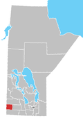
Pipestone is a rural municipality in the southwestern part of the province of Manitoba in Western Canada. The Canupawakpa Dakota First Nation Indian reserve lies within the borders of the municipality.
Communities
External links
- Official website
- Manitoba Municipalities: Rural Municipality of Pipestone
- Map of Pipestone R.M. at Statcan
49°39′55″N 101°08′40″W / 49.66528°N 101.14444°W

