
Struve Geodetic Arc


The Struve Geodetic Arc is a chain of survey triangulations stretching from Hammerfest in Norway to the Black Sea, through ten countries and over 2,820 km, which yielded the first accurate measurement of a meridian.
The chain was established and used by the German-born Russian scientist Friedrich Georg Wilhelm von Struve in the years 1816 to 1855 to establish the exact size and shape of the earth. At that time, the chain passed merely through two countries: Union of Sweden-Norway and the Russian Empire. The Arc's first point is located in Tartu Observatory, where Struve conducted much of his research.
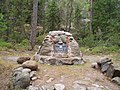
In 2005, the chain was inscribed on the World Heritage List as a memorable ensemble of the chain made up of 34 commemorative plaques or built obelisks out of the original 265, main station points which are marked by drilled holes in rocks, iron crosses, cairns, others.
Measurement of the triangulation chain comprises 258 main triangles and 265 geodetic vertices. The northernmost point is located near Hammerfest in Norway and the southernmost point near the Black Sea in Ukraine. This inscription is located in ten countries, the most of any UNESCO World Heritage.
Chain
Norway
- Fuglenes in Hammerfest
- Raipas in Alta
- Luvdiidcohkka in Kautokeino
- Baelljasvarri in Kautokeino
Sweden
- "Pajtas-vaara" (Tynnyrilaki) in Kiruna
- "Kerrojupukka" (Jupukka) in Pajala
- Pullinki in Övertorneå
- "Perra-vaara" (Perävaara) in Haparanda
Finland
- Stuor-Oivi (currently Stuorrahanoaivi) in Enontekiö (68°40′57″N 22°44′45″E / 68.68250°N 22.74583°E)
- Avasaksa (currently Aavasaksa) in Ylitornio (66°23′52″N 23°43′31″E / 66.39778°N 23.72528°E)
- Torneå (currently Alatornion kirkko) in Tornio (65°49′48″N 24°09′26″E / 65.83000°N 24.15722°E)
- Puolakka (currently Oravivuori) in Korpilahti (61°55′36″N 25°32′01″E / 61.92667°N 25.53361°E)
- Porlom II (currently Tornikallio) in Lapinjärvi (60°42′17″N 26°00′12″E / 60.70472°N 26.00333°E)
- Svartvira (currently Mustaviiri) in Pyhtää (60°16′35″N 26°36′12″E / 60.27639°N 26.60333°E)
Russia
- "Mäki-päälys" (Mäkipäällys (Finland 1917/1920-1940) in Hogland (Suursaari)
- "Hogland, Z" (Gogland, Tochka Z) in Hogland (60°5′9.8″N 26°57′37.5″E / 60.086056°N 26.960417°E)
Estonia
- "Woibifer" (Võivere) in Väike-Maarja Parish (59°03′28″N 26°20′16″E / 59.05778°N 26.33778°E)
- "Katko" (Simuna) in Väike-Maarja Parish (59°02′54″N 26°24′51″E / 59.04833°N 26.41417°E)
- "Dorpat" (Tartu Observatory) in Tartu. (58°22′43.64″N 26°43′12.61″E / 58.3787889°N 26.7201694°E)
Latvia
- "Sestu-Kalns" (Ziestu) in Ērgļu novads (56°50′24″N 25°38′12″E / 56.84000°N 25.63667°E)
- "Jacobstadt" in Jēkabpils (56°30′05″N 25°51′24″E / 56.50139°N 25.85667°E)
Lithuania
- "Karischki" (Gireišiai) in Panemunėlis (55°54′09″N 25°26′12″E / 55.90250°N 25.43667°E)
- "Meschkanzi" (Meškonys) in Nemenčinė (54°55′51″N 25°19′00″E / 54.93083°N 25.31667°E)
- "Beresnäki" (Paliepiukai) in Nemėžis (54°38′04″N 25°25′45″E / 54.63444°N 25.42917°E)
Belarus
- "Tupischki" (Tupishki) in Oshmyany district (54°17′30″N 26°2′43″E / 54.29167°N 26.04528°E)
- "Lopati" (Lopaty) in Zelva district (53°33′38″N 24°52′11″E / 53.56056°N 24.86972°E)
- "Ossownitza" (Ossovnitsa) in Ivanovo district (52°17′22″N 25°38′58″E / 52.28944°N 25.64944°E)
- "Tchekutsk" (Chekutsk) in Ivanovo district (52°12′28″N 25°33′23″E / 52.20778°N 25.55639°E)
- "Leskowitschi" (Leskovichi) in Ivanovo district (52°9′39″N 25°34′17″E / 52.16083°N 25.57139°E)
Moldova
- "Rudi" near Rudi village, Soroca district (48°19′08″N 27°52′36″E / 48.31889°N 27.87667°E)
Ukraine
- Katerinowka in Antonivka, Khmelnytsky Oblast (49°33′57″N 26°45′22″E / 49.56583°N 26.75611°E )
- Felschtin in Hvardiiske, Khmelnytsky Oblast (49°19′48″N 26°40′55″E / 49.33000°N 26.68194°E )
- Baranowka in Baranivka, Khmelnytsky Oblast (49°08′55″N 26°59′30″E / 49.14861°N 26.99167°E )
- Staro-Nekrassowka (Stara Nekrasivka) in Nekrasivka, Odessa Oblast (45°19′54″N 28°55′41″E / 45.33167°N 28.92806°E )
-
 Hogland Z

See also
External links
- Listing on UNESCO website
- A UNESCO article about the chain
- FIG - Proposal to UNESCO for the Struve Geodetic Arc to become a World Heritage Monument
- J.R. Smith. The Struve Geodetic Arc
- - LATVIA Struve arc webpage
- Estonian souvenir sheet and first day cover dedicated to Struve and Struve Geodetic Arc (2011)


- Geodesy
- World Heritage Sites in Belarus
- World Heritage Sites in Estonia
- World Heritage Sites in Finland
- World Heritage Sites in Latvia
- World Heritage Sites in Lithuania
- World Heritage Sites in Moldova
- World Heritage Sites in Norway
- World Heritage Sites in Sweden
- World Heritage Sites in Russia
- World Heritage Sites in Ukraine
- Struve family