
Thermopylae

Thermopylae (Template:PronEng) (Ancient and Katharevousa Greek Θερμοπύλαι, Demotic Θερμοπύλες: "hot gateway") is a location in Greece where a narrow coastal passage existed in antiquity. It derives its name from several natural hot water springs.
Geography

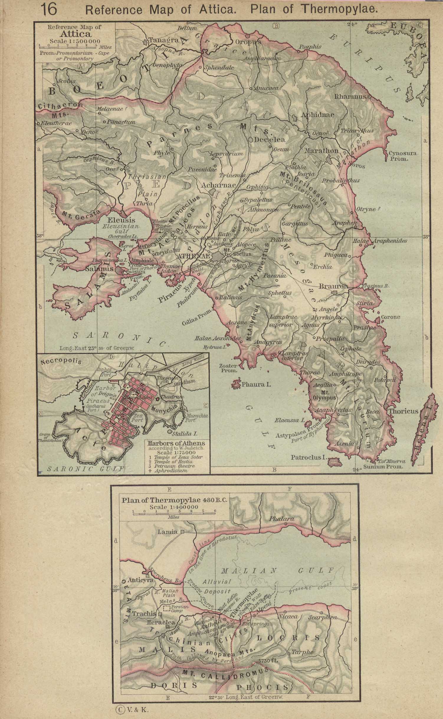
Thermopylae is located in eastern central Greece on the only land route large enough to bear any significant traffic between Lokris and Thessaly. Passage from north to south along the east coast of the Balkan peninsula requires use of the pass. Further west the way is blocked by mountains and the Gulf of Corinth. For this reason the area has been the site of several battles.
The area is dominated by the coastal floodplain of the Spercheios River, surrounded by steeply sloping forested limestone mountains. The continuous deposition of sediment from the river and travertine deposits from the hot springs has substantially altered the landscape during the past few thousand years. The land surface on which the famous Battle of Thermopylae was fought in 480 BC is now buried under 20 metres (66 ft) of soil. The shoreline has retreated greatly over the centuries because of the sedimentary deposition. The level of the Gulf of Malia was significantly higher during prehistoric times and the Spercheios was significantly shorter. The shoreline retreated by up to 2 kilometers between 2500 BC and 480 BC but still left several extremely narrow passages between the sea and the mountains. The narrowest point on the plain, where the Battle of Thermopylae was probably fought, would have been less than 100 metres (330 ft) wide. Between 480 BC and the 21st century, the shoreline retreated by as much as 9 km (5 miles) in places, eliminating the narrowest points of the pass and considerably increasing the size of the plain around the outlet of the Spercheios.[1]
A main highway now splits the pass, with a modern-day monument to King Leonidas I of Sparta on the east side of the highway. It is directly across the road from the hill where Simonides of Ceos's epitaph is engraved in stone at the top. Thermopylae is part of the infamous "horseshoe of Maliakos" also known as the "horseshoe of death": it is the narrowest part of the highway connecting the north and the south of Greece. It has many turns and has been the site of many vehicular accidents.
The hot springs from which the pass derives its name still exist close to the foot of the hill.
Mythology
Thermopylae means "hot gates" in Greek. This is derived from the myth that Heracles had jumped into the river in an attempt to wash off the Hydra poison imbibed in the cloak that he could not take off. The river was said to have turned hot and stayed that way ever since.
Battles

Greeks and Persians
Thermopylae is primarily known for the battle that took place there in 480 BC, in which an outnumbered Greek force of several thousands (including the famous 300 Spartans) held off substantially larger force of Persians under Xerxes. For two days they held out between two narrow cliff faces to prevent the use of Xerxes' vast cavalry force, before being outflanked on the third via a hidden goat path. The name since then has been used to reference heroic resistance against a more powerful enemy.
Greeks and Gauls
In 279 BC a Galic army led by Brennus successfully defeated a Greek army under Calippus of Syracuse.
Roman-Seleucid wars
In 191 BC Antiochus III the Great of Syria attempted in vain to hold the pass against the Romans under Manius Acilius Glabrio.
Less famous is the confrontation of 353 BC/352 BC during the Third Sacred War when 5,000 Athenian hoplites and 400 horsemen denied passage to the forces of Philip II of Macedon and the battle of 267 when the Heruli defeated the Greek force that tried to stop them.
Greek War of Independence
In 1821, a force of Greek fighters led by Athanasios Diakos made a stand near the pass to stop a force of 8,000 Turks from marching down from Thessaly to put down revolts in Roumeli and the Peloponnese. Diakos, after making a last stand at the bridge of Alamana with 48 of his men, was captured and killed.
World War II
In 1941 during World War II the ANZAC forces delayed the invading German forces in the area enough to allow the evacuation of the British expeditionary force to Crete. This conflict also became known as the Battle of Thermopylae. Such was the fame of Thermopylae that the sabotage of the Gorgopotamos bridge in 1942 was referred in German documents of the era as "the recent sabotage near Thermopylae".
Notes and references
- ^ Rapp, George Robert; Hill, Christopher L. Geoarchaeology: The Earth-science Approach to Archaeological Interpretation, p. 96. Yale University Press, 2006. ISBN 0300109660