
Swift County, Minnesota
Swift County | |
|---|---|
 Location within the U.S. state of Minnesota | |
 Minnesota's location within the U.S. | |
| Coordinates: 45°17′N 95°41′W / 45.29°N 95.68°W | |
| Country | |
| State | |
| Founded | February 18, 1870 [1] |
| Named for | Henry Adoniram Swift, Governor of Minnesota in 1863. |
| Seat | Benson |
| Largest city | Benson |
| Area | |
| • Total | 752 sq mi (1,949 km2) |
| • Land | 744 sq mi (1,926 km2) |
| • Water | 9 sq mi (23 km2) 1.17% |
| Population (2000) | |
| • Total | 11,956 |
| • Density | 16/sq mi (6/km2) |
| Time zone | UTC−6 (Central) |
| • Summer (DST) | UTC−5 (CDT) |
| Website | www |
Swift County is a county located in the U.S. state of Minnesota. As of 2000, the population was 11,956. Its county seat is BensonTemplate:GR.
Geography
According to the U.S. Census Bureau, the county has a total area of 752 square miles (1,949 km²), of which 744 square miles (1,926 km²) is land and 9 square miles (23 km²) (1.17%) is water.
History
Swift County was established February 18th, 1870. This county was named after Henry Adoniram Swift, the governor of Minnesota in 1863. It is located in the west central part of Minnesota and consists of 757 square miles with 3 tiers of 7 townships each. The Swift County Courthouse was built in 1897 and was declared a national historic site in 1976. The City of Benson is the County seat of Swift County. The railroad tracks run through the center of the town of Benson and divide the downtown business districts with parks on each side of the tracks.
The Indians had real grievances against the government including delays in sending annuities which caused near starvation several times. In August, 1862, an Indian rebellion broke out in Minnesota. The warfare reached the settlements just getting started in the northeastern part of Swift County. By the latter part of September, 1862, the Indian War was almost over but the settlers hesitated to venture back to the prairie country of Swift County until 1865 when all danger was apparently over. Scandinavians and Germans were in decided majority among the early settlers. A number of them came with the honor and privileges of Civil War veterans.
In 1869, the St. Paul & Pacific railroad had reached Willmar and the following year it arrived in Benson. The railroad company determined the number of future trading centers (Kerkhoven, DeGraff, Benson, Randall) in the county by locating sites at intervals of approximately eight miles.
| Year | Democrat | Republican |
|---|---|---|
| 2008 | 55.43% 2,907 | 41.65% 2,184 |
| 2004 | 55.19% 3,165 | 43.26% 2,481 |
| 2000 | 49.62% 2,698 | 43.70% 2,376 |
Topography & Vegetation
Swift County is primarily an agriculture community. It is a vast, flat monotonous stretch of land, unbroken by trees. Besides farming, the county is home to agriculture equipment manufacturers, an ethanol plant, and the new Fibromin Plant which burns turkey litter to create electricity.
Swift County is home to a total of 24 lakes. Lake Oliver is one of the biggest in the county at 416 acres. The lakes in Swift County are great for fishing. There are 9 rivers and streams in this county.
Major highways
Adjacent counties
- Stevens County and Pope County (north)
- Kandiyohi County (east)
- Chippewa County (south)
- Lac qui Parle County (southwest)
- Big Stone County (west)
Demographics
As of the censusTemplate:GR of 2000, there were 11,956 people, 4,353 households, and 2,881 families residing in the county. The population density was 16 people per square mile (6/km²). There were 4,821 housing units at an average density of 6 per square mile (2/km²). The racial makeup of the county was 90.67% White, 2.69% Black or African American, 0.50% Native American, 1.43% Asian, 1.52% Pacific Islander, 1.40% from other races, and 1.79% from two or more races. 2.68% of the population were Hispanic or Latino of any race. Swift County has the highest percentage of Pacific Islander natives out of any U.S. county outside Hawaii. 34.4% were of German, 30.5% Norwegian, 5.2% Swedish and 5.1% Irish ancestry according to Census 2000.
There were 4,353 households out of which 30.00% had children under the age of 18 living with them, 56.90% were married couples living together, 6.10% had a female householder with no husband present, and 33.80% were non-families. 30.90% of all households were made up of individuals and 17.60% had someone living alone who was 65 years of age or older. The average household size was 2.39 and the average family size was 3.00.

In the county the population was spread out with 23.00% under the age of 18, 7.30% from 18 to 24, 29.60% from 25 to 44, 21.60% from 45 to 64, and 18.50% who were 65 years of age or older. The median age was 39 years. For every 100 females there were 120.60 males. For every 100 females age 18 and over, there were 124.60 males.
The median income for a household in the county was $34,820, and the median income for a family was $44,208. Males had a median income of $29,362 versus $21,667 for females. The per capita income for the county was $16,360. About 5.30% of families and 8.40% of the population were below the poverty line, including 6.90% of those under age 18 and 13.80% of those age 65 or over.
Cities and towns
| Cities | Townships | |
|---|---|---|
References
External links
Places adjacent to Swift County, Minnesota | ||||||||||||||||
|---|---|---|---|---|---|---|---|---|---|---|---|---|---|---|---|---|
| ||||||||||||||||
Municipalities and communities of Swift County, Minnesota, United States | ||
|---|---|---|
| Cities | 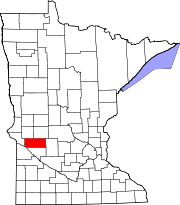 | |
| Townships | ||
| Unincorporated communities | ||