Snap Lake Airport: Difference between revisions
Appearance
Content deleted Content added
m Fixed some formatting issues. |
|||
| Line 13: | Line 13: | ||
| summer = MDT |
| summer = MDT |
||
| utcs = [[UTC−06:00]] |
| utcs = [[UTC−06:00]] |
||
| elevation- |
| elevation-m = 465 |
||
| coordinates = {{coord|63|35|37|N|110|54|20|W|region:CA-NT|display=inline,title}} |
| coordinates = {{coord|63|35|37|N|110|54|20|W|region:CA-NT|display=inline,title}} |
||
| pushpin_map = Canada Northwest Territories |
| pushpin_map = Canada Northwest Territories |
||
| Line 20: | Line 20: | ||
| website = |
| website = |
||
| r1-number = 09/27 |
| r1-number = 09/27 |
||
| r1-length- |
| r1-length-m = 1610 |
||
| r1-surface = Gravel |
| r1-surface = Gravel |
||
| metric-rwy = yes |
|||
| metric-elev = yes |
|||
| footnotes = Sources: [[Canada Flight Supplement]]<ref name="CFS">{{CFS}}</ref> |
| footnotes = Sources: [[Canada Flight Supplement]]<ref name="CFS">{{CFS}}</ref> |
||
}} |
}} |
||
Revision as of 00:49, 9 April 2019
Snap Lake Airport | |||||||||||
|---|---|---|---|---|---|---|---|---|---|---|---|
| Summary | |||||||||||
| Airport type | Private | ||||||||||
| Operator | De Beers Canada | ||||||||||
| Location | Snap Lake Diamond Mine, Northwest Territories | ||||||||||
| Time zone | MST (UTC−07:00) | ||||||||||
| • Summer (DST) | MDT (UTC−06:00) | ||||||||||
| Elevation AMSL | 465 m / 1,526 ft | ||||||||||
| Coordinates | 63°35′37″N 110°54′20″W / 63.59361°N 110.90556°W | ||||||||||
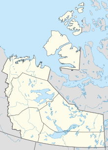
| Map | |||||||||||
| Runways | |||||||||||
| |||||||||||
Sources: Canada Flight Supplement[1] | |||||||||||
Snap Lake Airport (IATA: YNX, TC LID: CSK6) is located near the Snap Lake Diamond Mine, Northwest Territories, Canada.
Airlines and destinations
| Airlines | Destinations |
|---|---|
| First Air | Charter: Yellowknife |
References

