
Minlaton, South Australia: Difference between revisions
infobox - upgrade |
infobox - upgrade citation etc |
||
| Line 7: | Line 7: | ||
| image = MinlatonWarMemorial.JPG |
| image = MinlatonWarMemorial.JPG |
||
| caption = War memorial on Main St. |
| caption = War memorial on Main St. |
||
| coordinates = {{coord|34 |
| coordinates = {{coord|34.772545|S|137.594126|E|format=dms|display=inline,title}} |
||
| coord_ref = <ref name="LMV">{{cite web|title=Search results for 'Minlaton, LOCB' with the following datasets selected - 'Suburbs and localities', 'Counties', 'Government Towns','Local Government Areas', 'SA Government Regions' and 'Gazetteer' |url= https://location.sa.gov.au/viewer/?map=roads&x=137.64948&y=-34.81844&z=11&uids=19,2,115,11,20,105&pinx=137.595500&piny=-34.771100&pinTitle=Location&pinText=Minlaton,+Locb |website= Location SA Map Viewer |publisher=Government of South Australia |access-date= 15 December 2022}}</ref> |
|||
| coord_ref = |
|||
| use_lga_map = yes |
| use_lga_map = yes |
||
| Line 16: | Line 16: | ||
| established = 1876 |
| established = 1876 |
||
| established_footnotes = <ref name="LMV"/> |
|||
| established_footnotes = <ref name="PLB">{{cite web|url=http://maps.sa.gov.au/plb/ |title=Search result(s) for Minlaton (LOCB) with the following layers being selected – "Suburbs and Localities", "Counties", "Hundreds", "Place names (gazetteer)" and "Road labels" |id=SA0045172 |publisher=Government of South Australia |date=17 October 2013 |work=Property Location Browser |access-date=7 September 2017 }}</ref> |
|||
| postcode = 5575 |
| postcode = 5575 |
||
| elevation = |
| elevation = |
||
| Line 37: | Line 37: | ||
| dir2 = S |
| dir2 = S |
||
| lga = Yorke Peninsula Council |
| lga = Yorke Peninsula Council |
||
|county = [[County of Fergusson|Fergusson]]<ref name= |
|county = [[County of Fergusson|Fergusson]]<ref name="LMV"/> |
||
| region =[[Yorke and Mid North]]<ref name="LMV"/> |
|||
| region =[[Yorke and Mid North]]<ref>{{cite web|title= Yorke and Mid North SA Government region|url=https://www.sa.gov.au/__data/assets/pdf_file/0004/12793/Yorke_Mid_North_SA_Government_region.pdf |publisher=The Government of South Australia|access-date=28 April 2017}}</ref> |
|||
| stategov = [[Electoral district of Narungga|Narungga]]<ref name=ECSA>{{cite map |url=http://edbc.sa.gov.au/redistributions/2016/2016-electoral-district-maps/narungga-map-2016-pdf/download.html |title=Narungga |publisher=Electoral District Boundaries Commission |date=2016 |access-date=1 March 2018}}</ref> |
| stategov = [[Electoral district of Narungga|Narungga]]<ref name=ECSA>{{cite map |url=http://edbc.sa.gov.au/redistributions/2016/2016-electoral-district-maps/narungga-map-2016-pdf/download.html |title=Narungga |publisher=Electoral District Boundaries Commission |date=2016 |access-date=1 March 2018}}</ref> |
||
| fedgov = [[Division of Grey|Grey]]<ref name=AEC>{{cite web|title=Federal electoral division of Grey|url=http://www.aec.gov.au/profiles/sa/files/2011/2011-aec-a4-map-sa-grey.pdf |publisher=Australian Electoral Commission|access-date=24 July 2015}}</ref> |
| fedgov = [[Division of Grey|Grey]]<ref name=AEC>{{cite web|title=Federal electoral division of Grey|url=http://www.aec.gov.au/profiles/sa/files/2011/2011-aec-a4-map-sa-grey.pdf |publisher=Australian Electoral Commission|access-date=24 July 2015}}</ref> |
||
| Line 58: | Line 58: | ||
| near-n = [[Koolywurtie, South Australia|Koolywurtie]] |
| near-n = [[Koolywurtie, South Australia|Koolywurtie]] |
||
| near-ne = [[Curramulka, South Australia|Curramulka]] |
| near-ne = [[Curramulka, South Australia|Curramulka]] |
||
|footnotes=Adjoining localities<ref name= |
|footnotes=Adjoining localities<ref name="LMV"/> |
||
}} |
}} |
||
'''Minlaton''' is a town in central [[Yorke Peninsula]], [[South Australia]]. At the [[2016 Australian census|2016 census]], Minlaton had a population of 800.<ref name="DANCEN">{{Census 2016 AUS|id=UCL421026|name=Minlaton (L) (Urban Centre/Locality)|accessdate=2018-02-11|quick=on}}</ref> It is known as the "Barley capital of the world", due to the rich [[Barley]] production in the region. |
'''Minlaton''' is a town in central [[Yorke Peninsula]], [[South Australia]]. At the [[2016 Australian census|2016 census]], Minlaton had a population of 800.<ref name="DANCEN">{{Census 2016 AUS|id=UCL421026|name=Minlaton (L) (Urban Centre/Locality)|accessdate=2018-02-11|quick=on}}</ref> It is known as the "Barley capital of the world", due to the rich [[Barley]] production in the region. |
||
Revision as of 21:43, 14 December 2022
| Minlaton South Australia | |||||||||||||||
|---|---|---|---|---|---|---|---|---|---|---|---|---|---|---|---|
 War memorial on Main St. | |||||||||||||||
 Minlaton | |||||||||||||||
| Coordinates | 34°46′21″S 137°35′39″E / 34.772545°S 137.594126°E[1] | ||||||||||||||
| Population | 800 (2016 census)[2] | ||||||||||||||
| Established | 1876[1] | ||||||||||||||
| Postcode(s) | 5575 | ||||||||||||||
| Location | |||||||||||||||
| LGA(s) | Yorke Peninsula Council | ||||||||||||||
| Region | Yorke and Mid North[1] | ||||||||||||||
| County | Fergusson[1] | ||||||||||||||
| State electorate(s) | Narungga[3] | ||||||||||||||
| Federal division(s) | Grey[4] | ||||||||||||||
| |||||||||||||||
| Footnotes | Adjoining localities[1] | ||||||||||||||
Minlaton is a town in central Yorke Peninsula, South Australia. At the 2016 census, Minlaton had a population of 800.[2] It is known as the "Barley capital of the world", due to the rich Barley production in the region.
Minlaton was the hometown of Harry Butler, a World War I flying ace. His Bristol M1C monoplane has been restored and is preserved in pride of place in a building the centre of the town. When he flew an air mail run from Adelaide across Gulf St Vincent to Minlaton in 1919, it was the first over-water flight in the Southern Hemisphere.
Minlaton is in the District Council of Yorke Peninsula, the federal Division of Grey[5] and the state electoral district of Narungga.[3]
Climate
Minlaton, like most of the Yorke Peninsula, has a dry mediterranean climate bordering on semi-arid. Annual rainfall is around 360 millimetres or 14 inches, most of which falls in the winter months.[citation needed]
| Climate data for Minlaton Aero | |||||||||||||
|---|---|---|---|---|---|---|---|---|---|---|---|---|---|
| Month | Jan | Feb | Mar | Apr | May | Jun | Jul | Aug | Sep | Oct | Nov | Dec | Year |
| Record high °C (°F) | 45.6 (114.1) |
44.1 (111.4) |
41.0 (105.8) |
37.4 (99.3) |
30.9 (87.6) |
25.9 (78.6) |
23.0 (73.4) |
29.3 (84.7) |
33.0 (91.4) |
38.7 (101.7) |
44.3 (111.7) |
45.9 (114.6) |
45.6 (114.1) |
| Mean daily maximum °C (°F) | 29.6 (85.3) |
28.6 (83.5) |
26.7 (80.1) |
23.4 (74.1) |
19.5 (67.1) |
16.3 (61.3) |
15.3 (59.5) |
16.4 (61.5) |
19.1 (66.4) |
22.6 (72.7) |
26.0 (78.8) |
27.6 (81.7) |
22.6 (72.7) |
| Mean daily minimum °C (°F) | 15.4 (59.7) |
15.3 (59.5) |
14.1 (57.4) |
11.9 (53.4) |
10.0 (50.0) |
7.8 (46.0) |
7.0 (44.6) |
6.8 (44.2) |
7.9 (46.2) |
9.3 (48.7) |
12.0 (53.6) |
13.5 (56.3) |
10.9 (51.6) |
| Record low °C (°F) | 6.4 (43.5) |
8.0 (46.4) |
6.0 (42.8) |
5.0 (41.0) |
3.0 (37.4) |
0.0 (32.0) |
−0.3 (31.5) |
0.5 (32.9) |
0.2 (32.4) |
0.8 (33.4) |
2.1 (35.8) |
3.7 (38.7) |
−0.3 (31.5) |
| Average precipitation mm (inches) | 14.5 (0.57) |
18.1 (0.71) |
16.1 (0.63) |
24.5 (0.96) |
39.5 (1.56) |
52.5 (2.07) |
50.0 (1.97) |
46.1 (1.81) |
35.4 (1.39) |
22.8 (0.90) |
21.8 (0.86) |
19.6 (0.77) |
360.3 (14.19) |
| Average precipitation days (≥ 0.2 mm) | 4.6 | 3.4 | 5.2 | 8.6 | 13.1 | 17.6 | 18.5 | 18.6 | 14.6 | 8.3 | 6.9 | 6.9 | 126.3 |
| Average afternoon relative humidity (%) | 36 | 39 | 40 | 47 | 49 | 67 | 70 | 63 | 58 | 47 | 39 | 39 | 50 |
| Source: [6] | |||||||||||||
Gallery
-
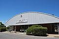
 Harry Butler's Red Devil is on display in Minlaton
 -
 Harry Butler memorial
 -
 Main street
 -
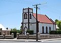 St Benedict's Anglican church, built in 1886


See also
References
- ^ a b c d e "Search results for 'Minlaton, LOCB' with the following datasets selected - 'Suburbs and localities', 'Counties', 'Government Towns','Local Government Areas', 'SA Government Regions' and 'Gazetteer'". Location SA Map Viewer. Government of South Australia. Retrieved 15 December 2022.
- ^ a b Australian Bureau of Statistics (27 June 2017). "Minlaton (L) (Urban Centre/Locality)". 2016 Census QuickStats. Retrieved 11 February 2018.
- ^ a b Narungga (Map). Electoral District Boundaries Commission. 2016. Retrieved 1 March 2018.
- ^ "Federal electoral division of Grey" (PDF). Australian Electoral Commission. Retrieved 24 July 2015.
- ^ "Localities". Australian Electoral Commission. Archived from the original on 6 July 2011. Retrieved 13 July 2010.
- ^ "MINLATON AERO (nearest Weather Station)". Climate statistics for Australian locations. Commonwealth of Australia , Bureau of Meteorology. Retrieved 13 December 2022.
External links
- Yorke Peninsula: Minlaton
- Harvest Corner website Yorke Peninsula Visitor Information Centre at Minlaton
| Major Townships | |||||||
|---|---|---|---|---|---|---|---|
| Minor Townships | |||||||
| Governance |
| ||||||
| Coastal features | |||||||
| Protected areas |
| ||||||
| Adjacent islands | |||||||
| Related and uncategorised | |||||||