Jump to content

National Register of Historic Places listings in South and Southwest Portland, Oregon: Difference between revisions

From Wikipedia, the free encyclopedia
Content deleted Content added
Visitor7 (talk | contribs)
→‎Current listings: Watzek House
Visitor7 (talk | contribs)
→‎Current listings: +19 contest photos
Line 71: Line 71:
! {{NRHP color}} | <small>3</small>
| [[Annand&ndash;Loomis House]]
| [[Annand&ndash;Loomis House]]
| [[File:Annand-Loomis House (Portland, Oregon).jpg|100px]]
| <span style="color: #fcfcfc">image pending
| {{dts|1997|6|27}}
| {{dts|1997|6|27}}
| 1825 SW Vista Avenue<br/><small>{{coord|45.51481|-122.6968|format=dms|name=Annand-Loomis House}}</small>
| 1825 SW Vista Avenue<br/><small>{{coord|45.51481|-122.6968|format=dms|name=Annand-Loomis House}}</small>
Line 204: Line 204:
! {{NRHP color}} | <small>22</small>
| [[Joseph R. Bowles House]]
| [[Joseph R. Bowles House]]
| [[File:Bowles House (Portland, Oregon).jpg|100px]]
| <span style="color: #fcfcfc">image pending
| {{dts|1978|3|8}}
| {{dts|1978|3|8}}
| 1934 SW Vista Avenue<br/><small>{{coord|45.51335|-122.6969|format=dms|name=Joseph R. Bowles House}}</small>
| 1934 SW Vista Avenue<br/><small>{{coord|45.51335|-122.6969|format=dms|name=Joseph R. Bowles House}}</small>
Line 393: Line 393:
! {{NRHP color}} | <small>49</small>
| [[J.G. Edwards House]]
| [[J.G. Edwards House]]
| [[File:Edwards House (Portland, Oregon).jpg|100px]]
| <span style="color: #fcfcfc">image pending
| {{dts|1991|2|22}}
| {{dts|1991|2|22}}
| 2645 SW Alta Vista Place<br/><small>{{coord|45.50814|-122.7045|format=dms|name=J.G. Edwards House}}</small>
| 2645 SW Alta Vista Place<br/><small>{{coord|45.50814|-122.7045|format=dms|name=J.G. Edwards House}}</small>
Line 470: Line 470:
! {{NRHP color}} | <small>60</small>
| [[Caroline W. and M. Louise Flanders House]]
| [[Caroline W. and M. Louise Flanders House]]
| [[File:Flanders House (Portland, Oregon).jpg|100px]]
| <span style="color: #fcfcfc">image pending
| {{dts|1991|3|1}}
| {{dts|1991|3|1}}
| 2421 SW Arden Road<br/><small>{{coord|45.5046|-122.7022|format=dms|name=Caroline W. and M. Louise Flanders House}}</small>
| 2421 SW Arden Road<br/><small>{{coord|45.5046|-122.7022|format=dms|name=Caroline W. and M. Louise Flanders House}}</small>
Line 540: Line 540:
! {{NRHP color}} | <small>70</small>
| [[Alan and Barbara Goldsmith House]]
| [[Alan and Barbara Goldsmith House]]
| [[File:Goldsmith House (Portland, Oregon).jpg|100px]]
| <span style="color: #fcfcfc">image pending
| {{dts|2007|4|5}}
| {{dts|2007|4|5}}
| 4140 SW Greenleaf Court<br/><small>{{coord|45|30|09.77|N|122|42|59.01|W|format=dms|name=Alan and Barbara Goldsmith House}}</small>
| 4140 SW Greenleaf Court<br/><small>{{coord|45|30|09.77|N|122|42|59.01|W|format=dms|name=Alan and Barbara Goldsmith House}}</small>
Line 596: Line 596:
! {{NRHP color}} | <small>78</small>
| [[Albert, Oscar, and Linda Heintz House]]
| [[Albert, Oscar, and Linda Heintz House]]
| [[File:Heintz House (Portland, Oregon).jpg|100px]]
| <span style="color: #fcfcfc">image pending
| {{dts|1990|10|17}}
| {{dts|1990|10|17}}
| 2556 SW Vista Avenue<br/><small>{{coord|45.50864|-122.701|format=dms|name=Albert, Oscar, and Linda Heintz House}}</small>
| 2556 SW Vista Avenue<br/><small>{{coord|45.50864|-122.701|format=dms|name=Albert, Oscar, and Linda Heintz House}}</small>
Line 631: Line 631:
! {{NRHP color}} | <small>83</small>
| [[David T. and Nan Wood Honeyman House]]
| [[David T. and Nan Wood Honeyman House]]
| [[File:Honeyman House (Portland, Oregon).jpg|100px]]
| <span style="color: #fcfcfc">image pending
| {{dts|1987|5|7}}
| {{dts|1987|5|7}}
| 1728 SW Prospect Drive<br/><small>{{coord|45.51736|-122.6974|format=dms|name=David T. and Nan Wood Honeyman House}}</small>
| 1728 SW Prospect Drive<br/><small>{{coord|45.51736|-122.6974|format=dms|name=David T. and Nan Wood Honeyman House}}</small>
Line 722: Line 722:
! {{NRHP color}} | <small>96</small>
| [[Victor H. and Marta Jorgensen House]]<ref name="WkList20080523">{{cite web | last = National Park Service | first = | authorlink = National Park Service | title = Weekly List of Actions Taken on Properties: 5/12/08 through 5/16/08 | date = 2008-05-23 | url = http://www.nps.gov/nr/listings/20080523.HTM | accessdate = 2008-10-31 }}</ref>
| [[Victor H. and Marta Jorgensen House]]<ref name="WkList20080523">{{cite web | last = National Park Service | first = | authorlink = National Park Service | title = Weekly List of Actions Taken on Properties: 5/12/08 through 5/16/08 | date = 2008-05-23 | url = http://www.nps.gov/nr/listings/20080523.HTM | accessdate = 2008-10-31 }}</ref>
| [[File:Jorgensen House (Portland, Oregon).jpg|100px]]
| <span style="color: #fcfcfc">image pending
| {{dts|2008|5|15}}<ref name="WkList20080523"/>
| {{dts|2008|5|15}}<ref name="WkList20080523"/>
| 2643 SW Buena Vista Drive<ref name="WkList20080523"/><br/><small>{{coord|45|30|32.17|N|122|42|13.80|W|format=dms|name=Victor H. and Marta Jorgensen House}}</small>
| 2643 SW Buena Vista Drive<ref name="WkList20080523"/><br/><small>{{coord|45|30|32.17|N|122|42|13.80|W|format=dms|name=Victor H. and Marta Jorgensen House}}</small>
Line 743: Line 743:
! {{NRHP color}} | <small>99</small>
| [[Grace Kern House]]
| [[Grace Kern House]]
| [[File:Kern House (Portland, Oregon).jpg|100px]]
| <span style="color: #fcfcfc">image pending
| {{dts|2008|1|9}}
| {{dts|2008|1|9}}
| 1740 SW West Point Court<br/><small>{{coord|45|30|58.78|N|122|41|48.93|W|format=dms|name=Grace Kern House}}</small>
| 1740 SW West Point Court<br/><small>{{coord|45|30|58.78|N|122|41|48.93|W|format=dms|name=Grace Kern House}}</small>
Line 848: Line 848:
! {{NRHP color}} | <small>114</small>
| [[William and Annie MacMaster House]]
| [[William and Annie MacMaster House]]
| [[File:MacMaster House (Portland, Oregon).jpg|100px]]
| <span style="color: #fcfcfc">image pending
| {{dts|1989|10|30}}
| {{dts|1989|10|30}}
| 1041 SW Vista Avenue<br/><small>{{coord|45.52083|-122.6982|format=dms|name=William and Annie MacMaster House}}</small>
| 1041 SW Vista Avenue<br/><small>{{coord|45.52083|-122.6982|format=dms|name=William and Annie MacMaster House}}</small>
Line 988: Line 988:
! {{NRHP color}} | <small>134</small>
| [[Nicholas&ndash;Lang House]]
| [[Nicholas&ndash;Lang House]]
| [[File:Nicholas-Lang House (Portland, Oregon).jpg|100px]]
| <span style="color: #fcfcfc">image pending
| {{dts|1979|3|13}}
| {{dts|1979|3|13}}
| 2030 SW Vista Avenue<br/><small>{{coord|45.51245|-122.6973|format=dms|name=Nicholas-Lang House}}</small>
| 2030 SW Vista Avenue<br/><small>{{coord|45.51245|-122.6973|format=dms|name=Nicholas-Lang House}}</small>
Line 995: Line 995:
! {{NRHP color}} | <small>135</small>
| [[Dr. A.S. Nichols House]]
| [[Dr. A.S. Nichols House]]
| [[File:Nichols House (Portland, Oregon).jpg|100px]]
| <span style="color: #fcfcfc">image pending
| {{dts|1992|3|5}}
| {{dts|1992|3|5}}
| 1961 SW Vista Avenue<br/><small>{{coord|45.51315|-122.697|format=dms|name=Dr. A.S. Nichols House}}</small>
| 1961 SW Vista Avenue<br/><small>{{coord|45.51315|-122.697|format=dms|name=Dr. A.S. Nichols House}}</small>
Line 1,002: Line 1,002:
! {{NRHP color}} | <small>136</small>
| [[Dr. Herbert S. Nichols House]]
| [[Dr. Herbert S. Nichols House]]
| [[File:Herbert Nichols House (Portland, Oregon).jpg|100px]]
| <span style="color: #fcfcfc">image pending
| {{dts|1990|6|1}}
| {{dts|1990|6|1}}
| 1925 SW Vista Avenue<br/><small>{{coord|45.51345|-122.6969|format=dms|name=Dr. Herbert S. Nichols House}}</small>
| 1925 SW Vista Avenue<br/><small>{{coord|45.51345|-122.6969|format=dms|name=Dr. Herbert S. Nichols House}}</small>
Line 1,051: Line 1,051:
! {{NRHP color}} | <small>143</small>
| [[Louis Pfunder House]]
| [[Louis Pfunder House]]
| [[File:Pfunder House (Portland, Oregon).jpg|100px]]
| <span style="color: #fcfcfc">image pending
| {{dts|2005|6|10}}
| {{dts|2005|6|10}}
| 2211 SW Vista Avenue<br/><small>{{coord|45.51118|-122.6981|format=dms|name=Louis Pfunder House}}</small>
| 2211 SW Vista Avenue<br/><small>{{coord|45.51118|-122.6981|format=dms|name=Louis Pfunder House}}</small>
Line 1,079: Line 1,079:
! {{NRHP color}} | <small>147</small>
| [[Martin Luther Pipes House]]
| [[Martin Luther Pipes House]]
| [[File:Pipes House (Portland, Oregon).jpg|100px]]
| <span style="color: #fcfcfc">image pending
| {{dts|1987|3|6}}
| {{dts|1987|3|6}}
| 2675 SW Vista Avenue<br/><small>{{coord|45.50639|-122.7041|format=dms|name=Martin Luther Pipes House}}</small>
| 2675 SW Vista Avenue<br/><small>{{coord|45.50639|-122.7041|format=dms|name=Martin Luther Pipes House}}</small>
Line 1,114: Line 1,114:
! {{NRHP color}} | <small>152</small>
| [[Portland Garden Club]]
| [[Portland Garden Club]]
| [[File:Portland Garden Club (Portland, Oregon).jpg|100px]]
| <span style="color: #fcfcfc">image pending
| {{dts|2005|10|7}}
| {{dts|2005|10|7}}
| 1132 SW Vista Avenue<br/><small>{{coord|45.52032|-122.6982|format=dms|name=Portland Garden Club}}</small>
| 1132 SW Vista Avenue<br/><small>{{coord|45.52032|-122.6982|format=dms|name=Portland Garden Club}}</small>
Line 1,156: Line 1,156:
! {{NRHP color}} | <small>158</small>
| [[O.L. Price House]]
| [[O.L. Price House]]
| [[File:Price House (Portland, Oregon).jpg|100px]]
| <span style="color: #fcfcfc">image pending
| {{dts|1988|8|11}}
| {{dts|1988|8|11}}
| 2681 SW Buena Vista Drive<br/><small>{{coord|45.50951|-122.7043|format=dms|name=O.L. Price House}}</small>
| 2681 SW Buena Vista Drive<br/><small>{{coord|45.50951|-122.7043|format=dms|name=O.L. Price House}}</small>
Line 1,184: Line 1,184:
! {{NRHP color}} | <small>162</small>
| [[Samuel G. Reed House]]
| [[Samuel G. Reed House]]
| [[File:Reed House (Portland, Oregon).jpg|100px]]
| <span style="color: #fcfcfc">image pending
| {{dts|1990|10|17}}
| {{dts|1990|10|17}}
| 2615 SW Vista Avenue<br/><small>{{coord|45.50847|-122.7035|format=dms|name=Samuel G. Reed House}}</small>
| 2615 SW Vista Avenue<br/><small>{{coord|45.50847|-122.7035|format=dms|name=Samuel G. Reed House}}</small>
Line 1,485: Line 1,485:
! {{NRHP color}} | <small>205</small>
| [[H.C. Wortman House]]
| [[H.C. Wortman House]]
| [[File:Wortman House (Portland, Oregon).jpg|100px]]
| <span style="color: #fcfcfc">image pending
| {{dts|1988|8|11}}
| {{dts|1988|8|11}}
| 1111 SW Vista Avenue<br/><small>{{coord|45.52045|-122.6982|format=dms|name=H.C. Wortman House}}</small>
| 1111 SW Vista Avenue<br/><small>{{coord|45.52045|-122.6982|format=dms|name=H.C. Wortman House}}</small>

Revision as of 04:25, 29 October 2011

NorthNortheastNorthwestSoutheastSouthwest
Locator map showing five of Portland's six quadrants. Click a quadrant to go to its National Register list. (South Portland listings are included on the Southwest Portland list.)

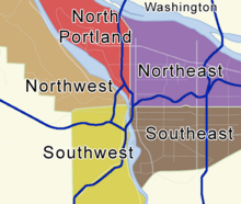
The following list attempts to comprehensively present the full set of National Register of Historic Places listings in Southwest Portland, Oregon, and offers brief descriptive information about each of them. The National Register of Historic Places (NRHP) recognizes buildings, structures, objects, sites, and districts of national, state, or local historic significance across the United States.[1] Out of over 80,000 NRHP sites nationwide,[2] Oregon is home to approximately 1,900,[3] and over one-fourth of those are found in Portland. While these sites are widely spread across all five of Portland's quadrants, heavy concentrations are found in the Downtown and Southwest Hills neighborhoods of the Southwest quadrant, and the Northwest District neighborhood of the Northwest quadrant.

Only NRHP sites within the municipal boundaries of Portland are shown in this list and its companion lists for the other four quadrants. Some sites beyond city limits will appear in other lists showing "Portland" as a general locality, but are excluded here. Although Portland's legal boundaries extend into Clackamas and Washington counties, all of the city's NRHP sites lie within Multnomah County.


          This National Park Service list is complete through NPS recent listings posted July 19, 2024.[4]

Current listings

[5] Site name[6] Image Date listed[6] Location[7] Summary
1 Maud and Belle Ainsworth House image pending February 27, 1986 2542 SW Hillcrest Drive
45°30′28″N 122°42′08″W / 45.50786°N 122.7023°W / 45.50786; -122.7023 (Maud and Belle Ainsworth House)
2 Ambassador Apartments February 26, 1979 1209 SW 6th Avenue
45°30′56″N 122°40′50″W / 45.51564°N 122.6805°W / 45.51564; -122.6805 (Ambassador Apartments)
3 Annand–Loomis House June 27, 1997 1825 SW Vista Avenue
45°30′53″N 122°41′48″W / 45.51481°N 122.6968°W / 45.51481; -122.6968 (Annand-Loomis House)
4 Arlington Club[8] August 30, 2010[8] 811 SW Salmon Street[8]
45°31′04.40″N 122°40′54.60″W / 45.5178889°N 122.6818333°W / 45.5178889; -122.6818333 (Arlington Club)
A four-story brick and terra cotta structure built in 1910.[9](Downtown Portland, Oregon MPS)
5 Arminius Hotel July 14, 1988 1022–1038 SW Morrison Street
45°31′13″N 122°40′58″W / 45.52016°N 122.6829°W / 45.52016; -122.6829 (Arminius Hotel)
6 Arnold–Park Log Home[10] image pending February 12, 20,010[10] 12000 SW Boones Ferry Road[10]
45°26′15.61″N 122°41′22.79″W / 45.4376694°N 122.6896639°W / 45.4376694; -122.6896639 (Arnold-Park Log Home)
7 Auditorium and Music Hall February 22, 1980 920–928 SW 3rd Avenue
45°31′00″N 122°40′33″W / 45.51668°N 122.6757°W / 45.51668; -122.6757 (Auditorium and Music Hall)
One of the few remaining Romanesque revival buildings in Portland, this 1890s building housed concert space, a commerce center, a dance hall, apartments, a boxing gym, and offices through its history.[11]
8 Auto Rest Garage September 12, 1996 925–935 SW 10th Avenue
45°31′05″N 122°41′00″W / 45.51818°N 122.6833°W / 45.51818; -122.6833 (Auto Rest Garage)
9 Balfour–Guthrie Building August 1, 2002 733 SW Oak Street
45°31′20″N 122°40′43″W / 45.52213°N 122.6785°W / 45.52213; -122.6785 (Balfour-Guthrie Building)
10 Ball–Ehrman House image pending February 22, 1991 2040 SW Laurel Street
45°30′39″N 122°41′56″W / 45.51074°N 122.6988°W / 45.51074; -122.6988 (Ball-Ehrman House)
11 Bank of California Building March 14, 1978 330 SW 6th Avenue
45°31′17″N 122°40′38″W / 45.52151°N 122.6773°W / 45.52151; -122.6773 (Bank of California Building)
12 Baruh–Zell House image pending April 5, 2007 3131 SW Talbot Road
45°30′05.07″N 122°42′33.16″W / 45.5014083°N 122.7092111°W / 45.5014083; -122.7092111 (Baruh-Zell House)
13 John M. and Elizabeth Bates House No. 1 image pending June 12, 1990 1837 SW Edgewood Road
45°30′15″N 122°41′54″W / 45.50417°N 122.6983°W / 45.50417; -122.6983 (John M. and Elizabeth Bates House No. 1)
14 Bedell Building February 23, 1989 520–538 SW 6th Avenue
45°31′12″N 122°40′40″W / 45.51988°N 122.6778°W / 45.51988; -122.6778 (Bedell Building)
15 Benson Hotel November 20, 1986 309–319 SW Broadway
45°31′19″N 122°40′42″W / 45.52191°N 122.6783°W / 45.52191; -122.6783 (Benson Hotel)
16 Simon Benson House October 25, 2002 1803 SW Park Avenue
45°30′44″N 122°41′07″W / 45.51233°N 122.6852°W / 45.51233; -122.6852 (Simon Benson House)
17 Charles F. Berg Building September 1, 1983 615 SW Broadway
45°31′12″N 122°40′46″W / 45.51988°N 122.6794°W / 45.51988; -122.6794 (Charles F. Berg Building)
18 Beth Israel School August 10, 1978 1230 SW Main Street
45°31′4.5″N 122°41′11.4″W / 45.517917°N 122.686500°W / 45.517917; -122.686500 (Beth Israel School)
19 Bishopcroft of the Episcopal Diocese of Oregon May 18, 2000 1832 SW Elm Street
45°30′34″N 122°41′50″W / 45.50956°N 122.6973°W / 45.50956; -122.6973 (Bishopcroft of the Episcopal Diocese of Oregon)
20 Bishop's House October 18, 1974 219–223 SW Stark Street
45°31′13″N 122°40′26″W / 45.52023°N 122.6739°W / 45.52023; -122.6739 (Bishop's House)
21 Bohnsen Cottages[12] December 4, 2008[12] 1918–1926 SW Elm Street and 2412–2416 SW Vista Avenue[12]
45°30′34.89″N 122°41′54.85″W / 45.5096917°N 122.6985694°W / 45.5096917; -122.6985694 (Bohnsen Cottages)
22 Joseph R. Bowles House March 8, 1978 1934 SW Vista Avenue
45°30′48″N 122°41′49″W / 45.51335°N 122.6969°W / 45.51335; -122.6969 (Joseph R. Bowles House)
23 J. S. Bradley House February 22, 1991 2111 SW Vista Avenue
45°30′43″N 122°41′52″W / 45.51185°N 122.6977°W / 45.51185; -122.6977 (J. S. Bradley House)
24 Broadway Building September 12, 1996 715 SW Morrison Street
45°31′10″N 122°40′47″W / 45.51942°N 122.6798°W / 45.51942; -122.6798 (Broadway Building)
25 Brown Apartments October 17, 1991 807 SW 14th Avenue
45°31′13″N 122°41′12″W / 45.52035°N 122.6866°W / 45.52035; -122.6866 (Brown Apartments)
26 Buyers Building January 28, 1994 317 SW Alder Street
45°31′08″N 122°40′31″W / 45.519°N 122.6754°W / 45.519; -122.6754 (Buyers Building)
27 Calumet Hotel September 21, 1984 620–626 SW Park Street
45°31′11″N 122°40′49″W / 45.5198°N 122.6802°W / 45.5198; -122.6802 (Calumet Hotel)
28 Calvary Presbyterian Church March 29, 1972 1422 SW 11th Avenue
45°30′56″N 122°41′09″W / 45.51543°N 122.6857°W / 45.51543; -122.6857 (Calvary Presbyterian Church)
29 Campbell Court Hotel[13] image pending June 25, 2008[13] 1115 SW 11th Avenue[13]
45°31′02.74″N 122°41′06.17″W / 45.5174278°N 122.6850472°W / 45.5174278; -122.6850472 (Campbell Court Hotel)
30 David Campbell Memorial[14] September 24, 2010[14] 1800 W Burnside Street
45°31′22.60″N 122°41′21.26″W / 45.5229444°N 122.6892389°W / 45.5229444; -122.6892389 (David Campbell Memorial)
31 Cardwell–Parrish House image pending February 22, 1991 7543 SW Fulton Park Boulevard
45°28′12″N 122°40′25″W / 45.46992°N 122.6737°W / 45.46992; -122.6737 (Cardwell-Parrish House)
32 Central Building, Public Library June 11, 1979 801 SW 10th Avenue
45°31′09″N 122°40′57″W / 45.51928°N 122.6825°W / 45.51928; -122.6825 (Central Building, Public Library)
Architect A.E. Doyle's 1913 public library building was one of the first open plan libraries in the US. It has become the core of the Multnomah County Library system.[15][16]
33 Francis R. Chown House image pending February 23, 1990 2030–2032 SW Main Street
45°31′12″N 122°41′40″W / 45.52001°N 122.6945°W / 45.52001; -122.6945 (Francis R. Chown House)
34 Clyde Hotel January 21, 1994 1000–1038 SW Stark Street
45°31′20″N 122°40′54″W / 45.52221°N 122.6818°W / 45.52221; -122.6818 (Clyde Hotel)
35 Frank J. and Maude Louise Cobbs Estate image pending July 25, 2002 2424 SW Montgomery Drive
45°30′36″N 122°42′16″W / 45.51012°N 122.7044°W / 45.51012; -122.7044 (Frank J. and Maude Louise Cobbs Estate)
36 Commodore Hotel June 27, 1984 1601–1617 SW Morrison Street
45°31′18″N 122°41′18″W / 45.52169°N 122.6883°W / 45.52169; -122.6883 (Commodore Hotel)
37 Concord Building October 21, 1977 208 SW Stark Street
45°31′12″N 122°40′25″W / 45.52002°N 122.6736°W / 45.52002; -122.6736 (Concord Building)
38 Corbett Brothers Auto Storage Garage September 12, 1996 630 SW Pine Street
45°31′21″N 122°40′38″W / 45.52249°N 122.6771°W / 45.52249; -122.6771 (Corbett Brothers Auto Storage Garage)
39 Corkish Apartments December 2, 1981 2734–2740 SW 2nd Avenue
45°30′11″N 122°40′45″W / 45.50314°N 122.6793°W / 45.50314; -122.6793 (Corkish Apartments)
40 Cornelius Hotel February 27, 1986 801–809 SW Alder Street
45°31′15″N 122°40′48″W / 45.52075°N 122.68°W / 45.52075; -122.68 (Cornelius Hotel)
41 Costanzo Family House image pending August 20, 2007 811 SW Broadway Drive
45°30′15.93″N 122°41′08.90″W / 45.5044250°N 122.6858056°W / 45.5044250; -122.6858056 (Costanzo Family House)
42 Cotillion Hall March 9, 1979 406 SW 14th Avenue
45°31′22″N 122°41′07″W / 45.52283°N 122.6852°W / 45.52283; -122.6852 (Cotillion Hall)
43 Cumberland Apartments October 17, 1990 1405 SW Park Avenue
45°30′54″N 122°41′01″W / 45.515°N 122.6837°W / 45.515; -122.6837 (Cumberland Apartments)
44 The Dekum October 10, 1980 505–519 SW 3rd Avenue
45°31′10″N 122°40′30″W / 45.51947°N 122.675°W / 45.51947; -122.675 (The Dekum)
45 Digman–Zidell House image pending May 27, 1993 2959 SW Bennington Drive
45°31′13″N 122°42′42″W / 45.52039°N 122.7116°W / 45.52039; -122.7116 (Digman-Zidell House)
46 Henry E. Dosch House October 2, 1978 4825 SW Dosch Park Lane
45°29′14.71″N 122°42′24.78″W / 45.4874194°N 122.7068833°W / 45.4874194; -122.7068833 (Henry E. Dosch House)
47 Alice Druhot House February 29, 1988 1903 SW Cable Street
45°30′53″N 122°41′41″W / 45.51467°N 122.6947°W / 45.51467; -122.6947 (Alice Druhot House)
48 Durham–Jacobs House March 6, 1987 2138 SW Salmon Street
45°31′15″N 122°41′41″W / 45.52088°N 122.6947°W / 45.52088; -122.6947 (Durham-Jacobs House)
49 J.G. Edwards House February 22, 1991 2645 SW Alta Vista Place
45°30′29″N 122°42′16″W / 45.50814°N 122.7045°W / 45.50814; -122.7045 (J.G. Edwards House)
50 Electric Building February 23, 1989 621 SW Alder Street
45°31′11″N 122°40′43″W / 45.51983°N 122.6785°W / 45.51983; -122.6785 (Electric Building)
51 Elks Temple February 17, 1978 614 SW 11th Avenue
45°31′15″N 122°40′58″W / 45.52081°N 122.6828°W / 45.52081; -122.6828 (Elks Temple)
52 Elm Street Apartments February 20, 1991 1825–1837 SW Elm Street
45°30′35.72″N 122°41′51.10″W / 45.5099222°N 122.6975278°W / 45.5099222; -122.6975278 (Elm Street Apartments)
53 Envoy Apartment Building March 3, 1988 2336 SW Osage Street
45°31′24″N 122°41′59″W / 45.5232°N 122.6997°W / 45.5232; -122.6997 (Envoy Apartment Building)
54 Equitable Building March 30, 1976 401–421 SW 6th Avenue
45°31′13″N 122°40′40″W / 45.52032°N 122.6779°W / 45.52032; -122.6779 (Equitable Building)
55 Failing Office Building October 31, 2007 620 SW 5th Avenue
45°31′09.04″N 122°40′37.20″W / 45.5191778°N 122.6770000°W / 45.5191778; -122.6770000 (Failing Office Building)
56 First Congregational Church May 2, 1975 1126 SW Park Avenue
45°31′00″N 122°40′55″W / 45.51656°N 122.6819°W / 45.51656; -122.6819 (First Congregational Church)
57 First National Bank October 15, 1974 401–409 SW 5th Avenue
45°31′15″N 122°40′36″W / 45.52074°N 122.6766°W / 45.52074; -122.6766 (First National Bank)
58 First Presbyterian Church of Portland December 19, 1974 1200 SW Alder Street
45°31′14″N 122°41′04″W / 45.52062°N 122.6844°W / 45.52062; -122.6844 (First Presbyterian Church of Portland)
59 First Unitarian Church of Portland November 22, 1978 1011 SW 12th Avenue
45°31′06″N 122°41′07″W / 45.51844°N 122.6853°W / 45.51844; -122.6853 (First Unitarian Church of Portland)
60 Caroline W. and M. Louise Flanders House March 1, 1991 2421 SW Arden Road
45°30′17″N 122°42′08″W / 45.5046°N 122.7022°W / 45.5046; -122.7022 (Caroline W. and M. Louise Flanders House)
61 Flatiron Building March 16, 1989 1223–1235 SW Stark Street
45°31′22″N 122°41′02″W / 45.52287°N 122.6838°W / 45.52287; -122.6838 (Flatiron Building)
62 M. Lloyd Frank Estate April 18, 1979 615 SW Palatine Hill Road
45°27′01″N 122°40′12″W / 45.45028°N 122.6701°W / 45.45028; -122.6701 (M. Lloyd Frank Estate)
63 Franklin Hotel October 31, 1985 1337 SW Washington Street
45°31′21″N 122°41′07″W / 45.52239°N 122.6852°W / 45.52239; -122.6852 (Franklin Hotel)
64 Fruit and Flower Mission June 5, 1986 1609 SW 12th Avenue
45°30′52″N 122°41′15″W / 45.51445°N 122.6875°W / 45.51445; -122.6875 (Fruit and Flower Mission)
65 J.O. Frye House image pending June 6, 1985 2997 SW Fairview Boulevard
45°31′17″N 122°42′42″W / 45.52133°N 122.7118°W / 45.52133; -122.7118 (J.O. Frye House)
66 Joseph Gaston House February 21, 1989 1960 SW 16th Avenue
45°30′43″N 122°41′36″W / 45.51191°N 122.6934°W / 45.51191; -122.6934 (Joseph Gaston House)
67 Gaston–Strong House February 23, 1990 1130 SW King Avenue
45°31′13″N 122°41′43″W / 45.52015°N 122.6954°W / 45.52015; -122.6954 (Gaston-Strong House)
68 Giesy–Failing House image pending February 22, 1991 1965 SW Montgomery Place
45°30′48″N 122°41′57″W / 45.51343°N 122.6992°W / 45.51343; -122.6992 (Giesy-Failing House)
69 Gilbert Building August 21, 1980 319 SW Taylor Street[6]
45°31′01″N 122°40′35″W / 45.51701°N 122.6765°W / 45.51701; -122.6765 (Gilbert Building)
70 Alan and Barbara Goldsmith House April 5, 2007 4140 SW Greenleaf Court
45°30′09.77″N 122°42′59.01″W / 45.5027139°N 122.7163917°W / 45.5027139; -122.7163917 (Alan and Barbara Goldsmith House)
71 Grand Stable Building and Adjacent Commercial Building October 7, 1982 411–429 SW 2nd Avenue
45°31′11″N 122°40′25″W / 45.51962°N 122.6737°W / 45.51962; -122.6737 (Grand Stable Building and Adjacent Commercial Building)
72 Bertha M. and Marie A. Green House image pending October 15, 1992 2610 SW Vista Avenue
45°30′31″N 122°42′11″W / 45.50851°N 122.703°W / 45.50851; -122.703 (Bertha M. and Marie A. Green House)
73 Frederick and Grace Greenwood House June 19, 1991 248 SW Kingston Avenue
45°31′19″N 122°42′24″W / 45.52205°N 122.7067°W / 45.52205; -122.7067 (Frederick and Grace Greenwood House)
74 Hamilton Building March 17, 1977 523–529 SW 3rd Avenue
45°31′10″N 122°40′30″W / 45.51938°N 122.675°W / 45.51938; -122.675 (Hamilton Building)
75 Harrison Court Apartments image pending October 19, 2005 1834 SW 5th Avenue
45°30′40″N 122°40′54″W / 45.51102°N 122.6818°W / 45.51102; -122.6818 (Harrison Court Apartments)
76 Edward Knox Haseltine House image pending November 15, 1984 1616 SW Spring Street[6]
45°30′30″N 122°41′44″W / 45.50835°N 122.6956°W / 45.50835; -122.6956 (Edward Knox Haseltine House)
77 Ernest Haycox Estate image pending January 28, 1994 4700 SW Humphrey Boulevard
45°30′19″N 122°43′30″W / 45.50525°N 122.725°W / 45.50525; -122.725 (Ernest Haycox Estate)
78 Albert, Oscar, and Linda Heintz House October 17, 1990 2556 SW Vista Avenue
45°30′31″N 122°42′04″W / 45.50864°N 122.701°W / 45.50864; -122.701 (Albert, Oscar, and Linda Heintz House)
79 C. K. Henry Building image pending May 13, 1982 309 SW 4th Avenue
45°31′16″N 122°40′31″W / 45.52109°N 122.6752°W / 45.52109; -122.6752 (C. K. Henry Building)
80 Levi Hexter House February 12, 1980 2326 SW Park Place
45°31′17″N 122°41′56″W / 45.52129°N 122.6989°W / 45.52129; -122.6989 (Levi Hexter House)
81 Rufus C. Holman House February 22, 1991 2116 SW Montgomery Drive
45°30′44″N 122°41′59″W / 45.5122°N 122.6998°W / 45.5122; -122.6998 (Rufus C. Holman House)
82 Holt–Saylor–Liberto House image pending November 22, 1978 3625 SW Condor Avenue
45°29′49″N 122°40′44″W / 45.49699°N 122.6789°W / 45.49699; -122.6789 (Holt-Saylor-Liberto House)
83 David T. and Nan Wood Honeyman House May 7, 1987 1728 SW Prospect Drive
45°31′02″N 122°41′51″W / 45.51736°N 122.6974°W / 45.51736; -122.6974 (David T. and Nan Wood Honeyman House)
[1]
84 John S. Honeyman House image pending October 31, 1985 1318 SW 12th Avenue
45°30′59″N 122°41′11″W / 45.51639°N 122.6864°W / 45.51639; -122.6864 (John S. Honeyman House)
85 Hotel Alder August 11, 2004 415 SW Alder Street
45°31′09″N 122°40′35″W / 45.51927°N 122.6764°W / 45.51927; -122.6764 (Hotel Alder)
86 Hotel Alma[17] September 9, 2009[17] 1201–1217 SW Stark Street[17]
45°31′22.09″N 122°41′00.38″W / 45.5228028°N 122.6834389°W / 45.5228028; -122.6834389 (Hotel Alma)
87 Olive and Ellsworth Hyland Apartments February 1, 1980 1424–1434 SW Morrison Street
45°31′17″N 122°41′13″W / 45.52126°N 122.687°W / 45.52126; -122.687 (Olive and Ellsworth Hyland Apartments)
88 Imperial Garage image pending May 27, 1993 200–218 SW 4th Avenue
45°31′18″N 122°40′29″W / 45.52173°N 122.6748°W / 45.52173; -122.6748 (Imperial Garage)
89 Imperial Hotel December 2, 1985 422–426 SW Broadway
45°31′15″N 122°40′42″W / 45.52078°N 122.6783°W / 45.52078; -122.6783 (Imperial Hotel)
90 Josef Jacobberger Country House image pending January 24, 2011 5545 SW Sweetbriar St.
45°29′56″N 122°44′4″W / 45.49889°N 122.73444°W / 45.49889; -122.73444 (Josef Jacobberger Country House)
91 Josef Jacobberger House image pending March 9, 1990 1502 SW Upper Hall Street
45°30′46″N 122°41′32″W / 45.51285°N 122.6922°W / 45.51285; -122.6922 (Josef Jacobberger House)
92 Jeanne Manor Apartment Building image pending March 5, 1998 1431 SW Park Avenue
45°30′53″N 122°41′02″W / 45.51485°N 122.6838°W / 45.51485; -122.6838 (Jeanne Manor Apartment Building)
93 Jefferson Substation May 31, 1980 37 SW Jefferson Street
45°30′49″N 122°40′31″W / 45.51359°N 122.6752°W / 45.51359; -122.6752 (Jefferson Substation)
94 Jewish Shelter Home image pending June 14, 1984 4133 SW Corbett Avenue
45°29′37″N 122°40′34″W / 45.49349°N 122.6762°W / 45.49349; -122.6762 (Jewish Shelter Home)
95 Dr. Noble Wiley Jones House February 11, 1988 2187 SW Market Street Drive
45°31′06″N 122°41′50″W / 45.51842°N 122.6971°W / 45.51842; -122.6971 (Dr. Noble Wiley Jones House)
96 Victor H. and Marta Jorgensen House[18] May 15, 2008[18] 2643 SW Buena Vista Drive[18]
45°30′32.17″N 122°42′13.80″W / 45.5089361°N 122.7038333°W / 45.5089361; -122.7038333 (Victor H. and Marta Jorgensen House)
97 Journal Building September 12, 1996 806–818 SW Broadway
45°31′07″N 122°40′48″W / 45.51858°N 122.68°W / 45.51858; -122.68 (Journal Building)
98 Jacob Kamm House November 5, 1974 1425 SW 20th Avenue
45°31′04″N 122°41′41″W / 45.51781°N 122.6946°W / 45.51781; -122.6946 (Jacob Kamm House)
99 Grace Kern House January 9, 2008 1740 SW West Point Court
45°30′58.78″N 122°41′48.93″W / 45.5163278°N 122.6969250°W / 45.5163278; -122.6969250 (Grace Kern House)
100 Samuel W. King House September 8, 1987 1060 SW King Avenue
45°31′14″N 122°41′43″W / 45.52043°N 122.6954°W / 45.52043; -122.6954 (Samuel W. King House)
101 King's Hill Historic District February 19, 1991 Roughly bounded by W Burnside Street, SW Canyon Road, SW 21st Avenue, and Washington Park[6]
45°31′16″N 122°41′51″W / 45.52119°N 122.6974°W / 45.52119; -122.6974 (King's Hill Historic District)
102 Edward D. Kingsley House image pending February 23, 1990 2132 SW Montgomery Drive
45°30′43″N 122°42′00″W / 45.51196°N 122.6999°W / 45.51196; -122.6999 (Edward D. Kingsley House)
103 Dr. Frank B. Kistner House April 30, 1987 5400 SW Hewett Boulevard
45°30′09″N 122°43′57″W / 45.50258°N 122.7325°W / 45.50258; -122.7325 (Dr. Frank B. Kistner House)
104 Moses and Ida Kline House August 11, 2004 2233 SW 18th Avenue
45°30′38″N 122°41′47″W / 45.51058°N 122.6964°W / 45.51058; -122.6964 (Moses and Ida Kline House)
105 Kress Building September 12, 1996 638 SW 5th Avenue
45°31′09″N 122°40′38″W / 45.5192°N 122.6773°W / 45.5192; -122.6773 (Kress Building)
106 Ladd Carriage House[19] January 7, 2010[19][20] 1331 SW Broadway[19]
45°30′53.70″N 122°40′56.67″W / 45.5149167°N 122.6824083°W / 45.5149167; -122.6824083 (Ladd Carriage House)
107 Alexander and Cornelia Lewthwaite House image pending January 18, 2006 1715 SW Montgomery Drive
45°31′01″N 122°41′47″W / 45.51687°N 122.6965°W / 45.51687; -122.6965 (Alexander and Cornelia Lewthwaite House)
108 H. Liebes and Company Building September 12, 1996 625 SW Broadway
45°31′11″N 122°40′46″W / 45.51983°N 122.6794°W / 45.51983; -122.6794 (H. Liebes and Company Building)
109 Lipman–Wolfe and Company Building September 8, 1988 521 SW 5th Avenue
45°31′12″N 122°40′37″W / 45.51988°N 122.677°W / 45.51988; -122.677 (Lipman-Wolfe and Company Building)
110 A.G. Long House image pending September 9, 1993 1987 SW 16th Avenue
45°30′42″N 122°41′37″W / 45.51178°N 122.6935°W / 45.51178; -122.6935 (A.G. Long House)
111 Lumbermen's Building September 12, 1996 333 SW 5th Avenue
45°31′16″N 122°40′35″W / 45.52105°N 122.6765°W / 45.52105; -122.6765 (Lumbermen's Building)
112 Matthew J. and Florence Lynch House and Garden September 15, 2002 337 SW Kingston Avenue
45°31′17″N 122°42′24″W / 45.52129°N 122.7068°W / 45.52129; -122.7068 (Matthew J. and Florence Lynch House and Garden)
113 W.R. Mackenzie House image pending November 28, 1978 1131 SW King Avenue
45°31′13″N 122°41′43″W / 45.52021°N 122.6954°W / 45.52021; -122.6954 (W.R. Mackenzie House)
114 William and Annie MacMaster House October 30, 1989 1041 SW Vista Avenue
45°31′15″N 122°41′54″W / 45.52083°N 122.6982°W / 45.52083; -122.6982 (William and Annie MacMaster House)
115 A. H. Maegly House December 2, 1981 226 SW Kingston Avenue
45°31′20″N 122°42′24″W / 45.52223°N 122.7067°W / 45.52223; -122.7067 (A.H. Maegly House)
116 Daniel J. Malarkey House image pending May 27, 1993 2141 SW Hillcrest Place
45°30′27″N 122°42′08″W / 45.50754°N 122.7021°W / 45.50754; -122.7021 (Daniel J. Malarkey House)
117 Herbert and Elizabeth Malarkey House August 4, 2005 1717 SW Elm Street
45°30′34″N 122°41′46″W / 45.50931°N 122.6962°W / 45.50931; -122.6962 (Herbert and Elizabeth Malarkey House)
118 Mallory Hotel May 19, 2006 729 SW 15th Avenue
45°31′16″N 122°41′14″W / 45.52116°N 122.6873°W / 45.52116; -122.6873 (Mallory Hotel)
119 William F. Mangels Four-Row Carousel image pending August 26, 1987 4033 SW Canyon Road
45°30′29″N 122°42′39″W / 45.50804°N 122.7109°W / 45.50804; -122.7109 (William F. Mangels Four-Row Carousel)
120 Markle–Pittock House image pending February 28, 1985 1816 SW Hawthorne Terrace
45°30′29″N 122°41′56″W / 45.50797°N 122.6989°W / 45.50797; -122.6989 (Markle-Pittock House)
121 Morris Marks House image pending December 30, 1975 1501 SW Harrison Street
45°30′48″N 122°41′29″W / 45.51337°N 122.6914°W / 45.51337; -122.6914 (Morris Marks House)
122 Marquam Manor May 27, 1993 3211 SW 10th Avenue
45°29′58″N 122°41′25″W / 45.49958°N 122.6902°W / 45.49958; -122.6902 (Marquam Manor)
123 Medical Arts Building image pending November 6, 1986 1020 SW Taylor Street
45°31′07″N 122°40′59″W / 45.51874°N 122.6831°W / 45.51874; -122.6831 (Medical Arts Building)
124 Meier and Frank Building July 8, 1982 621 SW 5th Avenue
45°31′10″N 122°40′38″W / 45.51931°N 122.6773°W / 45.51931; -122.6773 (Meier and Frank Building)
125 L.B. Menefee House image pending October 30, 1989 1634 SW Myrtle Street
45°30′37″N 122°41′41″W / 45.51039°N 122.6947°W / 45.51039; -122.6947 (L.B. Menefee House)
126 Mohawk Building September 12, 1996 708–724 SW 3rd Avenue
45°31′05″N 122°40′31″W / 45.51798°N 122.6753°W / 45.51798; -122.6753 (Mohawk Building)
127 Morgan Building image pending September 12, 1996 720 SW Washington Street
45°31′15″N 122°40′45″W / 45.52073°N 122.6791°W / 45.52073; -122.6791 (Morgan Building)
128 Multnomah County Courthouse June 11, 1979 1021 SW 4th Avenue
45°30′59″N 122°40′40″W / 45.51636°N 122.6778°W / 45.51636; -122.6778 (Multnomah County Courthouse)
129 Multnomah Hotel February 28, 1985 319 SW Pine Street
45°31′18″N 122°40′26″W / 45.52168°N 122.674°W / 45.52168; -122.674 (Multnomah Hotel)
130 Neighborhood House July 10, 1979 3030 SW 2nd Avenue
45°30′05″N 122°40′47″W / 45.50145°N 122.6798°W / 45.50145; -122.6798 (Neighborhood House)
131 Neighbors of Woodcraft Building February 22, 1996 1410–1412 SW Morrison Street
45°31′16″N 122°41′11″W / 45.52114°N 122.6864°W / 45.52114; -122.6864 (Neighbors of Woodcraft Building)
132 New Heathman Hotel February 16, 1984 712 SW Salmon Street
45°31′03″N 122°40′51″W / 45.51739°N 122.6809°W / 45.51739; -122.6809 (New Heathman Hotel)
133 New Imperial Hotel October 24, 2003 400 SW Broadway
45°31′17″N 122°40′43″W / 45.52127°N 122.6786°W / 45.52127; -122.6786 (New Imperial Hotel)
134 Nicholas–Lang House March 13, 1979 2030 SW Vista Avenue
45°30′45″N 122°41′50″W / 45.51245°N 122.6973°W / 45.51245; -122.6973 (Nicholas-Lang House)
135 Dr. A.S. Nichols House March 5, 1992 1961 SW Vista Avenue
45°30′47″N 122°41′49″W / 45.51315°N 122.697°W / 45.51315; -122.697 (Dr. A.S. Nichols House)
136 Dr. Herbert S. Nichols House June 1, 1990 1925 SW Vista Avenue
45°30′48″N 122°41′49″W / 45.51345°N 122.6969°W / 45.51345; -122.6969 (Dr. Herbert S. Nichols House)
137 Northwestern National Bank Building September 12, 1996 621 SW Morrison Street
45°31′09″N 122°40′44″W / 45.51917°N 122.6789°W / 45.51917; -122.6789 (Northwestern National Bank Building)
138 Odd Fellows Building October 24, 1980 1001–1019 SW 10th Avenue
45°31′04″N 122°41′00″W / 45.51786°N 122.6833°W / 45.51786; -122.6833 (Odd Fellows Building)
139 Olds, Wortman and King Department Store February 20, 1991 921 SW Morrison Street
45°31′11″N 122°40′53″W / 45.51983°N 122.6814°W / 45.51983; -122.6814 (Olds, Wortman and King Department Store)
140 Pacific Building March 5, 1992 520 SW Yamhill Street
45°31′05″N 122°40′42″W / 45.51819°N 122.6782°W / 45.51819; -122.6782 (Pacific Building)
141 Paramount Theatre April 22, 1976 1037 SW Broadway
45°31′02″N 122°40′51″W / 45.5171°N 122.6809°W / 45.5171; -122.6809 (Paramount Theatre)
142 Peck Bros. and Bartle Tire Service Company Building image pending February 27, 2003 900 SW 13th Avenue
45°31′10″N 122°41′09″W / 45.51943°N 122.6859°W / 45.51943; -122.6859 (Peck Bros. and Bartle Tire Service Company Building)
143 Louis Pfunder House June 10, 2005 2211 SW Vista Avenue
45°30′40″N 122°41′53″W / 45.51118°N 122.6981°W / 45.51118; -122.6981 (Louis Pfunder House)
144 Charles Piggott House image pending March 28, 1979 2591 SW Buckingham Terrace
45°30′23″N 122°41′14″W / 45.50642°N 122.6872°W / 45.50642; -122.6872 (Charles Piggott House)
145 Pioneer Courthouse March 20, 1973 520 SW Morrison Street
45°31′08″N 122°40′40″W / 45.51886°N 122.6779°W / 45.51886; -122.6779 (Pioneer Courthouse)
Built in 1875 and restored in the 1970s, this was one of the first monumental buildings in the Pacific Northwest. It has served as a U.S. courthouse, a customhouse, and a post office. It underwent another rehabilitation in the 2000s.[21]
146 George Pipes House image pending February 22, 1991 2526 SW St. Helens Court
45°30′36″N 122°42′06″W / 45.50994°N 122.7018°W / 45.50994; -122.7018 (George Pipes House)
147 Martin Luther Pipes House March 6, 1987 2675 SW Vista Avenue
45°30′23″N 122°42′15″W / 45.50639°N 122.7041°W / 45.50639; -122.7041 (Martin Luther Pipes House)
148 Pittock Block September 8, 1987 921 SW Washington Street
45°31′16″N 122°40′51″W / 45.52117°N 122.6807°W / 45.52117; -122.6807 (Pittock Block)
149 Portland (steam tug) August 14, 1997 Willamette River, at the foot of SW Pine Street[6]
45°31′14″N 122°40′11″W / 45.52058°N 122.6696°W / 45.52058; -122.6696 (PORTLAND (steam tug))
150 Portland Art Museum December 31, 1974 1219 SW Park Avenue
45°30′59″N 122°40′59″W / 45.51625°N 122.683°W / 45.51625; -122.683 (Portland Art Museum)
151 Portland City Hall November 21, 1974 1220 SW 5th Avenue
45°30′55″N 122°40′46″W / 45.51529°N 122.6795°W / 45.51529; -122.6795 (Portland City Hall)
152 Portland Garden Club October 7, 2005 1132 SW Vista Avenue
45°31′13″N 122°41′54″W / 45.52032°N 122.6982°W / 45.52032; -122.6982 (Portland Garden Club)
153 Portland Police Block June 6, 1985 209 SW Oak Street
45°31′15″N 122°40′24″W / 45.52072°N 122.6733°W / 45.52072; -122.6733 (Portland Police Block)
154 Portland Skidmore/Old Town Historic District December 6, 1975 Roughly bounded by the Willamette River,[22] NW Everett Street, NW/SW 3rd Avenue, and SW Oak Street[6]
45°31′21″N 122°40′18″W / 45.52242°N 122.6718°W / 45.52242; -122.6718 (Portland Skidmore/Old Town Historic District)
One of the most impressive historic commercial districts on the West Coast, this is where Portland began and first flourished. The buildings, which date from the mid-to-late-19th century, were built in a variety of High Victorian architectural styles, and many feature cast iron fronts.[21] Also extends into Northwest Portland.
155 Portland Yamhill Historic District July 30, 1976 Roughly bounded by SW Taylor and Morrison Streets, SW 2nd Avenue, and the Willamette River[6]
45°31′01″N 122°40′25″W / 45.51705°N 122.6735°W / 45.51705; -122.6735 (Portland Yamhill Historic District)
156 Postal Building March 14, 1978 502–513 SW 3rd Avenue
45°31′10″N 122°40′30″W / 45.51946°N 122.6749°W / 45.51946; -122.6749 (Postal Building)
157 Ira F. Powers Building image pending December 2, 1985 804–810 SW 3rd Avenue
45°31′02″N 122°40′31″W / 45.51717°N 122.6754°W / 45.51717; -122.6754 (Ira F. Powers Building)
158 O.L. Price House August 11, 1988 2681 SW Buena Vista Drive
45°30′34″N 122°42′15″W / 45.50951°N 122.7043°W / 45.50951; -122.7043 (O.L. Price House)
159 Public Service Building and Garage September 12, 1996 920 SW 6th Avenue
45°31′03″N 122°40′46″W / 45.51756°N 122.6794°W / 45.51756; -122.6794 (Public Service Building and Garage)
160 Railway Exchange Building and Huber's Restaurant image pending March 13, 1979 320 SW Stark Street
45°31′13″N 122°40′29″W / 45.52031°N 122.6747°W / 45.52031; -122.6747 (Railway Exchange Building and Huber's Restaurant)
161 Rosamond Coursen and Walter R. Reed House February 23, 1990 2036–2038 SW Main Street
45°31′12″N 122°41′40″W / 45.52003°N 122.6945°W / 45.52003; -122.6945 (Rosamond Coursen and Walter R. Reed House)
162 Samuel G. Reed House October 17, 1990 2615 SW Vista Avenue
45°30′30″N 122°42′13″W / 45.50847°N 122.7035°W / 45.50847; -122.7035 (Samuel G. Reed House)
163 Roosevelt Hotel March 5, 1998 1005 SW Park Avenue
45°31′04″N 122°40′56″W / 45.51766°N 122.6823°W / 45.51766; -122.6823 (Roosevelt Hotel)
164 Dr. J.J. Rosenberg House image pending June 1, 1990 1792 SW Montgomery Drive
45°30′56″N 122°41′51″W / 45.51561°N 122.6975°W / 45.51561; -122.6975 (Dr. J.J. Rosenberg House)
165 Dr. James Rosenfeld House image pending February 23, 1989 2125 SW 21st Avenue
45°30′44″N 122°41′56″W / 45.51215°N 122.6988°W / 45.51215; -122.6988 (Dr. James Rosenfeld House)
166 St. James Lutheran Church May 21, 1975 1315 SW Park Avenue
45°30′56″N 122°41′00″W / 45.51561°N 122.6834°W / 45.51561; -122.6834 (St. James Lutheran Church)
167 Charles J. and Elsa Schnabel House September 8, 1987 2375 SW Park Place
45°31′17″N 122°41′59″W / 45.52132°N 122.6998°W / 45.52132; -122.6998 (Charles J. and Elsa Schnabel House)
168 Maurice Seitz House image pending October 17, 1990 1495 SW Clifton Street
45°30′39″N 122°41′36″W / 45.51085°N 122.6934°W / 45.51085; -122.6934 (Maurice Seitz House)
169 Selling Building image pending October 17, 1991 610 SW Alder Street
45°31′11″N 122°40′43″W / 45.51978°N 122.6785°W / 45.51978; -122.6785 (Selling Building)
170 Seward Hotel February 28, 1985 611–619 SW 10th Avenue
45°31′14″N 122°40′54″W / 45.52057°N 122.6818°W / 45.52057; -122.6818 (Seward Hotel)
171 Sherlock Building image pending October 20, 1977 320 SW Oak Street
45°31′15″N 122°40′27″W / 45.52082°N 122.6742°W / 45.52082; -122.6742 (Sherlock Building)
172 Alfred H. and Mary E. Smith House image pending September 6, 2007 1806 SW High Street
45°30′24.03″N 122°41′55.86″W / 45.5066750°N 122.6988500°W / 45.5066750; -122.6988500 (Alfred H. and Mary E. Smith House)
173 Milton W. Smith House image pending January 11, 1980 305 SW Curry Street
45°29′53″N 122°40′29″W / 45.49793°N 122.6747°W / 45.49793; -122.6747 (Milton W. Smith House)
174 Walter V. Smith House image pending February 19, 1993 1943 SW Montgomery Drive
45°30′49″N 122°41′54″W / 45.51363°N 122.6982°W / 45.51363; -122.6982 (Walter V. Smith House)
175 South Portland Historic District image pending July 31, 1998 Roughly bounded by SW Arthur, Front, Grover, Hood, and Curry Streets and SW Barbur Boulevard[6]
45°30′02″N 122°40′40″W / 45.50053°N 122.6779°W / 45.50053; -122.6779 (South Portland Historic District)
176 Sovereign Hotel December 2, 1981 710–716 SW Madison Street
45°30′58″N 122°40′54″W / 45.51605°N 122.6816°W / 45.51605; -122.6816 (Sovereign Hotel)
177 Spalding Building October 7, 1982 311–319 SW Washington Street
45°31′11″N 122°40′30″W / 45.51967°N 122.6751°W / 45.51967; -122.6751 (Spalding Building)
178 Arthur Champlin Spencer and Margaret Fenton Spencer House image pending August 5, 1999 1812 SW Myrtle Street
45°30′38″N 122°41′47″W / 45.51066°N 122.6965°W / 45.51066; -122.6965 (Arthur Champlin Spencer and Margaret Fenton Spencer House)
179 Stevens Building image pending March 5, 1998 812 SW Washington Street
45°31′15″N 122°40′48″W / 45.52096°N 122.68°W / 45.52096; -122.68 (Stevens Building)
180 Stratton–Cornelius House March 8, 1978 2182 SW Yamhill Street
45°31′21″N 122°41′47″W / 45.52254°N 122.6963°W / 45.52254; -122.6963 (Stratton-Cornelius House)
181 Alice Henderson Strong House image pending October 17, 1990 2241 SW Montgomery Drive
45°30′40″N 122°42′04″W / 45.51117°N 122.701°W / 45.51117; -122.701 (Alice Henderson Strong House)
182 Swetland Building image pending April 24, 2007 500 SW 5th Avenue
45°31′11.54″N 122°40′36.21″W / 45.5198722°N 122.6767250°W / 45.5198722; -122.6767250 (Swetland Building)
183 Peter Taylor House and Gotlieb Haehlen House image pending August 1, 1984 2806–2818 SW 1st Avenue
45°30′09.93″N 122°40′42.40″W / 45.5027583°N 122.6784444°W / 45.5027583; -122.6784444 (Peter Taylor House and Gotlieb Haehlen House)
184 Telegram Building January 28, 1994 1101–1117 SW Washington Street
45°31′18″N 122°40′57″W / 45.52166°N 122.6825°W / 45.52166; -122.6825 (Telegram Building)
185 Terminal Sales Building October 17, 1991 1220 SW Morrison Street
45°31′14″N 122°41′04″W / 45.52062°N 122.6844°W / 45.52062; -122.6844 (Terminal Sales Building)
186 Abraham Tichner House August 23, 2000 114 SW Kingston Avenue
45°31′24″N 122°42′24″W / 45.5233°N 122.7067°W / 45.5233; -122.7067 (Abraham Tichner House)
187 The Town Club March 6, 1987 2115 SW Salmon Street
45°31′15″N 122°41′40″W / 45.52085°N 122.6945°W / 45.52085; -122.6945 (The Town Club)
188 US Courthouse April 30, 1979 620 SW Main Street
45°30′59″N 122°40′49″W / 45.51646°N 122.6803°W / 45.51646; -122.6803 (US Courthouse)
189 United States National Bank Building October 9, 1986 321–331 SW 6th Avenue
45°31′18″N 122°40′38″W / 45.52158°N 122.6773°W / 45.52158; -122.6773 (US National Bank Building)
190 University Club July 26, 1979 1225 SW 6th Avenue
45°30′56″N 122°40′50″W / 45.51555°N 122.6805°W / 45.51555; -122.6805 (University Club)
191 Villa St. Clara Apartments image pending May 5, 2000 909 SW 12th Avenue
45°31′09″N 122°41′06″W / 45.51912°N 122.685°W / 45.51912; -122.685 (Villa St. Clara Apartments)
192 Visitors Information Center[14] September 24, 2010[14] 1020 SW Naito Parkway[14]
45°30′53.89″N 122°40′23.71″W / 45.5149694°N 122.6732528°W / 45.5149694; -122.6732528 (Visitors Information Center)
In this, his only major non-residential commission, master architect John Yeon combined the principles of the International style with strong influences of the Northwest Regional style, which he pioneered. Northwest Regional elements include the naturally-inspired color scheme, the use of plywood walls and louvered ventilation panels, and concern for the site's unique views.[23]
193 Vista Avenue Viaduct April 26, 1984 1200 SW Vista Avenue
45°31′09″N 122°41′52″W / 45.51926°N 122.6979°W / 45.51926; -122.6979 (Vista Avenue Viaduct)
194 Waldo Block image pending April 29, 1982 431–433 SW 2nd Avenue
45°31′10″N 122°40′26″W / 45.51951°N 122.6739°W / 45.51951; -122.6739 (Waldo Block)
195 Washington Park Reservoirs Historic District January 15, 2004 2403–2404 SW Jefferson Street
45°31′09″N 122°42′11″W / 45.51917°N 122.7031°W / 45.51917; -122.7031 (Washington Park Reservoirs Historic District)
196 Aubrey R. Watzek House November 1, 1974 1061 SW Skyline Boulevard
45°30′56″N 122°43′39″W / 45.51558°N 122.7275°W / 45.51558; -122.7275 (Aubrey R. Watzek House)
1937 John Yeon house combined International Style with regional tastes to create Northwest Style
197 Wells Fargo Building October 9, 1986 309–319 SW 6th Avenue
45°31′18″N 122°40′38″W / 45.52164°N 122.6772°W / 45.52164; -122.6772 (Wells Fargo Building)
198 William Bittle Wells House image pending June 16, 1989 1515 SW Clifton Street
45°30′39″N 122°41′37″W / 45.51087°N 122.6935°W / 45.51087; -122.6935 (William Bittle Wells House)
199 Wheeldon Apartment Building October 25, 1990 910 SW Park Avenue
45°31′05″N 122°40′53″W / 45.51815°N 122.6814°W / 45.51815; -122.6814 (Wheeldon Apartment Building)
200 Cora Bryant Wheeler House image pending February 23, 1990 1841 SW Montgomery Drive
45°30′53″N 122°41′52″W / 45.51477°N 122.6977°W / 45.51477; -122.6977 (Cora Bryant Wheeler House)
201 James E. Wheeler House October 17, 1990 2417 SW 16th Avenue
45°30′32″N 122°41′42″W / 45.50882°N 122.6951°W / 45.50882; -122.6951 (James E. Wheeler House)
202 Catherine White House image pending March 10, 1983 1924 SW 14th Avenue
45°30′43″N 122°41′27″W / 45.51208°N 122.6907°W / 45.51208; -122.6907 (Catherine White House)
203 Whitney and Gray Building and Jake's Famous Crawfish Restaurant August 11, 1983 401–409 SW 12th Avenue
45°31′21″N 122°41′00″W / 45.52247°N 122.6832°W / 45.52247; -122.6832 (Whitney and Gray Building and Jake's Famous Crawfish Restaurant)
204 Wilcox Building February 23, 1989 506 SW 6th Avenue
45°31′13″N 122°40′41″W / 45.52023°N 122.678°W / 45.52023; -122.678 (Wilcox Building)
205 H.C. Wortman House August 11, 1988 1111 SW Vista Avenue
45°31′14″N 122°41′54″W / 45.52045°N 122.6982°W / 45.52045; -122.6982 (H.C. Wortman House)
206 Yeon Building January 21, 1994 520–530 SW 5th Avenue
45°31′12″N 122°40′37″W / 45.51995°N 122.6769°W / 45.51995; -122.6769 (Yeon Building)
207 John Eben Young House image pending August 25, 1988 916 SW King Avenue
45°31′19″N 122°41′43″W / 45.522°N 122.6952°W / 45.522; -122.6952 (John Eben Young House)
208 Walter S. Zimmerman House image pending February 28, 1991 1840 SW Hawthorne Terrace
45°30′29″N 122°41′57″W / 45.50809°N 122.6992°W / 45.50809; -122.6992 (Walter S. Zimmerman House)
209 Zion Lutheran Church March 8, 1996 1015 SW 18th Avenue
45°31′12″N 122°41′30″W / 45.5199°N 122.6917°W / 45.5199; -122.6917 (Zion Lutheran Church)
Master architect Pietro Belluschi employed a number of innovations in this 1950 church, a pioneering example of the application of modern architectural principles to a religious building. Using local materials, influences, and artists and craftsmen, it represents the Northwest Regional style of modern architecture, which Belluschi originated and developed.[24]

Former listings

Site name Image Date listed/removed Location Summary
Canterbury Castle[25] image pending September 8, 1987 (listed)[3]
October 13, 2010 (removed)[25]
2910 SW Canterbury Lane (former)[3] This 1931 house was designed by J.O. Frye to resemble Canterbury Castle in England on the exterior, and to evoke the Art Deco styling of Hollywood of the 1920s on the interior. It was demolished in 2009 after failing to meet municipal safety codes.[26]
Knights of Columbus Building[27] image pending June 1, 1990 (listed)[28]
March 18, 1998 (removed)[27]
804 SW Taylor Street (former)[27]

See also

References

  1. ^ National Park Service (1997). "How to Apply the National Register Criteria for Evaluation" (PDF). National Register Bulletins. Retrieved 2008-12-17.
  2. ^ National Park Service. "National Register Research". National Register of Historic Places. Retrieved 2008-12-17.
  3. ^ a b c Oregon Parks and Recreation Department (2008-08-08). "Oregon National Register List" (PDF). Retrieved 2008-10-09.
  4. ^ National Park Service, United States Department of the Interior, "National Register of Historic Places: Weekly List Actions", retrieved July 19, 2024.
  5. ^ Numbers represent an ordering by significant words (e.g. last name). Various colorings (defined here) differentiate standalone NRHP sites from NRHP sites that also hold status as National Historic Landmarks, historic districts, National Historical Parks, or hold other historic designations.
  6. ^ a b c d e f g h i National Park Service. "National Register Information System". Archived from the original on 2008-05-28. Retrieved 2008-10-15.
  7. ^ Text: Except as otherwise noted, all entries are drawn from: Oregon Parks and Recreation Department (2008-08-08). "Oregon National Register List" (PDF).{{cite web}}: CS1 maint: date and year (link)
    Coordinates: Except as otherwise noted, all entries are drawn from either: (a) Google Earth KMZ files available at: National Park Service. "National Register Information System". (b) A Google Earth search for the given street address. In limited instances, editors have adjusted coordinates for accuracy.
  8. ^ a b c National Park Service (2010-09-10). "Weekly List of Actions Taken on Properties: 8/30/10 through 9/03/10". Retrieved 2010-10-01.
  9. ^ Bingham, Larry (September 14, 2010). "Arlington Club lands spot on National Register of Historic Places". The Oregonian. Retrieved 15 September 2010.
  10. ^ a b c National Park Service (2010-02-19). "Weekly List of Actions Taken on Properties: 2/08/10 through 2/12/10". Retrieved 2010-02-19.
  11. ^ "Stumptown Stumper". Portland Tribune. July 24, 2008. p. A4. Retrieved October 15, 2009.
  12. ^ a b c National Park Service (2008-12-12). "Weekly List of Actions Taken on Properties: 12/1/08 through 12/5/08". Retrieved 2008-12-13.
  13. ^ a b c National Park Service (2008-07-03). "Weekly List of Actions Taken on Properties: 6/23/08 through 6/27/08". Retrieved 2008-10-27.
  14. ^ a b c d e National Park Service (2010-10-01). "Weekly List of Actions Taken on Properties: 9/20/10 through 9/24/10". Retrieved 2010-10-01.
  15. ^ Multnomah County Library (2008-07-10). "History - Multnomah County Library". Retrieved 2009-01-23.
  16. ^ Gragg, Randy (2006-09-24). "Recycling the Armory". The Oregonian. Portland. p. O1. {{cite news}}: Unknown parameter |curly= ignored (help)
  17. ^ a b c National Park Service (2009-09-18). "Weekly List of Actions Taken on Properties: 9/07/09 through 9/11/09". Retrieved 2009-12-12.
  18. ^ a b c National Park Service (2008-05-23). "Weekly List of Actions Taken on Properties: 5/12/08 through 5/16/08". Retrieved 2008-10-31.
  19. ^ a b c National Park Service (2010-01-22). "Weekly List of Actions Taken on Properties: 1/11/10 through 1/15/10". Retrieved 2010-01-22.
  20. ^ The Ladd Carriage House was originally listed on the NRHP in 1980. It was removed in 2008 due to relocation. When the relocation proved to be temporary, the carriage house was relisted. See: National Park Service (2008-01-11). "Weekly List of Actions Taken on Properties: 12/31/07 through 1/04/08". Retrieved 2010-01-22.. Also see: State Advisory Committee on Historic Preservation (2009-10-22). "Draft Meeting Minutes" (PDF). Retrieved 2010-01-22..
  21. ^ a b National Park Service. "National Historic Landmark Program: NHL Database". Retrieved 2008-12-27.
  22. ^ Source states Harbor Drive, a thoroughfare which has been removed since the particular record was entered into the source database.
  23. ^ Minor, Kristen (February 20, 2010). "National Register of Historic Places Registration Form: Visitors Information Center" (Document). Washington: National Park ServiceTemplate:Inconsistent citations {{cite document}}: Unknown parameter |format= ignored (help); Unknown parameter |url= ignored (help)CS1 maint: postscript (link)
  24. ^ Farr, Libby Dawson; Grams, Theodore C.W. (July 26, 1995). "National Register of Historic Places Registration Form: Zion Lutheran Church". {{cite journal}}: Cite journal requires |journal= (help)
  25. ^ a b National Park Service (2010-10-22). "Weekly List of Actions Taken on Properties: 10/12/10 through 10/15/10". Retrieved 2010-10-22.
  26. ^ Lednicer, Lisa Grace (May 28, 2009). "Portland's Canterbury (Lane) Castle is coming down". The Oregonian. Portland. Retrieved October 22, 2010.
  27. ^ a b c National Park Service (1998-03-27). "Weekly List of Actions Taken on Properties: 3/16/98 through 3/20/98". Retrieved 2010-10-22.
  28. ^ National Park Service (1990-06-08). "Weekly List of Listed Properties: 5/28/90 through 6/01/90" (PDF). p. 55. Retrieved 2010-10-22.