Namibia
Republic of Namibia | |
|---|---|
| Motto: "Unity, Liberty, Justice" | |
| Anthem: Namibia, Land of the Brave | |
 | |
| Capital and largest city | Windhoek |
| Official languages | English1 |
| Government | Republic |
| Hifikepunye Pohamba | |
| Nahas Angula | |
| Independence from South Africa | |
• Date | March 21 1990 |
• Water (%) | negligible |
| Population | |
• July 2005 estimate | 2,031,0002 (144th) |
• 2002 census | 1,820,916 |
| GDP (PPP) | 2005 estimate |
• Total | $15.14 billion (123rd) |
• Per capita | $7,478 (83rd) |
| HDI (2004) | Error: Invalid HDI value (125th) |
| Currency | Namibian dollar (NAD) |
| Time zone | UTC+1 (WAT) |
• Summer (DST) | UTC+2 (WAST) |
| Calling code | 264 |
| ISO 3166 code | NA |
| Internet TLD | .na |
1 German and Afrikaans were official languages until independence in 1990. The majority of the population speaks Afrikaans as a second language, while Oshiwambo is the first language of half the population. German is spoken by 32% of the European community whereas English is only spoken by 7%[1]. Estimates for this country explicitly take into account the effects of excess mortality due to AIDS; this can result in lower life expectancy, higher infant mortality and death rates, lower population and growth rates, and changes in the distribution of population by age and sex than would otherwise be expected. | |
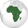
Namibia, officially the Republic of Namibia, is a country in southern Africa on the Atlantic coast. It shares borders with Angola, and Zambia to the north, Botswana to the east, and South Africa to the south. It gained independence from South Africa in 1990 and its capital city is Windhoek. Namibia is a member state of the Southern African Development Community (SADC), the African Union (AU), and the Commonwealth of Nations.
History
The dry lands of Namibia were inhabited since early times by Bushmen, Damara, Namaqua, and since about the fourteenth century AD, by immigrating Bantu who came with the Bantu expansion. The region was not extensively explored by Europeans until the 19th century, when the land came under German control as South-West Africa — apart from Walvis Bay under British control. South Africa occupied the colony during World War I and administered it as a League of Nations mandate territory until after World War II, when it unilaterally annexed the territory, albeit without international recognition.
In 1966 the Marxist South-West Africa People's Organisation (SWAPO) guerrilla group launched a war of independence, but it was not until 1988 that South Africa agreed to end its administration of Namibia, in accordance with a United Nations peace plan for the entire region. Independence came in 1990, and Walvis Bay was ceded to Namibia in 1994.
Administrative divisions
Namibia is divided into thirteen regions and subdivided into 102 constituencies.
Geography

At 318,674 mi² (825,418 km²[1]), Namibia is the world's thirty-fourth largest country (after Venezuela). It is comparable in size to Pakistan, and is about half the size of the US state of Alaska. After Mongolia, Namibia is the least densely populated country in the world (2.5 persons per km²).

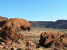
The Namibian landscape consists primarily of central highlands, of which the highest point is the Konigstein at 2,606 metres (8,411 feet)[2]. The central plateau runs from north to south, bordered by the Skeleton Coast to the north west, the Namib Desert and its coastal plains to the south west, the Orange River to the south, and the Kalahari Desert to the east.
A remarkable strip of land in the northeast, known as the Caprivi Strip is the vestige of a narrow corridor demarcated for the German Empire to access the Zambezi River.
The Namibian climate ranges from desert to subtropical, and is generally hot and dry; precipitation is sparse and erratic. The cold, north-flowing Benguela current accounts for some of the low precipitation. Besides the capital city Windhoek in the centre of the country, other important towns are the ports of Walvis Bay and Swakopmund, as well as Oshakati, Grootfontein, Tsumeb and Keetmanshoop.
Economy
The economy is very dependent on the extraction and processing of minerals for export. Mining accounts for 20% of the GDP. Namibia is the fourth largest exporter of non-fuel minerals in Africa, and the world's fifth largest producer of uranium. Rich alluvial diamond deposits make Namibia a primary source for gem-quality diamonds. Namibia also produces large quantities of lead, zinc, tin, silver, and tungsten.
About half of the population depends on agriculture (largely subsistence agriculture) for its livelihood, but Namibia must import some of its food. Although per capita GDP is five times the per capita GDP of Africa's poorest countries, the majority of Namibia's people live in pronounced poverty because of large-scale unemployment. Namibia has one of the highest rates of income inequality in the world. The Namibian economy has many close links to South Africa. Agreement has been reached on the privatisation of several more enterprises in coming years, which should stimulate long-run foreign investment. However, reinvestment of environmentally derived capital has hobbled Namibian per capita income (Lange, 2004).
Child labour occurs in Namibia, and the country is in the process of formulating an Action Programme on the Elimination of Child Labour, which is expected to be adopted in the period 2006-2007. For more information, see this article.
Tourism

Namibia generally attracts eco-tourists with the majority visiting to experience the different climates and natural geographical landscapes such as the great eastern desert and plains. There are many lodges and reserves for eco-tourists to travel to and stay over.
Politics
The politics of Namibia takes place in a framework of a presidential representative democratic republic, whereby the President of Namibia is both the head of state and the head of government, and of a pluriform multi-party system. Executive power is exercised by the government. Legislative power is vested in both the government and the two chambers of parliament. The Judiciary is independent of the executive and the legislature.
Demographics


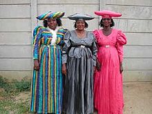
Namibia is among the three sovereign countries with the lowest population density. The majority of the Namibian population is black African — mostly of the Ovambo tribe, which forms about half of the population — and concentrated in the north of the country. In addition to the black Bantu majority, there are large groups of Khoisan (e.g. Nama and Bushmen), who are descendants of the original inhabitants of Southern Africa. Khoisan differ significantly in appearance from both Bantu and White Africans. Blacks of other Bantu descent are descendants of refugees from Angola. There are also two smaller groups of people with mixed racial origins, called "Coloureds" and "Basters", who together make up 8% (with the Coloureds outnumbering the Basters two to one). Whites of Dutch, German, British, French and Portuguese ancestry make up about 12% of the population — which is the second largest proportion in sub-Saharan Africa, after South Africa. Most of Namibian whites and nearly all those of mixed race are Afrikaans speakers and share similar origins, culture, religion and genealogy as the white and coloured populations of neighbouring South Africa. A smaller proportion of whites (around 130,000) trace their family origins directly back to German settlers and maintain German cultural and educational institutions. Nearly all Portuguese are white miners and settlers from their former colony of Angola[citation needed].
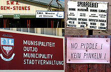
Half of all Namibians speak Oshiwambo (Ovambo) as their first language, whereas the most widely understood language is Afrikaans. Among the younger generation, the most widely understood language is English. Both Afrikaans and English are used primarily as a second language reserved for public sphere communication, but small first language groups exist throughout the country. While the official language is English, most of the white population speaks either Afrikaans or German, both official languages until 1990 when Namibia became independent. Portuguese is spoken by blacks and whites from Angola. Christianity is the major religion, with the Lutheran Church being the largest then followed by the Roman Catholic.
Foreign relations
Namibia follows a largely independent foreign policy, with lingering affiliations with states that aided the independence struggle, including Libya and Cuba.
With a small army and a fragile economy, the Namibian Government's principal foreign policy concern is developing strengthened ties within the Southern African region. A dynamic member of the Southern African Development Community, Namibia is a vocal advocate for greater regional integration.
Namibia became the 160th member of the United Nations on April 23, 1990. On its independence it became the fiftieth member of the Commonwealth of Nations.
The Reporters Without Borders' Worldwide Press Freedom Index 2003 ranks Namibia as fifty-sixth out of 166 countries, as compared with thirty-first out of 139 countries in 2002.
International disputes
Namibia is involved in several minor international disputes, including:
- Small residual disputes with Botswana along the Caprivi Strip, including the Situngu marshlands~Kasikili Island as known in the Namibian side along the Linyanti River, for which a commission to seek a resolution has been established;
- Protests from Botswana residents against Namibia's planned construction of the Okavango hydroelectric dam at the Popa Falls;
- A managed dispute with South Africa over the location of the boundary in the Orange River;
- A dormant dispute over where the boundaries of Botswana, Namibia, Zambia and Zimbabwe converge;
- Angolan rebels and refugees that still reside in Namibia.
Military
The constitution of Namibia defined the role of the military as "defending the territory and national interests." Namibia formed the National Defence Force (NDF), comprising former enemies in a 23-year bush war: the People's Liberation Army of Namibia (PLAN) and South West African Territorial Force (SWATF). The British formulated the force integration plan and began training the NDF, which consists of five battalions and a small headquarters element. The United Nations Transitional Assistance Group (UNTAG)'s Kenyan infantry battalion remained in Namibia for three months after independence to assist in training the NDF and stabilize the north. According to the Namibian Defence Ministry, enlistments of both men and women will number no more than 7,500. Defence and security account for less than 8% of government spending.
Notables
See also
Column-generating template families
The templates listed here are not interchangeable. For example, using {{col-float}} with {{col-end}} instead of {{col-float-end}} would leave a <div>...</div> open, potentially harming any subsequent formatting.
| Type | Family | Handles wiki
table code?† |
Responsive/ mobile suited |
Start template | Column divider | End template |
|---|---|---|---|---|---|---|
| Float | "col-float" | Yes | Yes | {{col-float}} | {{col-float-break}} | {{col-float-end}} |
| "columns-start" | Yes | Yes | {{columns-start}} | {{column}} | {{columns-end}} | |
| Columns | "div col" | Yes | Yes | {{div col}} | – | {{div col end}} |
| "columns-list" | No | Yes | {{columns-list}} (wraps div col) | – | – | |
| Flexbox | "flex columns" | No | Yes | {{flex columns}} | – | – |
| Table | "col" | Yes | No | {{col-begin}}, {{col-begin-fixed}} or {{col-begin-small}} |
{{col-break}} or {{col-2}} .. {{col-5}} |
{{col-end}} |
† Can template handle the basic wiki markup {| | || |- |} used to create tables? If not, special templates that produce these elements (such as {{(!}}, {{!}}, {{!!}}, {{!-}}, {{!)}})—or HTML tags (<table>...</table>, <tr>...</tr>, etc.)—need to be used instead.
Lists
External links


- Government
- Republic of Namibia - Namibian Governmental Portal
- http://www.orusovo.com/namcon/ Constitution of the Republic of Namibia
- News
- The Namibian - (in English)
- Die Republikein - (in Afrikaans)
- Allgemeine Zeitung Namibia - (in German)
- New Era - (in English)
- Insight Namibia - (in English)
- The Economist - (in English)
- Namibia PLUS - (in German and English)
- The Caprivi Vision - (in English)
- Insight Namibia - (in English)
- Travel News Namibia - (in German, English, French and Italian)
- History
- Dr Klaus Dierks' Chronology of Namibian History - (English)
- Dr Klaus Dierks' Database of Biographies of Notable Namibian Figures in History - (English)
- Overviews
- BBC News - Country Profile: Namibia
- UK Foreign Office's profile of Namibia
- CIA World Factbook - Namibia
- Open Directory Project - Namibia directory category
- US State Department - Namibia includes Background Notes, Country Study and major reports
- Tourism
- Namibia Tourism Board (official English Website)
- Namibia Tourism Board in Germany (official German Website)
- Other
- Map
- U.S. Embassy to Namibia
- Goethe Institut Windhoek (in German)
- Namibian Broadcasting Corporation - National TV and radio service
- Namibia Constitution
- Desert Research Foundation of Namibia - Environmental and development NGO based in Windhoek
- Gobabeb Training & Research Centre - Centre for ecological and development research and training in the Namib-Naukluft Park
- University of Namibia - National University
- Polytechnic of Namibia
- "Namibia and the Global Democratic Revolution", lecture by Michael Johns to the University of Pretoria (Pretoria, South Africa), Heritage Foundation Lecture #224, November 1, 1989, ISSN 0272-1155.
- Namibia Pictures
References
- ^ NamibiaCIA World Fact Book.
- ^ landsat.usgs.gov
- Lange, Glenn-marie. Wealth, Natural Capital, and Sustainable Development: Contrasting Examples from Botswana and Namibia. Environmental & Resource Economics; Nov 2004, Vol. 29 Issue 3, pp. 257–83, 27 p.
- Fritz, Jean-Claude . La Namibie indépendante. Les coûts d'une décolonisation retardée, Paris, L'Harmattan, 1991.


