
Spratly Islands
 | |
| Other names | see below |
|---|---|
| Geography | |
| Location | South China Sea |
| Coordinates | 8°38′N 111°55′E / 8.633°N 111.917°E (Spratly Island) |
| Demographics | |
| Population | No indigenous population[1] |
| Spratly Islands | |||||||||||
|---|---|---|---|---|---|---|---|---|---|---|---|
| Chinese name | |||||||||||
| Traditional Chinese | 南沙群島 | ||||||||||
| Simplified Chinese | 南沙群岛 | ||||||||||
| |||||||||||
| Vietnamese name | |||||||||||
| Vietnamese alphabet | Quần Đảo Trường Sa | ||||||||||
| Malay name | |||||||||||
| Malay | Kepulauan Spratly | ||||||||||
| Filipino name | |||||||||||
| Tagalog | Kapuluan ng Kalayaan | ||||||||||
The Spratly Islands are a group of more than 750 reefs,[2] islets, atolls, cays, and islands in the South China Sea between the Philippines, Malaysia, Brunei, Vietnam, and China. They comprise less than four square kilometers of land area, spread over more than 425,000 square kilometers of sea. The Spratlys are part of the three archipelagos of the South China Sea, comprising more than 30,000 islands and reefs and which so complicates geography, governance and economics in that region of Southeast Asia. Such small and remote islands have little economic value in themselves, but are important in establishing international boundaries. There are no native islanders but there are rich fishing grounds and initial surveys indicate the islands may contain significant oil and gas.
About 45 islands are occupied by relatively small numbers of military forces from the People's Republic of China, the Republic of China (Taiwan), Malaysia, the Philippines, and Vietnam. Brunei has claimed an EEZ in the southeastern part of the Spratlys encompassing just one area of small islands above mean high water (on Louisa Reef.)
Geographic and economic overview
- Coordinates: 8°38′N 111°55′E / 8.633°N 111.917°E
- Area (land): less than 5 km²
- note: includes 148 or so islets, coral reefs, and seamounts scattered over an area of nearly 410,000 km² of the central South China Sea
- Coastline: 926 km
- Political divisions:
- Brunei: Claims Louisa Reef itself, as well as an Exclusive Economic Zone (EEZ) around that and neighboring reefs [3];
- Malaysia: Part of the state of Sabah (also claimed by the Philippines);
- Philippines: Part of Palawan province;
- People's Republic of China: Part of the Paracels, Spratlys, and Zhongsha Islands Authority, Hainan province;
- Republic of China: Part of Kaohsiung municipality
- Vietnam: Part of Khanh Hoa Province;
- Climate: tropical
- Terrain: flat
- Elevation extremes:
- lowest point: South China Sea (0 m)
- highest point: unnamed location on Southwest Cay (4 m)
- Natural hazards: serious maritime hazards because of numerous banks, reefs and shoals
The islands are most likely volcanic in origin.[4] The islands themselves contain almost no significant arable land and have no indigenous inhabitants, although twenty of the islands, including Itu Aba, the largest, are considered to be able to sustain human life. Natural resources include fish, guano palm, undetermined oil and natural gas potential. Economic activity includes commercial fishing, shipping, and tourism. The proximity to nearby oil- and gas-producing sedimentary basins suggests the potential for oil and gas deposits, but the region is largely unexplored, and there are no reliable estimates of potential reserves. Commercial exploitation of hydrocarbons has yet to be developed. The Spratly Islands have at least three fishing ports, several docks and harbors, at least three heliports, at least four territorial rigging style outposts (especially due west of Namyit)[5], and six to eight airstrips. These islands are strategically located near several primary shipping lanes.
Ecology
Coral reefs
Coral reefs are the predominant structure of these islands; the Spratly group contains over 600 coral reefs in total.[2]
Vegetation
Little vegetation grows on these islands, which are subject to intense monsoons.[2] Larger islands are capable of supporting tropical forest, scrub forest, coastal scrub and grasses.[2] It is difficult to determine which species have been introduced or cultivated by humans.[2] Itu Aba Island was reportedly covered with shrubs, coconut, and mangroves in 1938; pineapple was also cultivated here when it was profitable.[2] Other accounts mention papaya, banana, palm, and even white peach trees growing on one island.[2] A few islands which have been developed as small tourist resorts have had soil and trees brought in and planted where there were none.[2]
Wildlife
The islands that do have vegetation provide important habitats for many seabirds and sea turtles.[2]
Both the Green Turtle (Chelonia mydas, endangered) and the Hawksbill Turtle (Eretmochelys imbricata, critically endangered) formerly occurred in numbers sufficient to support commercial exploitation.[2] These species reportedly continue to nest even on islands inhabited by military personnel (such as Pratas) to some extent, though it is believed that their numbers have declined.[2]
Seabirds use the islands for resting, breeding, and wintering sites.[2] Species found here include Streaked Shearwater (Calonectris Leucomelas), Brown Booby (Sula Leucogaster), Red-Footed Booby (S. sula), Great Crested Tern (Sterna bergii), and White Tern (Gygis Alba).[2] Little information is available regarding current status of the islands’ seabird populations, though it is likely that birds may divert nesting site to smaller, less disturbed islands. Bird eggs cover the majority of Song Tu, a small island in the eastern Danger Zone.[2]
Unfortunately, this ecoregion is still largely a mystery.[2] Scientists have focused their research on the marine environment, while the ecology of the terrestrial environment remains relatively unknown.[2]
Ecological hazards
Political instability, tourism and the increasing industrialization of neighboring countries has led to serious disruption of native flora and fauna, over-exploitation of natural resources, and environmental pollution.[2] Disruption of nesting areas by human activity or by introduced animals, such as dogs, has reduced the number of turtles nesting on the islands.[2] Sea turtles are also slaughtered for food on a significant scale.[2] The sea turtle is a symbol of longevity in Chinese customs and at times the military personnel are given orders to protect the turtles.[2]
Heavy commercial fishing in the region causes other problems. Though outlawed, fishing methods continue to include the use of bottom trawls fitted with chain rollers.[2] In addition, during a recent routine patrol, more than 200 kg of potassium cyanide solution was confiscated from fishermen who had been using it for fish poisoning. These activities have a devastating impact on local marine organisms and coral reefs.[2]
Some interest has been taken in regard to conservation of these island ecosystems.[2] J.W. McManus has explored the possibilities of designating portions of the Spratly Islands as a marine park.[2] One region of the Spratly Archipelago, called Truong Sa, was proposed by Vietnam's Ministry of Science, Technology and the Environment (MOSTE) as a future protected area.[2] The 160 km2 site is currently managed by the Khanh Hoa Provincial People's Committee of Vietnam.[2]
Military groups in the Spratlys have engaged in environmentally damaging activities such as shooting turtles and seabirds, raiding nests, and fishing with explosives.[2] The collection of rare medicinal plants, collecting of wood and hunting for the wildlife trade are common threats to the biodiversity of the entire region, including these islands.[2] Coral habitats are threatened by pollution, over-exploitation of fish and invertebrates, and the use of explosives and poisons as fishing techniques.[2]
History
Early cartography of the Spratly Islands

The first possible human interaction with the Spratly Islands dates back between 600 BCE to 3 BCE. This is based on the theoretical migration patterns of the people of Nanyue (southern China and northern Vietnam) and Old Champa kingdom who may have migrated from Borneo, which may have led them through the Spratly Islands.[6]
Ancient Chinese maps record the "Thousand Li Stretch of Sands"; Qianli Changsha (千里長沙) and the "Ten-Thousand Li of Stone Pools"; Wanli Shitang (萬里石塘)[7], which China today claims refers to the Spratly Islands. The Wanli Shitang have been explored by the Chinese since the Yuan Dynasty and may have been considered within their national boundaries. [8][9] They are also referenced in the 13th century,[10] followed by the Ming Dynasty.[11] When the Ming Dynasty collapsed, the Qing Dynasty continued to include the territory in maps compiled in 1724,[12] 1755,[13] 1767,[14] 1810,[15] and 1817[16]. A Vietnamese map from 1834 also includes the Spratly Islands clumped in with the Paracels (a common occurrence on maps of that time) labeled as "Wanli Changsha".[17]
According to Hanoi, old Vietnamese maps record Bãi Cát Vàng (Golden Sandbanks, referring to both Paracels and the Spratly Islands) which lay near the Coast of the central Vietnam as early as 1838.[18] In Phủ Biên Tạp Lục (Frontier Chronicles) by the scholar Lê Quý Đôn, Hoàng Sa and Trường Sa were defined as belonging to Quảng Ngãi District. He described it as where sea products and shipwrecked cargoes were available to be collected. Vietnamese text written in the 17th century referenced government-sponsored economic activities during the Lê Dynasty, 200 years earlier. The Vietnamese government conducted several geographical surveys of the islands in the 18th century.[18]
Despite the fact that China and Vietnam both made a claim to these territories simultaneously, at the time, neither side was aware that their neighbor had already charted and made claims to the same stretch of islands.[18]
The islands were sporadically visited throughout the nineteenth and early twentieth centuries by mariners from different European powers (including Richard Spratly, after whom the island group derives its most recognizable English name).[19] However, these nations showed little interest in the islands. In 1883, German boats surveyed the Spratly and Paracel Islands but withdrew the survey eventually after receiving protests from the Nguyễn Dynasty. Many European maps before the 20th century do not even make mention of this region.[20]
Military conflict
In 1933, France reasserted its claims from 1887[21] to the Spratly and Paracel Islands on behalf of its then-colony Vietnam.[22] It occupied a number of the Spratly Islands, including Itu Aba, built weather stations on two, and administered them as part of French Indochina. This occupation was protested by the Republic of China government because France admitted finding Chinese fishermen there when French war ships visited the nine islands.[23] In 1935, the ROC government also announced a sovereignty claim on the Spratly Islands. Japan occupied some of the islands in 1939 during World War II, and used the islands as a submarine base for the occupation of Southeast Asia. During the occupation, these islands were called Shinnan Shoto (新南諸島), literally the New Southern Islands, and put under the governance of Taiwan together with the Paracel Islands (西沙群岛). Today, Itu Aba Island is still administrated by the Republic of China, which took over the control of Taiwan from Japan in 1945.
Following the defeat of Japan at the end of World War II, China re-claimed the entirety of the Spratly Islands (including Itu Aba), accepting the Japanese surrender on the islands based on the Cairo and Potsdam Declarations. The ROC government withdrew from most of the Spratly and Paracel Islands after they retreated to Taiwan from the opposing Communist Party of China, which founded the People's Republic of China in 1949.[24] ROC quietly withdrew troops from Itu Aba in 1950, but reinstated them in 1956 in response to Tomas Cloma's sudden claim to the island as part of Freedomland.[25]
Japan renounced all claims to the islands in the 1951 San Francisco Peace Treaty, together with the Paracels, Pratas & other islands captured from China, upon which China reasserted its claim to the islands.
The naval units of the Vietnamese government took over in Trường Sa after the defeat of the French at the end of the First Indochina War. In 1958, the People's Republic of China issued a declaration defining its territorial waters, which encompassed the Spratly Islands. North Vietnam's prime minister, Phạm Văn Đồng, sent a formal note to Zhou Enlai, stating that the Government of the Democratic Republic of Vietnam respects the decision by China regarding the 12 nautical mile limit of territorial waters [26]. However, South Vietnam still claimed jurisdiction over the islands.
Modern territorial dispute

Hydrocarbons
There are multiple reasons why the neighboring nations would be interested in the Spratly Islands. In 1968 oil was discovered in the region. The Geology and Mineral Resources Ministry of the People's Republic of China (PRC) has estimated that the Spratly area holds oil and natural gas reserves of 17.7 billion tons (1.60 × 10¹⁰ kg), as compared to the 13 billion tons (1.17 × 10¹⁰ kg) held by Kuwait, placing it as the fourth largest reserve bed in the world. Naturally, these large reserves assisted in intensifying the situation and propelled the territorial claims of the neighboring countries.
In 1968, the Philippines started to take their claims a bit more seriously and stationed troops on three islands which had been claimed by the adventurer Tomas Cloma as part of Freedomland.[27] In 1973 Vietnamese troops were stationed on five islands.[28]
On 11 March 1976, the first major Philippine oil discovery occurred off the coast of Palawan, within the Spratly Islands territory, and these oil fields now account for fifteen percent of all petroleum consumed in the Philippines. In 1992, the PRC and Vietnam granted oil exploration contracts to U.S. oil companies that covered overlapping areas in the Spratlys. In May 1992, the China National Offshore Oil Corporation (CNOOC) and Crestone Energy (a U.S. company based in Denver, Colorado) signed a cooperation contract for the joint exploration of the Wan'an Bei-21 block, a 25,155 km² section of the southwestern South China Sea that includes Spratly Island areas. Part of the Crestone's contract covered Vietnam's blocks 133 and 134, where PetroVietnam, PetroStar Energy(USA) and ConocoPhillips Vietnam Exploration & Production, a unit of ConocoPhillips, agreed to evaluate prospects in April 1992. This led to a confrontation between China and Vietnam, with each demanding that the other cancel its contract.
Commercial fishing
An additional motive is the region's role as one of the world's most productive areas for commercial fishing. In 1988, for example, the South China Sea accounted for eight percent of the total world catch, a figure which has certainly risen. The PRC has predicted that the South China Sea holds combined fishing and oil and gas resources worth one trillion dollars. There have already been numerous clashes between the PRC, the Philippines and other nations over "foreign" fishing vessels in its Exclusive Economic Zone (EEZ) and the media regularly report the arrest of Chinese fishermen. In 1984, Brunei established an exclusive fishing zone encompassing Louisa Reef in the southeastern Spratly Islands.[3]
Commercial shipping
The region is also one of the busiest shipping lanes in the world. During the 1980s, at least two hundred and seventy ships passed through the Spratly Islands region each day, and currently more than half of the world's supertanker traffic, by tonnage, passes through the region's waters every year. Tanker traffic through the South China Sea is over three times greater than through the Suez Canal and five times more than through the Panama Canal; twenty five percent of the world's crude oil passes through the South China Sea.
Confrontations and other incidences
There have been occasional naval clashes over the Spratly Islands. In 1988, China and Vietnam clashed at sea over possession of Johnson Reef in the Spratlys. Chinese gunboats sank Vietnamese armed transport ships supporting a landing party of Vietnamese soldiers.
Extended continental shelf claims
The United Nations Convention on the Law of the Sea (UNCLOS) procedure for countries with coastlines to submit claims for their continental shelf to be extended beyond 200 nautical miles of their shores brought the spotlight back to the South China Sea and Spratly Islands in May 2009.[29] Two such submissions were made - one by Vietnam for a claim over the northern portion of the sea which included the Paracel Islands, and another jointly by Vietnam and Malaysia for a joint claim over a "defined area" in the middle of the sea between the two countries which included part of the Spratly Islands. Brunei, a potential claimant, has not submitted such a claim but had provided preliminary information to the United Nations notifying it of its intention to claim a continental shelf beyond 200 nautical miles from its shores.[30]
China immediately issued protests over the two submissions and called on the United Nations not to consider them. It also issued a stern warning to countries not to claim the islands which it said were its sovereign territory.[31]
Moves towards resolution
Diplomatic moves

Following a 1995 dispute between China and the Philippines, an ASEAN-brokered agreement was reached between the PRC and ASEAN member nations whereby one country would inform the other of any military movement within the disputed territory and that there would be no further construction. The agreement was promptly violated by China and Malaysia. Claiming storm damage, seven Chinese naval vessels entered the area to repair "fishing shelters" in Panganiban Reef. Malaysia erected a structure on Investigator Shoal and landed at Rizal Reef. In response the Philippines lodged formal protests, demanded the removal of the structures, increased naval patrols in Kalayaan and issued invitations to American politicians to inspect the PRC bases by plane. The Philippine senate also debates to send troops and navy forces to attempt the invasion in the islands.
In the early 21st century, the situation is improving. China recently held talks with ASEAN countries aimed at realizing a proposal for a free trade area between the ten countries involved. China and ASEAN have also been engaged in talks to create a code of conduct aimed at easing tensions in the disputed islands. On 5 March 2002, an agreement was reached, setting forth the desire of the claimant nations to resolve the problem of sovereignty "without further use of force"[citation needed]. In November 2002, a Declaration on the Conduct of Parties in the South China Sea was signed, easing tensions but falling short of a legally binding code of conduct.
Declaration on the Conduct of Parties in the South China Sea 2002
This declaration[32] was signed by the 10 foreign ministers of ASEAN countries and China on 4 November 2002 in Phnom Penh where the signatory countries pledged to resolve their sovereignty disputes in a peaceful manner, without resorting to the use of force and through direct negotiations among the countries concerned. The parties also undertook to exercise self-restraint with activities that would complicate or escalate disputes and affect peace and stability, including refraining from inhabiting on the presently uninhabited islands, reefs, shoals, cays, and other features.
In the interim, the parties pledged to carry out confidence building measures, such as by holding dialogues and exchange of views as appropriate between their defense and military officials; ensuring just and humane treatment of all persons who are in danger or distress; notifying on a voluntary basis other Parties concerned of any impending joint/combined military exercise; and exchanging, on a voluntary basis, relevant information.
The Parties may also explore or undertake cooperative activities such as marine environmental protection; marine scientific research; safety of navigation and communication at sea; search and rescue operation; and combating transnational crime, including but not limited to trafficking in illicit drugs, piracy and armed robbery at sea, and illegal traffic in arms.
Various claims
| Disputes over the South China Sea | ||||||||||
|---|---|---|---|---|---|---|---|---|---|---|
 Spratly islands map showing occupied features marked with the flags of countries occupying them. | ||||||||||
| ||||||||||
| Belligerents | ||||||||||
|
ASEAN Free Territory of Freedomland (Kalaya'an) |
China[33] |
Republic of Morac-Songhrati-Meads | ||||||||
Brunei
Brunei claims the part of the South China Seas nearest to it as part of its continental shelf and Exclusive Economic Zone (EEZ). In 1984, Brunei declared an EEZ encompassing the above-water islets it claims in Louisa Reef.[3][34] Brunei does not practice military control in the area.
Basis of Brunei's claim
Brunei's claims to the reef are based on the Law of the Sea.[35] It states that the southern part of the Spratly Chain is actually a part of its continental shelf and therefore a part of its territory and resources.[36]
Malaysia
Malaysia has militarily occupied three islands that it considers to be within its continental shelf. Swallow Reef (Layang Layang) has been turned into an island through land reclamation and hosts a dive resort.
The Malaysian military currently occupies Ardasier Reef (Terumbu Ubi), Mariveles Reef (Terumbu Mantanani) and Swallow Reef (Terumbu Layang or Pulau Layang Layang).[34]
Basis of Malaysia's claim
Malaysian claims are based upon the continental shelf principle, which requires clearly defined coordinates.
Criticisms of Malaysia's claim
Some countries believe that the right of sovereignty is based on who made their claim first and Malaysia's first claim was not made until 1979.[37]
People's Republic of China and Republic of China (Taiwan)
The People's Republic of China (PRC) claim all of the Spratly Islands as part of China and had a historical naval presence. Recently, they have had a profound military impact on the area.

The Republic of China (ROC), which ruled Mainland China before 1949 and has been confined to Taiwan since 1949, also claims all of the Spratly Islands. The ROC occupies Itu Aba, the largest island.
From 1932 to 1935, the ROC continued to include the territory in its administrative area through the Map Compilation Committee. When France claimed nine islands of the territory in 1933, it immediately encountered a revolt from Chinese fishermen and a protest from the Republic of China government in Nanking. Although China continued to claim the islands, the Second Sino-Japanese war drew its attention for the meantime from 1937 onwards. After the second world war, China reclaimed sovereignty over the islands through post World War II arrangements based on various treaties of the Allied Powers[38] and China built a stone marker on the island. In 1947, the government renamed 159 islands in the area and published the Map of the South China Sea Islands (See left).
In 1958, the People's Republic of China, having taken over all of the Republic of China's territory except Taiwan, Penghu, Kinmen, and Matsu, issued a declaration of a 12 nautical mile limit territorial waters that encompassed the Spratly Islands. North Vietnam's prime minister, Phạm Văn Đồng, sent a formal note to recognize these claims and stated that the Government of the Democratic Republic of Vietnam (North Vietnam) respects the decision on the 12 nautical mile limit territorial waters.

South Vietnam (Republic of Vietnam) continued to assert sovereignty over the islands. Up to the end of the Vietnam War the army of the South Vietnamese still held military control over the majority of the Spratly islands. After the Vietnam War, the unified Vietnam continued to claim the Spratly islands as an integral part of Vietnam. Today, the People's Liberation Army and the military of the Republic of China are both stationed in several islands, including the largest, Taiping Island.
Basis for PRC's and ROC's claims
The PRC and ROC base their claims on the belief that the islands have been an integral part of China for nearly two thousand years and that neighboring countries and European Powers took advantage of China's poor condition and diversity to impinge on its sovereignty.
China claims to have discovered the islands in the Han Dynasty in 2 BC. The islands were claimed to have been marked on maps compiled during the time of Eastern Han Dynasty and Eastern Wu (one of the Three Kingdoms). Since the Yuan Dynasty in the 12th century, several islands that may be the Spratlys have been labeled as Chinese territory ,[10] followed by the Ming Dynasty[11] and the Qing Dynasty from the 13th to 19th Century.[12][16] In archaeological surveys the remains of Chinese pottery and coins have been found in the islands and are cited as proof for the PRC claim.[39]
In addition, the PRC's military presence ensures a tangible claim to other potential challengers of sovereignty over at least those inhabited areas.
Criticisms to the PRC's and ROC's claims
Surveying an area without establishing a civilization there or a military garrison does not hold the same political weight as staking an official claim. However, the PRC's claim to the Spratly Islands is grounded in the philosophy that since they were present there first they rightly have sovereignty, similar logic to that involved in the British claim to the Falkland Islands.
Many of these claims to sovereignty come directly from the Ministry of Foreign Affairs of the People's Republic of China. There is also doubt as to whether these sources state a claim of sovereignty or simply mention the Spratlys alongside other foreign lands.
Claims of pottery being found are mostly shipwrecked treasure from Chinese galleons that sailed through the area and did not necessarily come from anyone who inhabited or even visited the islands.[39]
Philippines
While the Philippines' claim to the Spratly Islands was first expressed in the United Nations General Assembly in 1946, Philippine involvement in the Spratlys did not begin in earnest until 1956, when on May 15, 1956, Filipino citizen and admiral Tomas Cloma proclaimed the founding of a new state, Kalayaan (Freedom Land).
The text of the San Francisco treaty stated that Japan had to give up any claim of sovereignty over the Spratlys but did not specify the country to which the Spratlys would go. Tomas Cloma and the present day government's view is that this made the Spratlys res nullius.
Cloma's Kalayaan encompassed fifty three features spread throughout the eastern South China Sea, Itu Aba, Pag-asa and Nam Yit Islands, as well as West York Island, North Danger Reef, Mariveles Reef and Investigator Shoal but not including Spratly Island proper. Cloma then established a protectorate in July 1956 with Pag-asa as its capital and Cloma as "Chairman of the Supreme Council of the Kalayaan State".
This action, although not officially endorsed by the Philippine government, was considered by other claimant nations as an act of aggression by the Philippines and international reaction was swift.
The ROC, the PRC, South Vietnam, France, the United Kingdom and the Netherlands lodged official protests (the Netherlands on the premise that it considered the Spratly Islands part of Dutch New Guinea) and The ROC sent a naval task force to occupy the islands and establish a base on Itu Aba, which it retains to the present day.
Tomas Cloma and the Philippines continued to state their claims over the islands; in October 1956 Cloma traveled to New York to plead his case before the United Nations and the Philippines had troops posted on three islands by 1968 on the premise of protecting Kalayaan citizens. In early 1971 the Philippines sent a diplomatic note on behalf of Cloma to Taipei demanding the ROC's withdrawal from Itu Aba and on 10 July in the same year Ferdinand Marcos announced the annexation of the 53 island group known as Kalayaan, although since neither Cloma or Marcos specified which fifty three features constituted Kalayaan, the Philippines began to claim as many features as possible. In April 1972 Kalayaan was officially incorporated into Palawan province and was administered as a single "poblacion" (township), with Tomas Cloma as the town council Chairman and by 1992, there were twelve registered voters on Kalayaan. The Philippines also reportedly attempted to land troops on Itu Aba in 1977 to occupy the island but were repelled by ROC troops stationed on the island. There were no reports of casualties from the conflict. In 2005, a cellular phone base station was erected by the Philippines' Smart Communications on Pag-asa Island.
The Philippines base their claims of sovereignty over the Spratlys on the issues of res nullius and geography. The Philippines contend Kalayaan was res nullius as there was no effective sovereignty over the islands until the 1930s when France and then Japan acquired the islands. When Japan renounced their sovereignty over the islands in the San Francisco Peace Treaty in 1951, there was a relinquishment of the right to the islands without any special beneficiary. Therefore, argue the Philippines, the islands became res nullius and available for annexation. Philippine businessman Tomas Cloma did exactly that in 1956 and while the Philippines never officially supported Cloma's claim, upon transference of the islands’ sovereignty from Cloma to the Philippines, the Philippines used the same sovereignty argument as Cloma did. The Philippine claim to Kalayaan on geographical bases can be summarized using the assertion that Kalayaan is distinct from other island groups in the South China Sea because:
It is a generally accepted practice in oceanography to refer to a chain of islands through the name of the biggest island in the group or through the use of a collective name. Note that Spratly (island) has an area of only 13 hectares compared to the 22 hectare area of the Pag-asa Island. Distance-wise, Spratly Island is some 210 nm off Pag-asa Islands. This further stresses the argument that they are not part of the same island chain. The Paracels being much further (34.5 nm northwest of Pag-asa Island) is definitely a different group of islands[40]
A second argument used by the Philippines regarding their geographical claim over the Spratlys is that all the islands claimed by the Philippines lie within their archipelagic baselines, and that the Philippines is the only claimant which can make such a statement. The 1982 United Nations Convention on the Law of the Sea (UNCLOS III) stated that within its territorial waters (out to 12 nautical miles from the baseline), a coastal state is free to set laws, regulate use, and use any resource and that exclusive economic zones (EEZs) extend 200 nautical miles from the baseline. Within an EEZ, the coastal nation has sole exploitation rights over all natural resources. China, the Philippines, and Vietnam are all signatories to the UNCLOS III agreement.[41] The Philippines also argue, under Law of the Sea provisions, that the PRC can not extend its baseline claims to the Spratlys because the PRC is not an archipelagic state. Whether this argument (or any other used by the Philippines) would hold up in court is debatable but possibly moot, as the PRC and Vietnam seem unwilling to legally substantiate their claims and have rejected Philippine challenges to take the dispute to the World Maritime Tribunal in Hamburg.
Vietnam
Vietnam's response to China's claim is that Chinese records on Qianli Changsha and Wanli Shitang are in fact records about non-Chinese territories [42]. For example, Qianli Changsha and Wanli Shitang were referred to in the ancient Chinese texts Ling Wai Dai Da [43] and Zhu Fan Zhi [44] as being in the Sea of Jiaozhi, Jiaozhi being the old name for northern Vietnam (Giao Chỉ), or as writings on foreign countries.
Vietnam's view is that the Chinese records do not constitute the declaration and exercise of sovereignty and that China did not declare sovereignty over the Spratlys until after World War II.
On the other hand, Vietnam claims the Spratlys based on international law on declaring and exercising sovereignty.

Vietnamese geographical maps record Bãi Cát Vàng (Golden Sandbanks, referring to Spratly Islands) as Vietnamese territory as early as the 17th century.[citation needed] In Phủ Biên Tạp Lục (Miscellaneous Records of Pacification in the Border Area) by the scholar Lê Quý Đôn, Hoàng Sa (Paracel Islands), and Trường Sa (Spratly Islands) were defined as belonging to Quảng Ngãi District. In Đại Nam Nhất Thống Toàn Đồ (Dai Nam Unified Map), an atlas of Vietnam completed in 1838, Trường Sa was shown as Vietnamese territory.[citation needed] Vietnam had conducted many geographical and resource surveys of the islands.[citation needed] The results of these surveys have been recorded in Vietnamese literature and history published since the 17th century. After the treaty signed with the Nguyễn Dynasty, France represented Vietnam in international affairs and exercised sovereignty over the islands.[citation needed]
The Cairo Declaration, drafted by the Allies and China towards the end of World War II, listed the territories that the Allies intended to strip from Japan and return to China. Despite China being among the draftees of the declaration, this list did not include the Spratlys.[citation needed] Vietnam's response to China's claim that the Cairo Declaration somehow recognized the latter's sovereignty over the Spratlys is that this claim has no basis in fact.
At the San Francisco Conference on the peace treaty with Japan, the Soviet Union proposed that the Paracels and Spratlys belonged to China. This proposal was rejected by an overwhelming majority of the delegates. On July 7, 1951, Tran Van Huu, head of the Bảo Đại Government's delegation to the conference declared that the Paracels and Spratlys were part of Vietnamese territory. This declaration met with no challenge from the 51 representatives at the conference.[citation needed]
The text of the Treaty of San Francisco listed the Spratlys as not part of the list of territories to be returned to China.[45]
After the French left, the Vietnamese government exercised sovereignty over the islands.[dubious – discuss] Vietnam currently occupies 31 islands. They are organized as a district of Khanh Hoa Province. At the 12th National Assembly Election held early in Trường Sa, the people and soldiers also voted for their local district government for the first time. For the first time, Trường Sa is organized like a normal inland district, with a townlet (thị trấn Trường Sa) and two communes (xã Sinh Tồn, xã Song Tử Tây). Forty nine people were elected to the communes' people's councils.
Tabular listing of features showing country possessions
Occupied features
A feature is occupied by a country if one of the following is true:
- Soldiers and/or civilian citizens of a country are present in the feature, either by building structures over the feature to house the citizens (most features are of this type) or by manning a ship anchored over the feature (Philippine-occupied Irving Reef is of this type).
- Regularly visited by soldiers of a country, not necessarily having soldiers present in it 24 hours. These features must lie near (within 9 miles (14 km)) a feature occupied by the country in the way of the first condition. Presence of structures is not necessary. This is the case of Philippine-occupied Flat Island and Lankiam Cay where soldiers stationed at Nanshan Island and Loaita Island respectively, regularly visit on a daily basis.
The effective visible distance of horizon from a 15 meter (typical large structure) height above sea-level is 9 miles (14 km). This makes features occupied by the second condition to be also labeled as "occupied" since they can be guarded far away. However not all features within the 9-mile (14 km) radius can be considered as absolutely occupied. This is especially true for features that lie between and within 9 miles (14 km) of two or more features occupied by different countries. (See Virtually Occupied or Controlled table)
| Int'l Name | Local Names | Description | Area (ha.) |
| Itu Aba Island[34][46] | The largest of the Spratly islands. Located about 22 miles (35 km) south-southwest of Philippine-occupied Loiata (Kota) Island and about 6 miles (10 km) west of Vietnam-occupied Sand Cay. Covered with shrubs, coconut and mangroves. 600 soldiers stationed, lighthouse, radio and weather stations, concrete landing jetty and two wells at the SW end. Guano deposits, fringing reef. Hainan fishermen used to visit annually. In 8/93, plans were announced for a 2 km-long airstrip[47] and a fishing port. The now only 1150-meters-long airstrip was completed in January 2008.[48] Pineapple was once cultivated here. Occupied since September 1956, four months after Filipino Tomas Cloma claimed the islands. Part of Tizard Banks. | 46 | |
| Ban Than Reef[46] | Lies 3 miles (5 km) east of Itu-Aba Island and 3 miles (5 km) west of Vietnamese occupied Sand Cay. Small drying reef. Occupied since 1995. Part of Tizard Banks. | 0 | |
| Total | 1 island, 1 reef | 46 |
| Int'l Name | Local Names | Description | Area (ha.) |
| Cuarteron Reef[34][46] | Coral rocks only. Highest are 1.5 m high, on the north. Occupied since 1988. Part of London Reefs. | 0 | |
| Fiery Cross Reef/ Northwest Investigator Reef[34][46] | Rocks up to 1 m high. All below at high tide, but has guano deposits. PRC built a navy harbor by blasting, piling up and cementing coral, but says no soldiers stationed here. 8,080 square meters, 14 miles (23 km) long, with airstrip. "Marine observation station" built in 1988; coconut, fir, and banyan trees planted. Actually 3 reefs. Occupied since 1988. | 0 | |
| Gaven Reefs[34][46] | A sand dune, 2 m high. Has fringing reef plus a reef 2 miles (3 km) to the south, both covered at high tide. Now all cement and a raised metal frame, with two-story buildings placed on top. Southern reef was occupied by PRC on 7/4/92. Occupied since 1988.Part of Tizard Banks. | 0 | |
| Hughes Reef[34] | Lies 9 miles (14 km) to the east of Sin Cowe Island. Naturally above water at least at low tide. Occupied since 1988. Part of Union Banks. | 0 | |
| Johnson South Reef[34][46] | Contiguous with Vietnam-occupied Collins Reef which lies 4 miles (6 km) away northwest. Naturally above water only at low tide, but [9] says many rocks above water at high tide. Site of 1988 PRC/Vietnam clash. Occupied since 1988. Part of Union Banks. | 0 | |
| Mischief Reef[34][46] | Some rocks above water at low tide. Has a lagoon. In February 1995, PRC had built a wooden complex on stilts here, starting its formal occupation of the feature. In 1999, the Philippines protested over this structures claiming that it is a military outpost and it poses danger to Philippine security and national defense, being 130 miles (209 km) from Palawan. PRC claims it is a shelter for fishermen. | 0 | |
| Subi Reef[34][46] | Lies 16 miles (26 km) southwest of Philippine-occupied Thitu Island (Pagasa Island). Naturally above water only at low tide. Surrounds a lagoon. PRC has constructed 3-story buildings, wharfs, and a helipad here. | 0 | |
| First Thomas Reef |
|
A few rocks are permanently above sea level. Much of the reef is above water at low tide. Encloses a lagoon. | 0 |
| Whitson Reef[46] | Some rocks naturally above water at high tide. Part of Union Banks. | 0 | |
| Total | 9 reefs | 0 |
| Int'l Name | Local Names | Description | Area (ha.) |
| Flat Island[34][46] | The fourteenth largest Spratly island. About 6 miles (10 km) southwest of Philippine-occupied Lawak Island (Nanshan Island). It changes its shape seasonally. The sand build up will depend largely on the direction of prevailing wind and waves. It takes the shape of an elongated one for some years now and a shape like that of a crescent moon for few years ago and it formed the shape of a letter "S" in the past. Like Panata Island (Lankiam Cay), it is also barren of any vegetation. No underground water source is found in the island. Presently, this island serves only as a military observation post for the Municipality of Kalayaan. A low, flat, sandy cay, 240 by 90 m, subject to erosion. Has a nearby reef which is above water at high tide. With large guano deposits. No vegetation. Several soldiers stationed. | 0.57 | |
| |||
| Lankiam Cay[34][46] | The fifteenth largest and the smallest Spratly island. Located 8 miles (13 km) northeast of Philippine-occupied Kota Island (Lankiam Cay). A few years ago this island has a surface area of more than 5 hectares but strong waves brought by a strong typhoon washed out the sandy surface (beach) of the island leaving behind today the calcarenite foundation that can be seen at low tide. Several soldiers stationed. Part of Loaita Banks. | 0.44 | |
| |||
| Loaita Island[34][46] | The tenth largest Spratly island. Located 22 miles (35 km) southeast of Philippine-occupied Pag-asa Island (Thitu Island) and 22 miles (35 km) north-northeast of the ROC-occupied Itu Aba Island. It fringes the Laoita bank and reef. Its calcarenite outcrop is visible along its western side at low tide. The present shape of the island indicates sand buildup along its eastern side. The anchor-shaped side will eventually connect with the northern portion as the sand buildup continues thereby creating another mini-lagoon in the process. The presence of migrating sea birds adds to the high phosphorus contents of the sand found in the island. Occasionally, giant sea turtles are reported to be laying their eggs in the island. Covered with mangrove bushes, above which rose coconut palms and other small trees. Several soldiers stationed. Occupied since 1968. Part of Loaita Banks. | 6.45 | |
| |||
| Nanshan Island[34][46] | The eighth largest Spratly island. Located 98.0 miles (157.7 km) east of Pag-asa (Thitu Island). This island is a bird sanctuary. Its surroundings are highly phosphatized that superphosphate materials can be mined out on a small-scale basis. Near the fringes of the breakwaters (approx. 2 miles (3 km) from the island), intact hard coral reefs were observed to retain their natural environment and beautiful tropical fishes were seen colonizing these coral beds of varying colors. Covered with coconut trees, bushes and grass. 580 m long, on the edge of a submerged reef. Several soldiers stationed. Has a small airstrip. | 7.93 | |
| |||
| Northeast Cay[34][46] | The fifth largest Spratly island. Only 1.75 miles (2.82 km) north of Vietnamese-occupied Southwest Cay and can be seen before the horizon. Located 28 miles (45 km) northwest of Philippine-occupied Pag-asa (Thitu Island). Some of its outcrops are visible on its western side. It has high salinity groundwater and vegetation limited to beach type of plants. The corals around the island were mostly destroyed by rampant use of dynamite fishing and cyanide method employed by foreign fishing boats in the past. Covered with grass and thick trees. Much of the ringing reef is above water at high tide. Supported a beacon in 1984. Has Guano deposits. Several soldiers stationed. Satellite photography suggests it may have an airstrip.[50] Occupied since 1968. Part of North Danger Reef. | 12.7 | |
| |||
| Thitu Island[34][46] | The second largest Spratly island. Serves as the poblacion for the Municipality of Kalayaan, Palawan, Phils. It is covered with trees and has a variety of fauna. It is home to some 300+ civilians (including children) and over 50 soldiers. Other islands are expected to be populated before 2010. Population is regulated to protect the islands' flora and fauna and to avoid tension with other countries. It has 1.4 km airstrip, a marina, water filtering plant, power generator and a commercial communications tower (by Smart Communications). The Philippines' Department of Tourism is making improvements to the island to make it profitable. Occupied since 1968. Part of Thitu Reefs. | 37.2 | |
| |||
| West York Island[34][46] | The third largest Spratly island. This island is located 47 miles (76 km) northeast of Pag-asa (Thitu Island). Outcrops are visible on the southern and eastern portion of the island during low tides. This island is considered a sanctuary for giant sea turtles that lay their eggs on the island all year round. The high salinity of the ground water in the island retards the growth of introduced trees like coconuts, ipil-ipil, and other types. Only those endemic to the area that are mostly beach type of plants thrive and survive the hot and humid condition especially during the dry season. Has an observation post. Several soldiers stationed. | 18.6 | |
| |||
| Commodore Reef[34][46] | A sand "cay", 0.5 m high, surrounded by two lagoons. Parts of reef above water at high tide. It is a typical reef lying underwater and is now being manned by a military contingent based and established in the area. Some structures. Several soldiers stationed. Occupied since 1978. | 0 | |
| |||
| Irving Reef[46] | Naturally above water only at low tide. A very small cay lies at northern end. Some structures. Several soldiers stationed. | 0 | |
| |||
| Second Thomas Reef[51] | A shallow reef. It is close to Chinese-occupied Mischief Reef. It was occupied by the Philippines in 1999, after the 1995 controversial Chinese occupation of Mischief Reef, to put pressure on China not to occupy any features further which lie near the Philippines. | 0 | |
| |||
| Total | 7 islands, 3 reefs | 83.89 |
| Int'l Name | Local Names | Description | Area (ha.) |
| Amboyna Cay[34][46] | The thirteenth largest Spratly island. Two parts: East part consists of sand and coral, west part is covered with guano. Has fringing reef. An obelisk, about 2.7 m high, stands on the SW corner. Little vegetation. Lighthouse operational since May 1995. Heavily fortified. | 1.6 | |
| Namyit Island[34][46] | The twelfth largest Spratly island. Covered with small trees, bushes and grass. Has a fringing reef and is inhabited by sea birds. The island is inhabited by an unknown number of Vietnamese soldiers and in the deep waters fronting the south side it is said that a submarine base is situated.[citation needed] Occupied since 1975.Part of Tizard Banks. | 5.3 | |
| Sand Cay[34][46] | The ninth largest Spratly island. Lies 6 miles (10 km) to the east of Taiwan-occupied Itu Aba Island. Covered with trees and bushes. Fringing reef partly above water at low tide. This feature is commonly confused with Sandy Cay. Occupied since 1974. Part of Tizard Banks. | 7 | |
| Sin Cowe Island[34][46] | The seventh largest. Has fringing reef which is above water at low tide. Occupied since 1974. Part of Union Banks. | 8 | |
| Southwest Cay[34][46] | The sixth largest Spratly island. Only 1.75 miles (2.82 km) from Northeast Cay and can be seen before the horizon. Previously a breeding place for birds and covered with trees and guano. Export of guano was once carried out "on a considerable scale." Fringing reef partly above water at high tide. Vietnam erected its first lighthouse in the Spratlys here in October 1993 and built an airstrip. Has a three-story building, garrisoned by soldiers. Philippine military controlled the island before early 1970s. South Vietnamese forces (Republic of Vietnam) invaded the island in 1975, when Filipino soldiers guarding the island attended the birthday party of their commanding officer based in the nearby Northeast Cay. A confirmed report came out that Vietnamese prostitutes were sent by Vietnamese officials to the birthday party, supposedly a sign of good brotherhood between the forces, but was actually used to lure the Filipino soldiers guarding the island. Filipino forces apparently planned on attacking the island, thus it would have led to a war, but Vietnamese forces were able to erect a huge garrison in the island within few weeks, forcing Filipino officials to abort the plan. Since then, more soldiers were assigned to Parola Island (North East Cay), to avoid it from happening again. This was confirmed by interviews with soldiers involved in an episode of the defunct ABS-CBN's Magandang Gabi Bayan (Good Evening Nation) program. See Policies, activities and history of the Philippines in Spratly Islands#Southwest Cay invasion for more details. Part of North Danger Reef. | 12 | |
| |||
| Spratly Island (proper)/ Storm Island[34][46] | The fourth largest Spratly island. 2.5 m high, flat. Covered with bushes, grass, birds and guano. 5.5 m-high obelisk at southern tip. Has landing strip, and a fishing port. Fringing reef is above water at low tide. Some structures with soldiers stationed. Occupied since 1974. | 13 | |
| Alison Reef[34][46] | Naturally above water only at low tide. Encloses a lagoon. | 0 | |
| Barque Canada Reef/ Lizzie Weber Reef[34][46] | Coral. Highest rocks are 4.5 m high, at SW end. Much of reef is above water at high tide. Some sandy patches. 18 miles (29 km) long. Its military structures were recently upgraded. Occupied since 1987. | 0 | |
| Central London Reef[34][46] | SW part is a sandbank which barely submerges at high tide. The rest is coral reef, awash, surrounding a lagoon. Occupied since 1978. Part of London Reefs. | 0 | |
| Collins Reef/ Johnson North Reef[46] | Lies 8 miles (13 km) southwest of Vietnam-occupied Sin Cowe Island. Connected to Johnson South Reef. A "coral dune" is located at the southeast corner, above the high tide line. Part of Union Banks. | 0 | |
| Cornwallis South Reef[34][46] | Naturally above water only at low tide. Encloses a lagoon. Occupied since 1988. | 0 | |
| Great Discovery Reef[34][46] | Several rocks are above water at high tide. Most of reef is above water at low tide. Has lagoon. Occupied since 1988. | 0 | |
| East London Reef[34][46] | Rocks up to 1 m high. Encloses a lagoon. Occupied since 1988. Part of London Reefs. | 0 | |
| Grierson Reef[46] | A sand cay with fringing reef. Some references tell that there exist a Sin Cowe East Island. This island may be Grierson Reef. It was probably called Sin Cowe East Island because it is located to the east of Sin Cowe Island and that its sand bar is visible during low tides, making it an island. Due to convention that an island must always be visible even at highest tides, Grierson Reef is not considered as an island in this list. Its sand bar area is about 12 hectares. Part of Union Banks. | 0 | |
| Higgens Reef[34] | Lies 6 miles (10 km) southeast of Vietnam-occupied Sin Cowe Island. Only above water at low tide. Part of Union Banks. | 0 | |
| Ladd Reef[34] | Naturally above water at low tide. Has coral lagoon. Occupied since 1988. | 0 | |
| Lan(d)sdowne Reef[34][46] | Sand dune, with fringing reef. Part of Union Banks. | 0 | |
| Pearson Reef[34][46] | Two sand "cays", 2 m and 1 m high, lie on the edges of a lagoon. Parts of the surrounding reef are above water at high tide. Occupied since 1988. | 0 | |
| Petley Reef[34][46] | Naturally above water only at low tide, some small rocks might stand above high water. Occupied since 1988. Part of Tizard Banks. | 0 | |
| Pigeon Reef/ Tennent Reef[34][46] | Numerous rocks are naturally above the high tide line. Encloses a lagoon. Occupied since 1988. | 0 | |
| South Reef[34][46] | Lies about 2.5 miles (4 km) southwest of Vietnam-occupied Soutwest Cay. A tiny cay appears atop this reef on the most detailed map available. On the southwest end of North Danger Reef. Fringing reef is above water at low tide. Occupied since 1988. Part of North Danger Reef. | 0 | |
| West London Reef[34][46] | East part is sand "cay", 0.6 m high. West part is coral reef which is above water only at low tide. Between them is a lagoon. Vietnam erected a lighthouse here in May or June 1994. Part of London Reefs. | 0 | |
| Rifleman Bank (containing Bombay Castle)[46] | Shallowest natural depth is 3 m, called Bombay Castle. Sand and coral. Occupied since 1989. | 0 | |
| Prince of Wales Bank | Shallowest natural depth is 7 m. Has corals. Occupied since 1989. | 0 | |
| Grainger Bank[46] | Shallowest natural depth is either 9 m or 11 m. Occupied since 1991. | 0 | |
| Alexandra Bank | Shallowest natural depth is 5 m. Occupied since 1991. | 0 | |
| Prince Consort Bank[46] | Shallowest natural depth is 9 m. Occupied since 1990. | 0 | |
| Vanguard Bank[46] | Shallowest natural depth is 16 m. Vietnam has run three "economic technological service stations" in this area since July 1994. Occupied since 1989. | 0 | |
| Total | 6 islands, 16 reefs, 6 banks | 46.9 |
| Int'l Name | Local Names | Description | Area (ha.) |
| Swallow Reef/ Island[34][46] | The eleventh largest Spratly island. Treeless cay and rocks up to 3 m high surround a lagoon. Malaysia has drawn territorial seas around this and Amboyna Cay. Some 70 plus soldiers stationed here maintain a beacon. Has a fishing port and a 15-room diving resort, including a 1.5 km airstrip. Present land mass is reclaimed, making it the first artificial island in Spratly. Occupied since 1983. | 6.2 | |
| Ardasier Reef[34][46] | Naturally above water only at low tide. Encloses a lagoon. Has a few sandy patches. Several soldiers stationed. Occupied since 1986. | 0 | |
| Dallas Reef[46] | Naturally above water only at low tide. Encloses a lagoon. Several soldiers stationed. Malaysia is also using this reef for tourism. | 0 | |
| Erica Reef/ Enloa Reef[52] | Above water only at low tide. Some isolated rocks on the eastern edge stand above high water. | 0 | |
| Investigator Shoal[52] | Above water only at low tide. Some large rocks at the western end are visible at high water. Encloses a lagoon. | 0 | |
| Louisa Reef[46] | Rocks 1 m high. Malaysia operates a lighthouse here. | 0 | |
| Mariveles Reef[34][46] | A sand cay, 1.5–2 m high, surrounded by two lagoons, parts of which are above water at high tide. Several soldiers stationed. Occupied since 1986. | 0 | |
| Total | 1 artificial island, 5 reefs, 1 shoal | 6.2 |
Virtually occupied or controlled
An unoccupied feature that lies within 9 miles (14 km) radius of an occupied feature, provided that it does not lie between the occupied feature and another occupied feature controlled by a different country and is not within 9 miles (14 km) of the feature occupied by the other country, can be considered as virtually occupied. 9 miles (14 km) is the effective horizon distance that can be seen from a 15 meter high structure. The nearer the feature, the better.
While virtually occupied features are not actual occupied features (e.g., no structures built and no soldiers are stationed or regularly visits), they are on the other hand largely controlled. If a naval vessel of another country was seen within the effective horizon of a feature and in an inconvenient direction, it can be taken as a military assault. Thus, the forces occupying the feature may attack the vessel. Claimant countries currently cannot upgrade the status of these virtually occupied features to absolutely occupied because other countries may view this as an expansion motive which clearly violates the Code of Conduct signed in 2002. Also, making the virtually occupied to absolutely occupied requires building of structures which will serve as barracks of new soldiers who will guard it. Building of structures in unoccupied (including virtually occupied) features is prohibited by the Code of Conduct.
Note that most virtually occupied features are by the Philippines. Vietnam in the past, prior to signing of the Code of Conduct, have acquired many features as much as it can. As of now, it has a total of 26 occupied features. Whenever it occupied a feature in the past, it immediately occupies features which are near to it. Example of this is South Reef which Vietnam immediately occupied after it successfully invaded Southwest Cay. Thus, no feature has been virtually controlled by Vietnam since it always occupy features which it can see within its horizon. Also, Vietnam's occupied features in Tizard and Union Banks are near other countries' occupied features. Hence, many unoccupied features near to Vietnam's occupied features in these banks also lie near other countries' occupied features. As for Malaysia, it only occupied reefs at the southern tip of the Spratly chain where features are dispersed. No other features can be found within the horizon of Malaysian-occupied features.
| Int'l Name | Local Names | Description | Area (ha.) |
| Loaita Cay | Lies 1.5 miles (2 km) south-northeast of Philippine-occupied Loaita Island. Actually, it is between two Philippine-occupied islands, the other being Lankiam Cay, but is nearer to Loita Island. A sand cay, with fringing reef naturally above water at high tide. This feature is commonly confused with Lankiam Cay. Not to be confused with Loaita Island. Part of Loiata Banks. | ?? | |
| Loaita Nan/ Loaita Southwest Reef | Lies 5 miles (8 km) northwest of Philippine-occupied Loaita Island. Nearest feature occupied by other country is Subi Reef, occupied by China, lies 30 miles (48 km) northwest. Never above water. Part of Loaita Banks. | 0 | |
| North Reef | Lies 1.5 miles (2 km) northest of Philippine-occupied Northest Cay (Parola Island). Nearest feature occupied by other country is Southwest Cay, occupied by Vietnam, lies 3.5 miles (6 km) southwest. Because it is Northeast Cay which lies between Southwest Cay and North Reef, North Reef became virtually occupied by the Philippines. At NE end of North Danger Reef. Naturally above water only at low tide. The Philippines once considered building a long airstrip over this feature to ease transportation to Northeast Cay. Northeast Cay is only 12.7 hectares and it doesn't have a large coral base. This is unlike Pagasa Island (Thitu Island) were a long airstrip had been constructed adjacent to the island by reclaiming portions of Pagasa's large coral base. Hence, the Philippines cannot build a long airstrip in Northeast Cay, forcing them to consider building it in North Reef. However, though virtually occupied, they cannot build such airstrip in North Reef because the Code of Conduct prohibits it. Part of North Danger Reef. | 0 | |
| Sandy Cay/ Extension Reef | Lies 5 miles (8 km) west of Philippine-occupied Thitu Island. Nearest feature occupied by other country is Subi Reef, occupied by China, lies 13 miles (21 km) southwest. A low sand cay; fringing reef above water at high tide. | ?? | |
| Int'l Name | Local Names | Description | Area (ha.) |
| Kennan Reef | Lies just 1 mile (2 km) west of PRC-occupied Hughes Reef. Nearest features occupied by other country is Vietnam-occupied Sin Cowe Island and Higgens Reef, both lies about 9 miles (14 km) west and southwest respectively. Because China is very near compared to Vietnam, Kennan Reef became virtually occupied by China. It actually causes many references to be confused on which feature between Hughes and Kennan is actually occupied by China. Naturally above water at least at low tide. | 0 | |
| Edmund Reef | Lies 4 miles (6 km) east of Vietnam-occupied Sin Cowe Island and 4 miles (6 km) west of Kennan Reef. Part of Union Banks. | 0 | |
| Hallet Reef | Lies 1 mile (2 km) to the northeast of Hughes Reef. Part of Union Banks. | 0 | |
| Holiday Reef | Above water only at low tide. Part of Union Banks. | 0 | |
| Empire Reef | Above water only at low tide. Part of Union Banks. | 0 | |
| Eldad Reef | Only a few large rocks are naturally above water at high tide. Part of Tizard Banks. | 0 | |
Unoccupied features
| The reefs, shoals, etc. to the east of the 116°E meridian are closely guarded by the Philippine Navy and Air Force. Though not occupied, the Philippines undeniably has control over these features which are less 100 miles (160 km) from the Palawan west coast (note: Scarborough Shoal is 100 miles (160 km) from Zambales west coast). There are many Filipino fishermen in this region, who cooperate closely with the Philippine Navy. Non-Filipino fishermen are tolerated in this region, provided that they comply with Philippine laws. The press in the Philippines have reported many arrests of Chinese fishermen by the Philippine Navy because of illegal fishing methods and catching of endangered sea species, both in this region and in the Sulu Sea. Philippine military presence in this region intensified after the 1995 Mischief Reef incident. The Philippine Air Force has been active in striking even the markers set up by other countries to guide the latter's naval forces in this region. | |||
| Int'l Name | Local Names | Description | Area (ha.) |
| Amy Douglas Reef or Baker | Lies north of Palawan Passage. Awash at low tide. | 0 | |
| Bombay Shoal | Several rocks are exposed at low tide. Surrounds a lagoon. | 0 | |
| Boxall Reef | Above water only at low tide. | 0 | |
| Carnadic Shoal | 0 | ||
| Director Shoal/Reef | 0 | ||
| Ganges Reef | 0 | ||
| Glasgow Bank | Some sources say [citation needed] this area is occupied by the Philippines due to its proximity to the Commodore Reef. | 0 | |
| Half Moon Shoal | Several rocks on the eastern side rise one to two feet above high tide. Encloses a lagoon. | 0 | |
| Hardy Reef | Naturally above water only at low tide. Surrounds a narrow strip of sand. | 0 | |
| Hopkins Reef | 0 | ||
| Investigator Northeast Shoal | Lies only a few miles west of Palawan. Naturally above water at low tide. | 0 | |
| Iroquois Reef | Lies east of both Philippine-occupied Nanshan Island and Flat Island. Above water only at low tide. | 0 | |
| Leslie Bank | 0 | ||
| Lord Auckland Shoal | 0 | ||
| Lys Shoal | 0 | ||
| North East Shoal | Lies only a few miles north of Commodore Reef. Above water only at low tide. | 0 | |
| Pennsylvania North Reef | 0 | ||
| Pennsylvania South Reef | 0 | ||
| Reed Tablemount (including Nares Bank and Marie Louise
Bank) |
Shallowest natural depth is 9 m. About 2,500 square miles (6,500 km2) in area. The Philippines occupied this feature in 1971 and a Philippine-Sweden joint oil-exploration followed afterwards.[46] However, China protested this act of the Philippines saying that this tablemount which center lies 100 miles (160 km) from the Philippines is part of China's territories. After that, the Philippines tried asking China for a joint effort but China declined, arguing that the Philippines has no right in this feature. Presently, this feature is largely controlled by the Philippines. | 0 | |
| Royal Captain Shoal | A few rocks are above water at low tide. Surrounds a lagoon. | 0 | |
| Sabina Shoal | It encloses two lagoons, naturally above water at low tide. Lies east of the Philippine-occupied Second Thomas Reef. | 0 | |
| Sandy Shoal | 0 | ||
| Seahorse Shoal or Seashore Shoal | Lies north of Palawan Passage | 0 | |
| Stag Shoal | 0 | ||
| Southern Bank/Reef | A group of features located south of Reed Tablemount. The reef includes: Magat Salamat, Tagpi, Hubo Reef, and Katimugan Banks/Reef. The area is largely controlled and used for fishing by the Philippines due to its proximity to Flat Island and Nanshan Island. | 0 | |
| Templar Bank | 0 | ||
| Trident Shoal | 0 | ||
| Viper North Shoal | 0 | ||
| Viper Shoal | 0 | ||
| Malaysia claims a portion of the South China Sea together with 11 islands and other marine features in the Spratly group on the basis that they are within its continental shelf. These shoals lie off the North-Western coast of Sarawak over an area of 100 km in the South China Sea, as such, they are largely controlled by Malaysia. | |||
| Int'l Name | Local Names | Description | Area (ha.) |
| North Luconia Shoals | 0 | ||
| South Luconia Shoals | 0 | ||
| James Shoal | Shallowest natural depth is 17.5 m. | 0 | |
| These are the unoccupied features. Some sources say that some of these features are occupied by Vietnam or China but most sources, including the latest, say that they are not occupied. Occupation are probably confused because the said reefs are very close to occupied features. There are many unoccupied features in the Spratly chain. The current Code of Conduct prohibits any country from acquiring new features. Many of these features are actually in between and near two or more occupied features of different countries. Thus, they serve like buffer zones. Example of this is Jones Reef which lies almost exactly between PRC-occupied Hughes Reef and Vietnamese-occupied Higgens Reef. | |||
| Int'l Name | Local Names | Description | Area (ha.) |
| Alicia Annie Reef | A sand "cay", 1.2 m high. Many rocks above high tide line. | 0 | |
| Coronation Bank | 0 | ||
| Discovery Small Reef | Above water only at low tide. | 0 | |
| Dhaulle Shoal | 0 | ||
| Hopps Reef | Above water only at low tide. Part of Southampton Reefs. | 0 | |
| Jackson Atoll | Four or five portions are above water at low tide. Encloses a lagoon. | 0 | |
| Jones Reef | Lies 5 miles (8 km) south of Kennan Reef. Small reef, partly above water only at low tide. Part of Union Banks. | 0 | |
| Livock Reef | Above water only at low tide. Some rocks still visible at high tide. Part of Southampton Reefs. | 0 | |
| Menzies Reef | Awash at low tide. Part of Loaita Bank. | 0 | |
| Owen Shoal | Shallowest natural depth is 6 m. | 0 | |
| Thitu Reef | Above water only at low tide. Located northeast of Thitu Island and unnamed on most maps. Part of Thitu Reefs | 0 | |
Claimed features by country but occupied by other country
| Only the PRC, the ROC and Vietnam claim all of the Spratly Island Chain, including some features that are just 50 km from other countries like the Philippines and Malaysia. However, the Philippines, Malaysia and Brunei all have partial claims only. Here are the islands claimed but are not occupied by these three countries (flags refer to the country currently occupying the feature): |
| Philippines: Itu Aba Island |
| Malaysia: Amboyna Cay |
| Brunei: Rifleman Bank |
Amateur radio
The International Telecommunications Union issues distinct call sign prefixes for use by national bodies. Operators on one of the Spratly Islands would normally use a call sign issued by the country claiming that island. However, the non-ITU allocated prefix of 1S has sometimes been used to identify an amateur operating there.[53]
20th century timeline
| 1900 - | Vietnam's Nguyễn Dynasty continued to assert that the state Bac Hai Company had exercised Vietnam's sovereignty in the Spratlys since the 18th century. |
| 1927 | The French ship SS De Lanessan conducted a scientific survey of the Spratly Islands |
| 1930 | France launched a second expedition with the La Malicieuse, which raised the French flag on an island called Île de la Tempête. Chinese fishermen were present on the island, but the French made no attempt to expel them. |
| 1932 | The Republic of China sent the French government a memorandum contesting their sovereignty over the Paracels, stating that the Paracels were the extreme south of Chinese territories, based on the Chinese interpretation of the 1887 treaty ending the Sino-French War. |
| 1933 | Three French ships had taken control of nine of the largest islands and declared French sovereignty over the archipelago to the great powers including the UK, US, China and Japan, according to the principles found in the Berlin convention. France administered the area as part of Cochinchina. Japanese companies applied to the French authority in Cochichina for phosphate mining licence in the Spratlys. |
| 1939 | The Empire of Japan disputed French sovereignty over the islands, citing that Japan was the first country to discover the islands.
Japan declared its intention to place the island group under its jurisdiction. France and the United Kingdom protested and reasserted French sovereignty claims. |
| 1941 | Japan forcibly occupied the island group and remained in control until the end of World War II, administering the area as part of Taiwan. A submarine base was established on Itu Aba. |
| 1945 | After Japan's surrender at the end of World War II, the Republic of China claimed the Spratly Islands. The Republic of China sent troops to Itu Aba, and Chinese landing forces erected sovereignty markers. |
| 1946 | France dispatched warships to the islands several times but no attempts are made to evict Chinese forces. |
| 1947 | France demanded the Chinese withdraw from the islands. |
| 1948 | France ceased maritime patrols near the islands and China withdrew most of its troops. |
| 1951 | At the 1951 San Francisco Conference on the Peace Treaty with Japan, the Soviet Union proposed that the Spratlys belonged to China. This was overhelmingly rejected by the delegates. The delegates from Vietnam, which at that time was a French protectorate, declared sovereignty over the Paracel and the Spratly Islands, which was not opposed by any delegate at the conference. |
| 1956 | Tomas Cloma, director of the Maritime Institute of the Philippines, claimed sovereignty over much of the Spratly Islands, naming his territory "Kalaya'an" ("Freedomland"). The People's Republic of China, the Republic of China, France, South Vietnam, the United Kingdom and the Netherlands all issued protests. The Republic of China and South Vietnam launched naval units to the islands, though South Vietnam left no permanent garrison. Later in the year, South Vietnam declared its annexation of the Spratly Islands as part of its Phước Tuy Province. |
| 1958 | The People's Republic of China issued a declaration defining its territorial waters which encompassed the Spratly Islands. North Vietnam's prime minister, Phạm Văn Đồng, sent a formal note to Zhou Enlai, stating that the Government of the Democratic Republic of Vietnam respects the decision on the 12 nautical mile limit of territorial waters. Both the South Vietnamese government and the communist revolutionary movement in South Vietnam continued to assert that the Spratlys belonged to Vietnam. |
| 1961-3 | South Vietnam established sovereignty markers on several islands in the chain. |
| 1968 | The Philippines sent troops to three islands on the premise of protecting Kalayaan citizens and announced the annexation of the Kalayaan island group. |
| 1971 | Malaysia issued claims to some of the Spratly Islands. |
| 1972 | The Philippines incorporated the Kalayaan islands into its Palawan province. |
| 1975 | The unified Vietnam declared claims over the Spratly Islands. |
| 1978 | A presidential decree from the Philippines outlined territorial claims to the islands. |
| 1979 | Malaysia published a map of its continental shelf claim, which includes twelve islands from the Spratly group.
Vietnam published a white paper outlining its claims to the islands and disputing those of the other claimants. |
| 1982 | Vietnam published another white paper, occupied several of the islands and constructed military installations.
The Philippines also occupied several more islands and constructed an air strip. |
| 1983 | Malaysia occupied Swallow Reef (Layang Layang), one of the Spratly Islands. A naval base and resort was later built at this location. |
| 1984 | Brunei established an exclusive fishing zone encompassing the Louisa Reef and neighboring areas in the southeastern Spratly Islands. |
| 1987 | The People's Republic of China conducted naval patrols in the Spratly Islands and established a permanent base. |
| 1988 | PRC warships and Vietnamese transport ships had a minor clash over Johnson Reef. PRC forces prevailed and the PRC won control over some Spratly reefs for the first time in the dispute. |
| 1995 | The Philippine government revealed Chinese military structure being built at the Mischief Reefs. Philippine President Fidel Ramos ordered increased patrol of the Philippine-controlled areas, the incident leads to numerous arrests of Chinese fishermen and naval clashes with Chinese pirate vessels. |
| 2008 | Taiwan's President became the first head of state from the claimant countries to visit Spratly islands. His visit sparks criticism from other claimants. |
| 2009 | The Office of the Philippine President enacted the "Philippine Baselines Law of 2009" (RA 9522). The new law classifies the Kalayaan Island Group and the Scarborough Shoal as a "regime of islands under the Republic of the Philippines." This means that the Philippines continues to lay claim over the disputed islands.[54] |
| 2009 | Two submissions to the Commission on the Limits of the Continental Shelf were made on May. A joint submission by Malaysia and Vietnam claims jurisdiction over their respective continental shelves out to 200 nautical miles. A lone submission by Vietnam claims jurisdiction over an extended shelf area. The People's Republic of China and the Philippines both protested the moves stating that they violated agreements made with regards to the islands.[33][55] |
- See also: Spratly Islands History Timeline at spratlys.org.
References and notes
- ^ Note: There are scattered garrisons occupied by personnel of several claimant states.CIA World Factbook : Spratley Islands
- ^ a b c d e f g h i j k l m n o p q r s t u v w x y z aa ab ac World Wild Life: Terrestrial Ecoregions -- South China Sea Islands, World Lildlife Fund.
- ^ a b c Borneo Post: When All Else Fails Additionally, pages 48 and 51 of "The Brunei-Malaysia Dispute over Territorial and Maritime Claims in International Law" by R. Haller-Trost, Clive Schofield, and Martin Pratt, published by the International Boundaries Research Unit, University of Durham, UK, points out that this is, in fact, a "territorial dispute" between Brunei and other claimants over the ownership of one above-water feature (Louisa Reef)
- ^ MARA C. HURWITT, U.S. STRATEGY IN SOUTHEAST ASIA: THE SPRATLY ISLANDS DISPUTE (Masters Thesis), Defense Technical Information center.
- ^ A Chinese Outpost.
- ^ Thurgood, Graham (1999). From Ancient Cham to Modern Dialects: Two Thousand Years of Language Contact and Change. University of Hawaii Press. p. 16. ISBN 9780824821319..
- ^ Image: General Map of Distances and Historic Capitals, Wikimedia Commons.
- ^ Jianming Shen (1996). "Territorial Aspects of the South China Sea Island Disputes". In Nordquist, Myron H.; Moore, John Norton (eds.). Security Flashpoints. Martinus Nijhoff Publishers. pp. 165–166., ISBN 90-411-1056-9 ISBN 978-90-411-1056-5.
- ^ Historical Evidence To Support China's Sovereignty over Nansha Islands
- ^ a b 《元史》地理志;《元代疆域图叙》
- ^ a b 《海南卫指挥佥事柴公墓志铬》
- ^ a b 《清直省分图》天下总舆图
- ^ 皇清各直省分图》之《天下总舆图
- ^ 《大清万年一统天下全图》
- ^ 《大清万年一统地量全图》
- ^ a b 《大清一统天下全图》
- ^ Alleged Early Map of the Spratly Islands near the Vietnamese Coast
- ^ a b c King C. Chen, China's War with Vietnam (1979) pp.43-44.
- ^ MARITIME BRIEFING, Volume I, Number 6: A Geographical Description of the Spratly Island and an Account of Hydrographic Surveys Amongst Those Islands, 1995 by David Hancox and Victor Prescott. Pages 14–15
- ^ Map of Asia 1892, University of Texas
- ^ Paracel Islands, worldstatesmen.org
- ^ Spratly Islands, Microsoft Encarta Online Encyclopedia 2008. All Rights Reserved.
- ^ Todd C. Kelly, Vietnamese Claims to the Truong Sa Archipelago, Explorations in Southeast Asian Studies, Vol.3, Fall 1999.
- ^ Spratly Islands, MSN encarta.
- ^ Kivimäki, Timo (2002), War Or Peace in the South China Sea?, Nordic Institute of Asian Studies (NIAS), ISBN 87-91114-01-2
- ^ PRC's declaration over the islands in 1958 Xinhua archives
- ^ Admiral Tomas Cloma, father of maritime education and discoverer of freedomland/Kalayaan Islands. by Jose Veloso Abueva. Published in 1999, Center for Leadership, Citizenship and Democracy, National College of Public Administration and Governance, University of the Philippines (Diliman, Quezon City)
- ^ Territorial Disputes and Resource Management. By Rongxing Guo. Page 229.
- ^ "China asserts sea border claims". British Broadcasting Corporation. May 13, 2009. Retrieved 2009-06-11.
{{cite web}}: External link in|publisher=|publisher=(help) - ^ See the Commission on the Limits of the Continental Shelf's website
- ^ "Foreign Ministry Spokesperson Ma Zhaoxu's Remarks on Vietnam's Submission on Outer Limits of the Continental Shelf in South China Sea". Ministry of Foreign Affairs, People's Republic of China. 10 May 2009. Retrieved 2009-06-11.
- ^ Online version available from the ASEAN website.
- ^ a b c d e Commission on the Limits of the Continental Shelf (CLCS) Outer limits of the continental shelf beyond 200 nautical miles from the baselines: Submissions to the Commission: Joint submission by Malaysia and the Socialist Republic of Viet Nam. United Nations Commission on the Limits of the Continental Shelf. 28 May 2009. Retrieved 18 September 2009.
- ^ a b c d e f g h i j k l m n o p q r s t u v w x y z aa ab ac ad ae af ag ah ai aj ak al am an ao Territorial claims in the Spratly and Paracel Islands, globalsecurity.org Cite error: The named reference "GlobalSecurity" was defined multiple times with different content (see the help page).
- ^ United Nations Law of the Sea
- ^ Case of the Spratly Island Dispute
- ^ Malaysian Claims in the Spratlys (Spratly Islands)
- ^ "Jurisprudential Evidence To Support China's Sovereignty over the Nansha Islands";"Historical Evidence To Support China's Sovereignty over Nansha Islands";"International Recognition Of China's Sovereignty over the Nansha Islands", Foreign Ministry of the People's Republic of China
- ^ a b Undersea Treasure Chest Stirs up Tensions, BBC, April 29, 1999.
- ^ "Philippine claims on the Spratly Islands". spiritus-temporis.com. Retrieved 2008-11-12.
- ^ Chronological lists of ratifications of, accessions and successions to the Convention and the related Agreements as at 16 March 2009, United Nations Division for ocean Affairs and the law of the Sea.
- ^ The Sino-Vietnamese difference on the Hoang Sa and Truong Sa archipelagos, Luu Van Loi, 1996, The Gioi publisher
- ^ Ling Wai Dai Da (Information on Things Beyond the Passes) by Zhou Choufei
- ^ Zhu Fan Zhi (Notes on Foreign Countries) by Zhao Juguo
- ^ [1]
- ^ a b c d e f g h i j k l m n o p q r s t u v w x y z aa ab ac ad ae af ag ah ai aj ak al am an ao ap aq ar as at au av "Digital Gazetter of Spratly Islands". Retrieved 2008-02-08.
- ^ Google Earth at 10°22’40.72" N and 114°21’59.17".
- ^ Taiwan News.[full citation needed]
- ^ a b c d e f g h i j k l m n o p q r s t u v w x y z aa ab ac ad "Place Keywords by Country/Territory– Pacific Ocean (without Great Barrier Reef)" (PDF). Retrieved 2008-02-08.
- ^ Google Earth 11°27'12.79"N 114°21'21.61"E
- ^ No comprehensive list of Philippine-occupied Spratly islands is easily available. A web search can confirm that Ayungin Reef is occupied by the Philippines
- ^ a b Erica Reef and Investigator shoal were occupied by Malaysia in 1999. However, no comprehensive updated list of islands occupied by Malaysia is easily available. A web search can confirm the occupation of these two features
- ^ Numbered call sign prefixes from RAC
- ^ Philippine Baselines Law of 2009 signed, GMA News, March 11, 2009.
- ^ Commission on the Limits of the Continental Shelf (CLCS) Outer limits of the continental shelf beyond 200 nautical miles from the baselines: Submissions to the Commission: Submission by the Socialist Republic of Viet Nam. United Nations Commission on the Limits of the Continental Shelf. 28 May 2009. Retrieved 18 September 2009.
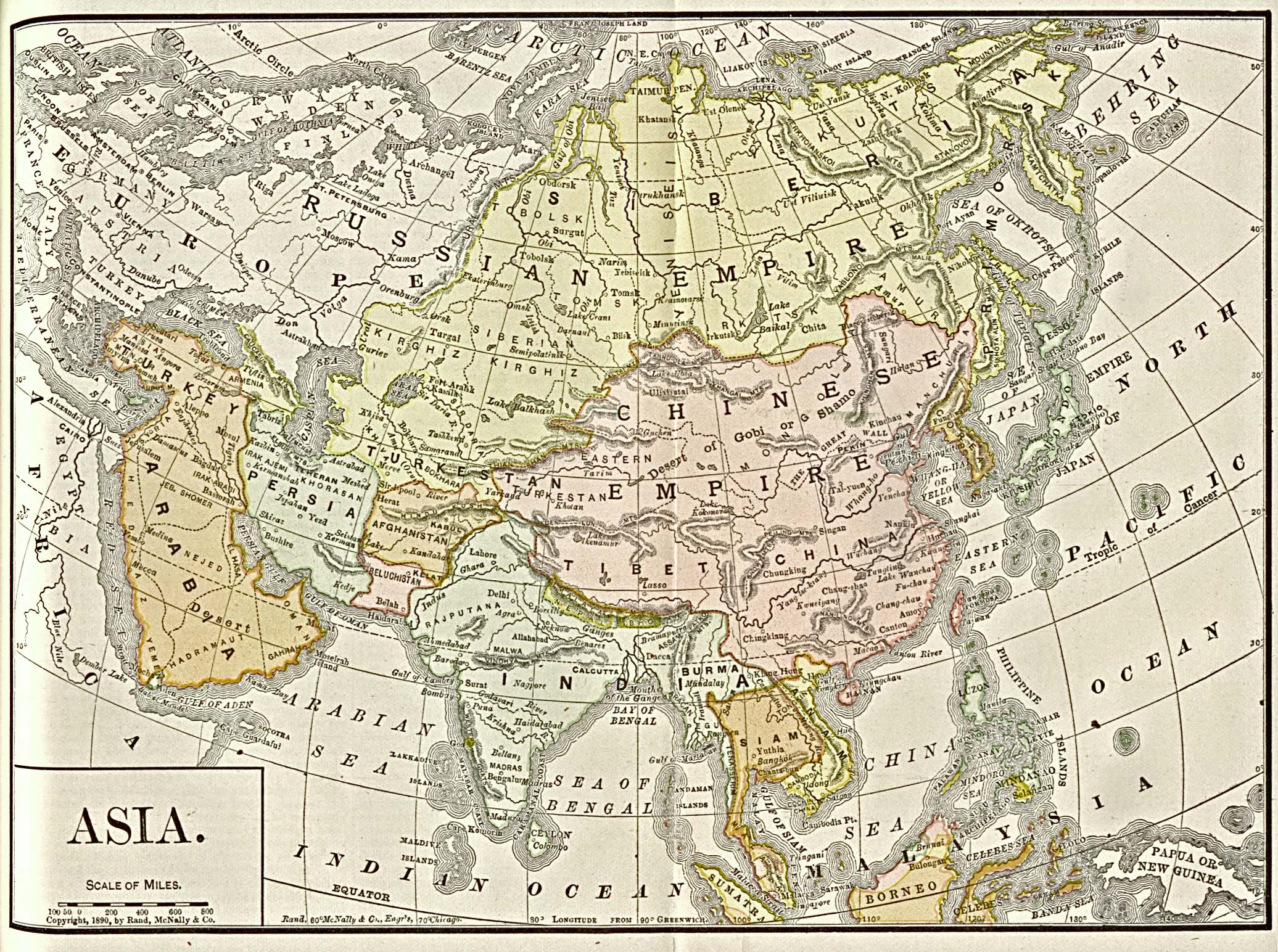
Other sources
- Spick, Mike. Dangerous Ground!, Air Forces Monthly, December 1993
See also
- Kingdom of Humanity
- South China Sea Islands
- Paracel Islands
- Junk Keying
- Policies, activities and history of the Philippines in Spratly Islands
- Mutual Defense Treaty (U.S.–Philippines)
- Kalayaan, Palawan, Philippines
- Zheng He
- Crysis, a computer game set on the Spratly Islands.
- SSN, a computer game set during a conflict over the Spratly Islands.
- List of islands in the South China Sea
- Rockall
| |||||||||
| |||||||||
| Da Nang city |  | |
|---|---|---|
| Bình Định province | ||
| Bình Thuận province | ||
| Khánh Hòa province |
| |
| Ninh Thuận province | ||
| Phú Yên province | ||
| Quảng Nam province | ||
| Quảng Ngãi province | ||
※ denotes provincial seat. / § Sovereignty over the Hoàng Sa and Trường Sa archipelagoes is disputed as of 1 November 2024. | ||
External links
- Template:Wikitravel
- Spratly Islands | Facebook Group
- Spratlys website
- Paracels and Spratlys website
- Mariner's page of the Spratly Islands
- Taiwanese List with ~170 entries
- List of atolls with areas
- Satellite images of all islands and reefs of the Spratly Islands.
- Flags of the World (FOTW) entry with various micronations on the Spratly Islands.
- Map showing the claims
- A tabular summary about the Spratly and Paracel Islands
- Another overview table of the Spratly Islands
- CIA World Factbook for Spratly Islands
- Template:PDFlink, from Vietnam Ministry of Foreign Affairs
- Template:PDFlink
- Third Party Summary of the Dispute
- Some coordinate points of reefs
- Google Map of Spratly Islands
 Wikimedia Atlas of the Spratly Islands
- Ji Guoxing (October 1995). "Maritime Jurisdiction in the Three China Seas: Options For Equitable Settlement" (PDF). Institute on Global Conflict and Cooperation.
{{cite journal}}: Cite journal requires|journal=(help) - A collection of documents on Spratly and Paracel Islands by Nguyen Thai Hoc Foundation