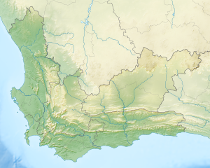
Nelson Bay Cave
| Nelson Bay Cave | |
|---|---|
 Entrance to Nelson Bay Cave | |
 | |
| Location | Plettenberg Bay, Western Cape, South Africa |
| Coordinates | 34°6′4.07″S 23°22′32.20″E / 34.1011306°S 23.3756111°E |
| Geology | quartz-sandstone and quartzites |

Nelson Bay Cave also known as Wagenaar's Cave is a Stone Age archaeological site located in the Robberg Nature Reserve on the Robberg Peninsula and facing Nelson's Bay near Plettenberg Bay in South Africa, and showing evidence of human occupation as far back as 125,000 years ago.[1]
The south-facing cave, which is rectangular in shape and roughly 18 metres (59 ft) wide by 35 metres (115 ft) deep, is in quartz-sandstone and quartzites while its mouth is 19–21 metres above mean sea level. In the same area are two other Stone Age caves, Hoffman's/Robberg Cave and Matjes River rock shelter which lies about 14 kilometres north at Keurboomstrand. Robberg shows notches, caves and other erosional features caused mainly by wave-cutting at various times in its past, but also due to lithological variation, bedding and characteristics of the bedrock. The cave developed in a breccia often found at the contact between Silurian Table Mountain Series quartzite and Cretaceous Uitenhage Series quartzitic sandstone. Excavations were carried out in 1964-5 by Ray R. Inskeep and again in 1970-1 by Inskeep and Richard G. Klein. The geology and geomorphology of Robberg were well documented by John Rogers in 1966.
The cave has yielded rich archaeological material covering its intermittent Middle and Later Stone Age occupation dating from a few hundred to more than 125,000 BP. The cave was abandoned between 40,000 and 20,000 BP during the last ice age when the sea level here dropped some 130 metres, the coastline moving about 100 kilometres (62 mi) seaward. From 22,000 to 14,000 BP extensive grasslands covered the coastal plateau in the Plettenberg Bay area with no closed evergreen climax forest. Animals that roamed this grassland included giant buffalo, an equine close to the quagga, springbok and alcelaphine antelopes: blesbok/bontebok, wildebeest, hartebeest and a giant alcelaphine. Bones from all these herbivores have been recorded in the cave's middens.[2]
The cave occupants enjoyed a variety of food types, ranging from birds and their eggs including ostriches, mammals, plants, fruits and corms to tidal creatures and shellfish, Perna perna and Scutellastra cochlear being collected most frequently. Occasionally Cape fur seals from the nearby colony, bushpigs, bushbuck and Cape buffalo were also eaten occasionally.[3] The various remains resulting in large middens dating back some 5,000 years, while older remains are thought to have been washed away by rising sea levels. Artefacts range from Stone Age tools (bladelets, bladelet cores, backed bladelets and scrapers, while worked bone and ostrich eggshell beads are also present) to pottery made about 2 000 years ago - the pottery shards and remains of sheep and cattle tell of Khoikhoi farmers who occupied the cave in recent times. Graves have been found near the mouth of the cave, the remains being in a fetal position, and decorated with shells and ochre. Study of the skeletons gives insight into the cave dwellers' diet as revealed by their teeth, and the environment of that time.[4][5] Because of collapsing sections of the cave in the 1980s, measures were taken to arrest its deterioration.[1][6][7]
References
- ^ a b Deacon, Janette; Brett, Michael (December 1993). "Peeling Away the Past: The Display of Excavations at Nelson Bay Cave". The South African Archaeological Bulletin. 48 (158): 98–104. doi:10.2307/3888949. JSTOR 3888949.
- ^ Lewis, Colin A. (n.d.), "Late Pleistocene and Early Holocene foragers in southern Africa" (PDF), Encyclopedia of archaeology; Geographic overviews: Africa (South), Mss no. 84 (pdf)
- ^ Klein, R. G. (1972). "The late Quaternary mammalian fauna of Nelson Bay Cave (Cape Province, South Africa): its implications for megafaunal extinctions and environmental and cultural change". Quaternary Research. 2 (2): 135–142.
- ^ Sealy, Judith; Pfeiffer, Susan (2000). "Diet, Body Size, and Landscape Use among Holocene People in the Southern Cape, South Africa". Current Anthropology. 41 (4): 642–655. doi:10.1086/317392.
- ^ Bernatchez, Jocelyn A. (June 2008). "Geochemical Characterization of Archaeological Ochre at Nelson Bay Cave (Western Cape Province), South Africa". The South African Archaeological Bulletin. 63 (187): 3–11. doi:10.2307/20474986. JSTOR 20474986.
- ^ Butzer, Karl W. (1973). "Geology of Nelson Bay Cave, Robberg, South Africa". The South African Archaeological Bulletin. 28 (111/112): 97–110. doi:10.2307/3888567. ISSN 0038-1969. JSTOR 3888567.
- ^ Elias, Scott, ed. (2006). Encyclopedia of Quaternary Science. Elsevier. pp. 7252–. ISBN 978-0-444-52747-9.


