
Cần Thơ
It has been suggested that Can Tho City be merged into this article. (Discuss) Proposed since November 2014. |
This article needs additional citations for verification. (October 2012) |
Cần Thơ City
Thành phố Cần Thơ | |
|---|---|
 Skyline of Cần Thơ | |
| Nickname: "The capital of the West" (Tây Đô) | |
 Provincial map | |
| Country | Vietnam |
| Region | Mekong Delta |
| Founded | 1789 |
| Area | |
| • Total | 1,408.9 km2 (544.0 sq mi) |
| Elevation | 0 m (0 ft) |
| Population (2014) | |
| • Total | 1,237,300 |
| • Density | 880/km2 (2,300/sq mi) |
| Postal code | 90xxxx |
| Area code | (+84) 710 |
| Vehicle registration | 65 |
| GDP (nominal) | 2013 |
| - Total | 3.6 billion USD |
| - Per capita | 2,980 USD [1] |
| Website | cantho.gov.vn Template:En icon |
Cần Thơ () is the fourth-largest city in Vietnam, and the largest city in the Mekong Delta.[2][3]
It is noted for its floating market, rice paper-making village, and picturesque rural canals.[3] It had a population of 1.2 million as of 2011[update], and is located on the south bank of the Hau River, a distributary of the Mekong river. In 2007, about 50 people died when the Cần Thơ Bridge collapsed, causing Vietnam's worst engineering disaster.[4] In 2011, Can Tho International Airport opened.[5]
The city is nicknamed the "western capital" (Tây Đô), and is located 169 kilometres (105 miles) from Ho Chi Minh City. Cần Thơ's climate is tropical and monsoonal with two seasons: rainy, from May to November; and dry, from December to April. Average annual humidity is 83%, rainfall 1,635 mm (64 in) and temperature 27 °C (81 °F).
Administrative system
The city is an independent municipality at the same level as provinces of Vietnam. It was created in the beginning of 2004 by a split of the former Cần Thơ Province into two new administrative units: Cần Thơ City and Hậu Giang Province.
Cần Thơ is subdivided into nine district-level sub-divisions:
- 5 urban districts:
- 4 rural districts:
They are further subdivided into five commune-level towns (or townlets), 36 communes, and 44 wards.
Ninh Kiều, which has the well-known port Ninh Kiều port, is the center district and also the most populated and wealthiest of these districts.[6]
The city borders the provinces of An Giang, Hậu Giang, Kiên Giang, Vĩnh Long and Đồng Tháp.
Transportation

Cần Thơ is connected to the rest of the country by National Route 1A and Can Tho International Airport. The city's bridge which is now completed, is the longest cable-stayed bridge in south-east Asia. The six-lane Saigon–Cần Thơ Expressway is being built in parts [clarification needed] from Hồ Chí Minh City to Mỹ Tho. The hydrofoil express boat links this city with Ho Chi Minh City. [citation needed]
Tourism

The Mekong Delta is considered to be the "rice basket of Vietnam", contributing more than half of the nation's rice production. People say of Cần Thơ:
Cần Thơ gạo trắng nước trong, Ai đi đến đó lòng không muốn về.
Cần Thơ, white rice, pure water, All who come wish never to leave.
Cần Thơ is famous for its floating markets, where people sell and buy things on the river, as well as the bird gardens and the port of Ninh Kiều. The city offers a wide range of tropical fruits such as pomelo, longan, jackfruit, mango and durian. The Cần Thơ City Museum has exhibits on the city's history.[7]
Tourist attractions
- Cần Thơ Bridge
- Nam Nhã Pagoda
- Bình Thủy Temple
- Ninh Kiều Quay
- Cái Răng Floating Market, Phong Điền Floating Market
- Bằng Lăng Stork Sanctuary (Thốt Nốt district)
- Canal Tour
- Cantho Cathedral
- Ông Chinese Pagoda
- Pitu Khôsa Răngsey Khmer Pagoda
- Quang Duc Pagoda

Education
Academic institutions in the city are Cần Thơ University, Cần Thơ University of Medicine and Pharmacy, Tây Đô University, Cần Thơ College, College of Foreign Economic Relations - Cần Thơ Branch, Medical College, The Economic and Technical College and Vocational College, with its well-known College of Agriculture and Mekong Delta Rice Research Institute.
Leaders
Chairman of Cần Thơ City People's Committee is Mr. Võ Thành Thống
Vice Chairmen/Chairwomen:
- Mr. Lê Văn Tâm: Permanent Vice Chairman
- Mr. Đào Anh Dũng: Vice Chairman
- Ms. Võ Thi Hồng Ánh: Vice Chairwoman
Climate
| Climate data for Cần Thơ (extremes 1963–2000) | |||||||||||||
|---|---|---|---|---|---|---|---|---|---|---|---|---|---|
| Month | Jan | Feb | Mar | Apr | May | Jun | Jul | Aug | Sep | Oct | Nov | Dec | Year |
| Record high °C (°F) | 34.9 (94.8) |
37.6 (99.7) |
38.5 (101.3) |
40.2 (104.4) |
38.3 (100.9) |
39.5 (103.1) |
38.8 (101.8) |
37.4 (99.3) |
34.8 (94.6) |
35.8 (96.4) |
34.0 (93.2) |
37.1 (98.8) |
40.2 (104.4) |
| Mean daily maximum °C (°F) | 29.8 (85.6) |
31.4 (88.5) |
32.7 (90.9) |
33.9 (93.0) |
33.0 (91.4) |
31.8 (89.2) |
30.6 (87.1) |
30.6 (87.1) |
30.1 (86.2) |
29.8 (85.6) |
29.9 (85.8) |
29.4 (84.9) |
31.1 (88.0) |
| Daily mean °C (°F) | 26.5 (79.7) |
27.0 (80.6) |
28.1 (82.6) |
28.8 (83.8) |
27.7 (81.9) |
27.2 (81.0) |
27.5 (81.5) |
27.4 (81.3) |
27.1 (80.8) |
27.3 (81.1) |
27.2 (81.0) |
26.2 (79.2) |
27.3 (81.1) |
| Mean daily minimum °C (°F) | 21.9 (71.4) |
22.4 (72.3) |
23.2 (73.8) |
24.3 (75.7) |
24.3 (75.7) |
23.9 (75.0) |
23.9 (75.0) |
24.4 (75.9) |
24.3 (75.7) |
24.6 (76.3) |
24.3 (75.7) |
22.8 (73.0) |
23.7 (74.7) |
| Record low °C (°F) | 11.4 (52.5) |
15.1 (59.2) |
14.6 (58.3) |
20.1 (68.2) |
19.7 (67.5) |
19.2 (66.6) |
20.0 (68.0) |
20.4 (68.7) |
20.1 (68.2) |
18.3 (64.9) |
17.2 (63.0) |
12.6 (54.7) |
11.4 (52.5) |
| Average rainfall mm (inches) | 9 (0.4) |
3 (0.1) |
12 (0.5) |
43 (1.7) |
167 (6.6) |
182 (7.2) |
225 (8.9) |
171 (6.7) |
278 (10.9) |
250 (9.8) |
168 (6.6) |
52 (2.0) |
1,560 (61.4) |
| Average rainy days | 2 | 0 | 2 | 4 | 15 | 17 | 19 | 17 | 19 | 17 | 12 | 6 | 130 |
| Average relative humidity (%) | 80.0 | 77.4 | 76.2 | 78.1 | 83.2 | 85.4 | 85.1 | 85.6 | 87.6 | 85.7 | 83.6 | 81.2 | 82.4 |
| Source 1: NOAA (normals)[8][9] | |||||||||||||
| Source 2: south-east Asian Climate Assessment & Dataset (extremes 1963–2000)[10][a] | |||||||||||||
Economy
After 120 years of development, the city now[when?] is the delta's most important center of economics, culture, science, and technology. It has a large freshwater port and two industrial parks. [citation needed]

Twin towns and sister cities
Gallery
-
 Cần Thơ market
 -
 Floating market
 -
 Floating market
 -
 Museum of People's Armed Forces
 -
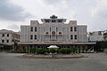
 Cần Thơ Museum


References
- ^ Statistical Handbook of Vietnam 2014 Template:Wayback, General Statistics Office Of Vietnam
- ^ "Trang chu". Cổng Thông tin Điện tử thành phố Cần Thơ - CANTHO PORTAL (in Vietnamese and English). Ghi rõ nguồn "CanTho Portal" khi phát hành lại thông tin từ Portal này. 2012. Retrieved 15 October 2012.
- ^ a b Ron Emmons (7 February 2012). Frommer's Vietnam: with Angkor Wat. John Wiley & Sons. ISBN 978-1-118-11997-6. Retrieved 15 October 2012.
- ^ Jessica Rowson (3 October 2007). "50 deaths in Can Tho bridge collapse". New Civil Engineer. EMAP Ltd. Retrieved 15 October 2012.
- ^ Emmons, p. 342.
- ^ SGT (13 April 2012). "Ca Ba Old House is Can Tho classic". Vietnam.net Bridge. VIETNAMNET Bridge. Retrieved 15 October 2012.
- ^ Emmons, p. 345.
- ^ "Annales du Service Météorologique de L'Indochine– Années 1938 et 1939" (PDF). Service Météorologique de L'Indochine. p. 80. Retrieved October 30, 2015.
- ^ "Annales du Service Météorologique de L'Indochine– Années 1938 et 1939" (PDF). Service Météorologique de L'Indochine. pp. 120, 180. Retrieved October 30, 2015.
- ^ "Indices data: Minimum of daily minimum temperature and Maximum of daily maximum temperature". Badan Meteorologi Klimatologi dan Geofisika (BMKG). Retrieved October 15, 2015.
Notes
- ^ Station ID for Can tho is 314. Download the data, open the text files for each month and use this station ID to obtain monthly values for this location
External links
Places adjacent to Cần Thơ | |
|---|---|

10°02′N 105°47′E / 10.033°N 105.783°E
| International | |
|---|---|
| National | |
| Geographic | |
| Other | |