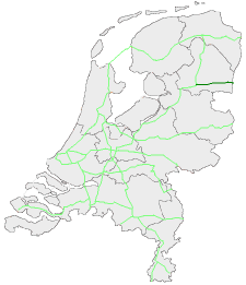
European route E233
| E233 | |
|---|---|
 | |
| Major junctions | |
| From | Cloppenburg (Germany) |
| To | Hoogeveen (Netherlands) |
| Location | |
| Countries | Netherlands and Germany |
| Highway system | |
The E 233 is a European Class-B road in the Netherlands and Germany, connecting the cities of Hoogeveen and Cloppenburg.
Highway connections
The E 233 has a total length of 135 kilometres, and serves as the connector between the E 37 and the E 232. From east to west the following highways share junctions with the E 233:
Germany
- E37 (Autobahn no. 1) - Cloppenburg (Lower Saxony)
- E41 (proposed extension; Autobahn no. 31) - Meppen
Netherlands
The Dutch section of the route is constructed as a motorway, while the German section is non-motorway (Bundesstrasse). Initially, the route connected Cloppenburg with Oldenzaal, where it joined the E 30. However, the Dutch national government wanted to promote a better connection of the province of Drenthe to Lower Saxony, thus the route was changed in the early 1990s.[1]
Before the renumbering of the E-roads in the 1980s, this route was known as the E 72.[2]
References
- ^ "Rijkswaterstaat: Wegen". Dutch Ministry of Transportation and Water Management (Rijkswaterstaat). Retrieved 2011-11-05.
- ^ Elsevier Atlas van Nederland, België en Luxemburg, samengesteld door de Winkler Prins redactie, Amsterdam/Brussel 1960.


