
Mudanjiang
You can help expand this article with text translated from the corresponding article in Chinese. (March 2009) Click [show] for important translation instructions.
|
Mudanjiang
牡丹江 | |
|---|---|
| 牡丹江市 | |
 | |
 Mudanjiang City (red) in Heilongjiang province (orange) and China | |
| Country | People's Republic of China |
| Province | Heilongjiang |
| Area | |
| • Prefecture-level city | 40,435 km2 (15,612 sq mi) |
| • Urban | 1,608 km2 (621 sq mi) |
| • Metro | 1,608 km2 (621 sq mi) |
| Elevation | 233 m (764 ft) |
| Population (2010 census) | |
| • Prefecture-level city | 2,798,723 |
| • Density | 69/km2 (180/sq mi) |
| • Urban | 805,584 |
| • Urban density | 500/km2 (1,300/sq mi) |
| • Metro | 805,584 |
| Time zone | UTC+8 (China standard time) |
| Licence plates | 黑C |
Mudanjiang (Chinese: 牡丹江; pinyin: Mǔdānjiāng; Manchu: Mudan bira ᠮᡠᡩ᠋ᠠᠨ ᠪᡳᡵᠠ) is a prefecture-level city in Heilongjiang province of the People's Republic of China. The administrative seat of the prefecture resides in Mudanjiang City. It was called Botankou when it was under Japanese occuption. It serves as a regional communications hub with a railway junction and an international airport connecting with several major Chinese cities as well as Seoul, Korea. Mudanjiang is also an important border city, located only 248 km from Vladivostok, Russia. In 2007 Mudanjiang had a GDP of RMB 42.1 billion with a 13.3% growth rate.
Its population is 2,798,723 at the 2010 census whom 805,584 live in the built up area made of 4 urban districts. Named after the Mudan River, the region's premier tourist attraction is Jingpo Lake famous for its craggy limestone cliffs (similar to those of Guilin) and its turquoise waters containing Ericton fish and fresh water coral.
Administrative divisions

| ||||||
| # | Name | Hanzi | Hanyu Pinyin | Population (2003 est.) | Area (km²) | Density (/km²) |
|---|---|---|---|---|---|---|
| 1 | Aimin District | 爱民区 | Àimín Qū | 230,000 | 359 | 641 |
| 2 | Dong'an District | 东安区 | Dōng'ān Qū | 180,000 | 566 | 318 |
| 3 | Yangming District | 阳明区 | Yángmíng Qū | 160,000 | 358 | 447 |
| 4 | Xi'an District | 西安区 | Xī'ān Qū | 210,000 | 325 | 646 |
| 5 | Muling City | 穆棱市 | Mùlíng Shì | 330,000 | 6,094 | 54 |
| 6 | Suifenhe City | 绥芬河市 | Suífēnhé Shi | 60,000 | 427 | 141 |
| 7 | Hailin City | 海林市 | Hǎilín Shì | 440,000 | 9,877 | 45 |
| 8 | Ning'an City | 宁安市 | Níng'ān Shì | 440,000 | 7,870 | 56 |
| 9 | Dongning County | 东宁县 | Dōngníng Xiàn | 210,000 | 7,368 | 29 |
| 10 | Linkou County | 林口县 | Línkǒu Xiàn | 450,000 | 7,191 | 63 |
Geography
| Mudanjiang | ||||||||||||||||||||||||||||||||||||||||||||||||||||||||||||
|---|---|---|---|---|---|---|---|---|---|---|---|---|---|---|---|---|---|---|---|---|---|---|---|---|---|---|---|---|---|---|---|---|---|---|---|---|---|---|---|---|---|---|---|---|---|---|---|---|---|---|---|---|---|---|---|---|---|---|---|---|
| Climate chart (explanation) | ||||||||||||||||||||||||||||||||||||||||||||||||||||||||||||
| ||||||||||||||||||||||||||||||||||||||||||||||||||||||||||||
| ||||||||||||||||||||||||||||||||||||||||||||||||||||||||||||
Mudanjiang is located in southeastern Heilongjiang province, and is also the province's southernmost prefecture. Neighbouring prefectures are:
It also borders Russia's Primorsky Krai to the east. The average elevation in the prefecture is 230 metres (755 ft), with the terrain primarily consisting of mountains and hills. The east of the prefecture begins to ascend to the Changbai Mountains, while the central parts belong to the Hegu Basin. The lowest part of the prefecture is Suifenhe City, bordering Russia, at a minimum elevation of 86.5 metres (283.8 ft), while the highest point is Zhangguangcai, at 1,686.9 metres (5,534 ft).
Under the Köppen climate classification, Mudanjiang features a monsoon-influenced, humid continental climate (Dwa) with hot, humid summers and very cold winters. Its winters are dry and bitterly cold, with a 24-hour average in January of only −17.3 °C (0.9 °F), yet the city see little precipitation during this season and is often sunny. Moreover, winter temperatures are far warmer than much of the rest of the province, and the city's basin location helps protect it from biting winds. Summers can be hot, with a July mean temperature of 22.3 °C (72.1 °F). Summer is also when most of the year's rainfall occurs. Spring and autumn constitute brief transition periods with variable wind directions.
| Climate data for Mudanjiang City (1971−2000) | |||||||||||||
|---|---|---|---|---|---|---|---|---|---|---|---|---|---|
| Month | Jan | Feb | Mar | Apr | May | Jun | Jul | Aug | Sep | Oct | Nov | Dec | Year |
| Mean daily maximum °C (°F) | −10.5 (13.1) |
−5.4 (22.3) |
3.2 (37.8) |
13.7 (56.7) |
20.9 (69.6) |
25.2 (77.4) |
27.9 (82.2) |
26.6 (79.9) |
21.0 (69.8) |
12.6 (54.7) |
1.1 (34.0) |
−8 (18) |
10.7 (51.3) |
| Mean daily minimum °C (°F) | −22.6 (−8.7) |
−18.4 (−1.1) |
−9 (16) |
0.4 (32.7) |
7.3 (45.1) |
13.6 (56.5) |
17.6 (63.7) |
16.5 (61.7) |
8.7 (47.7) |
0.0 (32.0) |
−9.7 (14.5) |
−18.8 (−1.8) |
−1.2 (29.8) |
| Average precipitation mm (inches) | 4.7 (0.19) |
5.5 (0.22) |
10.5 (0.41) |
25.6 (1.01) |
53.8 (2.12) |
90.6 (3.57) |
121.4 (4.78) |
108.9 (4.29) |
59.7 (2.35) |
35.2 (1.39) |
13.2 (0.52) |
7.9 (0.31) |
537.0 (21.14) |
| Average precipitation days (≥ 0.1 mm) | 5.0 | 5.5 | 6.5 | 8.5 | 12.9 | 15.9 | 14.8 | 13.9 | 11.0 | 8.5 | 6.8 | 5.8 | 115.1 |
| Average relative humidity (%) | 69 | 64 | 55 | 53 | 56 | 69 | 75 | 77 | 73 | 65 | 65 | 70 | 65.9 |
| Mean monthly sunshine hours | 162.4 | 180.2 | 228.4 | 218.2 | 237.3 | 221.1 | 215.8 | 208.3 | 206.6 | 195.6 | 156.8 | 136.8 | 2,367.5 |
| Source: China Meteorological Administration [1] | |||||||||||||
-
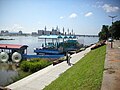 Walking along the Mudanjiang river
 -
 Monument to the women fallen in war
 -
 The main street of the city
 -
![Panoramic view on the river]]](//upload.wikimedia.org/wikipedia/commons/thumb/7/78/MDJ_vista_sul_fiume.jpg/120px-MDJ_vista_sul_fiume.jpg) Panoramic view on the river]]
Panoramic view on the river]]


![Panoramic view on the river]]](/wiki/File:MDJ_vista_sul_fiume.jpg)
References
- ^ a b "中国地面国际交换站气候标准值月值数据集(1971-2000年)" (in Simplified Chinese). China Meteorological Administration. Retrieved 2010-11-20.
External links
- http://ch-info.erina.or.jp/English/He/Mudan/mudanjiang.htm
- http://www.china.org.cn/english/travel/50995.htm
- http://wikitravel.org/en/Mudanjiang
Heilongjiang topics | |
|---|---|
| General | |
| Geography | |
| Education | |
| Visitor attractions | |