[ 3] Name on the Register[ 4]
Image
Date listed[ 5]
Location
City or town
Description
1
Ellsworth and Lovie Ballance House Ellsworth and Lovie Ballance House May 25, 2001 (#01000558 ) E side M.V. Australia Ln., 0.1 miles S of Stowe Landing Rd. 35°13′21″N 75°41′13″W / 35.2225°N 75.686944°W / 35.2225; -75.686944 (Ellsworth and Lovie Ballance House ) Hatteras
2
Bodie Island Lifesaving/Coast Guard Station Bodie Island Lifesaving/Coast Guard Station February 9, 1979 (#79000251 ) S of Nags Head on NC 12 35°50′11″N 75°33′33″W / 35.836389°N 75.559167°W / 35.836389; -75.559167 (Bodie Island Lifesaving/Coast Guard Station ) Nags Head
3
Bodie Island Light Station Bodie Island Light Station July 4, 2003 (#03000607 ) Off NC 12 35°49′12″N 75°33′49″W / 35.82°N 75.563611°W / 35.82; -75.563611 (Bodie Island Light Station ) Nags Head
4
C.S.S. CURLEW (side-wheel steamer) C.S.S. CURLEW (side-wheel steamer) August 24, 2018 (#100002802 ) Address restricted[ 6] Manns Harbor
5
Caffeys Inlet Lifesaving Station Upload image January 30, 1978 (#78001942 ) N of Duck on SR 1200 36°13′33″N 75°46′15″W / 36.225833°N 75.770833°W / 36.225833; -75.770833 (Caffeys Inlet Lifesaving Station ) Duck
6
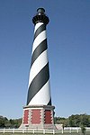
Cape Hatteras Light Station Cape Hatteras Light Station March 29, 1978 (#78000266 ) SE of Buxton off NC 12 in Cape Hatteras National Seashore 35°15′16″N 75°31′17″W / 35.254444°N 75.521389°W / 35.254444; -75.521389 (Cape Hatteras Light Station ) Buxton
7
Chicamacomico Life Saving Station Chicamacomico Life Saving Station December 12, 1976 (#76000164 ) NC 12 and SR 1247 35°35′42″N 75°27′54″W / 35.595°N 75.465°W / 35.595; -75.465 (Chicamacomico Life Saving Station ) Rodanthe
8
George Washington Creef House George Washington Creef House August 12, 1982 (#82004798 ) 304 Budleigh St. 35°54′29″N 75°40′18″W / 35.908056°N 75.671667°W / 35.908056; -75.671667 (George Washington Creef House ) Manteo
9
John T. Daniels House John T. Daniels House May 1, 2003 (#03000339 ) 960 Burnside Rd. 35°54′25″N 75°41′00″W / 35.906944°N 75.683333°W / 35.906944; -75.683333 (John T. Daniels House ) Manteo
10
DIXIE ARROW (shipwreck and remains)DIXIE ARROW (shipwreck and remains)September 25, 2013 (#13000781 ) Address restricted[ 6] 34°55′00″N 75°02′00″W / 34.9167°N 75.0333°W / 34.9167; -75.0333 (DIXIE ARROW (shipwreck and remains) Ocracoke
11
E.M. CLARK (shipwreck and remains)Upload image September 25, 2013 (#13000780 ) Address restricted[ 6] Cape Hatteras
12
EMPIRE GEM (shipwreck and remains)Upload image September 25, 2013 (#13000782 ) Address restricted[ 6] Cape Hatteras
13
First Colony Inn First Colony Inn January 21, 1993 (#92001835 ) 6720 S. Virginia Dare Trail 35°55′06″N 75°36′13″W / 35.918333°N 75.603611°W / 35.918333; -75.603611 (First Colony Inn ) Nags Head
14
Fort Raleigh National Historic Site Fort Raleigh National Historic Site October 15, 1966 (#66000102 ) 4 miles N of Manteo on U.S. 158 35°56′19″N 75°42′36″W / 35.938611°N 75.71°W / 35.938611; -75.71 (Fort Raleigh National Historic Site ) Manteo
15
Hatteras Weather Bureau Station Hatteras Weather Bureau Station February 17, 1978 (#78000268 ) Off NC 12 35°13′12″N 75°41′26″W / 35.22°N 75.690556°W / 35.22; -75.690556 (Hatteras Weather Bureau Station ) Hatteras
16
Kitty Hawk Life-Saving Station Kitty Hawk Life-Saving Station October 11, 1984 (#84000073 ) U.S. 158 36°04′02″N 75°41′28″W / 36.067222°N 75.691111°W / 36.067222; -75.691111 (Kitty Hawk Life-Saving Station ) Kitty Hawk
17
LANCING (shipwreck)LANCING (shipwreck)June 26, 2013 (#13000451 ) Address restricted[ 6] Buxton
18
LIGHT VESSEL 71 (shipwreck)LIGHT VESSEL 71 (shipwreck)August 19, 2015 (#15000541 ) Address restricted[ 6] Buxton
19
Markham-Albertson-Stinson Cottage Markham-Albertson-Stinson Cottage January 13, 2006 (#05001544 ) 4300 W. Soundside Rd. 35°56′46″N 75°37′46″W / 35.945975°N 75.629425°W / 35.945975; -75.629425 (Markham-Albertson-Stinson Cottage ) Nags Head Destroyed by Hurricane Irene [ 7]
20
Theodore S. Meekins House Theodore S. Meekins House December 17, 1982 (#82001295 ) 319 Sir Walter Raleigh St. 35°54′31″N 75°40′22″W / 35.908611°N 75.672778°W / 35.908611; -75.672778 (Theodore S. Meekins House ) Manteo
21
Mattie Midgett Store and House Mattie Midgett Store and House December 23, 2004 (#04001389 ) 4008 S. Virginia Dare Trail 35°57′23″N 75°37′28″W / 35.956389°N 75.624444°W / 35.956389; -75.624444 (Mattie Midgett Store and House ) Nags Head
22
Rasmus Midgett House Rasmus Midgett House October 21, 2009 (#09000847 ) 25438 NC Hwy 12 35°32′42″N 75°28′16″W / 35.545108°N 75.471094°W / 35.545108; -75.471094 (Rasmus Midgett House ) Waves
23
Nags Head Beach Cottages Historic District Nags Head Beach Cottages Historic District August 19, 1977 (#77000997 ) U.S. 158 35°57′50″N 75°35′49″W / 35.963889°N 75.596944°W / 35.963889; -75.596944 (Nags Head Beach Cottages Historic District ) Nags Head
24
Oregon Inlet Station Oregon Inlet Station December 23, 1975 (#75001253 ) 12 miles N of Rodanthe on Pea Island 35°46′06″N 75°31′28″W / 35.768333°N 75.524444°W / 35.768333; -75.524444 (Oregon Inlet Station ) Rodanthe
25
Salvo Post Office Salvo Post Office September 23, 1993 (#93000997 ) NC 12 W side, 0.1 miles S of jct. with Park Rd. 35°32′24″N 75°28′27″W / 35.54°N 75.474167°W / 35.54; -75.474167 (Salvo Post Office ) Salvo
26
Sam's Diner Sam's Diner January 27, 1999 (#99000062 ) 2008 S. Virginia Dare Trail 35°59′46″N 75°38′50″W / 35.996111°N 75.647222°W / 35.996111; -75.647222 (Sam's Diner ) Kill Devil Hills
27
Sea Foam Motel Sea Foam Motel December 23, 2004 (#04001392 ) 7111 S. Virginia Dare Trail 35°54′37″N 75°35′47″W / 35.910278°N 75.596389°W / 35.910278; -75.596389 (Sea Foam Motel ) Nags Head
28
U-85 (submarine) shipwreck and remainsU-85 (submarine) shipwreck and remainsNovember 12, 2015 (#15000805 ) Offshore 35°54′48″N 75°17′13″W / 35.913414°N 75.286946°W / 35.913414; -75.286946 (U-85 (submarine) shipwreck and remains Nags Head
29
U-576 and BLUEFIELDS (shipwrecks and remains)U-576 and BLUEFIELDS (shipwrecks and remains)December 8, 2015 (#15000864 ) Address restricted[ 6] Hatteras
30
U-701 (submarine) shipwreck and remainsU-701 (submarine) shipwreck and remainsNovember 12, 2015 (#15000806 ) Offshore 35°14′21″N 75°06′43″W / 35.239176°N 75.111842°W / 35.239176; -75.111842 (U-701 (submarine) shipwreck and remains Buxton
31
USS HURON USS HURON November 15, 1991 (#91001625 ) Shipwreck off Nags Head Coordinates missing
Nags Head
32
USS MONITOR USS MONITOR October 11, 1974 (#74002299 ) Shipwreck off Cape Hatteras Coordinates missing
Cape Hatteras
33
Wright Brothers National Memorial Wright Brothers National Memorial October 15, 1966 (#66000071 ) U.S. 158 36°00′58″N 75°40′12″W / 36.016111°N 75.67°W / 36.016111; -75.67 (Wright Brothers National Memorial ) Kill Devil Hills


