
Lane County, Kansas
Lane County | |
|---|---|
 Location within the U.S. state of Kansas | |
 Kansas's location within the U.S. | |
| Coordinates: 38°28′00″N 100°28′01″W / 38.4667°N 100.467°W | |
| Country | |
| State | |
| Founded | March 20, 1873 |
| Seat | Dighton |
| Area | |
| • Total | 717.43 sq mi (1,858.1 km2) |
| • Land | 717.22 sq mi (1,857.6 km2) |
| • Water | 0.21 sq mi (0.5 km2) 0.03% |
| Population (2010) | |
| • Total | 1,750 |
| • Density | 2.6/sq mi (1.0/km2) |
| Time zone | UTC−6 (Central) |
| • Summer (DST) | UTC−5 (CDT) |
Lane County (standard abbreviation: LE) is a county located in the U.S. state of Kansas. As of the 2010 census, the county population was 1,750.[1] The county seat is Dighton, the only city in the county. Lane County was named after James H. Lane who was a leader of the Jayhawker abolitionist movement and served as one of the first U.S. Senators from Kansas.[citation needed]
Law and government
Although the Kansas Constitution was amended in 1986 to allow the sale of alcoholic liquor by the individual drink with the approval of voters, Lane County has remained a prohibition, or "dry", county.[2]
Geography
According to the 2000 census, the county has a total area of 717.43 square miles (1,858.1 km2), of which 717.22 square miles (1,857.6 km2) (or 99.97%) is land and 0.21 square miles (0.54 km2) (or 0.03%) is water.[3]
Adjacent counties
- Gove County (north)
- Ness County (east)
- Finney County (south)
- Scott County (west)
Demographics
| Census | Pop. | Note | %± |
|---|---|---|---|
| 1900 | 1,563 | — | |
| 1910 | 2,603 | 66.5% | |
| 1920 | 2,848 | 9.4% | |
| 1930 | 3,372 | 18.4% | |
| 1940 | 2,821 | −16.3% | |
| 1950 | 2,808 | −0.5% | |
| 1960 | 3,060 | 9.0% | |
| 1970 | 2,707 | −11.5% | |
| 1980 | 2,472 | −8.7% | |
| 1990 | 2,375 | −3.9% | |
| 2000 | 2,155 | −9.3% | |
| 2010 | 1,750 | −18.8% | |

As of the censusTemplate:GR of 2000, there were 2,155 people, 910 households, and 613 families residing in the county. The population density was 3 people per square mile (1/km²). There were 1,065 housing units at an average density of 2 per square mile (1/km²). The racial makeup of the county was 97.73% White, 0.05% Native American, 0.09% Asian, 0.05% Pacific Islander, 0.51% from other races, and 1.58% from two or more races. 1.44% of the population were Hispanic or Latino of any race.
There were 910 households out of which 29.50% had children under the age of 18 living with them, 59.10% were married couples living together, 5.10% had a female householder with no husband present, and 32.60% were non-families. 30.30% of all households were made up of individuals and 16.50% had someone living alone who was 65 years of age or older. The average household size was 2.34 and the average family size was 2.91.
In the county the population was spread out with 25.40% under the age of 18, 5.40% from 18 to 24, 24.60% from 25 to 44, 24.10% from 45 to 64, and 20.50% who were 65 years of age or older. The median age was 42 years. For every 100 females there were 100.30 males. For every 100 females age 18 and over, there were 97.70 males.
The median income for a household in the county was $36,047, and the median income for a family was $41,892. Males had a median income of $29,429 versus $20,446 for females. The per capita income for the county was $18,606. About 5.40% of families and 8.20% of the population were below the poverty line, including 11.40% of those under age 18 and 7.60% of those age 65 or over.
Cities and towns
Incorporated cities
Name and population (2004 estimate):
- Dighton, 1,138 (county seat)
Unincorporated places
Townships
Lane County is divided into five townships. None of the cities within the county are considered governmentally independent, and all figures for the townships include those of the cities. In the following table, the population center is the largest city (or cities) included in that township's population total, if it is of a significant size.
| Township | FIPS | Population center |
Population | Population density /km² (/sq mi) |
Land area km² (sq mi) |
Water area km² (sq mi) |
Water % | Geographic coordinates |
|---|---|---|---|---|---|---|---|---|
| Alamota | 00775 | 108 | 0 (1) | 414 (160) | 0 (0) | 0 % | 38°24′55″N 100°19′43″W / 38.41528°N 100.32861°W | |
| Cheyenne | 13050 | 336 | 1 (4) | 245 (94) | 0 (0) | 0 % | 38°36′21″N 100°37′22″W / 38.60583°N 100.62278°W | |
| Dighton | 18075 | 1,573 | 2 (5) | 785 (303) | 0 (0) | 0.01% | 38°27′23″N 100°30′11″W / 38.45639°N 100.50306°W | |
| White Rock | 77950 | 26 | 0 (0) | 207 (80) | 0 (0) | 0.02% | 38°37′49″N 100°19′55″W / 38.63028°N 100.33194°W | |
| Wilson | 79725 | 112 | 1 (1) | 206 (80) | 0 (0) | 0.20% | 38°36′47″N 100°28′12″W / 38.61306°N 100.47000°W |
Education

Unified school districts
See also
- Community information for Kansas
- Kansas locations by per capita income
- List of counties in Kansas
- List of townships in Kansas
- List of cities in Kansas
- List of unincorporated communities in Kansas
- List of ghost towns in Kansas
References
- ^ "2010 County Population and Housing Occupancy Status". U.S. Census Bureau. Retrieved March 31, 2011.
- ^ "Map of Wet and Dry Counties". Alcoholic Beverage Control, Kansas Department of Revenue. 2004. Retrieved 2007-01-21.
{{cite web}}: Unknown parameter|month=ignored (help) - ^ "Census 2000 U.S. Gazetteer Files: Counties". United States Census. Retrieved 2011-02-13.
Further reading
- County
- Early Lane County History: 12,000 B.C. - A.D. 1884; Ellen May Stanley.
- Early Lane County Development; Ellen May Stanley.
- Golden Age, Great Depression, and Dust Bowl; Ellen May Stanley.
- State
- History of the State of Kansas; William G. Cutler; A.T. Andreas Publisher; 1883. (Online HTML eBook)
- Kansas : A Cyclopedia of State History, Embracing Events, Institutions, Industries, Counties, Cities, Towns, Prominent Persons, Etc; 3 Volumes; Frank W. Blackmar; Standard Publishing Co; 944 / 955 / 824 pages; 1912. (Volume1 - Download 54MB PDF eBook),(Volume2 - Download 53MB PDF eBook), (Volume3 - Download 33MB PDF eBook)
External links
- General county information
- County level data
- Maps
- Lane County Map, KDOT
- Kansas Highway Map, KDOT
- Kansas Railroad Map, KDOT
- Kansas School District Boundary Map, KSDE
Places adjacent to Lane County, Kansas | ||||||||||||||||
|---|---|---|---|---|---|---|---|---|---|---|---|---|---|---|---|---|
| ||||||||||||||||
Municipalities and communities of Lane County, Kansas, United States | ||
|---|---|---|
| Cities | 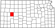 | |
| Unincorporated communities | ||
| Townships |
| |
| Footnotes | †This community is designated a Census-Designated Place (CDP) by the United States Census Bureau. | |