
Fairfield, Connecticut: Difference between revisions
No edit summary |
No edit summary |
||
| Line 195: | Line 195: | ||
*[http://www.trinitysouthport.org/ Trinity [[Episcopal Church]]] |
*[http://www.trinitysouthport.org/ Trinity [[Episcopal Church]]] |
||
*[http://fairfieldgrace.org/ Fairfield Grace [[United Methodist Church]]] |
*[http://fairfieldgrace.org/ Fairfield Grace [[United Methodist Church]]] |
||
*[[Black Rock Congregational Church]] [http://www.brcc.org/ (website)] - [[ |
*[[Black Rock Congregational Church]] [http://www.brcc.org/ (website)] - [[Non-denominational]] [[Evangelical]]] |
||
*[[Jehovah's Witness]] |
*[[Jehovah's Witness]] |
||
*[http://oursaviours.net/ Our Saviour's [[Lutheran Church]]] |
*[http://oursaviours.net/ Our Saviour's [[Lutheran Church]]] |
||
Revision as of 18:39, 15 January 2010
Fairfield, Connecticut | |
|---|---|
 Location in Fairfield County, Connecticut | |
| Country | United States |
| NECTA | Bridgeport-Stamford |
| Region | Greater Bridgeport |
| Settled | 1639 |
| Government | |
| • Type | Representative Town Meeting (RTM) |
| • First Selectman | Kenneth A. Flatto (D) |
| • Selectmen | Ralph A. Bowley (R) Sherri A. Steeneck (D) |
| • Board of Education Chair | Catherine Albin (D) |
| • Board of Finance Chair | Kevin Kiley (R) |
| • RTM Moderator | James Walsh (R) |
| Area | |
| • Total | 31.3 sq mi (81.1 km2) |
| • Land | 30.0 sq mi (77.8 km2) |
| • Water | 1.3 sq mi (3.4 km2) |
| Elevation | 59 ft (18 m) |
| Population (2005) | |
| • Total | 57,813 |
| • Density | 1,927/sq mi (744/km2) |
| Time zone | UTC-5 (Eastern) |
| • Summer (DST) | UTC-4 (Eastern) |
| ZIP code | 06824 06825 06828 (General Electric) 06890 (Southport) (Formerly 06430, 06432, 06431 [GE], 06490 [Spt.], respectively) |
| Area code | 203 |
| FIPS code | 09-26620 |
| GNIS feature ID | 0213429 |
| Website | http://www.fairfieldct.org/ |
Fairfield is a town located in Fairfield County, Connecticut, United States. It is situated along the Gold Coast of Connecticut. Fairfield is a town of many neighborhoods, two of which—Southport and Greenfield Hill—are notably affluent. As of the 2000 census, the town had a total population of 57,340. In July 2006, Money Magazine ranked Fairfield the ninth "best place to live" in the United States, and the best place to live in the Northeast.[1] This is primarily due to its affluence, low crime rate with only three homicides in the last five years [2] , excellent public school system, suburban character, scenic location on the Long Island Sound, and proximity to New York City. The town was also listed among the "preppiest" places in the United States in the tongue-in-cheek 1980s best-seller The Official Preppy Handbook.
It considers itself the "dogwood capital of the world," and each spring a Dogwood Festival takes place in the Greenfield Hill neighborhood.
History
Colonial Era
In 1635 some Puritans and Congregationalists in the Massachusetts Bay Colony were dissatisfied with the rate of Anglican reforms, and sought to establish an ecclesiastical society subject to their own rules and regulations. The Massachusetts General Court granted them permission to settle the cities of Windsor, Wethersfield, and Hartford in the area now known as Connecticut.
On January 14, 1639, a set of legal and administrative regulations called the Fundamental Orders was adopted, and established Connecticut as a self-ruled entity. By 1639 these settlers had started new towns in the surrounding areas. Roger Ludlow, framer of the Fundamental Orders, purchased the land presently Fairfield, and established the name.
According to historian John M. Taylor: "Early in 1639 the General Court granted a commission to Ludlow to begin a plantation at Pequannocke. He was on that errand, with a few others from Windsor, afterwards joined by immigrants from Watertown and Concord. He bought a large tract of land from the Pequannocke sachems, - afterwards greatly enlarged by other purchases to the westward,- and recalling the attractive region beyond (Uncoa), which he had personally seen on the second Pequot expedition, he also “set down” there, having purchased the territory embraced in the present town of Fairfield, to which he gave its name."[3]
Towns Created from Fairfield
Fairfield was one of the two principal settlements of the Connecticut Colony in southwestern Connecticut (the other was Stratford). Over time, it gave rise to several new towns that broke off and incorporated separately. The following is a list of towns created from parts of Fairfield.
- Redding in 1767
- Weston in 1787
- Easton created from Weston in 1845
- Bridgeport in 1821 (also partly from Stratford) and again in 1895 when the Black Rock section left Fairfield
- Westport in 1835 (also partly from Weston and Norwalk)
Revolutionary War
When the Revolutionary War began in the 1770s, Fairfielders were caught in the crisis as much as, if not more than, the rest of their neighbors in Connecticut. In a predominantly Tory section of the state, the people of Fairfield were early supporters of the cause for independence. Throughout the war, a constant battle was being fought across Long Island Sound as men from British-controlled Long Island raided the coast in whaleboats and privateers. Gold Selleck Silliman, whose home still stands on Jennings Road, was put in charge of the coastal defenses.
In the spring of 1779, he was kidnapped from his home by Tory forces in preparation for a British raid on Fairfield County. His wife watched from their home as, on the morning of July 7, 1779, approximately 2,000 enemy troops landed on Fairfield Beach near Pine Creek Point and proceeded to invade the town. When they left the following evening, the entire town lay in ruins, burned to the ground as punishment for Fairfield's support of the rebel cause. Ten years later, President George Washington noted after traveling through Fairfield, that " the destructive evidences of British cruelty are yet visible both in Norwalk and Fairfield; as there are the chimneys of many burnt houses standing in them yet."[4]
Fairfield recovered slowly from the burning, but soon after the end of the war its houses and public buildings had all been rebuilt.
Twentieth Century
World War I brought Fairfield out of its agrarian past by triggering an unprecedented economic boom in Bridgeport, the center of a large munitions industry. The prosperity created a housing shortage in the city, and many of the workers looked to Fairfield to build their homes. The trolley and later the automobile made the countryside accessible to these newly rich members of the middle class, who brought with them new habits, new attitudes, and new modes of dress. The prosperity lasted through the twenties.
By the time of the stock market crash in 1929, the population had increased to 17,000 from the 6,000 it had been just before the war. Even during the Depression, the town kept growing.
The grounding of a barge with two crewmen on Penfield Reef in Fairfield during a gale led to the first civilian helicopter hoist rescue in history, on November 29, 1945. The helicopter flew from the nearby Sikorsky Aircraft plant in Bridgeport.
Fairfield is also the home of the corporate headquarters of GE, General Electric, one of the world's largest companies.
The opening of the Connecticut Turnpike in the 1950s brought another wave of development to Fairfield and by the 1960s the town's residential, suburban character was firmly established.
-

-
Tide Mill Tavern Fairfield Connecticut Postcard.jpg
-
-
Pequot Library.jpg
-
-
Fairfield Connecticut Town Green Woodcut c1840.jpg
-

-
Penfield Reef Light.jpg


Government
The town government consists of the three-member Board of Selectmen, a Representative Town Meeting (RTM), a Board of Finance, a Board of Education, a Planning and Zoning Commission (TPZ), and many other politically appointed commissions, boards, and committees. The current First Selectman is Kenneth A. Flatto (D), who is currently serving his fifth term in office.
Education
Public schools in Fairfield include Fairfield Warde and Fairfield Ludlowe High Schools; Roger Ludlowe, Tomlinson Middle School, and Fairfield Woods Middle Schools; and 11 elementary schools.
Private schools include Fairfield College Preparatory School, Notre Dame Catholic High School, Fairfield Country Day School, Holy Family School, St. Thomas Aquinas Catholic School, Our Lady of the Assumption Catholic School and the Unquowa School.
Fairfield is also home to post-secondary institutions Fairfield University and Sacred Heart University.
Geography
The town is on the shore of the Long Island Sound. According to the United States Census Bureau, the town has a total area of 31.3 square miles (81.1 km²), of which, 30.0 square miles (77.8 km²) of it is land and 3.4 km² (1.3 sq mi or 4.15%) of it is water. The Mill River, the waters of which feed Lake Mohegan, flows through the town.
Fairfield consists of many neighborhoods. The best known are wealthy Southport -- where well-known General Electric Chief Executive Officer Jack Welch lived for many years—and Greenfield Hill, with its large areas, famous dogwood trees, and picturesque green with white-spired Congregational church. Other well established neighborhoods include Stratfield, Tunxis Hill, the University area, Grasmere, Mill Plain, Knapp's Village, Melville Village, Holland Hill, and the Fairfield Beach area, which has recently undergone a renaissance with the construction of many new homes by residents wising to live in proximity to the beach and downtown.[5] Two shopping districts in town include the Post Road (U.S. 1) and Black Rock Turnpike.
Neighborhoods

- Fairfield Center
- Southport
- Sasco
- Greenfield Hill
- Tunxis Hill
- Stratfield
Points of Interest
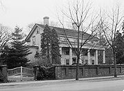
Historic sites
- Connecticut Audubon Society Birdcraft Museum and Sanctuary — 314 Unquowa Road (added 1982)
- Bronson Windmill — 3015 Bronson Road (added 1971)
- David Ogden House — 1520 Bronson Road (added 1979)
- Fairfield Historic District — Old Post Road from Post Road to Turney Road (added 1971). This is the old town center of Fairfield, roughly along Old Post Road between U.S. Route 1 and Turney Road. The area contains Fairfield's town hall, public library, and houses dating from the late 18th century. The area also contains the Fairfield County Courthouse and Fairfield County Jail.
- Fairfield Railroad Stations — Carter Henry Drive (added 1989)
- Greenfield Hill Historic District — Roughly bounded by Meeting House Lane, Hillside Road, Verna Hill Road and Bronson Road (added 1971)
- John Osborne House — 909 King's Highway West (added 1987)
- Jonathan Sturges House — 449 Mill Plain Road (added 1984)
- Pine Creek Park Bridge — North of Old Dam Road, over Pine Circle (added 1992)
- Southport Historic District — Roughly bounded by Southport Harbor, railroad tracks, Old South Road, and Rose Hill Road (added 1971)
- Southport Railroad Stations — 96 Station St. and 100 Center St. (added 1989)
Other points of interest
- Connecticut Audobon Society Center at Fairfield (separate from the Birdcraft Museum and Sanctuary) – six miles of boardwalk nature trails in a 160-acre wildlife sanctuary with a nature center
- Fairfield Museum and History Center[2];– displays on local history, art and decorative arts, and a library on local history
- Gallery of Contemporary Art at Sacred Heart University – holds five exhibitions each year
- Regina A. Quick Center for the Arts at Fairfield University
Large and Distinctive Companies
- General Electric Co. -- headquarters, 3135 Easton Turnpike (307,000 employees companywide)
- R.C. Bigelow (Bigelow Tea Company) -- headquarters, Black Rock Turnpike
- Sturm, Ruger & Co. -- headquarters, Lacey Place in Southport, firearms manufacturer
- Pepperidge Farm--former headquarters, The Ridge
- The Voice--Ad agency with designers-in-residence
Media
- Fairfield Online News
- Connecticut Post (headquartered in neighboring Bridgeport)
- Fairfield Minuteman
- Fairfield Citizen-News
- Fairfield Sun
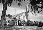
Places of Worship
- Church of the Apostles - Anglican
- Trinity Baptist Church
- Greenfield Hill Congregational Church
- First Church Congregational, UCC
- Southport Congregational Church
- St. Paul's Episcopal Church
- St. Timothy's Episcopal Church
- Trinity Episcopal Church
- Fairfield Grace United Methodist Church
- Black Rock Congregational Church (website) - Non-denominational Evangelical]
- Jehovah's Witness
- Our Saviour's Lutheran Church
- First Presbyterian Church of Fairfield
- Holy Cross Roman Catholic Church
- Our Lady of the Assumption
- St. Pius X Church
- St. Thomas Roman Catholic Church
- Congregation Ahavath Achim
- Congregation Beth El
Arts and Entertainment

- The Fairfield Community Theatre Foundation or the FTC, not only runs the downtown, two-screen moviehouse for independent and second-run films, but operates educational programs for young people who also volunteer at the moviehouse. More information including what movies are currently playing, is available at the foundation's Web site.
- The Regina A. Quick Center for the Arts on the campus of Fairfield University opened in 1990 and includes events such as popular and classical music, dance, theatre, programs for young audiences, and the Open VISIONS Forum lecture series featuring present eminent opinion-makers, artists, authors, learned contributors to the humanities and sciences and civic and political commentators. It houses the 740-seat Kelley Theatre, the 150-seat Lawrence A. Wien Experimental (Black Box) Theatre, and the Thomas J. Walsh, Jr. Art Gallery. The Quick Center has become known as one of the finest concert halls in the country and was recognized as the "cultural epicenter of Fairfield County" by Westport Magazine.
- The PepsiCo Theatre, a renovated 1922 carriage house on the campus of Fairfield University, is the home to the Theatre Program of the Department of Visual and Performing Arts and Theater Fairfield, the resident production company of the University. The PepsiCo Theatre is also home to Shakespeare Ventures, a professional theatre company.
- WSHU Public Radio
- WVOF
Recreation
Fairfield residents enjoy a wealth of recreational opportunities, many of which stem from Fairfield's enviable location on the Long Island Sound.
- The town's five miles of Long Island Sound coastline include 5 town beaches which are staffed by lifeguards during the summer, and miles of privately owned beach which are open to the public below the high tide mark.
- South Benson Marina is a town-owned facility providing 600 boat slips which residents can rent for the summer.[6]
- Lake Mohegan, which includes waterfalls called The Cascades, is in the middle of town and is a popular destination for hiking, as is the Fairfield Audubon Society on Burr Street and the Bird Sancutary on Unquowa Road.
- Ye Yacht Yard, a town owned facility on picturesque Southport Harbor provides boat launch services to residents, and access to moorings in Southport Harbor. Ye Yacht Yard is also the location of Community Sailing of Fairfield, whose members share use of two 18-foot sailboats.
Transportation
Fairfield is traversed by U.S. 1, Interstate 95, and the Merritt Parkway. It has two Metro-North Railroad stations, Fairfield station and Southport station. A third station is under construction near the Grasmere neighborhood and adjacent Black Rock neighborhood of Bridgeport along with a large commercial development known as Fairfield Metro Center. The town is served by several public bus lines of the Greater Bridgeport Transit Authority.
Demographics
As of the censusTemplate:GR of 2000, there are 57,340 people in the town, organized into 20,397 households and 14,808 families. The population density is 1,909.3 people per square mile (737.2/km²). There are 21,029 housing units at an average density of 700.2/sq mi (270.4/km²). The racial makeup of the town is 95.27% White, 2.04% Asian, 1.09% African American, 0.06% Native American, 0.03% Pacific Islander, 0.55% from other races, and 0.97% from two or more races. 2.34% of the population are Hispanic or Latino of any race.
There are 20,397 households out of which 33.9% have children under the age of 18 living with them, 61.8% are married couples living together, 8.5% have a female householder with no husband present, and 27.4% are non-families. 22.0% of all households are made up of individuals and 10.3% have someone living alone who is 65 years of age or older. The average household size is 2.61 and the average family size is 3.07.
In the town the population is spread out with 23.7% under the age of 18, 9.8% from 18 to 24, 27.5% from 25 to 44, 22.7% from 45 to 64, and 16.3% who are 65 years of age or older. The median age is 38 years. For every 100 females there are 90.6 males. For every 100 females age 18 and over, there are 85.7 males.
The median income for a household in the city is $83,512, and the median income for a family is $100,920 (these figures had risen to $103,352 and $121,749 respectively as of a 2007 estimate[7]). Males have a median income of $69,525 versus $44,837 for females. The per capita income for the city is $43,670. 2.9% of the population and 1.8% of families are below the poverty line. Out of the total population, 2.8% of those under the age of 18 and 3.6% of those 65 and older are living below the poverty line.
Fairfield is notable for, among other things, its very low crime rate. There have been only three murders in the last five years in town. Money Magazine's 2006 Best Places to Live Survey ranks Fairfield as the second safest municipality in the United States. [3]
| Voter Registration and Party Enrollment as of October 25, 2005[8] | |||||||||||||||||||||||||
|---|---|---|---|---|---|---|---|---|---|---|---|---|---|---|---|---|---|---|---|---|---|---|---|---|---|
| Party | Active Voters | Inactive Voters | Total Voters | Percentage | Republican | 10,829 | 1,047 | 11,876 | 31.88% | Democratic | 8,634 | 728 | 9,362 | 25.13% | Unaffiliated | 14,423 | 1,574 | 15,997 | 42.94% | Minor Parties | 21 | 1 | 22 | 0.06% | |
| Total | 33,907 | 3,350 | 37,257 | 100% | |||||||||||||||||||||
Popular Culture

The following movies were filmed in Fairfield:
- Revolutionary Road (2008)
- College Road Trip (2008)
- Freezer Burn (2009)
- More Than Skin Deep (2002)
- Racewalk (2000)
- Robbie the Rabbit (1998)
- The Stepford Wives (1975)
- Man On A Swing (1974)
The television sitcom Who's the Boss? took place in Fairfield. In certain episodes, particular streets and even neighboring Bridgeport were mentioned. In fact, the lead character, Tony, attended Fairfield University and wore an official Fairfield University sweatshirt during the episode.
An episode of the Food Network show Rachael Ray's Block Party was filmed in Fairfield, as were portions of several episodes of Ham on the Street.
On January 29, 2009, Stephen Colbert mentioned Archie Moore's Restaurant's wing sauce spill on his show The Colbert Report.
It is the fictional location of the Bureau for Paranormal Research and Defense in the Hellboy graphic novel series.
Famous Residents (Past and Present)
This section needs additional citations for verification. (April 2008) |
- Kristin Errett singer/songwriter [9]
- William Burnett Benton (1900-1973), former U.S. Senator[10]
- Leonard Bernstein (1918-1990), conductor, composer, musician[11]
- James Blake (b.1979), professional tennis player[12]
- Aaron Burr, Sr. (1716-1757), native, clergyman, educator, and father of Vice President Aaron Burr[13]
- John Byrne(b.1950), legendary Comic Book creator.
- Imogene Coca, actress in Your Show of Shows
- Susan Cooper, author of the acclaimed children's sequence The Dark Is Rising.
- Hume Cronyn, actor
- Michael J. Daly (1924-2008), World War II Medal of Honor recipient
- T. F. Gilroy Daly, attorney and Federal judge
- C. Douglas Dillon, US Sec of Treasury, Amb to France, former resident
- David L. Downie, author and professor of politics and environment policy at Fairfield University
- Keir Dullea, actor[14]
- Dick Durrell, a founder of People Magazine
- Timothy Dwight IV (1752-1817), American Congregationalist minister, theologian, educator, and author; president of Yale College
- Chris Frantz and Tina Weymouth, founding members of Talking Heads and Tom Tom Club
- Pierce J. Gerety Jr., native, UNHCR Director of Operations for the Great Lakes Region of Africa, died in the 1998 crash of Swissair Flight 111
- J. J. Henry, PGA golfer, 2006 Ryder Cup team member, and a native
- Faith Hill and Tim McGraw have a country house in Southport.
- George Hull, town founder, see historical plaque to west of YMCA

- Jeffrey Immelt, CEO of General Electric
- Don Imus, radio personality, past resident in Southport
- Eliot A. Jardines, Assistant Deputy Director of National Intelligence for Open source intelligence
- Carmen Kass, model
- Linda Kozlowski, actress and a native
- David LaChapelle, born in Fairfield, CT: a famous, renowned photographer and director
- Jonathan Lewis (oncologist), biomedical researcher, cancer drug developer
- Charles Lindbergh, aviator and former resident (circa 1940-45)
- Justin Long, actor and a native
- Roger Ludlow, town founder
- John Mayer, Grammy-winning singer-songwriter
- Stewart McKinney, U.S. Representative
- Matt Morgan, professional wrestler, American Gladiator and actor
- Anne M. Mulcahy, Chairman, Xerox Corporation
- David N. Mullany, inventor of the Wiffleball
- Joe Namath, New York Jets quarterback and sport commentator, past resident
- Charles Nagy Former MLB Baseball Pitcher
- Patrick O'Boyle, international speed skater
- Henry Fairfield Osborn, late scientist, eugenicist and a native
- John Osterlind, radio personality, native
- Reza Pahlavi, former Crown Prince of Iran, former resident (purchased Stewart McKinney's home when the Congressman moved to Westport)

- Jason Robards, actor
- Richard Rodgers, composer
- Meg Ryan, actress and a native
- Chris Sarandon and Joanna Gleason, actors[15]
- Gold Selleck Silliman, Revolutionary War general
- Howard Sosin, founder of AIG Financial Products, presently investor
- Martha Stewart, business magnate, author, editor, and homemaking advocate, past resident
- Gene Tierney, actress, Tierney cottage just off Sasco Hill
- Brian Torff, jazz musician, composer, head of Fairfield University's music program
- Raviv Ullman, star of Phil of the Future
- Franco Ventriglia, opera singer and a native
- Donatella Versace, fashion designer
- Robert Penn Warren, author and poet[16]
- Michael Weatherly, actor and a native, currently starring as Special Agent Anthony DiNozzo in the hit CBS series, NCIS.
- Jack Welch, former CEO of General Electric, former town resident
- Mabel Osgood Wright, author, founder of the Connecticut Audubon Society (Birdcraft Museum in Fairfield)
- Robert Bob Wright, former chairman of NBC for 20 years
- Nicholas Braun, actor and native
References
- ^ Money Magazine Best Places to Live, 2006 Retrieved on March 11, 2008
- ^ [1] Connecticut Uniform Crime Reports
- ^ Taylor, John M., Roger Ludlow the Colonial Lawmaker, 1900, Google Book Search, Retrieved May 27, 2008
- ^ Washington, George. (1860). The Diary of George Washington, from 1789 to 1791: Embracing the Opening of the First Congress.... A.D.F. Randolph & Co. p. 21. Google Book Search. Retrieved on March 11, 2008
- ^ Prevost, Lisa (July 3, 2005)."LIVING IN/The Fairfield, Conn., Beach Area; A Beach Community in an Awkward Transition, The New York Times"
- ^ Prevost, Lisa (July 3, 2005)."LIVING IN/The Fairfield, Conn., Beach Area; A Beach Community in an Awkward Transition, The New York Times"
- ^ http://factfinder.census.gov/servlet/ADPTable?_bm=y&-context=adp&-qr_name=ACS_2007_3YR_G00_DP3YR3&-ds_name=ACS_2007_3YR_G00_&-tree_id=3307&-redoLog=false&-_caller=geoselect&-geo_id=06000US0900126620&-format=&-_lang=en
- ^ "Registration and Party Enrollment Statistics as of October 25, 2005" (PDF). Connecticut Secretary of State. Retrieved 2006-10-02.
- ^ Errett,Kristen - Biographical Information
- ^ Benton, William - Biographical Information
- ^ Dixon, Ken, "Music Hall of Fame proposed for state ", article in Connecticut Post in Bridgeport, Connecticut, April 26, 2007 ("Leonard Bernstein, a longtime Fairfield resident")
- ^ James Blake bio
- ^ RootsWeb's WorldConnect Project: RJHARMOR
- ^ After 50 Years in Acting, Fully Relaxed in His Craft, New York Times Web page, The New York Times, April 8, 2007, accessed May 21, 2008
- ^ Beautiful Life, Westport/Fairfield Magazine Web page, December, 2008, accessed January 5, 2009
- ^ Robert Penn Warren, Poet and Author, Dies, obituary article, no byline noted on New York Times Web page, The New York Times, September 16, 1989, page 1, accessed February 6, 2007
External links
- Town website
- Fairfield Chamber of Commerce
- Fairfield Museum and History Center
- Fairfield Public Library
- Fairfield CT Business Directory
- Fairfield CT Guide
- Coastal Fairfield County Convention & Visitor Bureau
- Internet Movie Database page for Fairfield, Connecticut
- Postcards with images of Fairfield
