Agery, South Australia: Difference between revisions
Appearance
Content deleted Content added
JJMC89 bot (talk | contribs) Migrate {{Infobox Australian place}} coordinates parameters to {{Coord}}, see Wikipedia:Coordinates in infoboxes |
Rescuing 1 sources and tagging 0 as dead. #IABot (v1.4beta4) |
||
| Line 29: | Line 29: | ||
| near-w = [[Nalyappa, South Australia|Nalyappa]] |
| near-w = [[Nalyappa, South Australia|Nalyappa]] |
||
| near-nw = [[Kooroona, South Australia|Kooroona]] |
| near-nw = [[Kooroona, South Australia|Kooroona]] |
||
|footnotes=Adjoining localities<ref name="PLB">{{cite web |
|footnotes=Adjoining localities<ref name="PLB">{{cite web|url=http://maps.sa.gov.au/plb/# |title=Search result(s) for Agery (LOCB) (Record No. SA0000379) with the following layers being selected - "Suburbs and Localities", "Counties", "Hundreds", "Place names (gazetteer)" and "Road labels" |publisher=Government of South Australia |work=Property Location Browser |accessdate=28 April 2017 |deadurl=yes |archiveurl=https://web.archive.org/web/20161012010923/http://maps.sa.gov.au/plb/ |archivedate=12 October 2016 }}</ref><ref name=CCC>{{cite web|title= Development Plan, Copper Coast Council, Consolidated – 28 August 2014 |url=http://www.sa.gov.au/__data/assets/pdf_file/0016/20770/Copper_Coast_Council_Development_Plan.pdf |publisher=[[Department of Planning, Transport and Infrastructure]] |date=2014|accessdate=23 October 2015|pages=286 & 394}}</ref> |
||
}} |
}} |
||
Revision as of 23:49, 27 June 2017
| Agery South Australia | |||||||||||||||
|---|---|---|---|---|---|---|---|---|---|---|---|---|---|---|---|
| Coordinates | 34°09′0″S 137°44′24″E / 34.15000°S 137.74000°E | ||||||||||||||
| Population | 90 (SAL 2021)[1] | ||||||||||||||
| Postcode(s) | 5558 | ||||||||||||||
| Elevation | 104 m (341 ft) | ||||||||||||||
| LGA(s) | Yorke Peninsula Council | ||||||||||||||
| Region | Yorke and Mid North[2] | ||||||||||||||
| County | Daly[3] | ||||||||||||||
| State electorate(s) | Goyder[4] | ||||||||||||||
| Federal division(s) | Grey[5] | ||||||||||||||
| |||||||||||||||
| Footnotes | Adjoining localities[3][6] | ||||||||||||||
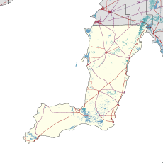
Agery is a locality in the Australian state of South Australia located on Yorke Peninsula. It is situated 17 km south-east of Moonta. Its name comes from the Aboriginal word ngadjali meaning "pipe clay".[7]
History
Agery School opened in 1880 and operated for over 100 years. It closed in 1982. Agery Post Office opened in December 1890.[7] Agery Methodist Church, originally known as the New Wesleyan Chapel, was built in 1885 and remained open until 1970. [8]
Features
Agery Reserve is a small nature reserve that is managed by the Moonta Branch of the National Trust of South Australia. It comprises 3.3 ha of mallee scrub. [9]
See also
References
- ^ Australian Bureau of Statistics (28 June 2022). "Agery (suburb and locality)". Australian Census 2021 QuickStats. Retrieved 28 June 2022.
- ^ "Yorke and Mid North SA Government region" (PDF). The Government of South Australia. Retrieved 17 April 2017.
- ^ a b "Search result(s) for Agery (LOCB) (Record No. SA0000379) with the following layers being selected - "Suburbs and Localities", "Counties", "Hundreds", "Place names (gazetteer)" and "Road labels"". Property Location Browser. Government of South Australia. Archived from the original on 12 October 2016. Retrieved 28 April 2017.
{{cite web}}: Unknown parameter|deadurl=ignored (|url-status=suggested) (help) - ^ "Goyder electorate boundaries as of 2014". ELECTORAL COMMISSION SA. Retrieved 23 July 2015.
- ^ "Federal electoral division of Grey" (PDF). Australian Electoral Commission. Retrieved 24 July 2015.
- ^ "Development Plan, Copper Coast Council, Consolidated – 28 August 2014" (PDF). Department of Planning, Transport and Infrastructure. 2014. pp. 286 & 394. Retrieved 23 October 2015.
- ^ a b "Agery, (Place names of South Australia)". Place names of South Australia. State Library of South Australia. Retrieved 24 October 2015.
- ^ "Trove". Trove. National Library of Australia. Retrieved 17 April 2015.
- ^ "National Trust - Agery Reserve". National Trust - Agery Reserve. National Trust. Retrieved 17 April 2015.

