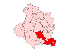
Mehsi, Bihar
This article has multiple issues. Please help improve it or discuss these issues on the talk page. (Learn how and when to remove these messages)
|
Mehsi
Kaswa Mehsi | |
|---|---|
City | |
 Mehsi is a 1st Biggest town in Assembly constituency area | |
| Coordinates: 26°21′N 85°07′E / 26.35°N 85.11°E | |
| Country | |
| State | Bihar |
| Division | Tirhut |
| Established | 1216 AD |
| Founded by | Data Mirja Halim |
| Nagar Palika | Kaswa Mehsi |
| Government | |
| • Type | Nagar Panchayat Mehsi/Nagar Palika |
| • Body | Ward - (15) |
| • Rank | 42.68km |
| Elevation | 64 m (210 ft) |
| Population (2011/2024) | |
| • Total | 25,995/73,642 in town |
| Demonym | 'mehsiwashi |
| Languages | |
| • Official | Bhojpuri, Urdu, Hindi , English |
| Time zone | UTC+5:30 (IST) |
| PIN | 845426,[1]845406, 843111 |
| Telephone code | 06257 |
| ISO 3166 code | IN-BR |
| Vehicle registration | BR05 |
| Neighbors | Kaswa Mehsi (Office), Rajepur, Bakhari, Ojhilpur, Hardo Patti |
| Avg. summer temperature | 42 °C (108 °F) |
| Lok Sabha constituency | 3. Purvi Champaran |
| Vidhan Sabha constituency | Pipra, Mehsi |
| Website | eastchamparan |
Mehsi is a CD Block and Mehsi Nagar Panchayat City and a municipality in the Purvi Champaran district [citation needed] in the Indian state of Bihar.[2] It is a part of the Tirhut Division[citation needed]. The town is the entry point of the Purvi Champaran district. There are many smaller factories manufacturing buttons for the clothing Industry, although most of the population depends upon commercial business and Business agriculture.[3]
Around 1216–1225 during the time of the Delhi Sultanate, a famous Sunni donor Mirza Haleem named Mehsi after his best follower Mahesh Ray. Which is the grave of Data Mirza Haleem in the town Mehsi Bihar state of India.
Location
Mehsi is located Area (2020) 154.12 km² Population (2020) 207856 Population Density 1348 people per km² Male Population 108041 Female Population 99815 Nearest Railway Station & Distance
Mehsi railway station, 1.71 km
Nearest Bus stand and Distance Naya tola Bus stand, 0.71 km (Land Mark) Asian Highway 42 in Mehsi Town Areas. Mehsi is an urban part and office Kasba Mehsi/Kaswa Mehsi of East Champaran and Mehsi Nagar Panchayat in Mehsi consists of total 15 wards.
Nearest (Aerial) Darbhanga Airport 63.18 km & Muzaffarpur Airport, 35.54 km distance
Industry
Mehsi industry include shell buttons[4] and harvesting of litchi and mango fruits. Mehsi is the major producer of these fruits in India.[citation needed]
River
The perennial Budhi Gandak river flows near the town of Mehsi which is a tributary of the Ganga river.[5]
Connectivity
Railways
Mehsi town, through railway, is directly connected to the major Indian cities like – Patna, Varanasi, Haridwar, Chandigarh, Dehradun, Allahabad, Kolkata, New Delhi, Mumbai, Bhopal, Amritsar, Guwahati, Lucknow, Gorakhpur, Kanpur, Ranchi, Raipur, Nagpur, Hyderabad etc. Mehsi railway station is situated on Muzaffarpur–Gorakhpur main line under the Samastipur railway division of East Central Railway zone.[6] It is also the closest railway station to Kesaria Stupa, a Buddhist pilgrimage site.
Air
The nearest airport is Darbhanga airport.[2] and Patna Airport.
Road
Through Mehsi India's 2nd Longest National Highway pass, that is NH -27.
It is directly connected via Road with Nearby Cities.
References
- ^ "Mehsi Pin Code". www.pincodeinfo.online.
- ^ a b "Mehsi in India", India9.com, 30 June 2005, web: i9-Mehsi.
- ^ "Mehsi Button Industry | An Official Website of East Champaran, Motihari | India". Retrieved 4 March 2023.
- ^ "Mehsi Button Industry | An Official Website of East Champaran, Motihari | India". Retrieved 4 March 2023.
- ^ Begam, Shama; Khan, R. A. (1 December 2002). "Impact of the Pollution of River Burhi Gandak on Plankton and Maicofauna at Mehsi, North Bihar Caused by Sugar Mills and Mother of Pearl Button Industries". Records of the Zoological Survey of India. 100 (3–4): 85. doi:10.26515/rzsi/v100/i3-4/2002/159588. ISSN 2581-8686. S2CID 251695899.
- ^ "Mehsi Railway Station Forum/Discussion - Railway Enquiry". indiarailinfo.com. Retrieved 16 September 2021.


