Rural Municipality of Argyle
Appearance
Argyle | |
|---|---|
| Rural Municipality of Argyle | |
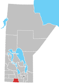
Location of Argyle in Manitoba | |
| Coordinates: 49°22′11″N 99°09′2″W / 49.36972°N 99.15056°W | |
| Country | Canada |
| Province | Manitoba |
| Incorporated | August 15, 1881 |
| Named for | John Campbell, 9th Duke of Argyll |
| Area | |
• Total | 770.44 km2 (297.47 sq mi) |
| Population (2016) | |
• Total | 1,025 |
| Time zone | UTC-6 (CST) |
| • Summer (DST) | UTC-5 (CDT) |
Argyle is a rural municipality in the province of Manitoba in Western Canada. It was incorporated on 15 August 1881 and is named after John Campbell, 9th Duke of Argyll who was the fourth Governor General of Canada.
Baldur is the largest community in the municipality, which is in southwestern Manitoba between Brandon and Portage la Prairie.
Communities
References
- Manitoba Historical Society - Rural Municipality of Argyle
- Map of Argyle R.M. at Statcan
- Baldur - R.M. Profile
External links


