Hydra (island)
Hydra
Ύδρα | |
|---|---|
Settlement | |
 View of Hydra town. | |
 | |
| Country | Greece |
| Administrative region | Attica |
| Regional unit | Islands |
| Government | |
| • Mayor | Aggelos Kotronis (Ind.) |
| Time zone | UTC+2 (EET) |
| • Summer (DST) | UTC+3 (EEST) |
| Postal code | 180 40 |
| Area code(s) | 22980 |
| Vehicle registration | Z |
Hydra (Template:Lang-el, pronounced [ˈiðra] in modern Greek) is one of the Saronic Islands of Greece, located in the Aegean Sea between the Saronic Gulf and the Argolic Gulf. It is separated from the Peloponnese by a narrow strip of water. In ancient times, the island was known as Hydrea (Υδρέα, derived from the Greek word for "water"), a reference to the springs on the island.
The municipality of Hydra consists of the islands Hydra (area 52 km2 (20.1 sq mi)), Dokos (pop. 18, area 13.5 km2 (5.2 sq mi)), and a few uninhabited islets. The province of Hydra (Template:Lang-el) was one of the provinces of the Piraeus Prefecture. Its territory corresponded with that of the current municipality.[2] It was abolished in 2006.
There is one main town, known simply as "Hydra port" (pop. 1,900 in 2011). It consists of a crescent-shaped harbor, around which is centered a strand of restaurants, shops, markets, and galleries that cater to tourists and locals (Hydriots). Steep stone streets lead up and outward from the harbor area. Most of the local residences, as well as the hostelries on the island, are located on these streets. Other small villages or hamlets on the island include Mandraki (pop. 11), Kamini, Vlychos (19), Palamidas, Episkopi, and Molos.
Transport, tourism and leisure
Hydra depends on tourism, and Athenians account for a sizable segment of its visitors. High-speed hydrofoils and catamarans from Piraeus, some 37 nautical miles (69 km) away, serve Hydra, stopping first at Poros before going on to Spetses. There is a passenger ferry service providing an alternative to Hydrofoils that runs from Hydra Harbor to Metochi on the Peloponnese coast. Many Athenians drive to Metochi, leave their car in the secure car park, and take the 20-minute passenger ferry across to Hydra.
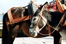
Rubbish trucks are the only motor vehicles on the island, as cars and motorcycles are not allowed by law. Horses, mules and donkeys, and water taxis provide public transportation. The inhabited area, however, is so compact that most people walk everywhere.
Hydra benefits from numerous bays and natural harbors, and has a strong maritime culture. The island is a popular yachting destination and is the home of the Kamini Yacht Club, an international yacht club based in the port of Kamini.
In 2007, a National Geographic Traveler panel of 522 experts rated Hydra the highest of any Greek island (11th out of 111 islands worldwide) as a unique destination preserving its "integrity of place."[3]
Captains' mansions
The Tsamadou mansion on the left-hand side of the harbor as one enters is now a Maritime Academy.
The Tombazi mansion is now part of the School of Fine Arts.
The mansions of Lazarus and George Kountouriotis, Boudouri, Kriezi, Voulgari, Sahini, and Miaouli all contain collections of 18th-century island furniture. The descendants of Lazarus Kountouriotis donated his mansion to the Historic-Ethnologic Institute of Greece. Today, it operates as an extension branch of the National Museum of History.
Monasteries and the Cathedral
There are numerous churches and six Orthodox monasteries on the island. Two particularly noteworthy monasteries are Profitis Ilias, founded in the 10th century, and Ayia Efpraxia. Both are on a hill overlooking the main harbor.
The island's cathedral is the old Monastery of the Dormition of the Virgin and sits on the quayside in the town. The monastery contains the tomb of Lazarus Kountouriotis, the richest sea captain on Hydra, who gave his entire fortune to support the Greek War of Independence.
History
Pre-history, antiquity, and the Byzantine Era

There is evidence of farmers and herders from the second half of the third millennium BCE on the small, flat areas that are not visible from the sea. Obsidian from Milos has also been found. During the Helladic period, Hydra probably served as a maritime base for the kingdoms on the Greek peninsula. Fragments of vases, tools, and the head of an idol have been found on Mount Chorissa.
The large-scale Dorian invasion of Greece around the 12th century BCE appears to have depopulated the island. Hydra was repeopled by farmers and herders, perhaps sailing from the mainland port of Ermioni, in the 8th century BCE. Herodotus reports that toward the 6th century BCE, the island belonged to Ermioni, which sold it to Samos. Samos, in turn, ceded it to Troizina.
For much of its existence, Hydra stayed on the margins of history. The population was very small in ancient times and, except for the brief mentions in Herodotus and Pausanias, left little or no record in the history of those times.
It is clear that Hydra was populated during the Byzantine Era, as vases and coins have been discovered in the area of Episkopi. However, it appears that the island again lost its population during the Latin Empire of Constantinople as its inhabitants fled the pirate depredations. On other islands, inhabitants moved inland, something that was essentially impossible on Hydra.
From 1204 to 1566, it belonged to Venice. From 1566 to 1821 (nominally 1829), it was part of the Ottoman Empire.
In the 16th century, the island began to be settled by refugees from the warfare between the Ottomans and Venetians.[4] The Arvanites' presence was evident until the mid-20th century, when, according to T. Jochalas, the majority of the island's population was composed of Arvanites.[5] The island is known in Arvanitika as Nίδρα.[5]
The Ottoman era: Period of commercial and naval strength


Hydra was relatively unimportant during much of the period of Ottoman rule. Its naval and commercial development began in the 17th century, and its first school for mariners was established in 1645.[6] Apparently, the first truly Hydriot vessel was launched in 1657. However, the conflict between the Republic of Venice and the Ottoman Empire limited the island's maritime development until after 1718 and the Treaty of Passarowitz. From the 17th century on, Hydra began to take on a greater importance because of its trading strength.
During the first half of the 18th century, Hydra built the same kind of vessels as were built in the other Aegean Islands: the sachtouri of 15 to 20 tons, and the latinadiko of 40 to 50 tons. The Hydriots contented themselves with trading in the Aegean, going as far as Constantinople. A great change occurred in 1757 after they launched a vessel of 250 tons. The larger boats enabled Hydra to become an important commercial port. By 1771, one could count up to 50 vessels from throughout Greece in the roads. Ten years later, the island had fitted out 100 vessels.[7]
However, the Ottoman Empire and its policies constrained Hydra's economic success. Heavy tariffs and taxes limited the speed of development. The Ottoman administration limited free trade, permitting only Ottoman vessels to navigate the Dardanelles and the Bosphorus, and hence to have access to the Black Sea, its ports, and the trade in grain from their hinterlands. The Treaty of Küçük Kaynarca changed all this. Russia gained from the Ottoman Empire the right to protect the Empire's Orthodox Christians. The religious protection had a commercial corollary: the Hydriots began to sail under the Russian flag. The treaty also provided for free passage between the Aegean and the Black Sea. Hydra entered its commercial era. Hydriot vessels carried goods between Southern Russia in the east and the Italian ports of Ancona and Livorno in the west. From 1785 on, the Hydriot shippers began to engage in commerce, not just transport. Each vessel became its own small commercial enterprise, and trade with the Levant quickly began to depend on Hydra's vessels, though not without competition from those of Spetses and Psara.
However, the plague of 1792 killed a large part of the population, and many people moved away. As a result, the town was almost completely abandoned for a while. Still, by the end of the 18th century, Hydra had again become quite prosperous, with its vessels trading as far as France, Spain, and even the Americas. Napoleon presented the island with the huge silver chandelier in the cathedral as a gesture of gratitude for the Hydriots' role in running the British blockade and so bringing food to France and Europe.
The Greek War of Independence and the decline


In the 19th century, Hydra was home to some 125 boats and 10,000 sailors. The mansions of the sea captains that ring the harbor are a testament to the prosperity that shipping brought to the island, which, at the time of the Greek Revolution, had 16,000 inhabitants. During the revolution, the fleets of Hydra and the other two naval islands of Psara and Spetses were able to wrest control of the eastern Aegean Sea from the Ottoman Empire.
When the Greek War of Independence broke out, Hydra's contribution of some 150 ships, plus supplies, to fight against the Turks played a critical role. The Greek admiral Andreas Miaoulis, himself a settler on Hydra, used Hydriot fire ships to inflict heavy losses on the Ottoman fleet.
With the end of the revolution and the creation of the Greek state, the island gradually lost its maritime position in the Eastern Mediterranean, igniting an economic crisis that led to a period of hardship and unemployment. The main reason was that with the creation of the Greek state, Hydra's fleet lost the privileges that the Treaty of Küçük Kaynarca and the use of the Russian flag had given it. Another reason was that the traditional families who owned the majority of the fleet failed to foresee the benefits of participating in the steam ship revolution, which significantly cut shipping operational costs through reduced crew and independence of the winds, putting them at a disadvantage vis-á-vis the new shipping companies of Piraeus, Patras, and Syros. A third reason was that the new conditions made illegal activities such as piracy impossible. Once again, many inhabitants abandoned Hydra, leaving behind their large mansions and beautiful residences, which fell into ruin. The mainstay of the island's economy became fishing for sponge. This brought prosperity again until 1932, when Egypt forbade fishing along its coast. By World War II, the Hydriots were again leaving the island; many of them went abroad.
Second World War
Between 1941 and 1943, during the Axis occupation of Greece during World War II, there was famine on Hydra. It is estimated that some eight percent of the population died of starvation.
Historical population
| Year | Town population | Municipality/Island population |
|---|---|---|
| 1981 | 2,732 | - |
| 1991 | 2,279 | 2,387 |
| 2001 | 2,526 | 2,719 |
| 2011 | 1,900 | 1,982 |
Topography and ecology


The dominant geographic features of Hydra are its rocky hillsides, which are bare, pine forested valleys with the occasional farmhouse. The island was subject to a modern geologic study by Renz in 1955. Some of the later Permian limestone strata are rich in well-preserved fossils.
There are many types of wildflowers, including rare 'spentzes' or cyclamen and poppies. As well as pine trees, there are cypress and olive trees. Birds species include partridges, quails, and many migratory birds, which are subject to local hunting. Mammals include rabbits, feral cats, and goats.
Although the island's name is derived from ancient springs known to the Ancient Greeks, it is now almost dry. Hydra previously had wells, and three new wells have been found. Today, the island imports its water by boat from the Greek mainland. A new desalinization plant has been finished but is not in operation. Many local people store winter rainfall in cisterns beneath their houses to use later as drinking water.
A savage fire during the intense heat of 2007 destroyed much of the pine forest to the east of Hydra port. However, the fire left untouched some forest above Kamini and at the west end of Hydra. The forest around Molos, Bisti, and Agios Nikolaous was also unaffected.
The island has almost no nighttime light pollution. This is a boon to astronomy.
Municipality of Hydra
The municipality of Hydra includes the following islands:
| Name | Area | Population |
|---|---|---|
| Dokos Island | 13.5 | 18 |
| Agios Georgios Island | 4.3 | 0 |
| Hydra Island | 52 | 1960 |
| Trikeri Island and more Islands | 2.2 | 4 |
The total area of the municipality is 72 km2 (28 sq mi), and its population is 1980 (2011), most in Hydra (city).
Cultural life
The Hydrama Theater and Arts Center hosts performances, drama and dance workshops for the local community, and courses in ancient Greek theater for international participants.
The island hosts an annual conference on Rebetiko, a type of Greek urban folk music, in mid-October.
In June 2009, the art collector Dakis Joannou opened a Hydra branch of a private art museum, the Deste Foundation, to show the work of established young artists.
Since 1960, the Canadian singer-songwriter Leonard Cohen has owned a house on the island.
International relations
Twin towns — Sister cities
The municipality of Hydra is twinned with:
Notable people

- Andreas Miaoulis (1768–1835) merchant, Shipowner, Naval hero, admiral
- Laskarina Bouboulina (1771–1825) Merchant, Shipowner, Naval heroine, Admiral
- Iakovos Tombazis (1782–1829) merchant, shipowner, Naval hero, Admiral
- Emmanuel Tombazis merchant, shipowner, Naval hero, Admiral
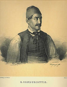
- Georgios Kountouriotis (1789–1858) merchant, shipowner, politician, Prime Minister of Greece
- Lazaros Kountouriotis) merchant, shipowner, The biggest funder of the Greek War of Independence.
- Georgios Sahinis (1789 -1864)Merchant, Shipowner, Naval hero, Admiral
- Stavros Sahinis died in the Battle of Sphacteria (1825), holding off the Egyptian-Turkish landing force.
- Antonios Kriezis (1796–1865) merchant, shipowner, Naval hero, Admiral, Prime Ministers
- Anastassios Tsamados, merchant, shipowner, Naval hero, Captain of the Aris, died in the Battle of Sphacteria (1825), holding off the Egyptian-Turkish landing force.
- Dimitrios Voulgaris (1802–1878) merchant, shipowner, Prime Minister of Greece
- Athanasios Miaoulis (1815–1867) Prime Minister of Greece
- Nikolaos Vokos (1854–1902) painter
- Pavlos Kountouriotis (1855–1935) naval hero, admiral and President of Greece
- Nikolaos Votsis (1877–1931) naval hero and admiral
- Dorotheus (1888–1957) Archbishop of Athens and All Greece
- Nikos Nikolaou (1909–1986) artist
- Gikas N. Koulouras Shipowner, member of Parliament, founded and donated the Historical Museum and Archives of Hydra, founder and first President of the Greek Shipowners Association
- Panayiotis Tetsis (1925) painter
- Michalis Maniatis (1952) film and TV actor, producer, screen and book writer
- Rallou Manou, choreographer
- Elena Votsi (b. 1964), jewellery designer
- Leonard Cohen (b. 1934) Canadian poet and songwriter
- Axel Jensen (1932–2003) Norwegian author
- George Johnston (1912–1970) Australian journalist, novelist and writer
- Charmian Clift (1923–1969) Australian novelist and writer
- Göran Tunström (1937–2000) Swedish author
Books about or set on Hydra
- The Colossus of Maroussi, Henry Miller (1941)
- Peel Me a Lotus, Charmian Clift (1959)
- A Rope of Vines: Journal from a Greek Island, Brenda Chamberlain (1965)
- Rien ne va plus (The Sleepwalker), Margarita Karapanou (1994)
- Clouds over Hydra, Charles Young (1996)
- Fugitive Pieces, Anne Michaels (1996)
- The Riders, Tim Winton (1996)
- Hydra and the Bananas of Leonard Cohen, Roger Green (2003)
- Rhubarbs from a Rock, David Fagan (2003)
- Lighthousekeeping, Jeannette Winterson (2006)
- Hydra, Catherine Vanderpool (1980)
- Le Premier jour, Marc Levy (2009)
- Travels with Epicurus, Daniel Klein (2012)
- Hydra vues privées / Private views, Catherine Panchout, Éditions Gourcuff Gradenigo (2015)
- Island of Cats – Hydra, Gabriela Staebler, Edition Reuss (2015)
The Sea Change Elizabeth Jane Howard 1959
Movies filmed on Hydra
- A Girl in Black (Greece 1956)
- Boy on a Dolphin (1957). Hydra was the setting for this Sophia Loren hit movie.
- Phaedra (1962)
- Island of Love (1963)
- Incense for the Damned (1970)
- Out of the Shadows (1988)
- The Blue Villa (Un Bruit Qui Rend Fou) (1995)
- Boat Trip (2002)
- Fugitive Pieces (2007)
- The Capsule (2012)
Gallery
-
The Epitaphios being carried, Good Friday
-
Boy on dolphin, a statue based on the feature-film of the same name
-
A snapshot from the seafront
References
- ^ "Απογραφή Πληθυσμού - Κατοικιών 2011. ΜΟΝΙΜΟΣ Πληθυσμός" (in Greek). Hellenic Statistical Authority.
- ^ Template:PDFlink Template:El icon Template:Fr icon
- ^ http://traveler.nationalgeographic.com/2007/11/destinations-rated/list-text
- ^ Vanderpool, Catherine (1980) Hydra, Athens Lycabettus Press, pp. 3-4.
- ^ a b Jochalas, Titos P. (1971): Über die Einwanderung der Albaner in Griechenland: Eine zusammenfassene Betrachtung ["On the immigration of Albanians to Greece: A summary"]. München: Trofenik.
- ^ Iles grecques, Guide Bleu, Hachette, 1998. p. 185.
- ^ Georgios Voyatis, Le Golfe Saronique, p. 164.
- ^ "Twinnings" (PDF). Central Union of Municipalities & Communities of Greece. Retrieved 2013-08-25.
- ^ "National Commission for Decentralised cooperation". Délégation pour l’Action Extérieure des Collectivités Territoriales (Ministère des Affaires étrangères) (in French). Retrieved 2013-12-26.
External links
 Hydra travel guide from Wikivoyage


