Tanaga (volcano)
| Tanaga | |
|---|---|
 Tanaga | |
| Highest point | |
| Elevation | 5,925 ft (1,806 m)[1] |
| Prominence | 5,925 ft (1,806 m)[1] |
| Listing | |
| Coordinates | 51°53′02″N 178°08′29″W / 51.88389°N 178.14139°W |
| Geography | |
| Location | Tanaga Island, Alaska, U.S. |
| Parent range | Aleutian Range |
| Geology | |
| Mountain type | Stratovolcano |
| Volcanic arc/belt | Aleutian Arc |
| Last eruption | 1914 |
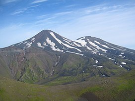
Tanaga (Aleut: Kusuuginax̂)[2] is a 5,924-foot (1,806 m) stratovolcano in the Aleutian Range of the U.S. state of Alaska. There have been three known eruptions since 1763. The most recent was in 1914 and produced lava flows.
See also
- List of mountain peaks of North America
- List of Ultras of the United States
- List of volcanoes in the United States
References
- ^ a b "Alaska & Hawaii P1500s - the Ultras". PeakList.org. Retrieved 2013-01-06.
- ^ Bergsland, K. (1994). Aleut Dictionary. Fairbanks: Alaska Native Language Center.
External links


