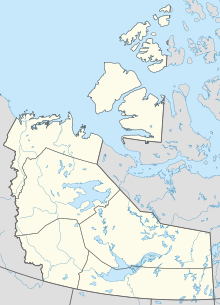
Tuktoyaktuk/James Gruben Airport
Tuktoyaktuk/James Gruben Airport | |||||||||||
|---|---|---|---|---|---|---|---|---|---|---|---|
 | |||||||||||
| Summary | |||||||||||
| Airport type | Public | ||||||||||
| Operator | Government of the Northwest Territories | ||||||||||
| Location | Tuktoyaktuk, Northwest Territories | ||||||||||
| Time zone | MST (UTC−07:00) | ||||||||||
| • Summer (DST) | MDT (UTC−06:00) | ||||||||||
| Elevation AMSL | 14 ft / 4 m | ||||||||||
| Coordinates | 69°26′00″N 133°01′35″W / 69.43333°N 133.02639°W | ||||||||||
| Map | |||||||||||
| Runways | |||||||||||
| |||||||||||
| Statistics (2010) | |||||||||||
| |||||||||||
Tuktoyaktuk/James Gruben Airport (IATA: YUB, ICAO: CYUB) is near Tuktoyaktuk, Northwest Territories, Canada.
The airport is classified as an airport of entry by Nav Canada and is staffed by the Canada Border Services Agency (CBSA). CBSA officers at this airport can handle general aviation aircraft only, with no more than 15 passengers. There are regular flights going and arriving into the airport, but they come almost entirely from Inuvik.[1]
The airport is named for James Gruben a local bush pilot/businessman who was killed on the ice road from Inuvik to Tuktoyaktuk on 13 April 2001.[4] He was the owner of the only 100% Inuvialuit-owned transportation company, E. Gruben's Transport Ltd., that was passed down to him from his father Eddie Gruben and is still in business to this day.[citation needed]
Airlines and destinations
| Airlines | Destinations |
|---|---|
| Kenn Borek Air operating as Aklak Air | Inuvik[5] |
References
- ^ a b Canada Flight Supplement. Effective 0901Z 16 July 2020 to 0901Z 10 September 2020.
- ^ Synoptic/Metstat Station Information
- ^ Total aircraft movements by class of operation
- ^ CBC News article on Gruben's accident
- ^ KBA flight schedule
External links
- GNWT Hansard with members comments on James Gruben[permanent dead link]
- Past three hours METARs, SPECI and current TAFs for Tuktoyaktuk Airport from Nav Canada as available.

