Sandimen
22°43′N 120°39′E / 22.717°N 120.650°E
Sandimen Township 三地門鄉 | |
|---|---|
 | |
 Sandimen Township in Pingtung County | |
| Location | Pingtung County, Taiwan Province, Republic of China |
| Area | |
• Total | 196 km2 (76 sq mi) |
| Population (February 2024) | |
• Total | 7,717 |
| • Density | 39/km2 (100/sq mi) |
| Sandimen Township | |||||||||||||||||
|---|---|---|---|---|---|---|---|---|---|---|---|---|---|---|---|---|---|
| Traditional Chinese | 三地門鄉 | ||||||||||||||||
| |||||||||||||||||
| Alternative Chinese name | |||||||||||||||||
| Traditional Chinese | 山地門 | ||||||||||||||||
| |||||||||||||||||
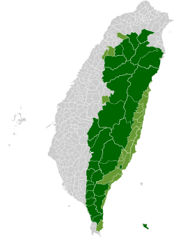
Sandimen Township[1] is a mountain indigenous township in Pingtung County, Taiwan Province, Republic of China. The population of the township consists mainly of the Paiwan people with a substantial Rukai minority.
Names
[edit]Ethnic Chinese settlers homophonically translated the original Paiwan name (Paiwan: setjimur, lit. 'people of Tjimur communinty'[2]) into Hokkien (Chinese: 山豬毛; Pe̍h-ōe-jī: Soaⁿ-ti-mn̂g; lit. 'wild-boar bristle'; or 山地門; Soaⁿ-tē-mn̂g; 'mountains-gate').[3] Under Japanese rule the name was Sanchimon (Japanese: 山地門). Following the handover of Taiwan from Japan to the Republic of China in 1945, the area became Sandimeng Township (三地盟鄉; Sāndìméng Xiāng) but the name was changed again in 1947 to Sandi Township (Chinese: 三地鄉; pinyin: Sāndì Xiāng; Pe̍h-ōe-jī: Sam-tē-hiong) but the Taiwanese pronunciation of Soaⁿ-tē-mn̂g continued to be commonly used.[4] In August 1992, the township assumed its current name.
History
[edit]During the Japanese era, Sandimen was grouped with modern-day Majia Township and Wutai Township as "Aboriginal Areas" (蕃地), which was governed under Heitō District (屏東郡) of Takao Prefecture. Following the Kuomintang takeover of Taiwan in 1945, Sandimen was assigned to Kaohsiung County and, on 16 August 1950, it became a part of the newly established Pingtung County.
Geography
[edit]- Population: 7,717 people (February 2024)
- Area: 196.4 square kilometres (75.8 sq mi)
Administrative divisions
[edit]The township comprises 10 villages: Anpo, Dalai, Dashe, Dewen, Jingshan, Jingye, Koushe, Mani, Saijia and Sande.
Tourist attractions
[edit]References
[edit]- ^ 臺灣地區鄉鎮市區級以上行政區域名稱中英對照表 Archived 2012-03-25 at the Wayback Machine Glossary of Names for Administrative Divisions. (in Chinese) Accessed at Taiwan Geographic Names Information System website Archived 2013-08-16 at the Wayback Machine (in English). Ministry of the Interior. 16 June 2011. Retrieved 1 April 2015.
- ^ Taiwan Sōtokufu Banzoku Chōsakai (臺灣總督府蕃族調查會) (2015). 蕃族調查報告書 第八冊:排灣族 [An Investigation of the Aborigines in Taiwan. Vol VIII. Paiwan] (in Chinese (Taiwan)). Translated by Institute of Ethnology, Academia Sinica. Taipei: Institute of Ethnology, Academia Sinica. ISBN 978-986-04-6856-4.
- ^ "Entry #40016". 臺灣閩南語常用詞辭典 [Dictionary of Frequently-Used Taiwan Minnan]. (in Chinese and Hokkien). Ministry of Education, R.O.C. 2011.
- ^ 吳秀麗 (1994). Independent Evening Post 商用台語 (in Chinese). Taipei. p. 145. ISBN 9789575963149.
{{cite book}}: CS1 maint: location missing publisher (link)
External links
[edit]- Sandimen Government website (in Chinese)


