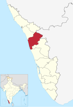
Malappuram district
| Malappuram district | |
| — district — | |
| Coordinates | 11°02′N 76°03′E / 11.03°N 76.05°ECoordinates: 11°02′N 76°03′E / 11.03°N 76.05°E |
| Country | India |
| State | Kerala |
| Headquarters | Malappuram |
| Population • Density |
3,625,471 • 1,022 /km2 (2,647 /sq mi) |
| Time zone | IST (UTC+05:30) |
| Collector | M.C Mohandas |
| ISO 3166-2 | IN-KL- |
Malappuram district (Malayalam: മലപ്പുറം ജില്ല, pronounced [malappuram jilla]) is a revenue district (similar to a county) in the state of Kerala, south India with headquarters at the town of Malappuram. The district was formed on 16 June 1969.
The classic medieval center of Vedic learning and politics, Thirunavaya, home of the traditional Ayurveda medicine, Kottakkal and the oldest centre of education of Islam, Ponnani are situated in Malappuram District along with economically booming towns like Manjeri (former capital of the Cholanaikkans[1]), Perinthalmanna, Chemmad, Edappal, and Kottakkal. In 1921, present day Malappuram district witnessed a devastating revolts and massacres known as the Moplah rebellions, followed by decades of frozen economical, social, and political development. In the early years of the Communist rule in Kerala, Malappuram now part of the newly formed Kerala state, saw large land reforms under the Land Reform Ordinance. In early 1970s, huge oil reserves of Persian gulf were opened to commercial extraction, and thousands of unskilled people migrated to "the Gulf" seeking fortunes. They sent money home, propping up a sleepy rural economy, and by late 20th century, the region had achieved first-world health standards and near universal literacy.[2] The present development, both economical and social, of the Malappuram District owes to the Kerala Gulf diaspora.
Malappuram district comprises a vast wildlife collection and a number of small hills, forests, little rivers and streams flowing to the west, backwaters and paddy, arecanut, cashew nut, pepper, ginger, pulses, coconut, banana, tapioca, and rubber plantations. Malappuram is one of two Muslim majority districts or Union Territories in south India other being Lakshadweep. The Hindu temples and Moplah mosques of the region are known for their colorful festivals. It is the most populous district in Kerala (out of 14).[3] The populations include Muslims, Hindus, Christians, various tribal religion believers, Buddhists, Sikhs, Jains and others.[1]
History
The word Malappuram ("terraced place atop the hills") came to represent the present region only after the formation of the district, before it was called Eranad or Valluvanad
The district has a rich cultural and political heritage. From the time immemorial the port of Ponnani (sometimes roughly identified with Tyndis) was a centre of trade with the Romans. After the Cheras, numerous powerful dynasties controlled the area, and by 9th century the region came to hands of the Kulasekharas of Mahodayapuram. After the disintegration of the Kulasekhara kingdom a number of Nair city states emerged called Valluvanad, Vettathunad, Parappanad, Nediyiruppu (the Zamorins) and more. But, from 13th century the Samoothiri of Calicut expanded their territories to the whole of Malabar. Thirunavaya, the seat of Mamankam, was in Malappuram district. European colonial powers landed in Malabar in 15th century, and changed the course of the history. The petty vassals of the Samoothiris often allied with the foreign powers against their rule. In 18th century, the de facto rulers of Mysore kingdom, Hyder Ali and Tipu Sultan, marched to Samoothiris’ districts.
Malappuram has seen participation in movements such as Khilafat Movement and Moplah Rebellion in the early 20th century.
Before Indian independence in 1947, Malappuram was a part of Malabar District in the Madras Presidency of British India. The area covered by the present district was administered as a part of Kozhikode, Eranad taluk, Valluvanad Taluk and Ponnani taluk. Malabar District remained part of Madras state for some time after Indian independence. On 1 November 1956, Malabar District was merged with Travancore-Cochin to form the state of Kerala. Large-scale changes in the territorial jurisdiction of this tract took place in 1957 and 1969. On 1 January 1957, Tirur taluk was newly formed, taking portions of Eranad taluk and Ponnani taluks. Another portion of Ponnani taluk was transferred to the newly formed Chavakkad taluk. The residuary portion constitutes present-day Ponnani taluk. Perinthalmanna Taluk was a new taluk formed out of the erstwhile Perinthalmanna Taluk. Of these, Eranad Taluk and Tirur continued under Kozhikode District and Perinthalmanna Taluk as well as Ponnani taluk under the Palakkad District. The new district of Malappuram was formed with four taluks, Eranad Taluk, Perinthalmanna Taluk, Tirur Taluk and Ponnani Taluk, four statutory towns, fourteen developmental blocks and 95 panchayats. Two more taluks, namely Tirurangadi taluk and Nilambur taluk, were formed later by bifurcating Tirur Taluk and Eranad taluk.

Geography
The district lies in northern Kerala and is bounded on the north by Wayanad and Kozhikkode districts, on the northeast by Tamil Nadu, on the southeast and south by Palakkad District, on the southwest by Thrissur District, on the west by the Arabian Sea, and on the northwest by Kozhikode District.
At present Malappuram District consists of 2 revenue divisions, 6 taluks, 135 villages, 15 blocks, 7 municipalities and 100 panchayats.
Rivers
- Bharathapuzha (Nila)
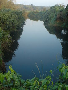
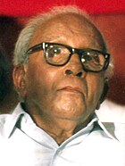
- Chaliyar: On north of this district. Chaliyar has a length of 169 km and originates from Illambalieri hills in Tamil nadu, important tributaries of this river are Chalipuzha, Punnapuzha, Pandiyar, Karimpuzha, Cherupuzha and Vadapurampuzha. Chaliyar traverses through Nilambur, Mampad, Edavanna, Areekode, Vazhakkad and flows into the sea at Beypore in Kozhikode district. Of these rivers, only Chaliyar is perennial. The other rivers dry up in summer. This is one of the reasons that Malappuram district is prone to drought. Chaliyar Agitation under the leadership of K A Rahman is a success story of a people’s environmental movement in the state of Kerala. For the fight against river pollution in this land of rivers which continues in other parts of the state.
- River Kadalundi: Formed by the confluence of two rivers, the Olipuzha and Veliyar. Olipuzha originates form Cherakomban hill and Veliyar from Erattakomban hill. They flow through the Silent Valley and traverse through Eranad and Valluvanad regions, before flowing into the sea at Kadalundi. It passes through places like Melattur, Pandikkad, Malappuram, Panakkad, Parappur, Kooriyad and Tirurangadi. It has a circuit course of 130 km.
Backwaters
In [Tirur] and [Ponnani taluk]s, backwaters like Biyyam, Veliyancode, Manur, and Kodinhi offer fishing and navigation facilities.
Demographics
According to the 2011 census Malappuram district has a population of 4,110,956,[3] roughly equal to the nation of Lebanon[4] or the US state of Oregon.[5] This gives it a ranking of 50th in India (out of a total of 640).[3] The district has a population density of 1,158 inhabitants per square kilometre (3,000/sq mi) .[3] Its population growth rate over the decade 2001-2011 was 13.39 %.[3] Malappuram has a sex ratio of 1096 females for every 1000 males,[3] and a literacy rate of 93.55 %.[3]
Muslims constitute the majority of the population, followed by the Hindu and Christian communities. A great majority of them are traditional Sunnis following the Shafi School of thought.
Languages
Malayalam is the main language of the district. Other languages used in the district include Allar, a Dravidian language with 350 speakers;[6] and Aranadan, also Dravidian, kept alive by the low education level of its 200 speakers.[7]
Legislative constituencies
Malappuram district has the most number of Legislative constituencies in the state
| Constituency | Local Body | MLA | Political Party | Kerala Ministry |
|---|---|---|---|---|
| Malappuram | Malappuram Municipality, Pulpetta, Anakkayam, Morayur, Pokkottur Panchayaths of Eranad Taluk and Kodur Panchayath of Perintalmanna Taluk | P. Ubaidullah | Muslim League | |
| Manjeri | Manjeri Municipality , Pandikkad, Thrikkalangode panchayaths of Eranad Taluk and Edappatta, Kizhattur Panchayaths of Perintalmanna Taluk | Adv. M. Ummar | Muslim League | |
| Kondotty | Kondotty, Cherukavu, Muthuvalloor, Vazhayur, Vazhakkad, Pulikkal, Nediyirippu and Cheekkode Panchayaths of Eranad Taluk | Mammunny Haji | Muslim League | |
| Eranad | Chaliyar Panchayath of Nilambur Taluk, Areekkode, Oorngattiri, Kavanur, Keezhu paramba, Kuzhimanna and Edavanna Panchayaths of Eranad Taluk | P.K. Basheer | Muslim League | |
| Mankada | Mankada, Angadippuram, Kuruva, Koottilangadi, Puzhakkatteeri,Moorkkanad and Makkaraparamba Panchayaths of Perintalmanna Taluk | T.A. Ahammad Kabeer | Muslim League | |
| Perinthalmanna | Perintalmanna Municipality , Aliparamba,Elamkulam, Thazhekode, Vettathoor, Pulamanthole and Melattur Panchayaths of Perintalmanna Taluk | Manajalam Kuzhi Ali | Muslim League | |
| Thirurangadi | Thirurangadi, Parappanagadi, Nannambra, Thennala and Edarikode Panchayaths of Thirurangadi Taluk and Perumanna-Klari Panchayath of Tirur Taluk | P.K. Abdu Rrabb | Muslim League | Minister for Education |
| Vengara | Vengara, AR Nagar, Kannamangalam, Oorakam, Othukkungal and Parappur Panchayaths of Thirurangadi Taluk | P.K.Kunjali Kutty | Muslim League | Minister for Industries,Information Technology and Urban Affairs |
| Vallikunnu | Vallikkunnu, Pallikkal, Chelembra, Moonniyur, Thenjippalam and Peruvalloor Panchayaths of Thirurangadi Taluk | Adv. KNA Kader | Muslim League | |
| Tirur | Tirur Municipality,Athavanadu, Kalpakanchery, Valavannur, Vettam, Thalakkad and thirunavaya Panchayaths of Tirur Taluk | Mammutty | Muslim League | |
| Tanur | Tanur, Thanalur, Niramaruthoor, Cheriyamundom, Ponmundom and Ozhur Panchayaths of Tirur Taluk | Abdu Rahman Randathani | Muslim League | |
| Kottakkal | Kottakkal Municipality, Ponamala, Marakkara, Edayur, Irimbiliyam, Valanchery and Kuttippuram Panchayaths of Tirur Taluk | Abdussamad Samadani | Muslim League | |
| Nilambur | Nilambur Municipality,Vazhikkadavu, Pothukal, Edakkara, Muthedam, Chungathara, Amarambalam and Karulai Panchayaths of Nilambur Taluk | Aryadan Muhammad | INC | Minister for Power |
| Wandoor | Wandoor, Tiruvali, Mampad, Porur, Kalikavu, Chokkad, Karuvarakundu and Thuvvoor Panchayaths of Nilambur Taluk | A.P. Anil Kumar | INC | Minister for Welfare of Scheduled Castes & Backward Classes and Tourism |
| Ponnani | Ponnani Municipality, Alankode, Maranchery, Nannammukku, Perumpadappu and Veliyancode Panchayaths of Ponnani Taluk | P.Sreerama Krishnan | CPI(M) | |
| Thavanur | Thavanur, Kaladi, Vattamkulam, Edappal Panchayaths of Ponnani Taluk and Mangalam, Purathoor, Thrippangode Panchayaths of Tirur Taluk | KT.Jaleel | CPI(M) Ind. |
Parliament Constituencies
| Parliament Constituency | Assembly Constituencies | MP | Political party | |
|---|---|---|---|---|
| Malappuram | Malappuram, Manjeri, Mankada, Perinthalmanna, Vallikunnu and Vengara. | E. Ahamed | Muslim League | Minister of State (Deputy Minister) for the Ministry of External Affairs and HRD |
| Ponnani (Part) | Thirurangadi, Tirur, Tanur, Ponnani, Kottakkal and Thavanur. | E.T. Muhammed Basheer | Muslim League | |
| Waynad (Part) | Eranad, Wandoor and Nilambur. | M.I. Shanavas | INC |
Taluks
The district has six taluks. District is divided by two revenue divisions namely Tirur and Perintalmanna .
- Tirur
- Tirurangadi
- Ponnani
- Ernad
- Perintalmanna
- Nilmabur
Grama Panchayats and Block Panchayaths
There are 15 Block Panchayaths and 100 Grama panchayats in Malappuram District.
| Block Name | Panchayaths |
|---|---|
| Malappuram Block | Anakkayam, Morayur, Pokkottur, Kodur, Ponmala and Othukkungal. |
| Perumpadappu Block | Perumpadappu, Alankode, Marancheri, Nannammukku and Veliyankode. |
| Tirur Block | Purathoor, Thrippangode, Thalakkad, Vettom, Mangalam and Tirunavaya. |
| Tirurangadi Block | Tirurangadi, parappanagadi, Vallikkunnu, Thenjippalam, Moonniyoor, Peruvalloor and Nannambra. |
| Vengara Block | Vengara, AR Nagar, Parappur, Kannamangala, Oorakam, Edarikode and Thennala. |
| Tanur Block | Tanur, Tanalur, Niramaruthoor, Ponmundam, Ozhur, Perumanna-Klari, Valavanoor and Cheriyamundom. |
| Kuttippuram Block | Kuttippuram, Athavanadu, Kalapakancheri, Edayur, Irimbiliyam, Marakkara and Valanchery. |
| Mankada Block | Mankada, Kuruva, Koottilangadi, Puzhakkattiri, Moorkkanad and MakkaraParamba. |
| Perintalmanna Block | Aliparamba, Elamkulam, Thazkekode, Vettathur, Pulamanthole, Melattur, Keezhattur and Angadippuram. |
| Ponnani Block | Edappal, Thavanur, Kaladi and Vattamkulam. |
| Areecode Block | Areecode, Orngattiri, Kavanur, Keezhuparamba, Kuzhimanna, Edavanna, Cheekode and Pulpetta. |
| Kalikavu Block | Kalikavu, Chokkadu, Karuvarakundu, Thuvvoor, Amarambalam, Karulai and Edappatta. |
| Kondotty Block | Kondotty, Vherukavu, Muthuvalloor, Vazhayur, Vazhakkad, Pulikkal, Nediyiruppu, Pallikkal and Chelembra. |
| Wandoor Block | Wandoor, Tiruvali, Mampad, Porur, Pandikkad and Thrikkalangode. |
| Nilambur Block | Vazhikkadavu, Pothukal, Edakkara, Muthedam, Chungathra and Chaliyar. |
Municipalities
The Municipalities in Malappuram District are:
Art and Culture
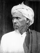
Malappuram district has a good tradition in the field of art and culture. Many renowned writers and poets hail from this part of the land. Thunchath Ezhuthachan, honored as the father of modern Malayalam literature was born in Trikkandiyur near Tirur, almost 400 years ago. Mampuram is a historical place involved in anti-British rebellions in Malabar, especially the Moplah Rebellion of 1921. The grave of Mampuram Thangal is located here. It is also the birthplace of Omar Qazi, a Muslim scholar and a leader of anti-British movements. The family of Panakkad Thangals, the presidents of the Kerala state committee of the Indian Union Muslim League and supreme leaders of E. K. Sunni faction of the Muslims of Kerala is located at Panakkad. Kathakali Musician Kalamandalam Tirur Nambissan was born at Ezhoor.
Fairs And Festivals
With a number of temples, mosques & churches Malappuram bounds in fairs and festivals. Some important ones are given below.
Thirumandhamkunnu Pooram
Thirumandham kunnu pooram is an important temple festival of central Malabar. Thirumandham kunnu temple is said to be one among the three important Bhagavati temples of Kerala, the others being Kodungallur and Panayarakavu. The pooram festival is during March–April. The cultural feast is the most attractive feature of this festival. The seven day daily pooja attracts thousands of devotees. The famous Mangalya Pooja attracts young women in thousands, who come to pray for a good wedlock. Thirumandham kunnu is 2 km west of Perinthalmanna, in the Kozhikode-Palakkad state highway.
Kottakkal pooram
Kottakkal, the seat of Ayurvedic treatment is also famous for its temple festival. Kottakkal pooram, celebrated during March–April, is attractive for its cultural festivity. During the seven days, famous classical artists of the country perform here.
Nilambur Pattu
Nilambur Pattu is an ancient festival. Nilambur Kovilakam conducts it during January. Thousands gather to witness this weeklong celebration. The festival is related to ancient war and hunting. Tribal chieftains have important roles in the rituals.
Kondotty Nercha
Kondotty Nercha is a weeklong festival in March. The Nercha is conducted in Pazhayangadi Mosque of Kondotty, constructed in the 18th century AD. The tomb of Mohammed shah the Sufi exponent, is close to the mosque. It was constructed in Mughal style. The nercha has an inter-religious expression in its ‘Petty Varavu’. Thousands gather during the nercha, which assumes carnival proportion with hectic trade and amusements.
Puthenpalli Nercha
The Andu Nercha of Puthenpalli at Perumpadappu in the southwest border of the district is also famous. Lakhs of devotees attend this annual festival of the mosque. As a part of the festival, Ney Choru (Ghee Rice) is distributed to devotees and the poor.
Omanur Nercha
Omanur Nercha is a famous mosque festival in Malappuram district, celebrated in memory of martyrs. Omaanur is 6 km away from Kondotty.
Malaparamba Perunnal
The Church festival at Malaparamba near Angadipuram is famous. Church festivals in pariyapuram, Chungathara and Edakkara in summer also attracts plenty of devotees.
Vairamkode Vela or Theeyaattu

Vairamkode, Vairamkode Vela (Temple Festival) is one of the famous temple festival in Malappuram district, Every year Month of February celebrating the festival. The festival lasting for 6 days (from Sunday to Friday), Procession is one of the main attractions of festival. A number of procession coming to Vairamkode with folk forms like Pootha, Thira, Kattalan, Pulikkali etc. from near villages and places most of procession carry Eratta Kala (the huge decorated effigies of bullocks).Fireworks are performed after midnight. Kanalattam (Devotees walking around and on live coal) performing early morning. Another main attraction of festival is village trade fair. The villagers bring their home made stuff such as Muram, Pullupaaya, Kaithola papaya, ulakka, Chooral, Manpathrangal etc. and the homemade sweets, snacks (pori, nurukku) to sell. The festival day fish market is famous, the fishermen bring the fishes from rivers and ponds which is rare to get normally.
Industries
Malappuram district is an industrially backward area. As on 31-03-2001, there were 11334 small industrial units with permanent registration[citation needed]. Out of them, 21.21 per cent are agro-based and 22.94 per cent are textile based. These units have a total investment of Rs. 176 cores and they provide employment directly to 45200 people. The average investment per unit is Rs.1.55 lakhs. There are about 696 women’s industrial units and about Rs.1 core is spent annually for various industrial promotion schemes like investment subsidy, interest subsidy, self employment assistance, etc. in the district[citation needed]. There are 25 medium industries of which only 11 are working which provide direct employment to 2,300 people. These units have a total capital investment of Rs. 46 cores. Among the medium undertakings, 3 are spinning mills[citation needed].
There is one major industrial Estate (16 Industries and 8 mini industrial estate in the District – 51 working units) in the district[citation needed]. About 1,000 persons were assisted under PMRY scheme every year of self-employment scheme. Preliminary steps for establishing an industrial growth centre in 250 acres (1.0 km2) near panakkad, has been completed[citation needed]. There is a Kinfra Food Park and IT park have at Kakkancherry. There is also a rubber based common facility centre and industrial estate at Payyanad. The estate is spread in an area of 15.03 acres (60,800 m2), in which 32 plots have been given to entrepreneurs for rubber based units. 17 units function at present [citation needed].
Wood related business are widely seen in Malappuram district. For e.g. at Kottakkal, Edavanna, Vaniyambalam, Karulai, Nilambur and Mampad; there are more than hundred wood related industries. Saw mills, furniture manufactures and timber sales are the most important business in Malappuram district.
The Employees' State Insurance Corporation (ESIC) has a branch office at Malappuram.
Healthcare
The district has recently emerged as a major healthcare destination in south Malabar. The town of Perintalmanna has four privately-owned specialty hospitals. They are Moulana Hospital, MES Medical College, Al-Shifa Hospital and EMS Co-operative Hospital. The state-owned General Hospital (formerly, District Hospital) at Manjeri is an another major healthcare facility. Kottakkal has three main hospitals-the world famous Arya Vaidya Sala, Malabar Institute of Medical Sciences (MIMS) and Al-Mas.
Transport

Air
The Calicut International Airport is at Karippur in Malappuram district, 26 km away from Malappuram City.
Rail
Two railways lines, namely Mangalore-Madras and Nilambur – Shoranur Railway Line pass through the district. The former passes through the coastal areas and the latter through the eastern parts of the district.Vallikkunnu, Parappanangadi, Tanur, Tirur, Tirunavaya and Kuttippuram (from north to South) are railway stations on the Mangalore-Madras line. Nilambur, Vaniyambalam, Thuvur, Melattur, Pattikkad, Angadipuram and Cherukara are railway stations on the Nilambur – Shoranur Railway Line.
Road
Bus Services are available to all centres and rural areas in the district. 93 schedules are operated by K.S.R.T.C on the main routes besides the 300 long route buses passing through the district. There are three K.S.R.T.C bus Stations (Malappuram Depot, Ponnani, Perinthalmanna and Nilambur).
The District has a good road network. National Highway 17 (India) (Renumbered as NH 66) enters the district at Idimuzhikkal in the north and runs through Calicut University, Kottakkal, Valanchery, Kuttipuram, Thavanur, Ponnani, Puduponnani, Veliyancode and ends at Kadikkad, having a length of 82 km. The road proceeds to Thrissur district in the South. National Highway 213 (India) (Renumbered as NH 966) enters at Iykarappadi near Ramanattukara and pass through Kondotty, Malappuram, Perinthalmanna and ends at Karinkallathani. The highway has a length of 68 km.
Important State Highways like Tirur-Malappuram-Manjeri, Malappuram-Parappanangadi, Kozhikode-Nilambur-Gudalur road pass through the district. The district has a total of 208.178 km of State Highway and 1220.202 km of major district roads, 102 km of other district roads and 160 km of rural road.

The Chaliyar, Kadalundipuzha, Bharathapuzha rivers and their tributaries flow through the district necessitating the construction of a number of road bridges. Some of the bridges across these rivers are Kuttippuram bridge, Thutha bridge and Pulamanthole bridge across Bharathapuzha bridges at Kottakadavu, Parakkadav, Thayyilakadav, Panampuzha, Koomankallu, Nooradi, Kottilangadi, Aanakkayam, Melattur, Kalikavu, Olipram Kadavu, Koomankallu, Kuzhipram Kadavu and Panakkadu bridges across Kadalundi River and bridges at Areekode, Edavanna, Mampad, Vadapuram, Myladi, Karimpuzha, Koorad, Kattadikadavu, Cherupuzha, Kadungallur and Poonkudi across the Chaliyar river and its tributaries and bridges at Edakulam, Thalakadathur, Tirur, Unniyal, Mangattiri, Ettirikkadavu across Tirur river, Tanur bridge across T.N Canal.
Vehicle Registration
On the commencement of the Motor Vehicles Act 1988, wef 01/07/1989, the registration mark of vehicles is formed in a new format. The Government of India has allotted ‘KL’ as the state-code to Kerala State; which forms the first part of registration mark for the vehicles registered in this state. The second part was a numerical District-Code starting from 01 for Trivandrum, ending at 14 for Kasargod and 15 for Sate Transport Undertaking (KSRTC).When three Sub Regional Transport Offices are upgraded as Rural Regional Transport Offices, district code is extended to them as 16 for Attingal, 17 for Muvattupuzha and 18 for Vadagara. Later, considering the exponential increase in the registration of the vehicles and difficulty in allotting groups of numbers from Regional Offices to Sub Regional offices, Government has decided to allot registration codes for every office. Code numbers 19 to 65 are allotted to each Sub Regional Transport Office.The last part is numerical part starting from 1 to 9999. When the number comes to 9999 a third part is introduced in between the second and last numerical parts. This third part represents the ‘series’ starting from A to Z avoiding ‘I’ and ‘O’. When the series comes to ‘Z’ new series starts from AA to AZ and then BA to ZZ avoiding ‘I’ and ‘O’.
Following are the Vehicle Registrations in Malappuram Districts.
- KL-10 : Malappuram RTO (Ernad & Nilambur Taluk),
- KL-53 : Perintalmanna SRTO (Perintalmanna Taluk),
- KL-54 : Ponnani SRTO (Ponnani Taluk),
- KL-55 : Tirur SRTO (Tirur Taluk) and
- KL-65 : Tirurangadi SRTO (Tirurangadi Taluk).
Old Structure:- Till the implementation of the Motor Vehicles Act 1988, we used a combination of three English alphabets followed by numerals, from 1 to 9999, to make a unique registration mark. First letter ‘K’ represents the state of Kerala, the second letter shows the series and is fixed by the Government of Kerala when the previous one was exhausted.
Following are the Old Registration Numbers in Malappuram District:-
KLM, KLL and KRM.
Education
The University of Calicut is located at Thenjipalam
. There are 3 Education Districts, namely Tirur, Malappuram, Wandoor and 17 Sub Education districts in this District
- Medical Cillege:-
1.M.E.S Medical College, Perinthalmanna
2.Manjeri General Hospital is planned to upgrad to Govt, Medical College
- Ayurvedic Medical Cillege:-
1. VPSV Ayurveda College, Kottakkal
- Engineering College:-
1. MES Engineering College, Kuttippuram
2. Kelappaji College of Agricultural Engineering & Technology, Malappuram
3. M.E.A. Engineering College, Perinthalmanna
4. Veda Vyasa Institute of Technlogy, Karadparamba
5. Calicut University Institute of Engineering and Technology, Thenhipalam
- Govt. Arts Colleges:-
1. Government College, Malappuram
2. Pookkoya Thangal Memorial Govt. Vollege, Perintalmanna
3. Thunchan memorial Govt. Vollege, vakkad, Tirur
Post And Telegraph
There are two postal divisions, Manjeri and Tirur. Four Head Post Offices, 120 Sub Post Offices and 284 extra department branch Post Offices function in the district. Speed post facility is available at Malappuram, Manjeri, Perinthalmanna, Calicut University, Karipur, Ponnani, Kottakkal, Kuttippuram, and Edappal.
For Telecom Services, Malappuram revenue district come under Malappuram Secondary Switching Area. There are seven divisional offices at Manjeri, Nilambur, Perinthalmanna, Tirur, Ponnani and Parappanangadi.
Mass Communication
Malayala Manorama, Mathrubhumi, Madhyamam, Chandrika, Deshabhimani dailies have their printing centres in the district. Prahelika and flash are the only evening dailies. A few periodicals-monthlies, fortnightlies and weeklies-mostly devoted to religion and culture are also published. Almost all Malayalam channels have their bureau at district head quarters. There are some local cable TV channels including Malappuram Cable Vision (MCV), Asianet Cablevision (ACV) and Den Malabar Vision. Malappuram Press Club is situated at UP Hill. Doordarshan has two relay stations (at Malappuram and Manjeri). All India Radio has an FM station at Manjeri.
See also
References
- ^ a b pp. 396, Malayala Manorama Yearbook 2006, Kottayam, 2006 ISSN 0970-9096
- ^ [1]
- ^ a b c d e f g "District Census 2011". Census2011.co.in. 2011. Retrieved 30 September 2011.
- ^ US Directorate of Intelligence. "Country Comparison:Population". Retrieved 1 October 2011.
Lebanon 4,143,101 July 2011 est.
{{cite web}}: line feed character in|quote=at position 8 (help) - ^ "2010 Resident Population Data". U. S. Census Bureau. Retrieved 30 September 2011.
Oregon 3,831,074
{{cite web}}: line feed character in|quote=at position 7 (help) - ^ M. Paul Lewis, ed. (2009). "Allar: A language of India". Ethnologue: Languages of the World (16th edition ed.). Dallas, Texas: SIL International. Retrieved 28 September 2011.
{{cite encyclopedia}}:|edition=has extra text (help) - ^ M. Paul Lewis, ed. (2009). "Aranadan: A language of India". Ethnologue: Languages of the World (16th edition ed.). Dallas, Texas: SIL International. Retrieved 28 September 2011.
{{cite encyclopedia}}:|edition=has extra text (help)
External links


