
File:China edcp location map.svg

Size of this PNG preview of this SVG file: 512 × 408 pixels. Other resolutions: 301 × 240 pixels | 602 × 480 pixels | 964 × 768 pixels | 1,280 × 1,020 pixels | 2,560 × 2,040 pixels.
Original file (SVG file, nominally 512 × 408 pixels, file size: 2.56 MB)
| This is a file from the Wikimedia Commons. Information from its description page there is shown below. Commons is a freely licensed media file repository. You can help. |
Summary
| Description |
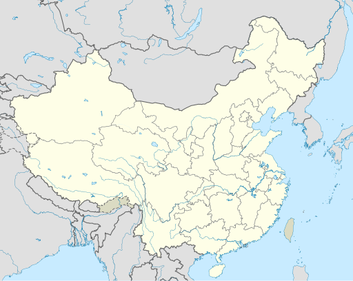
English: Location map of China.
EquiDistantConicProjection : Central parallel :
Central meridian :
Standard parallels:
Latitudes on the central meridian :
|
| Date | |
| Source | Own work |
| Author | Uwe Dedering |
| Other versions |
Derivative works of this file:
|
| SVG development | This W3C-invalid map was created with Adobe Illustrator, and with Inkscape. |

Licensing
I, the copyright holder of this work, hereby publish it under the following licenses:
This file is licensed under the Creative Commons Attribution-Share Alike 3.0 Unported license.
- You are free:
- to share – to copy, distribute and transmit the work
- to remix – to adapt the work
- Under the following conditions:
- attribution – You must give appropriate credit, provide a link to the license, and indicate if changes were made. You may do so in any reasonable manner, but not in any way that suggests the licensor endorses you or your use.
- share alike – If you remix, transform, or build upon the material, you must distribute your contributions under the same or compatible license as the original.

|
Permission is granted to copy, distribute and/or modify this document under the terms of the GNU Free Documentation License, Version 1.2 or any later version published by the Free Software Foundation; with no Invariant Sections, no Front-Cover Texts, and no Back-Cover Texts. A copy of the license is included in the section entitled GNU Free Documentation License. |
You may select the license of your choice.
File history
Click on a date/time to view the file as it appeared at that time.
| Date/Time | Thumbnail | Dimensions | User | Comment | |
|---|---|---|---|---|---|
| 14:08, 2 October 2020 |  | 512 × 408 (2.34 MB) | MilkyDefer | There was an edit war on zhwiki because the color of disputed territory failed to tell its difference from the color of China mainland. Thus I tweaked the color, making the mainland part brighter, and the disputed part darker. | |
| 09:38, 6 February 2020 |  | 512 × 408 (2.34 MB) | Interaccoonale | South Tibet is declared but not controlled by PRC,should use the same color as Taiwan. | |
| 15:43, 21 August 2012 |  | 1,181 × 940 (2.62 MB) | NordNordWest | minor graphical changes | |
| 15:00, 18 October 2011 |  | 1,181 × 940 (4.07 MB) | Tartanator | RV back, to avoid pushing the POV that Taiwan is not a part of China. | |
| 20:14, 31 August 2011 |  | 1,181 × 940 (4.07 MB) | Energiya | The disputed territories should be treated in the same color. | |
| 20:22, 8 July 2010 |  | 1,181 × 940 (4.07 MB) | Uwe Dedering | Reverted to version as of 18:00, 5 July 2010 wrong color, no inkscape layers | |
| 19:35, 8 July 2010 |  | 1,181 × 940 (2.6 MB) | JOSH tw | ||
| 18:00, 5 July 2010 |  | 1,181 × 940 (4.07 MB) | Uwe Dedering | taiwan color changed | |
| 11:44, 3 March 2010 |  | 1,181 × 940 (4.07 MB) | Uwe Dedering | {{Information |Description={{en|1=Location map of China. EquiDistantConicProjection. Center: * N: 36.0° N * E: 104.0° E Standard parallels: * 1: 30.0° E * 2: 42.0° E Made with Natural Earth. Free vector and raster map data @ naturalearthdata.com. |
File usage
More than 100 pages use this file. The following list shows the first 100 pages that use this file only. A full list is available.
- 2004 AFC Asian Cup
- 2007 FIFA Women's World Cup
- Ancient Tombs at Longtou Mountain
- Anyang
- Baoding
- Beijing Capital International Airport
- Beijing railway station
- Changchun
- Chaowai Subdistrict
- Chaozhou
- Chengde
- Chengdu
- China National Space Administration
- Chinese Basketball Association
- Chinese space program
- Dali City
- Dalian
- Daqing
- Daqing Oil Field
- Datong
- Dongguan
- Dongying
- Forbidden City
- Fuzhou
- Ganzhou
- Gaoliying, Beijing
- Guangzhou
- Guangzhou Baiyun International Airport
- Guilin
- Guiyang
- Hangzhou
- Harbin
- Hefei
- Hepingli Subdistrict, Beijing
- Hohhot
- Huai'an
- Jiangmen
- Jiaxing
- Jinan
- Jingshan Park
- Jinzhong College
- Jiyuan
- Kaifeng
- Kunming
- Lanzhou
- Lhasa
- Lianyungang
- Lijiang
- List of Chinese administrative divisions by GDP
- Liuzhou
- Luoyang
- Lüshunkou, Dalian
- Nanchang
- Nanjing
- Nanning
- Nantong
- Nanyang, Henan
- Ningbo
- Qinhuangdao
- Quanzhou
- Qufu
- Quzhou
- Ritan (Beijing)
- Samzhubzê, Xigazê
- Shanghai Hongqiao International Airport
- Shanghai Pudong International Airport
- Shantou
- Shaoguan
- Shaoshan
- Shaoxing
- Shenyang
- Shenzhen
- Shijiazhuang
- Suzhou
- Taiyuan
- Taiyuan Normal University
- Tangshan
- Temple of Heaven
- Weifang
- Weizhou Island
- Wenzhou
- Wuhan
- Wuxi
- Xi'an
- Xiamen
- Xinxiang
- Xuzhou
- Yancheng
- Yangzhou
- Yantai
- Yinxu
- Zhangjiakou
- Zhangzhou
- Zhanjiang
- Zhaoqing
- Zhengzhou
- Zhenjiang
- Zhongshan
- Zhoushan Island
- Zhuhai
View more links to this file.
Global file usage
The following other wikis use this file:
- Usage on ace.wikipedia.org
- Usage on af.wikipedia.org
- Nanjing
- Groot Muur van China
- Sjabloon:Liggingkaart Volksrepubliek China
- Shangqiu
- Dongguan
- Wenzhou
- Zibo
- Suzhou, Jiangsu
- Kaifeng
- Qingdao
- Xiamen
- Shantou
- Wuxi
- Quanzhou
- Shijiazhuang
- Changsha
- Hefei
- Kunming
- Tangshan
- Ningbo
- Fuzhou
- Changzhou
- Taizhou, Zhejiang
- Ürümqi
- Guiyang
- Xuzhou
- Nanchang
- Lanzhou
- Anshan
- Yangzhou
- Nantong
- Hohhot
- Jilin (stad)
- Huainan
- Linyi
- Xiangtan
- Huizhou
- Baotou
- Nanyang
- Baoding
- Liuzhou
- Tai'an
- Fuyang
- Jiangmen
- Yinchuan
- Weifang
- Zhuhai
- Huangshi
View more global usage of this file.