From Wikipedia, the free encyclopedia
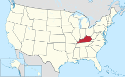
 Map of the United States with Kentucky highlighted
This page lists census-designated places (CDPs) in the U.S. state of Kentucky. As of 2018, there were a total of 102 census-designated places in Kentucky.
Census-Designated Places
| CDP[1]
|
Population
|
County
|
| Annville
|
1,095
|
Jackson
|
| Artemus
|
590
|
Knox
|
| Auxier
|
669
|
Floyd
|
| Bandana
|
203
|
Ballard
|
| Beech Grove
|
243
|
McLean
|
| Beechmont
|
689
|
Muhlenberg
|
| Belleview
|
343
|
Boone
|
| Betsy Layne
|
688
|
Floyd
|
| Boston
|
266
|
Nelson
|
| Breckinridge Center
|
2,080
|
Union
|
| Brooks
|
2,401
|
Bullitt
|
| Buckner
|
5,837
|
Oldham
|
| Buffalo
|
498
|
LaRue
|
| Burlington
|
15,926
|
Boone
|
| Burna
|
257
|
Livingston
|
| Cannonsburg
|
856
|
Boyd
|
| Cawood
|
731
|
Harlan
|
| Cayce
|
123
|
Fulton
|
| Cecilia
|
572
|
Hardin
|
| Cerulean
|
314
|
Trigg
|
| Chaplin
|
418
|
Nelson
|
| Claryville
|
2,355
|
Campbell
|
| Coldiron
|
223
|
Harlan
|
| Crayne
|
173
|
Crittenden
|
| Dexter
|
277
|
Calloway
|
| Diablock
|
453
|
Perry
|
| Doe Valley
|
1,931
|
Meade
|
| Dunmor
|
317
|
Logan and Muhlenberg
|
| Dwale
|
329
|
Floyd
|
| East Bernstadt
|
716
|
Laurel
|
| Elizaville
|
181
|
Fleming
|
| Elk Creek
|
1,539
|
Spencer
|
| Emlyn
|
427
|
Whitley
|
| Ezel
|
235
|
Morgan
|
| Fairview
|
286
|
Christian and Todd
|
| Fancy Farm
|
458
|
Graves
|
| Farley
|
4,701
|
McCracken
|
| Farmers
|
284
|
Rowan
|
| Farmington
|
245
|
Graves
|
| Flat Lick
|
960
|
Knox
|
| Fort Campbell North
|
13,685
|
Christian
|
| Fort Knox
|
10,124
|
Hardin and Meade
|
| Francisville
|
7,944
|
Boone
|
| Freeburn
|
399
|
Pike
|
| Garrison
|
866
|
Lewis
|
| Gilbertsville
|
458
|
Marshall
|
| Gracey
|
138
|
Christian
|
| Hardyville
|
156
|
Hart
|
| Hazel Green
|
228
|
Wolfe
|
| Hebron
|
5,929
|
Boone
|
| Hendron
|
4,687
|
McCracken
|
| High Bridge
|
242
|
Jessamine
|
| Hiseville
|
240
|
Barren
|
| Jeff
|
323
|
Perry
|
| Kenvir
|
297
|
Harlan
|
| Ledbetter
|
1,683
|
Livingston
|
| Lovelaceville
|
148
|
Ballard
|
| Lowes
|
98
|
Graves
|
| Maceo
|
413
|
Daviess
|
| Magnolia
|
524
|
LaRue
|
| Manitou
|
181
|
Hopkins
|
| Marrowbone
|
217
|
Cumberland
|
| Masonville
|
1,014
|
Daviess
|
| Massac
|
4,505
|
McCracken
|
| Mayking
|
487
|
Letcher
|
| Mays Lick
|
242
|
Mason
|
| Maytown
|
243
|
Floyd
|
| McCarr
|
164
|
Pike
|
| McRoberts
|
784
|
Letcher
|
| Millstone
|
117
|
Letcher
|
| New Hope
|
129
|
Nelson
|
| North Corbin
|
1,779
|
Knox and Laurel
|
| Oakbrook
|
9,036
|
Boone
|
| Oneida
|
410
|
Clay
|
| Onton
|
141
|
Webster
|
| Pathfork
|
379
|
Harlan
|
| Payne Gap
|
329
|
Letcher
|
| Petersburg
|
620
|
Boone
|
| Phelps
|
893
|
Pike
|
| Pine Knot
|
1,621
|
McCreary
|
| Plano
|
1,117
|
Warren
|
| Pleasant View
|
350
|
Whitley
|
| Pryorsburg
|
311
|
Graves
|
| Rabbit Hash
|
315
|
Boone
|
| Reidland
|
4,491
|
McCracken
|
| Rockholds
|
390
|
Whitley
|
| Rosine
|
113
|
Ohio
|
| Salvisa
|
420
|
Mercer
|
| Sedalia
|
295
|
Graves
|
| South Wallins
|
859
|
Harlan
|
| South Williamson
|
602
|
Pike
|
| Spottsville
|
325
|
Henderson
|
| Stearns
|
1,416
|
McCreary
|
| Summer Shade
|
307
|
Metcalfe
|
| Summersville
|
568
|
Green
|
| Symsonia
|
615
|
Graves
|
| Tolu
|
88
|
Crittenden
|
| Verona
|
1,455
|
Boone
|
| Virgie
|
279
|
Pike
|
| Westport
|
268
|
Oldham
|
| Westwood
|
4,746
|
Boyd
|
| Whitley City
|
1,170
|
McCreary
|
References
See also
Lists of census-designated places in the United States by state |
|---|
| States | |
|---|
| By population | |
|---|

