
Amedi District
Amadiya District, Amêdî, قەزای ئامێدی
قضاء العمادية ܪܘ݂ܣܬܵܩܵܐ ܕܥܲܡܵܕܝܵܐ | |
|---|---|
 | |
| Coordinates (Amadiya): 37°05′33″N 43°29′14″E / 37.09250°N 43.48722°E | |
| Country | |
| Region | |
| Governorate | Dohuk |
| Seat | Amadiya |
| Time zone | UTC+3 (AST) |
| Area code | +964 62 |

Amadiya District (Kurdish: قەزای ئامێدی, Amêdî, Arabic: قضاء العمادية, romanized: qaḍāʾ al-Emadiyah) is a district in northern central Dohuk Governorate within Kurdistan Region. Administrative center is the city of Amadiya.
Subdistricts
The district has four sub-districts:
Gallery
-
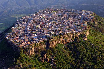 The town and capital of the district, Amadiya.
 -
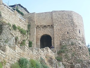 Citadel of Al Amadiya.


Population
(as of 2012)

This Iraqi Kurdistan geographical location article is a stub. You can help Wikipedia by expanding it. |