
Fountains Square, Baku
Fountains Square | |
|---|---|
.jpeg) | |
| Nickname: "Parapet" | |
| Coordinates: 40°22′15″N 49°50′13″E / 40.37083°N 49.83694°E | |
| Country | Azerbaijan |
| Capital of Azerbaijan | Baku |
| Baku#Districts of Baku | Sabail raion |
| Elevation | −28 m (−92 ft) |
| Time zone | UTC+4 (AZT) |
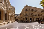
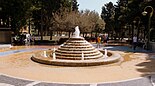
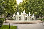
Fountains Square (Azerbaijani: Fəvvarələr meydanı) is a public square in downtown Baku, capital of Azerbaijan. The square was previously called Parapet and is often referenced to by the same name now. The name of the fountains square derives from the presence of dozens of fountains throughout the square first constructed during Soviet rule of Azerbaijan.
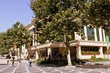
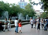
The square is a public gathering place, especially after business hours and during the weekend. It is an attractive tourist destination with many boutiques, restaurants, shops, hotels and passage.[1] It starts from the Istiglaliyyat Street and walls of the Icheri Sheher and stretches through Nizami Street, also called in popular culture as the Torgovaya street running parallel to Baku Boulevard. The fountains square is a location where the city authorities hold many public festivals, shows and celebrations.
In 2010, the square was renovated by Baku authorities.[2][3] A "Fountains Square" salad has been named after the square.[4]
Views of the Fountains Square
- Fountains Square
-
 The first McDonald's in Baku on Fountains Square
 -
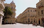
 19th century building on Nizami street
 -
 Torgovaya street awaiting the evening crowd
 -
 Evening fountain
 -
 Palm tree - popular decoration of new Baku
 -
 Morning hours
 -
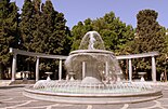 Main fountain
 -
 Passage crowded with merchants of antiques after business hours
 -
 Another fountain
 -
 Fountains Square in 2008 before reconstruction
 -
 Fountain in the "Governor's garden" in Baku
 -
 IFountain
 -
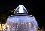
 Fountain "Balls" night
 -
 Fountain


.jpg)


Notes
- ^ "Fountain Square". Retrieved September 1, 2010.
- ^ "Обновленный облик площади Фонтанов в Баку". Retrieved September 1, 2010.
- ^ "Fountains Square opens after reconstruction in Baku center". Retrieved September 1, 2010.
- ^ "Fəvvarələr meydanı salatı". Retrieved September 1, 2010.
This article about a building or structure in Azerbaijan is a stub. You can help Wikipedia by expanding it. |
This Azerbaijan-related article is a stub. You can help Wikipedia by expanding it. |