
Barry County, Michigan
Barry County | |
|---|---|
 Location within the U.S. state of Michigan | |
 Michigan's location within the U.S. | |
| Coordinates: 42°36′N 85°19′W / 42.6°N 85.31°W | |
| Country | |
| State | |
| Founded | April 29, 1829 |
| Seat | Hastings |
| Largest city | Hastings |
| Area | |
| • Total | 577 sq mi (1,490 km2) |
| • Land | 556 sq mi (1,440 km2) |
| • Water | 21 sq mi (50 km2) 3.60% |
| Population (2000) | |
| • Total | 56,755 |
| • Density | 100/sq mi (39/km2) |
| Congressional district | 3rd |
| Website | www |
Barry County is a county in the U.S. state of Michigan. It is part of the Grand Rapids – Wyoming Metropolitan Statistical Area. As of the 2000 census, the population was 56,755. The county seat is HastingsTemplate:GR.
Barry County was formed by an act of the legislature of the Michigan Territory on April 29, 1829. The name comes from William Taylor Barry, United States Postmaster General under President Andrew Jackson, making it one of Michigan's "cabinet counties".
Barry County is part of the Grand Rapids-Wyoming metropolitan area.
Geography
According to the U.S. Census Bureau, the county has a total area of 577 square miles (1,494 km²), of which, 556 square miles (1,440 km²) of it is land and 21 square miles (54 km²) of it (3.60%) is water.
Adjacent counties
- Ionia County (northeast)
- Eaton County (east)
- Calhoun County (southeast)
- Kalamazoo County (southwest)
- Allegan County (west)
- Kent County (northwest)
Places adjacent to Barry County, Michigan | ||||||||||||||||
|---|---|---|---|---|---|---|---|---|---|---|---|---|---|---|---|---|
| ||||||||||||||||
Highways
Demographics
As of the 2000 census, [1] there were 56,755 people, 21,035 households, and 15,986 families residing in the county. The population density was 102 people per square mile (39/km²). There were 23,876 housing units at an average density of 43 per square mile (17/km²). The racial makeup of the county was 97.39% White, 0.24% African American, 0.46% Native American, 0.27% Asian, 0.01% Pacific Islander, 0.50% from other races, and 1.12% from two or more races. 1.46% of the population were Hispanic or Latino of any race. 21.8% were of German, 13.6% English, 12.5% Dutch, 12.4% American and 9.6% Irish ancestry according to Census 2000. 98.2% spoke English as their first language.
There were 21,035 households out of which 35.20% had children under the age of 18 living with them, 64.10% were married couples living together, 7.70% had a female householder with no husband present, and 24.00% were non-families. 19.50% of all households were made up of individuals and 7.70% had someone living alone who was 65 years of age or older. The average household size was 2.68 and the average family size was 3.06.
In the county the population was spread out with 27.20% under the age of 18, 7.50% from 18 to 24, 29.00% from 25 to 44, 24.60% from 45 to 64, and 11.80% who were 65 years of age or older. The median age was 37 years. For every 100 females there were 99.70 males. For every 100 females age 18 and over, there were 98.80 males.
The median income for a household in the county was $46,820, and the median income for a family was $51,794. Males had a median income of $38,991 versus $26,387 for females. The per capita income for the county was $20,636. About 3.90% of families and 5.50% of the population were below the poverty line, including 5.90% of those under age 18 and 5.90% of those age 65 or over.
Government
The county government operates the jail, maintains rural roads, operates the major local courts, keeps files of deeds and mortgages, maintains vital records, administers public health regulations, and participates with the state in the provision of welfare and other social services. The county board of commissioners controls the budget but has only limited authority to make laws or ordinances. In Michigan, most local government functions—police and fire, building and zoning, tax assessment, street maintenance, etc.—are the responsibility of individual cities and townships.
Barry County elected officials
- Prosecuting Attorney: Thomas E. Evans
- Sheriff: Dar Leaf
- County Clerk: Pamela A. Jarvis
- County Treasurer: Susan L. Vandecar
- Register of Deeds: Darla K. Burghdoff
- Drain Commissioner: Russ Yarger
- County Surveyor: Brian Reynolds
- County Board of Commissioners: 8 Members (8 Republicans, 0 Democrats)
(information as of January 2009)
Cities, villages, and townships
Template:Multicol Cities
Villages
Template:Multicol-break Unincorporated
Townships Template:Multicol
References
- ^ Statistical profile of Barry County, Michigan, United States Census Bureau, Census 2000
External links
- Official Website of Barry County, Michigan
- Clarke Historical Library, Central Michigan University, Bibliography on Barry County
- Antique Postcard Collection of Barry County, Michigan
- Barry County, MI GenWeb. Many history and genealogy pages.
Municipalities and communities of Barry County, Michigan, United States | ||
|---|---|---|
| City | 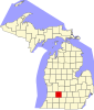 | |
| Villages | ||
| Charter townships | ||
| Civil townships | ||
| CDPs | ||
| Other communities | ||