
Graham, North Carolina: Difference between revisions
m r2.7.1) (Robot: Adding war:Graham, North Carolina |
No edit summary |
||
| Line 89: | Line 89: | ||
== Education == |
== Education == |
||
The local school system is known as the [[Alamance-Burlington School System]], which was created by a merger between the Alamance County School System and the Burlington City School System in 1996. |
The local school system is known as the [[Alamance-Burlington School System]], which was created by a merger between the Alamance County School System and the Burlington City School System in 1996.Bryan Harden |
||
Local public schools in Graham include: |
Local public schools in Graham include: |
||
Revision as of 13:42, 6 December 2011
Graham, North Carolina | |
|---|---|
 Location of Graham, North Carolina | |
| Country | United States |
| State | North Carolina |
| County | Alamance |
| Area | |
| • Total | 8.1 sq mi (21.1 km2) |
| • Land | 8.1 sq mi (21.0 km2) |
| • Water | 0.0 sq mi (0.0 km2) |
| Elevation | 653 ft (199 m) |
| Population (2008) | |
| • Total | 14,533 |
| • Density | 1,579.3/sq mi (609.8/km2) |
| Time zone | UTC-5 (Eastern (EST)) |
| • Summer (DST) | UTC-4 (EDT) |
| ZIP code | 27253 |
| Area code | 336 |
| FIPS code | 37-27280Template:GR |
| GNIS feature ID | 1024758Template:GR |
| Website | www.cityofgraham.com |
Graham is a city in Alamance County, North Carolina, United States. It is part of the Burlington, North Carolina Metropolitan Statistical Area. The current population estimate (2008) is 14,533.[1] It is the county seat of Alamance County.Template:GR
History
Graham was laid out in 1849 as the county seat of the newly formed Alamance County, and was incorporated as a town in 1851; it became a city in 1961. It was named for William Alexander Graham, United States Senator from North Carolina (1840–1843) and Governor of North Carolina (1845–1849).
Geography
Graham is located at 36°3′52″N 79°23′53″W / 36.06444°N 79.39806°WInvalid arguments have been passed to the {{#coordinates:}} function (36.064486, -79.397941).Template:GR
According to the United States Census Bureau, the city has a total area of 8.1 square miles (21 km2), all of it land.
Education
The local school system is known as the Alamance-Burlington School System, which was created by a merger between the Alamance County School System and the Burlington City School System in 1996.Bryan Harden
Local public schools in Graham include:
- Graham High School
- Southern Alamance High School
- Graham Middle School
- Southern Middle School
- Alexander Wilson Elementary School
- B. Everett Jordan Elementary School
- North Graham Elementary School
- South Graham Elementary School
Private Schools include:
Graham is also home to Alamance Community College, a 2-year technical college.
Demographics
As of the censusTemplate:GR of 2000, there were 12,833 people, 5,241 households, and 3,385 families residing in the city. The population density was 1,579.3 people per square mile (609.5/km²). There were 5,685 housing units at an average density of 699.6 per square mile (270.0/km²). The racial composition of the city was: 72.88% White, 21.64% Black or African American, 10.14% Hispanic or Latino American, 0.73% Asian American, 0.44% Native American, 0.0% Native Hawaiian or Other Pacific Islander, 3.19% some other race, and 1.12% two or more races.
There were 5,241 households out of which 29.9% had children under the age of 18 living with them, 44.0% were married couples living together, 16.2% had a female householder with no husband present, and 35.4% were non-families. 30.1% of all households were made up of individuals and 11.8% had someone living alone who was 65 years of age or older. The average household size was 2.37 and the average family size was 2.91.
In the city the population was spread out with 24.0% under the age of 18, 9.9% from 18 to 24, 31.8% from 25 to 44, 20.1% from 45 to 64, and 14.1% who were 65 years of age or older. The median age was 34 years. For every 100 females there were 90.1 males. For every 100 females age 18 and over, there were 86.4 males.
The median income for a household in the city was $35,706, and the median income for a family was $40,769. Males had a median income of $27,844 versus $22,163 for females. The per capita income for the city was $17,865. About 11.9% of families and 14.9% of the population were below the poverty line, including 19.8% of those under age 18 and 14.9% of those age 65 or over.
References
External links

Municipalities and communities of Alamance County, North Carolina, United States | ||
|---|---|---|
| Cities | 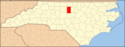 | |
| Towns | ||
| Village | ||
| CDPs | ||
| Other communities | ||
| Footnotes | ‡This populated place also has portions in an adjacent county or counties | |