
K2
| K2 | |
|---|---|
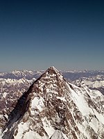
 K2, summer 2006 | |
| Highest point | |
| Elevation | 8,611 m (28,251 ft) Ranked 2nd |
| Prominence | 4,017 m (13,179 ft) Ranked 22nd |
| Isolation | 1,316 km (818 mi) |
| Listing | Eight-thousander Country high point Seven Second Summits Ultra |
| Geography | |
| Parent range | Karakoram |
| Climbing | |
| First ascent | 31 July 1954 Achille Compagnoni Lino Lacedelli |
| Easiest route | Abruzzi Spur |

K2 (also known as Chhogori/Qogir, Ketu/Kechu, and Mount Godwin-Austen) (Urdu:شاہ گوری) is the second-highest mountain on Earth, after Mount Everest. It is located on the border[2] between Baltistan, in the Gilgit–Baltistan region of northern Pakistan, and the Taxkorgan Tajik Autonomous County of Xinjiang, China.[3] With a peak elevation of 8,611 m (28,251 feet), K2 is the highest point of the Karakoram Range and the highest point in Pakistan.
K2 is known as the Savage Mountain due to the extreme difficulty of ascent and the second-highest fatality rate among the eight thousanders. One in every four people who have attempted the summit have died trying.[4] It is more difficult and hazardous to reach the peak of K2 from the Chinese side; thus, it is usually climbed from the Pakistani side. Unlike Annapurna, the mountain with the highest fatality-to-summit rate (246 summits, 55 deaths),[5] K2 has never been climbed in winter.
Name

The name K2 is derived from the notation used by the Great Trigonometric Survey. Thomas Montgomerie made the first survey of the Karakoram from Mount Haramukh, some 210 km (130 miles) to the south, and sketched the two most prominent peaks, labeling them K1 and K2.[6]
The policy of the Great Trigonometric Survey was to use local names for mountains wherever possible[7] and K1 was found to be known locally as Masherbrum. K2, however, appeared not to have acquired a local name, possibly due to its remoteness. The mountain is not visible from Askole, the last village to the south, or from the nearest habitation to the north, and is only fleetingly glimpsed from the end of the Baltoro Glacier, beyond which few local people would have ventured.[8] The name Chogori, derived from two Balti words, chhogo ("big") and ri ("mountain") (شاہگوری) has been suggested as a local name,[9] but evidence for its widespread use is scant. It may have been a compound name invented by Western explorers[10] or simply a bemused reply to the question "What's that called?"[8] It does, however, form the basis for the name Qogir (simplified Chinese: 乔戈里峰; traditional Chinese: 喬戈里峰; pinyin: Qiáogēlǐ Fēng) by which Chinese authorities officially refer to the peak. Other local names have been suggested including Lamba Pahar ("Tall Mountain" in Urdu) and Dapsang, but are not widely used.[8]
Lacking a local name, the name Mount Godwin-Austen was suggested, in honor of Henry Godwin-Austen, an early explorer of the area, and while the name was rejected by the Royal Geographical Society[8] it was used on several maps, and continues to be used occasionally.[11][12]
The surveyor's mark, K2, therefore continues to be the name by which the mountain is commonly known. It is now also used in the Balti language, rendered as Kechu or Ketu[10][13] (Urdu: کے ٹو). The Italian climber Fosco Maraini argued in his account of the ascent of Gasherbrum IV that while the name of K2 owes its origin to chance, its clipped, impersonal nature is highly appropriate for so remote and challenging a mountain. He concluded that it was ...[14]
... just the bare bones of a name, all rock and ice and storm and abyss. It makes no attempt to sound human. It is atoms and stars. It has the nakedness of the world before the first man – or of the cindered planet after the last.
Geographical setting
K2 lies in the northwestern Karakoram Range. It is located in the Baltistan region of Gilgit–Baltistan, Pakistan and the Taxkorgan Tajik Autonomous County of Xinjiang, China.[a] The Tarim sedimentary basin borders the range on the north and the Lesser Himalayas on the south. Melt waters from vast glaciers, such as those south and east of K2, feed agriculture in the valleys and contribute significantly to the regional fresh-water supply.
K2 is only ranked 22nd by topographic prominence, a measure of a mountain's independent stature, because it is part of the same extended area of uplift (including the Karakoram, the Tibetan Plateau, and the Himalaya) as Mount Everest, in that it is possible to follow a path from K2 to Everest that goes no lower than 4,594 metres (15,072 ft), at Mustang Lo. Many other peaks which are far lower than K2 are more independent in this sense.
K2 is notable for its local relief as well as its total height. It stands over 3,000 metres (9,840 ft) above much of the glacial valley bottoms at its base. It is a consistently steep pyramid, dropping quickly in almost all directions. The north side is the steepest: there it rises over 3,200 metres (10,500 ft) above the K2 (Qogir) Glacier in only 3,000 metres (9,800 ft) of horizontal distance. In most directions, it achieves over 2,800 metres (9,200 ft) of vertical relief in less than 4,000 metres (13,000 ft).[15]
A 1986 expedition led by George Wallenstein made an inaccurate measurement incorrectly showing that K2 was taller than Mount Everest, and therefore the tallest mountain in the world. A corrected measurement was made in 1987, but by that point the meme that K2 was the tallest mountain in the world had already made it into many news reports and reference works.[16]
Geology
The mountains of K2 and Broad Peak and the area westward to the lower reaches of Sarpo Laggo glacier consist of metamorphic rocks, which are known as the K2 Gneiss and part of the Karakroam Metamorphic Complex. The K2 Gneiss consists of a mixture of orthogneiss and biotite-rich paragneiss. On the south and southeast face of K2, the orthogneiss consists of a mixture of a strongly foliated plagioclase-hornblende gneiss and a biotite-hornblende-K-feldspar orthogneiss, which has been intruded by garnet-mica leucogranitic dikes. In places, the paragneisses include clinopyroxene-hornblende-bearing psammites, garnet (grossular)-diopside marbles, and biotite-graphite phyllites. Near the memorial to the climbers, who have died on K2, above Base camp on the south spur, thin impure marbles with quartzites and mica schists, which is called the Gilkey-Puchoz sequence, are interbanded within the orthogneisses. On the west face of Broad Peak and south spur of K2, lamprophyre dikes, which consist of clinopyroxene and biotite-porphyritic vogesites and minettes, have intruded the K2 gneiss. The K2 Gneiss is separated from the surrounding sedimentary and metasedimentary rocks of the surrounding Karakroam Metamorphic Complex by normal faults. For example, a fault separates the K2 gneiss of the east face of K2 from limestones comprising nearby Skyang Kangri.[17][18]
40Ar/39Ar ages of 115 to 120 million years ago obtained from and geochemical analyses of the K2 Gneiss demonstrate that it is a metamorphosed, older, Cretaceous, pre-collisional granite. The granitic precursor (protolith) to the K2 Gneiss originated as the result of the production of large bodies of magma by a northward-dipping subduction zone along what was the continental margin of Asia at that time and and their intrusion as batholiths into its lower continental crust. During the initial collision of the Asia and Indian plates, this granitic batholith was buried to depths of about 20 kilometres (12 mi) or more, highly metamorphosed, highly deformed, and partially remelted during the Eocene Period to form gneiss. Later, the K2 Gneiss was then intruded by leucogranite dikes and finally exhumed and uplifted along major breakback thrust faults during post-Miocene time. The K2 Gneiss was exposed as the entire K2-Broad Peak-Gasherbrum range experienced rapid uplift with which erosion rates have been unable to keep pace.[18][19]
Climbing history
Early attempts

The mountain was first surveyed by a European survey team in 1856. Thomas Montgomerie was the member of the team who designated it "K2" for being the second peak of the Karakoram range. The other peaks were originally named K1, K3, K4 and K5, but were eventually renamed Masherbrum, Gasherbrum IV, Gasherbrum II and Gasherbrum I respectively.[20] In 1892, Martin Conway led a British expedition that reached "Concordia" on the Baltoro Glacier.[21]
The first serious attempt to climb K2 was undertaken in 1902 by Oscar Eckenstein, Aleister Crowley, Jules Jacot-Guillarmod, Heinrich Pfannl, Victor Wessely and Guy Knowles via the Northeast Ridge. In the early 1900s, modern transportation did not exist: It took "fourteen days just to reach the foot of the mountain".[22] After five serious and costly attempts, the team reached 6,525 metres (21,407 ft)[23]—although considering the difficulty of the challenge, and the lack of modern climbing equipment or weatherproof fabrics, Crowley's statement that "neither man nor beast was injured" highlights the pioneering spirit and bravery of the attempt. The failures were also attributed to sickness (Crowley was suffering the residual effects of malaria), a combination of questionable physical training, personality conflicts, and poor weather conditions—of 68 days spent on K2 (at the time, the record for the longest time spent at such an altitude) only eight provided clear weather.[24]
The next expedition to K2, in 1909, led by Prince Luigi Amedeo, Duke of the Abruzzi, reached an elevation of around 6,250 metres (20,510 ft) on the South East Spur, now known as the Abruzzi Spur (or Abruzzi Ridge). This would eventually become part of the standard route, but was abandoned at the time due to its steepness and difficulty. After trying and failing to find a feasible alternative route on the West Ridge or the North East Ridge, the Duke declared that K2 would never be climbed, and the team switched its attention to Chogolisa, where the Duke came within 150 metres (490 ft) of the summit before being driven back by a storm.[25]

The next attempt on K2 was not made until 1938, when an American expedition led by Charles Houston made a reconnaissance of the mountain. They concluded that the Abruzzi Spur was the most practical route, and reached a height of around 8,000 metres (26,000 ft) before turning back due to diminishing supplies and the threat of bad weather.[26][27] The following year an expedition led by Fritz Wiessner came within 200 metres (660 ft) of the summit, but ended in disaster when Dudley Wolfe, Pasang Kikuli, Pasang Kitar and Pintso disappeared high on the mountain.[28][29]
Charles Houston returned to K2 to lead the 1953 American expedition. The expedition failed due to a storm that pinned the team down for ten days at 7,800 metres (25,590 ft), during which time Art Gilkey became critically ill. A desperate retreat followed, during which Pete Schoening saved almost the entire team during a mass fall, and Gilkey was killed, either in an avalanche or in a deliberate attempt to avoid burdening his companions. In spite of the failure and tragedy, the courage shown by the team has given the expedition iconic status in mountaineering history.[30][31][32]
Success and repeats

An Italian expedition finally succeeded in ascending to the summit of K2 via the Abruzzi Spur on 31 July 1954. The expedition was led by Ardito Desio, and the two climbers who reached the summit were Lino Lacedelli and Achille Compagnoni. The team included a Pakistani member, Colonel Muhammad Ata-ullah, who had been a part of the 1953 American expedition. Also on the expedition were Walter Bonatti and Pakistani Hunza porter Amir Mehdi, who both proved vital to the expedition's success in that they carried oxygen tanks to 8,100 metres (26,600 ft) for Lacedelli and Compagnoni. This ascent is controversial because Lacedelli and Compagnoni moved their camp to prevent the younger Bonatti from joining the successful ascent, thus deliberately stranding Bonatti and Mehdi overnight without shelter above 8,000 meters before the latter were able to descend while leaving oxygen tanks behind as requested. Bonatti and Mehdi survived, but Mehdi was hospitalized for months and suffered amputations for frostbite. Efforts in the 1950s to suppress these facts to protect Lacedelli and Compagnoni's reputations as Italian national heroes were later brought to light.[33]
On 9 August 1977, 23 years after the Italian expedition, Ichiro Yoshizawa led the second successful ascent, with Ashraf Aman as the first native Pakistani climber. The Japanese expedition took the Abruzzi Spur, and used more than 1,500 porters.[34]
The third ascent of K2 was in 1978, via a new route, the long and corniced Northeast Ridge. The top of the route traversed left across the East Face to avoid a vertical headwall and joined the uppermost part of the Abruzzi route. This ascent was made by an American team, led by James Whittaker; the summit party was Louis Reichardt, Jim Wickwire, John Roskelley, and Rick Ridgeway. Wickwire endured an overnight bivouac about 150 metres (490 ft) below the summit, one of the highest bivouacs in history. This ascent was emotional for the American team, as they saw themselves as completing a task that had been begun by the 1938 team forty years earlier.[35]
Another notable Japanese ascent was that of the difficult North Ridge on the Chinese side of the peak in 1982. A team from the Mountaineering Association of Japan led by Isao Shinkai and Masatsugo Konishi put three members, Naoe Sakashita, Hiroshi Yoshino, and Yukihiro Yanagisawa, on the summit on 14 August. However Yanagisawa fell and died on the descent. Four other members of the team achieved the summit the next day.[36]
The first climber to reach the summit of K2 twice was Czech climber Josef Rakoncaj. Rakoncaj was a member of the 1983 Italian expedition led by Francesco Santon, which made the second successful ascent of the North Ridge (31 July 1983). Three years later, on 5 July 1986, he reached the summit via the Abruzzi Spur (double with Broad Peak West Face solo) as a member of Agostino da Polenza's international expedition.
The first woman to summit K2 former Pole Wanda Rutkiewicz - 23 June 1986.
In 1986, two Polish expedition paved two new hard road - Magic Line and Polish Line. This second has not yet been repeated.
In 2004 the Spanish climber Carlos Soria Fontán became the oldest person ever to summit K2, at the age of 65.[37]
The peak has now been climbed by almost all of its ridges. Although the summit of Everest is at a higher altitude, K2 is a much more difficult and dangerous climb, due in part to its more inclement weather and comparatively greater height from base to peak. The mountain is believed by many to be the world's most difficult and dangerous climb, hence its nickname "the Savage Mountain". It, and the surrounding peaks, have claimed more lives than any others.[38] As of July 2010[update], only 302 people have completed the ascent,[39] compared with over 2,700 who have ascended Everest. At least 80 (as of September 2010) people have died attempting the climb. Thirteen climbers from several expeditions died in the 1986 K2 Disaster, August 13, 1995 killed six mountaineers, eleven climbers died in the 2008 K2 disaster.
Recent attempts
- 2008
- On 1 August 2008, a group of climbers went missing after a large piece of ice fell during an avalanche taking out the fixed ropes on part of the route; four climbers were rescued, but 11, including Gerard McDonnell, the first Irish person to reach the summit, were confirmed dead.[40]
- 2009
- Despite several attempts, nobody won the summit.
- 2010
- On 6 August 2010, Fredrik Ericsson, who intended to ski from the summit, joined Gerlinde Kaltenbrunner on the way to the summit of K2. Ericsson fell 1,000 metres (3,300 ft) and was killed. Kaltenbrunner aborted her summit attempt.[41]
Despite several attempts, nobody won the summit.
- 2011
- On August 23, 2011, a team of four climbers reached the summit of K2 from the North side. Gerlinde Kaltenbrunner became first woman to complete all 14 eight-thousanders without supplemental oxygen.[42] Kazakhs Maxut Zhumayev, and Vassiliy Pivtsov completed their eight-thousanders quest. The fourth team member was Dariusz Załuski from Poland[43]
- 2012
- The year started with a vigorous Russian team aiming for a first winter ascent. The expedition ended on with the demise of Vitaly Gorelik due to frostbite and pneumonia. The Russian team cancelled the ascent.[44] In the summer season, K2 saw a record crowd standing on its summit—28 climbers in a single day—bringing the total for the year to 30.[45]
- 2013
- On 28 July 2013, two New Zealanders, Marty Schmidt and his son Denali, died after an avalanche destroyed their camp. A guide had reached the camp they were at, but said they were nowhere to be seen and the campsite tent showed signs of having been hit by an avalanche. British climber Adrian Hayes, who was with the group later posted on his Facebook page that the campsite had been wiped out.[46]
- 2014
- On 26 July 2014, the first team of Pakistani climbers scaled K2. There are six Pakistani and three Italian climbers in the expedition, called K2 60 Years Later, according to BBC. Before, it was summited by individual Pakistanis as part of international expeditions.[47]
Climbing routes and difficulties
There are a number of routes on K2, of somewhat different character, but they all share some key difficulties. First, is the extreme high altitude and resulting lack of oxygen: there is only one-third as much oxygen available to a climber on the summit of K2 as there is at sea level.[48] Second is the propensity of the mountain to experience extreme storms of several days' duration, which have resulted in many of the deaths on the peak. Third is the steep, exposed, and committing nature of all routes on the mountain, which makes retreat more difficult, especially during a storm. Despite many attempts there have been no successful winter ascents. All major climbing routes lie on the Pakistani side, which is also where base camp is located.
Abruzzi Spur
The standard route of ascent, used far more than any other route, is the Abruzzi Spur,[49][50] located on the Pakistani side, first attempted by Prince Luigi Amedeo, Duke of the Abruzzi in 1909. This is the southeast ridge of the peak, rising above the Godwin Austen Glacier. The spur proper begins at an altitude of 5,400 metres (17,700 ft), where Advanced Base Camp is usually placed. The route follows an alternating series of rock ribs, snow/ice fields, and some technical rock climbing on two famous features, "House's Chimney" and the "Black Pyramid." Above the Black Pyramid, dangerously exposed and difficult to navigate slopes lead to the easily visible "Shoulder", and thence to the summit. The last major obstacle is a narrow couloir known as the "Bottleneck", which places climbers dangerously close to a wall of seracs which form an ice cliff to the east of the summit. It was partly due to the collapse of one of these seracs around 2001 that no climbers summitted the peak in 2002 and 2003.[51]
On 1 August 2008, a number of climbers went missing when a serac in the Bottleneck snapped and broke their ropes.[40][52] Survivors were seen from a helicopter, but rescue efforts were impeded by the high altitude. Eleven were never found, and presumed dead.[40]
North Ridge
Almost opposite from the Abruzzi Spur is the North Ridge,[49][50] which ascends the Chinese side of the peak. It is rarely climbed, partly due to very difficult access, involving crossing the Shaksgam River, which is a hazardous undertaking.[53] In contrast to the crowds of climbers and trekkers at the Abruzzi basecamp, usually at most two teams are encamped below the North Ridge. This route, more technically difficult than the Abruzzi, ascends a long, steep, primarily rock ridge to high on the mountain—Camp IV, the "Eagle's Nest" at 7,900 metres (25,900 ft)—and then crosses a dangerously slide-prone hanging glacier by a leftward climbing traverse, to reach a snow couloir which accesses the summit.
Besides the original Japanese ascent, a notable ascent of the North Ridge was the one in 1990 by Greg Child, Greg Mortimer, and Steve Swenson, which was done alpine style above Camp 2, though using some fixed ropes already put in place by a Japanese team.[53]
Other routes
- Northeast Ridge (long and corniced; finishes on uppermost part of Abruzzi route), 1978.
- West Ridge, 1981.
- Southwest Pillar or "Magic Line", very technical, and second most demanding. First climbed in 1986 by the Polish-Slovak trio Piasecki-Wróż-Božik. Since then the Spanish Jordi Corominas was the only successful climber on this route, despite many other attempts.
- South Face or "Polish Line" (extremely exposed and most dangerous). In 1986, Jerzy Kukuczka and Tadeusz Piotrowski summitted on this route. Piotrowski was killed while descending. Reinhold Messner called it a suicidal route and no one has repeated their achievement. "The route is so avalanche-prone, that no one else has ever considered a new attempt."[54]
- Northwest Face, 1990.
- Northwest Ridge (finishing on North Ridge). First ascent in 1991.
- South-southeast spur or "Cesen route" (finishing on Abruzzi route—possibly safer alternative to the Abruzzi Spur, because it avoids Black Pyramid, the first big obstacle on Abruzzi), 1994.
- West Face, technical difficulty at high altitude, first climbed by Russian team in 2007
Use of bottled oxygen
For most of its climbing history, K2 was not usually climbed with bottled oxygen, and small, relatively lightweight teams were the norm.[49][50] However the 2004 season saw a great increase in the use of oxygen: 28 of 47 summitteers used oxygen in that year.[51]
Acclimatisation is essential when climbing without oxygen to avoid some degree of altitude sickness.[55] K2's summit is well above the altitude at which high altitude pulmonary edema (HAPE), or high altitude cerebral edema (HACE) can occur.[56] In mountaineering, when ascending above an altitude of 8,000 metres (26,000 ft), the climber enters what is known as the death zone.
-
 The West Face and upper slopes of K2
 -
 Climbing ladders on Abruzzi Spur
 -
 The north side of K2. The North Ridge is in the centre of the picture.
 -
 The major routes to have been climbed on the south side of the mountain. A: West Ridge; B: West Face; C: Southwest Pillar; D: South Face; E: South-southeast Spur; F: Abruzzi Spur


Films
- Vertical Limit, 2000
- K2, 1991
- Karakoram & Himalayas, 2007
- The Summit, 2012
See also
- List of books about K2
- 1986 K2 disaster
- 2008 K2 disaster
- Concordia
- Gilgit–Baltistan
- List of mountains in Pakistan
- List of the highest mountains in the world
- List of peaks by prominence
- List of deaths on eight-thousanders
Bibliography
- Booth, Martin (2001) [2000]. A Magick Life: A Biography of Aleister Crowley (trade paperback) (Coronet ed.). London: Hodder and Stoughton. ISBN 0-340-71806-4.
- Curran, Jim (1995). K2: The Story of the Savage Mountain. Hodder & Stoughton. ISBN 978-0-340-66007-2.
- McDonald, Bernadette (2007). Brotherhood of the Rope – The Biography of Charles Houston. The Mountaineers Books. ISBN 978-0-89886-942-2.
Notes and references
- ^ K2 is located in Gilgit–Baltistan, a region which along with Azad Kashmir forms Pakistan-administered Kashmir. The Kashmir region is currently the center of a territorial dispute between Pakistan and India. India maintains a territorial dispute on Pakistan-administered Kashmir. Likewise, Pakistan maintains a territorial dispute on Jammu and Kashmir, the Indian-administered part of the region.
- ^ "Karakoram and India/Pakistan Himalayas Ultra-Prominences". peaklist.org. Retrieved 24 January 2014.
- ^ Text of border agreement between China and Pakistan
- ^ "K2". Britannica.com. Retrieved 23 January 2010.
- ^ "K2 list of ascents and fatalities" (PDF). 8000ers.com. Retrieved 23 January 2010.
- ^ "Shared summits - K2 facts".
- ^ Curran, p. 25
- ^ The most obvious exception to this policy was Mount Everest, where the Tibetan name Chomolungma (Qomolongma) was probably known, but ignored in order to pay tribute to George Everest. See Curran, pp. 29–30
- ^ a b c d Curran, p. 30
- ^ "Place names – II". The Express Tribune. 2 September 2011. Retrieved 4 September 2011.
- ^ a b H. Adams Carter, "A Note on the Chinese Name for K2, 'Qogir'", American Alpine Journal, 1983, p. 296. Carter, the long-time editor of the AAJ, goes on to say that the name Chogori "has no local usage. The mountain was not prominently visible from places where local inhabitants ventured and so had no local name ... The Baltis use no other name for the peak than K2, which they pronounce 'Ketu'. I strongly recommend against the use of the name Chogori in any of its forms."
- ^ "Pakistan". The World Factbook (2024 ed.). Central Intelligence Agency.
- ^ H. Adams Carter, "Balti Place Names in the Karakoram", American Alpine Journal, 1975, pp. 52–53. Carter notes that "Godwin Austen is the name of the glacier at its eastern foot and is only incorrectly used on some maps as the name of the mountain."
- ^ Carter, op cit. Carter notes a generalisation of the word Ketu: "A new word, ketu, meaning 'big peak', seems to be entering the Balti language."
- ^ Maraini, Fosco (1961). Karakoram: the ascent of Gasherbrum IV. Hutchinson. Quoted in Curran, p. 31.
- ^ Jerzy Wala, The Eight-Thousand-Metre Peaks of the Karakoram, Orographical Sketch Map, The Climbing Company Ltd/Cordee, 1994.
- ^ Ian. "Which is taller, Mt. Everest or K2?". The Straight Dope. Retrieved 6 September 2013.
- ^ Searle, M.P., R.R. Parrish, R. Tirrul, and D.C. Rex. 1990. Age of crystallisation and cooling of the K2 gneiss in the Baltoro Karakoram. Journal of the Geological Society, London. vol. 147, pp. 603–606.
- ^ a b Searle, M.P. 1991. Geology and tectonics of the Karakoram Mountains. John Wiley & Sons, Inc., New York, New York. 358 pp. ISBN 0-471-92773-2
- ^ Searle, M.P., R.R. Parrish, A. Thow A, S.R. Noble, R. Phillips, and D. Waters. 2010. Anatomy, Age and Evolution of a Collisional Mountain Belt: the Baltoro granite batholith and Karakroam Metamorphic Complex, Pakistani Karakoram. Journal of the Geological Society, London. vol. 167, pp. 183-202.
- ^ Kenneth Mason (1987 edition) Abode of Snow p.346
- ^ Charles S. Houston (1953) K2, the Savage Mountain. McGraw-Hill.
- ^ "Confessions of Aleister Crowley, Chapter 16". hermetic.com. Retrieved 12 January 2014.
- ^ "A timeline of human activity on K2". k2climb.net. Retrieved 12 January 2014.
- ^ Booth, pp. 152-157 in chapter "Rhythms of Rapture"
- ^ Curran, pp. 65–72
- ^ Houston, Charles S; Bates, Robert (1939). Five Miles High. Dodd, Mead. ISBN 978-1-58574-051-2. Reprinted (2000) by First Lyon Press with introduction by Jim Wickwire
- ^ Curran, pp.73–80
- ^ Kaufman, Andrew J.; Putnam, William L. (1992). K2: The 1939 Tragedy. Mountaineers Books. ISBN 978-0-89886-323-9.
- ^ Curran pp. 81–94
- ^ Houston, Charles S; Bates, Robert (1954). K2 – The Savage Mountain. Mc-Graw-Hill Book Company Inc. ISBN 978-1-58574-013-0. Reprinted (2000) by First Lyon Press with introduction by Jim Wickwire
- ^ McDonald, pp. 119–140
- ^ Curran, pp. 95–103
- ^ http://www.bbc.com/news/magazine-28696985
- ^ Curran, Appendix I
- ^ American Alpine Journal, 1979, pp. 1–18
- ^ American Alpine Journal, 1983, p. 295
- ^ Lua error in Module:Citation/CS1/Date_validation at line 961: bad argument #3 to 'format' (string expected, got nil).
- ^ BBC, Planet Earth, "Mountains", Part Three
- ^ "Climber Lists: Everest, K2 and other 8000ers".
- ^ a b c "Climber: 11 killed after avalanche on Pakistan's K2". CNN. 3 August 2008. Retrieved 7 May 2010.
- ^ "Österreicherin bricht nach Tod ihres Gefährten Besteigung von K2 ab". Stern (in German).
{{cite news}}: Unknown parameter|trans_title=ignored (|trans-title=suggested) (help) - ^
"K2 editorial: end of an era in womens' Himalaya". Explorers Web. 26 August 2011. Retrieved 12 January 2014.
{{cite news}}: Unknown parameter|subscription=ignored (|url-access=suggested) (help) - ^
"K2 north pillar summiteers safely back!". Explorers Web. 25 August 2011. Retrieved 12 January 2014.
{{cite news}}: Unknown parameter|subscription=ignored (|url-access=suggested) (help) - ^
"K2: details on the fight for Vitaly Gorelik". Explorers Web. 9 February 2012. Retrieved 12 January 2014.
{{cite news}}: Unknown parameter|subscription=ignored (|url-access=suggested) (help) - ^
"K2 summit pics and video: Polish climbers on a roll". Explorers Web. 3 August 2012. Retrieved 12 January 2014.
{{cite news}}: Unknown parameter|subscription=ignored (|url-access=suggested) (help) - ^ "New Zealand mountaineer and son feared dead on K2". The Guardian. 30 July 2013. Retrieved 12 January 2014.
- ^ "First Pakistan team of climbers scale K2 summit".
- ^ "Altitude oxygen calculator". altitude.org. Retrieved 12 January 2014.
- ^ a b c Andy Fanshawe and Stephen Venables, Himalaya Alpine-Style, Hodder and Stoughton, 1995, ISBN 0-340-64931-3
- ^ a b c Audrey Salkeld, editor, World Mountaineering, Bulfinch Press, 1998, ISBN 0-8212-2502-2
- ^ a b American Alpine Journal, 2005, p. 351–353
- ^ "Nine feared dead in K2 avalanche". BBC. 3 August 2008. Retrieved 3 August 2008.
- ^ a b American Alpine Journal, 1991, pp. 19–32
- ^ R. Messner and A. Gogna [1981] (1982) K2 Mountain of Mountains. Translated from German by A. Salked. Oxford University Press. ISBN 0-19-520253-8
- ^ Muza, SR; Fulco, CS; Cymerman, A. (2004). "Altitude Acclimatisation Guide". U.S. Army Research Inst. of Environmental Medicine Thermal and Mountain Medicine Division Technical Report (USARIEM–TN–04–05). Retrieved 5 March 2009.
- ^
Cymerman, A.; Rock, PB. "Medical Problems in High Mountain Environments. A Handbook for Medical Officers". USARIEM-TN94-2. US Army Research Inst. of Environmental Medicine Thermal and Mountain Medicine Division Technical Report. Retrieved 5 March 2009.
{{cite journal}}: Cite journal requires|journal=(help)
External links
- Himalaya-Info.org page on K2 (German)
- How high is K2 really?—Measurements in 1996 gave 8614.27±0.6 m a.m.s.l
- Aleister Crowley's account of the 1902 K2 expedition
- The climbing history of K2 from the first attempt in 1902 until the Italian success in 1954.
- Template:PDFlink From Everest-K2 Posters
- Northern Pakistan—highly detailed placemarks of towns, villages, peaks, glaciers, rivers and minor tributaries in Google Earth
- "K2". SummitPost.org.
- Map of K2
- List of ascents to December 2007
- 'K2: The Killing Peak' Men's Journal November 2008 feature
- Achille Compagnoni —Daily Telegraph obituary
- Dr Charles Houston —Daily Telegraph obituary
- Google Map of the 1954 K2 Mountain Climb Using the associated KML file within the map you can digitally climb the first successful route up K2 in Google Earth.
| Passes |  | |
|---|---|---|
| Valleys | ||
| Cities and towns | ||
| Rivers, glaciers and lakes | ||
| Architecture | ||
| See also | ||