Lånke
Lånke Municipality
Lånke herad Laanke | |
|---|---|
 View of the village of Hell in Lånke | |
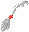
 Nord-Trøndelag within Norway | |
 Lånke within Nord-Trøndelag | |
| Coordinates: 63°26′41″N 10°56′03″E / 63.44472°N 10.93417°E | |
| Country | Norway |
| County | Nord-Trøndelag |
| District | Stjørdalen |
| Established | 1 Jan 1902 |
| • Preceded by | Nedre Stjørdal in 1902 |
| Disestablished | 1 Jan 1962 |
| • Succeeded by | Stjørdal in 1962 |
| Administrative centre | Hell |
| Area (upon dissolution) | |
| • Total | 185 km2 (71 sq mi) |
| Population (1962) | |
| • Total | 1,967 |
| • Density | 11/km2 (28/sq mi) |
| Demonym | Lånkbygg[1] |
| Time zone | UTC+01:00 (CET) |
| • Summer (DST) | UTC+02:00 (CEST) |
| ISO 3166 code | NO-1713[2] |
Lånke was a former municipality in the old Nord-Trøndelag county, Norway. The 185-square-kilometre (71 sq mi) municipality existed from 1902 until its dissolution in 1962. The municipality was located south of the Stjørdalselva river in what is now the south-central part of Stjørdal municipality in Trøndelag county. The administrative centre was located in the village of Hell. The famous Hell Station in the village of Hell is situated in the westernmost part of Lånke. There are two churches in Lånke: Lånke Church and Elvran Chapel. Historically, this parish was also known as Leksdal. Lånke is an area dominated by agriculture and forests.[3]
History
The municipality of Laanke was created on 1 January 1902 when the old municipality of Nedre Stjørdal was split into three new municipalities: Laanke (population: 1,449), Stjørdal (population: 3,158), and Skatval (population: 2,125). On 1 January 1914 the small Jøssås area of southwestern Laanke (population: 38) was transferred to the neighboring municipality of Malvik which at that time was in the neighboring county of Sør-Trøndelag.[4] The spelling of the municipality was later changed to Lånke. During the 1960s, there were many municipal mergers across Norway due to the work of the Schei Committee. On 1 January 1962, the neighboring municipalities of Lånke (population: 1,967), Stjørdal (population: 6,204), Hegra (population: 2,704), and Skatval (population: 1,944) to form a new, larger municipality of Stjørdal.[5]
See also
References
- ^ "Navn på steder og personer: Innbyggjarnamn" (in Norwegian). Språkrådet.
- ^ Bolstad, Erik; Thorsnæs, Geir, eds. (2023-01-26). "Kommunenummer". Store norske leksikon (in Norwegian). Kunnskapsforlaget.
- ^ Askheim, Svein, ed. (2017-11-26). "Lånke" (in Norwegian). Kunnskapsforlaget. Retrieved 2018-03-25.
{{cite web}}: Unknown parameter|encyclopedia=ignored (help) - ^ "Prestegjeld og sogn i Sør-Trøndelag" (in Norwegian). Arkivverket.no. Retrieved 2018-03-25.
- ^ Jukvam, Dag (1999). "Historisk oversikt over endringer i kommune- og fylkesinndelingen" (PDF) (in Norwegian). Statistisk sentralbyrå.

