
Gilgit-Baltistan
Gilgit-Baltistan گلگت بلتستان གིལྒིཏ་སྦལ་ཏི་སྟཱན | |
|---|---|
Administrative territory of Pakistan[1] | |
  .jpg) .jpg)  | |
| Nickname: GB | |
_(claims_hatched).svg) Gilgit-Baltistan is shaded in red. The rest of Pakistan is shown in white. The Indian-administered territory of Jammu and Kashmir is indicated by hatching. | |
| Coordinates: 35°21′N 75°54′E / 35.35°N 75.9°E | |
| Country | |
| Established | 1 Nov 1948 |
| Capital | Gilgit |
| Largest city | Skardu[3] |
| Government | |
| • Type | Self-governing territory of Pakistan |
| • Body | Legislative assembly |
| • Governor | Mir Ghanzafar Ali[4] |
| • Chief Minister | Hafeezur Rahman[5] |
| Area | |
| • Total | 72,971 km2 (28,174 sq mi) |
| [6] | |
| Population (2015) | |
| • Total | 1,800,000[2] |
| Time zone | UTC+5 (PKT) |
| ISO 3166 code | PK-GB |
| Main languages | Balti, Shina, Burushaski |
| Assembly seats | 33[7] |
| Districts | 10 |
| Towns | 9 |
| Website | gilgitbaltistan |
| Animal | Wild yak[8][9] | .jpg)
|
|---|---|---|
| Bird | Shaheen falcon[8][9] | _-_Flickr_-_Lip_Kee.jpg)
|
| Tree | Himalayan oak[8][9] | 
|
| Flower | Granny's bonnet | 
|
| Sport | Yak polo | 
|
Gilgit-Baltistan (Urdu: گلگت بلتستان, Balti: གིལྒིཏ་སྦལ་ཏི་སྟཱན or རྒྱལ་སྐྱིད་ སྦལ་ཏི་ཡུལ། rgyal skyid sbal ti yul), formerly known as the Northern Areas,[10] is the northernmost administrative territory in Pakistan.[1] It borders Azad Kashmir to the south, the province of Khyber Pakhtunkhwa to the west, the Wakhan Corridor of Afghanistan to the north, the Xinjiang region of China, to the east and northeast, and the Indian-administered state of Jammu and Kashmir to the southeast. Gilgit-Baltistan is part of the Kashmir region that is disputed by India and Pakistan, along with Azad Kashmir, Aksai Chin, the Shaksgam Valley, and Jammu, Ladakh, and the Valley of Kashmir.[1][11][12]
The territory of present-day Gilgit-Baltistan became a separate administrative unit in 1970 under the name "Northern Areas". It was formed by the amalgamation of the former Gilgit Agency, the Baltistan district and several small former princely states, the larger of which being Hunza and Nagar.[2] In 2009, it was granted limited autonomy and renamed to Gilgit-Baltistan via the Self-Governance Order signed by Pakistan president Asif Ali Zardari, which also aimed to empower the people of Gilgit-Baltistan. However, scholars state that the real power rests with the governor and not with chief minister or elected assembly.[13][14] The population of Gilgit-Baltistan wants to be merged into Pakistan as a separate fifth province and opposes integration with Kashmir.[15][16] The Pakistani government has rejected Gilgit-Baltistani calls for integration with Pakistan on the grounds that it would jeopardise its demands for the whole Kashmir issue to be resolved according to UN resolutions.[17]
Gilgit-Baltistan covers an area of over 72,971 km² (28,174 sq mi)[6] and is highly mountainous. It had an estimated population of 1,800,000 in 2015.[2] Its capital city is Gilgit (population 216,760 est). Gilgit-Baltistan is home to five of the "eight-thousanders" and to more than fifty peaks above 7,000 metres (23,000 ft). Three of the world's longest glaciers outside the polar regions are found in Gilgit-Baltistan. Tourism is mostly in trekking and mountaineering, and this industry is growing in importance.
History
Early history


The rock carvings found in various places in Gilgit-Baltistan, especially those found in the Passu village of Hunza, suggest a human presence since 2000 BC.[19] Within the next few centuries after human settlement in the Tibetan plateau, this region became inhabited by Tibetans, who preceded the Balti people of Baltistan. Today Baltistan bears similarity to Ladakh physically and culturally (although not religiously). Dards are found mainly in the western areas. These people are the Shina-speaking peoples of Gilgit, Chilas, Astore and Diamir while in Hunza and in the upper regions Burushaski and Khowar speakers dominate. The Dards find mention in the works of Herodotus,[a] Nearchus, Megasthenes, Pliny,[b] Ptolemy,[c] and the geographical lists of the Puranas.[20] In the 1st century the people of these regions were followers of the Bon religion while in the 2nd century they followed Buddhism.

Between 399 and 414, the Chinese Buddhist pilgrim Faxian (Fa-hsien) visited Gilgit-Baltistan,[21] while in the 6th century Somana Palola (greater Gilgit-Chilas) was ruled by an unknown king. Between 627 and 645, the Chinese Buddhist pilgrim Xuanzang (Hsüan-tsang) travelled through this region. From 644 to 655, Navasurendrādityanandi was King of Palola (Gilgit ). In 706/707, Jayamaṅgalavikramādityanandi became king of Palola. It is said that in the year 717, a delegation of a ruler of great Palola, named Su-fu-she-li-ji-li-ni according to the transcription of Chinese characters, reached the Chinese imperial court. In 719, Su-fu-she-li-ji-li-ni, King of Palola, sent a second delegation to the Chinese Imperial court.[22] By at least 719/720, Ladakh (Mard) was part of the Tibetan Empire. By that time, Buddhism was practiced in Baltistan, and Sanskrit was the written language. It is unknown if Baltistan temporarily was ruled under Palola at that time. In 720, the delegation of Sou-lin-t'o i che (= Surendrāditya), King of Palola, went to the Chinese imperial court. The Emperor gave the ruler of Cashmere, "Tchen-fo-lo-pi-li (Chandrāpīḍa)", the title of "King of Cashmere". By 721/722, Baltistan had become part of the Tibetan Empire.[23]
During 721-722 the conquest of Little Palola or Bru-zha (Yasin) by the Tibetan army failed. Mo-ching-mang (Mo-kin-mang) had become the King of Palola by this time which was visited by the Korean Buddhist pilgrim Hyecho(Huichao) between 723-728. In 737/738, Tibetan troops under the leadership of Minister sKyes-bzang ldong-tsab conquered Little Palola. By 747 the Chinese army under the leadership of the ethnic-Korean commander Gao Xianzhi (Kao Hsien-chih) reconquered Palola.[24] In 753 Great Palola was conquered by a Chinese army under the military Governor Feng Changqing but by 755, due to the An Lushan rebellion, the Chinese lost supremacy in Central Asia and in the regions around Gilgit-Baltistan.[25]
Turkic tribes practicing Zoroastrianism arrived in Gilgit during the 7th century, and founded the Trakhan dynasty in Gilgit. During the 8th century, Tibetans were known to live in Baltistan. Rulers of Gilgit formed an alliance with the Chinese T'ang Dynasty and forced the Arabs back with their help.[26]
Medieval history
In the 14th century Sufi Muslim preachers from Persia and Central Asia introduced Islam in Baltistan. Famous amongst them was Mir Sayyid Ali Hamadani who came via Kashmir[27] while in the Gilgit region Islam entered in the same century through Turkic Tarkhan rulers. Gilgit-Baltistan was ruled by many local rulers, amongst whom the Maqpon dynasty of Skardu and the Rajas of Hunza were famous. The Maqpons of Skardu unfied Gilgit-Baltistan with Chitral and Ladakh, especially in the era of Ali Sher Khan Anchan[28] who had friendly relations with the Mughal court.[29] Anchan reign brought prosperity and entertained art, sport, and variety in architecture. He introduced polo to the Gilgit region and from Chitral he sent a group of musicians to Delhi to learn Indian music; the Mughal architecture influenced the architecture of the region as well.[30] Later Anchan in his successors Abdal Khan had great influence though in the popular literature of Baltistan he is still alive as dark figure by the nickname "Mizos" "man-eater". The last Maqpons Raja, Ahmed Shah, ruled all of Baltistan between 1811–1840. The areas of Gilgit, Chitral and Hunza had already become independent of the Maqpons.[citation needed]
Before the demise of Shribadat, a group of Shin people migrated from Gilgit Dardistan and settled in the Dras and Kharmang areas. The descendants of those Dardic people can be still found today, and are believed to have maintained their Dardic culture and Shina language up to the present time.[citation needed]
Modern history

In November 1839, Dogra commander Zorawar Singh, whose allegiance was to Gulab Singh, started his campaign against Baltistan.[32] By 1840 he conquered Skardu and captured its ruler, Ahmad Shah. Ahmad Shah was then forced to accompany Zorawar Singh on his raid into Western Tibet. Meanwhile, Baghwan Singh was appointed as administrator (Thanadar) in Skardu. But in the following year, Ali Khan of Rondu, Haidar Khan of Shigar and Daulat Ali Khan from Khaplu led a successful uprising against the Dogras in Baltistan and captured the Dogra commander Baghwan Singh in Skardu.[33]
In 1842, Dogra Commander Wasir Lakhpat, with the active support of Ali Sher Khan (III) from lKartaksho, conquered Baltistan for the second time. There was a violent capture of the fortress of Kharphocho. Haidar Khan from Shigar, one of the leaders of the uprising against the Dogras,[34] was imprisoned and died in captivity. Gosaun was appointed as administrator (Thanadar) of Baltistan and till 1860, the entire region of Gilgit-Baltistan was under the Sikhs and then the Dogras.[35][36]
After the defeat of the Sikhs in the First Anglo-Sikh War, the region became a part of the princely state called Jammu and Kashmir which since 1846 remained under the rule of the Dogras. The population in Gilgit perceived itself to be ethnically different from Kashmiris and disliked being ruled by the Kashmir state.[37] The region remained with the princely state, with temporary leases of some areas assigned to the British, till a rebellion, organized by commander Major William Brown of the Gilgit Scouts mutiny, overthrew Ghansara Singh, the Governor administering the region on behalf of the Maharajah of Jammu and Kashmir, on 1 November 1947.
After Pakistan's independence, Jammu and Kashmir initially remained an independent state. Later on 22 October 1947, tribal militias backed by Pakistan crossed the border into Jammu and Kashmir.[38][39] Local tribal militias and the Pakistani armed forces moved to take Srinagar but on reaching Uri they encountered defensive forces. Hari Singh made a plea to India for assistance and signed the Instrument of Accession.
Gilgit's population did not favour the State's accession to India.[40] The Muslims of the Frontier Districts Province (modern day Gilgit-Baltistan) had wanted to join Pakistan.[41] Sensing their discontent, Major William Brown, the Maharaja's commander of the Gilgit Scouts, mutinied on 1 November 1947, overthrowing the Governor Ghansara Singh. The bloodless coup d'etat was planned by Brown to the last detail under the code name "Datta Khel", which was also joined by a rebellious section of the Jammu and Kashmir 6th Infantry under Mirza Hassan Khan. Brown ensured that the treasury was secured and minorities were protected. A provisional government (Aburi Hakoomat) was established by the Gilgit locals with Raja Shah Rais Khan as the president and Mirza Hassan Khan as the commander-in-chief. However, Major Brown had already telegraphed Khan Abdul Qayyum Khan asking Pakistan to take over. The Pakistani political agent, Khan Mohammad Alam Khan, arrived on 16 November and took over the administration of Gilgit.[42][43] According to Brown,
Alam replied [to the locals], "you are a crowd of fools led astray by a madman. I shall not tolerate this nonsense for one instance... And when the Indian Army starts invading you there will be no use screaming to Pakistan for help, because you won't get it."... The provisional government faded away after this encounter with Alam Khan, clearly reflecting the flimsy and opportunistic nature of its basis and support.[44]
The provisional government lasted 16 days. The provisional government lacked sway over the population. The Gilgit rebellion did not have civilian involvement and was solely the work of military leaders, not all of whom had been in favor of joining Pakistan, at least in the short term. Dani mentions that although there was lack of public participation in the rebellion, pro-Pakistan sentiments were intense in the civilian population and their anti-Kashmiri sentiments were also clear.[45] According to various scholars, the people of Gilgit as well as those of Chilas, Koh Ghizr, Ishkoman, Yasin, Punial, Hunza and Nagar joined Pakistan by choice.[46][47][48][49][50]
After taking control of Gilgit, the Gilgit Scouts along with Azad irregulars moved towards Baltistan and Ladakh and captured Skardu by May 1948. They successfully blocked the Indian reinforcements and subsequently captured Dras and Kargill as well, cutting off the Indian communications to Leh in Ladakh. The Indian forces mounted an offensive in Autumn 1948 and recaptured all of Kargil district. Baltistan region, however, came under Gilgit control.[51][52]
On 1 January 1948, India took the issue of Jammu and Kashmir to the United Nations Security Council. In April 1948, the Council passed a resolution calling for Pakistan to withdraw from all of Jammu and Kashmir and India to reduce its forces to the minimum level, following which a plebiscite would be held to ascertain the people's wishes.[53] However, no withdrawal was ever carried out, India insisting that Pakistan had to withdraw first and Pakistan contending that there was no guarantee that India would withdraw afterwards.[54] Gilgit-Baltistan and a western portion of the state called Azad Jammu and Kashmir have remained under the control of Pakistan since then.[55]
Inside Pakistan
While the residents of Gilgit-Baltistan expressed a desire to join Pakistan after gaining independence from Maharaja Hari Singh, Pakistan declined to merge the region into itself because of the territory's link to Jammu and Kashmir.[49] For a short period after joining Pakistan, Gilgit-Baltistan was governed by Azad Kashmir if only "theoretically, but not practically" through its claim of being an alternative government for Jammu and Kashmir.[56] In 1949, the Government of Azad Kashmir handed administration of the area to the federal government via the Karachi Agreement, on an interim basis which gradually assumed permanence. According to Indian journalist Sahni, this is seen as an effort by Pakistan to legitimize its rule over Gilgit-Baltistan.[57]
There were two reasons why administration was transferred from Azad Kashmir to Pakistan: (1) the region was inaccessible to Azad Kashmir and (2) because both the governments of Azad Kashmir and Pakistan knew that the people of the region were in favour of joining Pakistan in a potential referendum over Kashmir's final status.[49]
According to the International Crisis Group, the Karachi Agreement is highly unpopular in Gilgit-Baltistan because Gilgit-Baltistan was not a party to it even while its fate was being decided upon.[58]
From then until 1990s, Gilgit-Baltistan was governed through the colonial-era Frontier Crimes Regulations, which treated tribal people as "barbaric and uncivilised," levying collective fines and punishments.[59][60] People had no right to legal representation or a right to appeal.[61][60] Members of tribes had to obtain prior permission from the police to travel to any location and had to keep the police informed about their movements.[62][63] There was no democratic set-up for Gilgit-Baltistan during this period. All political and judicial powers remained in the hands of the Ministry of Kashmir Affairs and Northern Areas (KANA). The people of Gilgit-Baltistan were deprived of rights enjoyed by citizens of Pakistan and Azad Kashmir.[64]
A primary reason for this state of affairs was the remoteness of Gilgit-Baltistan. Another factor was that the entire of Pakistan itself was deficient in democratic norms and principles, therefore the federal government did not prioritise democratic development in the region. There was also a lack of public pressure as an active civil society was absent in the region, with young educated residents usually opting to live in Pakistan's urban centers instead of staying in the region.[64]
In 1970 the two parts of the territory, viz., the Gilgit Agency and Baltistan, were merged into a single administrative unit, and given the name "Northern Areas".[1] The Shaksgam tract was ceded by Pakistan to China following the signing of the Sino-Pakistani Frontier Agreement in 1963.[65][66] In 1969, a Northern Areas Advisory Council (NAAC) was created, later renamed to Northern Areas Council (NAC) in 1974 and Northern Areas Legislative Council (NALC) in 1994. But it was devoid of legislative powers. All law-making was concentrated in the KANA Ministry of Pakistan. In 1994, a Legal Framework Order (LFO) was created by the KANA Ministry to serve as the de facto constitution for the region.[67][68]
In 1984 the territory's importance shot up on the domestic level with the opening of the Karakoram Highway and the region's population came to be more connected with mainland Pakistan. With the improvement in connectivity, the local population availed education opportunities in the rest of Pakistan.[69] Improved connectivity also allowed the political parties of Pakistan and Azad Kashmir to setup local branches, raise political awareness in the region, and these Pakistani political parties have played a 'laudable role' in organising a movement for democratic rights among the residents of Gilgit-Baltistan.[64]
In the late 1990s, the President of Al-Jihad Trust filed a petition in the Supreme Court of Pakistan to determine the legal status of Gilgit-Baltistan. In its judgement of 28 May 1999, the Court directed the Government of Pakistan to ensure the provision of equal rights to the people of Gilgit-Baltistan, and gave it six months to do so. Following the Supreme Court decision the government took several steps to devolve power to the local level. However, in several policy circles the point was raised that the Pakistani government was helpless to comply with the court verdict because of the strong political and sectarian divisions in Gilgit-Baltistan and also because of the territory's historical connection with the still disputed Kashmir region and this prevented the determination of Gilgit-Baltistan's real status.[70]
A position of 'Deputy Chief Executive' was created to act as the local administrator, but the real powers still rested with the 'Chief Executive', who was the Federal Minister of KANA. "The secretaries were more powerful than the concerned advisors," in the words of one commentator. In spite of various reforms packages over the years, the situation is essentially unchanged.[71] Meanwhile, public rage in Gilgit-Baltistan is "growing alarmingly." Prominent "antagonist groups" have mushroomed protesting the absence of civic rights and democracy.[72] Pakistan government has been debating the grant of a provincial status to Gilgit-Baltistan.[73]
According to Antia Mato Bouzas, the PPP-led Pakistani government has attempted a compromise through its 2009 reforms between its traditional stand on the Kashmir dispute and the demands of locals, most of whom may have pro-Pakistan sentiments. While the 2009 reforms have added to the self-identification of the region, they have not resolved the constitutional status of the region within Pakistan.[74]
The people of Gilgit-Baltistan want to be merged into Pakistan as a separate fifth province,[15][16] however, leaders of Azad Kashmir are opposed to any step to integrate Gilgit-Baltistan into Pakistan.[75] The people of Gilgit-Baltistan oppose any integration with Kashmir and instead want Pakistani citizenship and constitutional status for their region.[15][16]
Government
The territory of present-day Gilgit-Baltistan became a separate administrative unit in 1970 under the name "Northern Areas". It was formed by the amalgamation of the former Gilgit Agency, the Baltistan District of the Ladakh Wazarat and the hill states of Hunza and Nagar. It presently consists of ten districts,[76] has a population approaching one million, an area of approximately 28,000 square miles (73,000 km2), and shares borders with Pakistan, China, Afghanistan, and India. In 1993, an attempt was made by the High Court of Azad Jammu and Kashmir to annex Gilgit-Baltistan but was quashed by the Supreme Court of Pakistan after protests by the locals of Gilgit-Baltistan, who feared domination by the Kashmiris.[17]
Government of Pakistan abolished State Subject Rule in Gilgit-Baltistan in 1974, which resulted in demographic changes in the territory.[77][78] While administratively controlled by Pakistan since the First Kashmir War, Gilgit-Baltistan has never been formally integrated into the Pakistani state and does not participate in Pakistan's constitutional political affairs.[79][80] On 29 August 2009, the Gilgit-Baltistan Empowerment and Self-Governance Order 2009, was passed by the Pakistani cabinet and later signed by the then President of Pakistan Asif Ali Zardari.[81] The order granted self-rule to the people of Gilgit-Baltistan, by creating, among other things, an elected Gilgit-Baltistan Legislative Assembly and Gilgit-Baltistan Council. Gilgit-Baltistan thus gained a de facto province-like status without constitutionally becoming part of Pakistan.[79][82] Currently Gilgit-Baltistan is neither a province nor a state. It has a semi-provincial status.[83] Officially, the Pakistan government has rejected Gilgit-Baltistani calls for integration with Pakistan on the grounds that it would jeopardise its demands for the whole Kashmir issue to be resolved according to UN resolutions.[17] Some Kashmiri nationalist groups, such as the Jammu and Kashmir Liberation Front, claim Gilgit-Baltistan as part of a future independent state to match what existed in 1947.[17] India, on the other hand, maintains that Gilgit-Baltistan is a part of the former princely state of Jammu and Kashmir that is "an integral part of the country [India]."[84]
Regions

Gilgit-Baltistan is administratively divided into three divisions[85] which, in turn, are divided into ten districts, consisting of the four Baltistan districts of Skardu, Shigar, Kharmang, and Ghanche, and the six Gilgit districts of Gilgit, Ghizer, Diamer, Astore, Hunza and Nagar, of which Astore and Diamer are part of Diamer Division.[86][87] The principal administrative centers are the towns of Gilgit and Skardu.
| Division | District | Area (km²) | Capital | Population (2013)[88] | Divisional Capital |
|---|---|---|---|---|---|
| Baltistan | Ghanche | 4,052 | Khaplu | 108,000 | Skardu |
| Shigar | 8,500 | Shigar | - | ||
| Kharmang | 5,500 | Kharmang | - | ||
| Skardu | 8,700 | Skardu | 305,000* | ||
| Gilgit | Gilgit | 14,672 | Gilgit | 222,000 | Gilgit |
| Ghizer | 9,635 | Gahkuch | 190,000 | ||
| Hunza | 7,900 | Aliabad | 70,000 (2015)[89] | ||
| Nagar | 5,000 | Nagar | 51,387 (1998)[88] | ||
| Diamer | Diamer | 10,936 | Chilas | 214,000 | ---- |
| Astore | 5,092 | Eidghah | 114,000 |
* Combined population of Skardu, Shigar and Kharmang Districts. Shigar and Kharmang Districts were carved out of Skardu District after 1998. The estimated population of Gilgit-Baltistan was about 1.8 million in 2015[2] and the overall population growth rate between 1998 and 2011 was 63.1% making it 4.85% annually.[90][91]
Geography and climate


Gilgit-Baltistan borders Pakistan's Khyber Pukhtunkhwa province to the west, a small portion of the Wakhan Corridor of Afghanistan to the north, China's Xinjiang Uyghur Autonomous Region to the northeast, the Indian-administered Jammu and Kashmir to the southeast, and the Pakistani-administered state of Azad Jammu and Kashmir to the south.
Gilgit-Baltistan is home to five of the "eight-thousanders" and to more than fifty peaks above 7,000 metres (23,000 ft). Gilgit and Skardu are the two main hubs for expeditions to those mountains. The region is home to some of the world's highest mountain ranges. The main ranges are the Karakoram and the western Himalayas. The Pamir Mountains are to the north, and the Hindu Kush lies to the west. Amongst the highest mountains are K2 (Mount Godwin-Austen) and Nanga Parbat, the latter being one of the most feared mountains in the world.

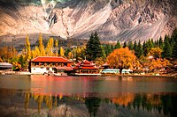
Three of the world's longest glaciers outside the polar regions are found in Gilgit-Baltistan: the Biafo Glacier, the Baltoro Glacier, and the Batura Glacier. There are, in addition, several high-altitude lakes in Gilgit-Baltistan:
- Sheosar Lake in the Deosai Plains, skardu
- Naltar lakes in the Naltar Valley, Gilgit
- Satpara Tso Lake in Skardu, Baltistan
- Katzura Tso Lake in Skardu, Baltistan
- Zharba Tso Lake in Shigar, Baltistan
- Phoroq Tso Lake in Skardu, Baltistan
- Lake Kharfak in Gangche, Baltistan
- Byarsa Tso Lake in Gultari, Astore
- Borith Lake in Gojal, upper Hunza, Gilgit
- Rama Lake near Astore
- Rush Lake near Nagar, Gilgit
- Kromber Lake at Kromber Pass Ishkoman Valley, Ghizer District
- Barodaroksh Lake in Bar Valley, Nagar
- Ghorashi Lake in Ghandus Valley, Kharmang
The Deosai Plains, are located above the tree line and constitute the second-highest plateau in the world at 4,115 metres (14,500 feet) after Tibet. The plateau lies east of Astore, south of Skardu and west of Ladakh. The area was declared as a national park in 1993. The Deosai Plains cover an area of almost 5,000 square kilometres (1,900 sq mi). For over half the year (between September and May), Deosai is snow-bound and cut off from rest of Astore and Baltistan in winters. The village of Deosai lies close to Chilum chokki and is connected with the Kargil district of Ladakh through an all-weather road.
-
 Satpara Lake, Skardu, in 2002
 -
 Upper Kachura Lake
 -
 A boat in AttaAbad lake
 -
 Shangrila Lake, Skardu


Rock art and petroglyphs
There are more than 50,000 pieces of rock art (petroglyphs) and inscriptions all along the Karakoram Highway in Gilgit-Baltistan, concentrated at ten major sites between Hunza and Shatial. The carvings were left by invaders, traders, and pilgrims who passed along the trade route, as well as by locals. The earliest date back to between 5000 and 1000 BCE, showing single animals, triangular men and hunting scenes in which the animals are larger than the hunters. These carvings were pecked into the rock with stone tools and are covered with a thick patina that proves their age.
The ethnologist Karl Jettmar has pieced together the history of the area from inscriptions and recorded his findings in Rock Carvings and Inscriptions in the Northern Areas of Pakistan[93] and the later-released Between Gandhara and the Silk Roads — Rock Carvings Along the Karakoram Highway.[94] Many of these carvings and inscriptions will be inundated and/or destroyed when the planned Basha-Diamir dam is built and the Karakoram Highway is widened.
Climate
The climate of Gilgit-Baltistan varies from region to region, surrounding mountain ranges creates sharp variations in weather. The eastern part has the moist zone of the western Himalayas, but going toward Karakoram and Hindu Kush, the climate dries considerably.[95]
There are towns like Gilgit and Chilas that are very hot during the day in summer yet cold at night and valleys like Astore, Khaplu, Yasin, Hunza, and Nagar, where the temperatures are cold even in summer.[96]
Economy and resources

The economy of the region is primarily based on a traditional route of trade, the historic Silk Road. The China Trade Organization forum led the people of the area to actively invest and learn modern trade know-how from its Chinese neighbor Xinjiang. Later, the establishment of a chamber of commerce and the Sust dry port (in Gojal Hunza) are milestones. The rest of the economy is shouldered by mainly agriculture and tourism. Agricultural products are wheat, corn (maize), barley, and fruits. Tourism is mostly in trekking and mountaineering, and this industry is growing in importance.[97][98]
In early September 2009, Pakistan signed an agreement with the People's Republic of China for a major energy project in Gilgit-Baltistan which includes the construction of a 7,000-megawatt dam at Bunji in the Astore District.[99]
Mountaineering


Gilgit-Baltistan is home to more than 20 peaks of over 20,000 feet (6,100 m), including K-2 the second highest mountain on Earth.[101] Other well known peaks include Masherbrum (also known as K1), Broad Peak, Hidden Peak, Gasherbrum II, Gasherbrum IV, and Chogolisa, situated in Khaplu Valley. The following peaks have so far been scaled by various expeditions:
| Name of Peak | Photos | Height | Date of Conquest | Location |
|---|---|---|---|---|
| 1.K-2 | |
(28,250Ft) | 31 Jul 1954 | Karakoram |
| 2. Nanga Parbat |  |
(26,660 Ft) | 3 Jul 1953 | Himalaya |
| 3. Gasherbrum I |  |
(26,360Ft) | 7 Jul 1956 | Karakoram |
| 4. Broad Peak |  |
(26,550Ft) | 9 Jun 1957 | Karakoram |
| 5. Muztagh Tower |  |
(23,800Ft) | 6 Aug 1956 | Karakoram |
| 6. Gasherbrum II |
|
(26,120Ft) | 4 Jul 1958 | Karakoram |
| 7. Hidden Peak |  |
(26,470Ft) | 4 Jul 1957 | Karakoram |
| 8. Khunyang Chhish |  |
(25,761 Ft) | 4 July 1971 | Karakoram |
| 9. Masherbrum |  |
(25,659 Ft) | 4 Aug 1960 | Karakoram |
| 10. Saltoro Kangri |  |
(25,400Ft) | 4 June 1962 | Karakoram |
| 11. Chogolisa | 
|
(25,148 Ft) | 4 Aug 1963 | Karakoram |
Transport
Before 1978, Gilgit-Baltistan was cut off from the rest of the Pakistan and the world due to the harsh terrain and the lack of accessible roads. All of the roads to the south opened toward the Pakistan-administered state of Azad Kashmir and to the southeast toward the present-day Indian-administered Jammu and Kashmir. During the summer, people could walk across the mountain passes to travel to Rawalpindi. The fastest way to travel was by air, but air travel was accessible only to a few privileged local people and to Pakistani military and civilian officials. Then, with the assistance of the Chinese government, Pakistan began construction of the Karakoram Highway (KKH), which was completed in 1978.
The Karakoram Highway connects Islamabad to Gilgit and Skardu, which are the two major hubs for mountaineering expeditions in Gilgit-Baltistan. The journey from Rawalpindi/Islamabad to Gilgit takes approximately 20 to 24 hours. Landslides on the Karakoram Highway are very common. The Karakoram Highway connects Gilgit to Tashkurgan Town, Kashgar, China via Sust, the customs and health-inspection post on the Gilgit-Baltistan side, and the Khunjerab Pass, the highest paved international border crossing in the world at 4,693 metres (15,397 ft).
Northern Areas Transport Corporation (NATCO) offers bus and jeep transport service to the two hubs and several other popular destinations, lakes, and glaciers in the area.

In March 2006, the respective governments announced that, commencing on 1 June 2006, a thrice-weekly bus service would begin across the boundary from Gilgit to Kashgar and road-widening work would begin on 600 kilometres (370 mi) of the Karakoram Highway. There would also be one daily bus in each direction between the Sust and Taxkorgan border areas of the two political entities.[102]
Pakistan International Airlines used to fly a Fokker F27 Friendship daily between Gilgit Airport and Benazir Bhutto International Airport. The flying time was approximately 50 minutes, and the flight was one of the most scenic in the world, as its route passed over Nanga Parbat, a mountain whose peak is higher than the aircraft's cruising altitude. However, the Fokker F27 was retired after a crash at Multan in 2006. Currently, flights are being operated by PIA to Gilgit on the brand-new ATR 42-500, which was purchased in 2006. With the new plane, the cancellation of flights is much less frequent. Pakistan International Airlines also offers regular flights of a Boeing 737 between Skardu and Islamabad. All flights are subject to weather clearance; in winter, flights are often delayed by several days.
A railway through the region has been proposed; see Khunjerab Railway for details.
Population
Demographics
At the last census (1998), the population of Gilgit-Baltistan was 870,347.[103] Approximately 14% of the population was urban.[104] The estimated population of Gilgit-Baltistan in 2013 was over 2 million. The population of Gilgit-Baltistan consists of many diverse linguistic, ethnic, and religious sects, due in part to the many isolated valleys separated by some of the world's highest mountains. The ethnic groups include Shins, Yashkuns, Kashmiris, Kashgaris, Pamiris, Pathans, and Kohistanis.[105] A significant number of people from Gilgit-Baltistan are residing in other parts of Pakistan, mainly in Punjab and Karachi. The literacy rate of Gilgit-Baltistan is approximately 72%.
Languages
Gilgit-Baltistan is a multilingual region where Urdu being a national and official language serves as the lingua franca for inter ethnic communications. English is co-official and also used in education, while Arabic is used for religious purposes. The table below shows a break up of Gilgit-Baltistan first language speakers.
| Rank | Language | Detail[106][107][108][109][110][111][112][113] |
|---|---|---|
| 1 | Shina | It is a Dardic language spoken by the majority in six Tehsils (Gilgit, Diamir/Chilas, Darel/Tangir, Astore, Puniyal/Gahkuch and Rondu). |
| 2 | Balti | It is spoken by majority in five Tehsils (Skardu/Shigar, Kharmang, Gultari, Khaplu and Mashabrum). It is from the Tibetan language family and has Urdu borrowings. |
| 3 | Burushaski | It is spoken by majority in four Tehsils (Nagar 1, Hunza/Aliabad, Nagar II, and Yasin). It is a language isolate that has borrowed considerable Urdu vocabulary. |
| 4 | Khowar | It is spoken by majority in two Tehsils (Gupis and Ishkomen but also spoken in Yasin and Puniyal/Gahkuch Tehsils). Like Shina, it is a Dardic language. |
| 5 | Wakhi | It is spoken by majority of people in Gojal Tehsil of Hunza. But it is also spoken in Ishkomen and Yasin Tehsils of District Ghizer. It is classified as eastern Iranian/ Pamiri language. |
| Others | Pashto, Kashmiri, Domaaki (spoken by musician clans in the region) and Gojri languages are also spoken by a significant population of the region. |
Religion
The population of Gilgit-Baltistan is Muslim, with the Shia sect being predominant. Gilgit-Baltistan is the only Shia majority area in Sunni majority Pakistan.[115] People in the Skardu district are mostly Shia, while Diamir and Astore districts have Sunni majorities. Ghanche has a Noorbakhshi population and Ghizar has an Ismaili (Shia) majority.[116] The populations in Gilgit, Hunza and Nagar districts are composed of a mix of all of these sects.[114] In 1948, the Shias and Ismailis constituted about 85% of the population. The proportion was brought down by General Zia ul-Haq through a conscious policy of demographic change by encouraging the migration of Sunnis from other provinces and the Federally Administered Tribal Areas. The policy is said to have been motivated by a desire to counter the growing sectarian consciousness of the Shias after the Iranian Revolution in 1979.[117]
Culture


Gilgit-Baltistan is home to diversified cultures, ethnic groups, languages and backgrounds.[118] Major cultural events include the Shandoor Polo Festival, Babusar Polo Festival and Jashn-e-Baharan or the Harvest Time Festival (Navroz).[118] Traditional dances include: Old Man Dance in which more than one person wears old-style dresses; Cow Boy Dance (Payaloo) in which a person wears old style dress, long leather shoes and holds a stick in hand and the Sword Dance in which the participants show taking one sword in right and shield in left. One to six participants can dance in pairs.
Sports

Many types of sports are in currency, throughout the region, but most popular of them is Polo.[119][120] Almost every bigger valley has a polo ground, polo matches in such grounds attract locals as well as foreigners visitors during summer season. One of such polo tournament is held in Shandur each year and polo teams of Glgit with Chitral participates.[121] Though very internationally unlikely, but even For some local historians like Hassan Hasrat from skardu and for some national writers like Ahmed Hasan Dani it was originated in same region.[122] for testimonies they present the Epic of King Gesar of balti version where king gesar started polo by killing his step son and hit head of cadaver with a stick thus started the game[123] they also held that the very simple rules of local polo game also testifies its primitiveness. The English word Polo has balti origin, that is spoken in same region, dates back to the 19th century which means ball.[124][125]
Other popular sports are Football, Cricket, Volleyball (mostly play in winters) and other minor local sports. with growing facilities and particular local geography Climbing, trekking and other similar sports are also getting popularity. Samina Baig from Hunza valley is the only Pakistani woman and the third Pakistani to climb Mount Everest and also the youngest Muslim woman to climb Everest, having done so at the age of 21 while Hassan Sadpara from Skardu valley is the first Pakistani to have climbed six eight-thousanders including the world's highest peak Everest (8848m) besides K2 (8611m), Gasherbrum I (8080m), Gasherbrum II (8034m), Nanga Parbat (8126 m), Broad Peak (8051m).
See also
Notes
- ^ He mentions twice a people called Dadikai, first along with the Gandarioi, and again in the catalogue of king Xerxes's army invading Greece. Herodotus also mentions the gold-digging ants of Central Asia.
- ^ In the 1st century, Pliny repeats that the Dards were great producers of gold.
- ^ Ptolemy situates the Daradrai on the upper reaches of the Indus
References
- ^ a b c d Weightman, Barbara A. (2 December 2005). Dragons and Tigers: A Geography of South, East, and Southeast Asia (2nd ed.). John Wiley & Sons. p. 193. ISBN 978-0-471-63084-5.
- ^ a b c d Shahid Javed Burki 2015.
- ^ "Skardu". Skardu. Retrieved 16 July 2015.
{{cite web}}: Italic or bold markup not allowed in:|website=(help) - ^ "Pir Karam Ali Shah appointed GB Governor". The News. 2011-01-26. Retrieved 2011-01-28.
- ^ "In the saddle: New CM has a vision for Gilgit-Baltistan". The Express Tribune. 30 June 2015. Retrieved 16 July 2015.
{{cite news}}: Italic or bold markup not allowed in:|publisher=(help) - ^ a b "UNPO: Gilgit Baltistan: Impact Of Climate Change On Biodiversity". unpo.org. Retrieved 20 June 2016.
- ^ Legislative Assembly will have directly elected 24 members, besides six women and three technocrats. "Gilgit Baltistan: New Pakistani Package or Governor Rule" 3 September 2009, The Unrepresented Nations and Peoples Organization (UNPO)
- ^ a b c "Symbols of Gilgit-Baltistan". knowpakistan.gov.in. Retrieved 14 August 2013.
- ^ a b c "Gilgit-Baltistan Key Indicators" (PDF). Retrieved 14 August 2013.
- ^ Hinman, Bonnie (15 September 2011), We Visit Pakistan, Mitchell Lane Publishers, Inc., p. 41, ISBN 978-1-61228-103-2
- ^ Gilgit-Baltistan: Disputed or victim of Kashmir dispute?
- ^ The Myth of Gilgit-Baltistan's Linkage with Jammu & Kashmir
- ^ In Pakistan-controlled Kashmir, residents see experiment with autonomy as 'illusion', Christian Science Monitor, 28 November 2011
- ^ Sering, Senge H., "Constitutional Impasse in Gilgit-Baltistan (Jammu and Kashmir): The Fallout", Strategic Analysis, 34 (3): 354–358, doi:10.1080/09700161003658998,
Instead of the chief minister, the order rests all administrative, political and judicial authority with the governor, which makes him the supreme authority and portrays the assembly as a toothless tiger. At best, the order legitimises Pakistan's occupation and claims political rights for the locals without changing the power equation.
{{citation}}: Unknown parameter|subscription=ignored (|url-access=suggested) (help) - ^ a b c Singh, Pallavi (29 April 2010). "Gilgit-Baltistan: A question of autonomy". The Indian Express. Retrieved 27 December 2016.
But it falls short of the main demand of the people of Gilgit- Baltistan for a constitutional status to the region as a fifth province and for Pakistani citizenship to its people.
- ^ a b c Shigri, Manzar (12 November 2009). "Pakistan's disputed Northern Areas go to polls". Reuters. Retrieved 27 December 2016.
Many of the 1.5 million people of Gilgit-Baltistan oppose integration into Kashmir and want their area to be merged into Pakistan and declared a separate province.
- ^ a b c d Schofield, Victoria (2000). Kashmir in Conflict: India, Pakistan, and the Unending War. I.B. Tauris. pp. 180–181.
- ^ a b "Episode 1: A Window to Gilgit-Baltistan".
- ^ By Ian Hibbert. Alpamayo to Everest: It's Not About the Summit.
- ^ Petech, Luciano (1977). The Kingdom of Ladakh c. 950–1842 A.D. Istituto Italiano per il media ed Estremo Oriente.
- ^ By Rafi U. Samad. The Grandeur of Gandhara: The Ancient Buddhist Civilization of the Swat ...
- ^ "Baltistan". tibetan incyclopedia.
- ^ August Hermann Francke. Antiquities of Indian Tibet, Part 1.
- ^ René Grousset. The Rise and Splendour of the Chinese Empire. p. 160.
- ^ By Angela Falco Howard. Chinese Sculpture. p. 313.
- ^ Robert W. Bradnock (1994). South Asian Handbook. Trade & Travel Publications. p. 1168.
- ^ By Henry Osmaston, Philip Denwood. Recent Research on Ladakh 4 & 5: Proceedings of the Fourth and Fifth ...
- ^ P. Stobdan,. The last colony: Muzaffarabad-Gilgit-Baltistan.
{{cite book}}: CS1 maint: extra punctuation (link) - ^ International Council on Archives, National Archives of Pakistan. Guide to the Sources of Asian History: National archives, Provincial archives, District archives.
- ^ Philippe Fabry, Yousuf Shahid. Wandering with the Indus.
- ^ Francke, August Hermann (1907), A History of Western Tibet: One of the Unknown Empires, Asian Educational Services, pp. 164–, ISBN 978-81-206-1043-9
- ^ By S.R. Bakshi. Kashmir: History and People.
- ^ By Sanjeev Kumar Bhasin. Amazing Land Ladakh: Places, People, and Culture.
- ^ By Shridhar Kaul, H. N. Kaul. Ladakh Through the Ages, Towards a New Identity.
- ^ Varieties of Secularism in Asia: Anthropological Explorations of Religion ...
- ^ By Peter Berger, Frank Heidemann. The Modern Anthropology of India: Ethnography, Themes and Theory.
- ^ Yaqoob Khan Bangash (2010) Three Forgotten Accessions: Gilgit, Hunza and Nagar, The Journal of Imperial and Commonwealth History, 38:1, 125-126, DOI: 10.1080/03086530903538269
- ^ "Quick guide: Kashmir dispute". BBC News. 29 June 2006. Retrieved 14 June 2009.
- ^ "Who changed the face of '47 war?". Times of India. 14 August 2005. Retrieved 14 August 2005.
- ^ Bangash 2010, p. 128: [Ghansara Singh] wrote to the prime minister of Kashmir: 'in case the State accedes to the Indian Union, the Gilgit province will go to Pakistan', but no action was taken on it, and in fact Srinagar never replied to any of his messages.
- ^ Snedden, Christopher (2013). Kashmir-The Untold Story. HarperCollins Publishers India. ISBN 9789350298985.
Similarly, Muslims in Western Jammu Province, particularly in Poonch, many of whom had martial capabilities, and Muslims in the Frontier Districts Province strongly wanted J&K to join Pakistan.
- ^ Schofield 2003, pp. 63–64.
- ^ Bangash 2010
- ^ Bangash 2010, p. 133.
- ^ Yaqoob Khan Bangash (2010) Three Forgotten Accessions: Gilgit, Hunza and Nagar, The Journal of Imperial and Commonwealth History, 38:1, 132, DOI: 10.1080/03086530903538269
- ^ Yaqoob Khan Bangash (2010) Three Forgotten Accessions: Gilgit, Hunza and Nagar, The Journal of Imperial and Commonwealth History, 38:1, 137, DOI: 10.1080/03086530903538269
- ^ Bangash, Yaqoob Khan (9 January 2016). "Gilgit-Baltistan—part of Pakistan by choice". The Express Tribune. Retrieved 5 January 2017.
Nearly 70 years ago, the people of the Gilgit Wazarat revolted and joined Pakistan of their own free will, as did those belonging to the territories of Chilas, Koh Ghizr, Ishkoman, Yasin and Punial; the princely states of Hunza and Nagar also acceded to Pakistan. Hence, the time has come to acknowledge and respect their choice of being full-fledged citizens of Pakistan.
- ^ Chitralekha Zutshi (2004). Languages of Belonging: Islam, Regional Identity, and the Making of Kashmir. C. Hurst & Co. Publishers. pp. 309–. ISBN 978-1-85065-700-2.
- ^ a b c Ershad Mahmud 2008, p. 24.
- ^ Sokefeld, Martin (November 2005), "From Colonialism to Postcolonial Colonialism: Changing Modes of Domination in the Northern Areas of Pakistan", The Journal of Asian Studies, 64 (4): 939–973, doi:10.1017/S0021911805002287
- ^ Schofield 2003, p. 66.
- ^ Bajwa, Farooq (2013), From Kutch to Tashkent: The Indo-Pakistan War of 1965, Hurst Publishers, pp. 22–24, ISBN 978-1-84904-230-7
- ^ Bose, Tapan K. (2004). Raṇabīra Samāddāra (ed.). Peace Studies: An Introduction To the Concept, Scope, and Themes. Sage. p. 324. ISBN 978-0-7619-9660-6.
- ^ Varshney, Ashutosh (1992), "Three Compromised Nationalisms: Why Kashmir has been a Problem" (PDF), in Raju G. C. Thomas (ed.), Perspectives on Kashmir: the roots of conflict in South Asia, Westview Press, p. 212, ISBN 978-0-8133-8343-9
- ^ Warikoo, Kulbhushan (2008). Himalayan Frontiers of India: Historical, Geo-Political and Strategic Perspectives (1st ed.). Routledge. p. 78. ISBN 978-0-415-46839-8.
- ^ Snedden 2013, p. 91. sfn error: multiple targets (2×): CITEREFSnedden2013 (help)
- ^ Sahni 2009, p. 73.
- ^ International Crisis Group 2007, p. 5.
- ^ Bansal 2007, p. 60.
- ^ a b From the fringes: Gilgit-Baltistanis silently observe elections, Dawn, 1 May 2013.
- ^ Priyanka Singh 2013, p. 16.
- ^ Raman 2009, p. 87.
- ^ Behera 2007, p. 180.
- ^ a b c Ershad Mahmud 2008, p. 25.
- ^ Chellaney, Brahma (2011). Water: Asia's New Battleground. Georgetown University Press. p. 249. ISBN 978-1-58901-771-9.
- ^ "China's Interests in Shaksgam Valley". Sharnoff's Global Views.
- ^ International Crisis Group 2007, pp. 8–9.
- ^ Ershad Mahmud 2008, pp. 28–29.
- ^ Ershad Mahmud 2008, p. 25-26.
- ^ Ershad Mahmud 2008, p. 27.
- ^ Ershad Mahmud 2008, pp. 26–27.
- ^ Ershad Mahmud 2008, p. 32.
- ^ Ershad Mahmud, Gilgit-Baltistan: A province or not, The News on Sunday, 24 January 2016.
- ^ Antia Mato Bouzas (2012) Mixed Legacies in Contested Borderlands: Skardu and the Kashmir Dispute, Geopolitics, 17:4, 874, DOI: 10.1080/14650045.2012.660577
- ^ Naqash, Tariq (9 July 2015). "AJK opposes giving provincial status to GB". Dawn. Retrieved 27 December 2016.
MUZAFFARABAD: Azad Jammu and Kashmir (AJK) Prime Minister Chaudhry Abdul Majeed warned the federal government on Wednesday against any attempt to convert Gilgit-Baltistan into a province of Pakistan.
- ^ Dividing governance: Three new districts notified in G-B, The Express Tribune, 5 February 2017.
- ^ "Pakistan abolished State Subject Rule in Gilgit-Baltistan in 1974-Those Troubled Peaks".
- ^ "GB's aspirations".
- ^ a b "Gilgit-Baltistan: A question of autonomy". Indian Express. September 21, 2009. Retrieved 2013-02-23.
- ^ Shigri, Manzar. "Pakistan's disputed Northern Areas go to polls". Reuters.com. Retrieved 2013-02-23.
- ^ "Pakistani president signs Gilgit-Baltistan autonomy order _English_Xinhua". News.xinhuanet.com. 2009-09-07. Retrieved 2010-06-05.
- ^ "Gilgit-Baltistan autonomy". Dawn. 2009-09-09. Retrieved 2013-02-23.
- ^ "Skardu.pk".
- ^ "Gilgit-Baltistan part of Jammu and Kashmir: India". Times of India. Press Trust of India. March 10, 2006.
- ^ "Gilgit-Baltistan divided into three divisions - The Express Tribune". tribune.com.pk. 1 February 2012. Retrieved 20 June 2016.
- ^ "Mehdi Shah announces formation of 2 Divisions, 2 sub-divisions and 4 Tehsils in Gilgit – Baltistan - PAMIR TIMES - Voices of the Mountain Communities". pamirtimes.net. Retrieved 20 June 2016.
- ^ "Wrangling over new Astore district headquarters". Dawn Newspaper Internet Edition. Retrieved 2006-11-17.
- ^ a b "Gilgit-Baltistan: Districts & Places - Population Statistics in Maps and Charts". citypopulation.de. Retrieved 20 June 2016.
- ^ Shafqat Hussain 2015.
- ^ "Pak population increased by 46.9% between 1998 and 2011". The Times of India. Retrieved 27 January 2016.
- ^ "Statistical Booklet on Gilgit-Baltistan" (PDF). Government of Gilgit-Baltistan, 2014. Retrieved 2014-12-11.
- ^ Tropical Bryology
- ^ "Rock Carvings and Inscriptions along the Karakorum Highway (Pakistan) –- a brief introduction".
- ^ "Between gandhara and the silk roads".
- ^ WWF Pakistan. "Climate of Gilgit-Baltistan (formerly Northern Areas)". WWF Pakistan. Retrieved 2009-06-11.
- ^ http://gilgit-baltistan.com/weather/
- ^ Encyclopædia Britannica. "Baltistan (region, Northern Areas, Kashmir, Pakistan) – Britannica Online Encyclopedia". Britannica.com. Retrieved 2010-06-05.
- ^ Encyclopædia Britannica. "Gilgit (Kashmir region, Indian subcontinent) – Britannica Online Encyclopedia". Britannica.com. Retrieved 2010-06-05.
- ^ "Pakistan | Gilgit-Baltistan autonomy". Dawn.Com. 2009-09-09. Archived from the original on September 12, 2009. Retrieved 2010-06-05.
{{cite web}}: Unknown parameter|deadurl=ignored (|url-status=suggested) (help) - ^ "Welcome to PAKISTANALPINE.COM". pakistanalpine.com. Retrieved 20 June 2016.
- ^ Baltistan in History, Banat Gul Afridi
- ^ "Kashgar-Gilgit bus service planned". Dawn Newspaper Internet Edition. Archived from the original on 2009-02-15. Retrieved 2006-11-17.
{{cite web}}: Unknown parameter|deadurl=ignored (|url-status=suggested) (help) - ^ "Administrative Divisions and Population of the Northern Areas (1998)". Northern Areas Management Information System. Retrieved 2006-11-17.
- ^ "Population, poverty and environment" (PDF). Northern Areas Strategy for Sustainable Development. Retrieved 2006-11-17.
- ^ "Pakistan's Fragile Foundations". Council on Foreign Relations. 2009-03-12.
- ^ "International Programs".
- ^ "Khowar - South Asia Blog".
- ^ Katy, Gardner (1999). Leif O. Manger (ed.). Muslim diversity: local Islam in global contexts. Routledge. p. 64. ISBN 978-0-7007-1104-8.
- ^ "Election : Gilgit-Baltistan - 8 Languages, 10 Ethnic Groups, 6 Districts, 4 Religious sects - 24 National Assembly Seats ! - GILGIT BALTISTAN (GB)".
- ^ Colin P. Masica (1993), The Indo-Aryan Languages, Cambridge University Press, ISBN 0-521-29944-6,
... he agreed with Grierson in seeing Rajasthani influence on Pahari and 'Dardic' influence on (or under) the whole Northwestern group + Pahari [...] Sindhi and including 'Lahnda', Dardic, Romany and West Pahari, there has been a tendency to transfer of 'r' from medial clusters to a position after the initial consonant ...
- ^ S. Munshi, Keith Brown (editor), Sarah Ogilvie (editor) (2008), Concise encyclopedia of languages of the world, Elsevier, ISBN 0-08-087774-5, retrieved 2010-05-11,
Based on historical sub-grouping approximations and geographical distribution, Bashir (2003) provides six sub-groups of the Dardic languages ...
{{citation}}:|author=has generic name (help)CS1 maint: multiple names: authors list (link) - ^ Amar Nath Malik (1995), The phonology and morphology of Panjabi, Munshiram Manoharlal Publishers, ISBN 81-215-0644-1, retrieved 2010-05-26,
... drakhat 'tree' ...
- ^ electricpulp.com. "DARDESTĀN".
- ^ a b "Sectarian conflict in Gilgit-Baltistan" (PDF). pildat. May 2011. Retrieved 24 June 2013.
- ^ Naumann & Fischer-Tahir 2013, p. 87.
- ^ Spencer C. Tucker & Priscilla Roberts 2008, p. 917.
- ^ Raman 2009, p. 79.
- ^ a b "Culture and Heritage of Gilgit". visitgilgitbaltistan.gov.pk. Gov.Pk. Retrieved 23 April 2015.
- ^ Amanullah Khan. Gilgit Baltistan, a disputed territory or a fossil of intrigues?.
- ^ F. M. Khan. The story of Gilgit, Baltistan and Chitral: a short history of two millenniums AD 7-1999.
- ^ edited by James H. Mills. Subaltern Sports: Politics and Sport in South Asia.
{{cite book}}:|last1=has generic name (help) - ^ Filippo De Filippi, Luigi Amedeo di Savoia (duca degli Abruzzi). Karakoram and Western Himalaya 1909.
- ^ edited by Edward Delmar Morgan. Transactions of the Ninth International Congress of Orientalists ..., Volume 2.
{{cite book}}:|last1=has generic name (help) - ^ Israr-ud-Din. Proceedings of the Third International Hindu Kush Cultural Conference. Oxford University Press, 2008 - Reference - 540 pages.
- ^ Banat Gul Afridi. Baltistan in History.
Bibliography
- Pakistan Trekking Guide, by Isobel and Ben Shaw, 1993.
- Wang, S. (2004). "Of Rivers and Human Rights: the Northern Areas, Pakistan's Forgotten Colony in Jammu and Kashmir". International Journal on Minority and Group Rights. 11: 187. doi:10.1163/1571811041631272.
- Matthias Naumann; Andrea Fischer-Tahir (12 January 2013), Peripheralization: The Making of Spatial Dependencies and Social Injustice, Springer Science & Business Media, ISBN 978-3-531-19018-1
- Spencer C. Tucker; Priscilla Roberts (12 May 2008), The Encyclopedia of the Arab-Israeli Conflict: A Political, Social, and Military History [4 volumes]: A Political, Social, and Military History, ABC-CLIO, ISBN 978-1-85109-842-2
{{citation}}: CS1 maint: ref duplicates default (link) - Bangash, Yaqoob Khan (2010), "Three Forgotten Accessions: Gilgit, Hunza and Nagar", The Journal of Imperial and Commonwealth History, 38 (1): 117–143, doi:10.1080/03086530903538269
{{citation}}: Unknown parameter|subscription=ignored (|url-access=suggested) (help) - Bansal, Alok (2007), "In Pursuit of Forced Assimilation: Sectarian and Ethnic Marginalisation in Gilgit-Baltistan", India Quarterly: A Journal of International Affairs, 63 (2): 56–80, doi:10.1177/097492840706300203
{{citation}}: Unknown parameter|subscription=ignored (|url-access=suggested) (help) - Burki, Shahid Javed (2015), Historical Dictionary of Pakistan, Rowman & Littlefield, p. 228, ISBN 978-1-4422-4148-0
- Behera, Navnita Chadha (2007), Demystifying Kashmir, Pearson Education India, ISBN 81-317-0846-2
- Bouzas, Antia Mato (12 January 2013), "Securitization and Development as Modes of Peripheralization in North-Eastern Pakistan", in Matthias Naumann; Andrea Fischer-Tahir (eds.), Peripheralization: The Making of Spatial Dependencies and Social Injustice, Springer Science & Business Media, pp. 77–98, ISBN 978-3-531-19018-1
- Hussain, Shafqat (2015), Remoteness and Modernity: Transformation and Continuity in Northern Pakistan, Yale University Press, p. 14, ISBN 978-0-300-20555-8
- International Crisis Group (2007), Discord in Pakistan's Northern Areas (PDF), Brussels: International Crisis Group
{{citation}}: CS1 maint: ref duplicates default (link) - Mahmud, Ershad (2008), "The Gilgit-Baltistan Reforms Package 2007: Background, Phases and Analysis", Policy Perspectives, 5 (1): 23–40, JSTOR 42909184
- Raman, B. (2009), "The Northern Areas of Jammu and Kashmir", in K. Warikoo (ed.), Himalayan Frontiers of India: Historical, Geo-Political and Strategic Perspectives, Routledge, pp. 78–88, ISBN 978-1-134-03294-5
- Schofield, Victoria (2003) [First published in 2000], Kashmir in Conflict, London and New York: I. B. Taurus & Co, ISBN 1-86064-898-3
- Sahni, Sat Paul (2009), "The Ceasefire Line and Line of Control in Jammu and Kashmir: Evolution of a border", in K. Warikoo (ed.), Himalayan Frontiers of India: Historical, Geo-Political and Strategic Perspectives, Routledge, pp. 67–77, ISBN 978-1-134-03294-5
- Singh, Priyanka (2013), Gilgit Baltistan: Between Hope and Despair, New Delhi: Institute for Defence Studies and Analyses, ISBN 978-93-82169-13-0
- Snedden, Christopher (2013) [first published as The Untold Story of the People of Azad Kashmir, 2012], Kashmir: The Unwritten History, HarperCollins India, ISBN 93-5029-898-8
External links
 Definitions from Wiktionary
 Media from Commons
 News from Wikinews
 Quotations from Wikiquote
 Texts from Wikisource
 Textbooks from Wikibooks
 Resources from Wikiversity
 Travel information from Wikivoyage
- Official Website of the Gilgit-Baltistan Council
- Official Website of the Government of Gilgit-Baltistan
- Official Tourism Website of the Government of Gilgit-Baltistan
- Official Website of Ministry of Kashmir & Gilgit-Baltistan
- Gilgit-Baltistan at Curlie
Places adjacent to Gilgit-Baltistan | ||||||||||||||||
|---|---|---|---|---|---|---|---|---|---|---|---|---|---|---|---|---|
| ||||||||||||||||
Capital: Gilgit | |
| Passes | |
| Valleys | |
| Cities and towns | |
| Rivers, glaciers and lakes |
|
| Architecture | |
| See also | |
| Provinces | ||
|---|---|---|
| Territories | ||
| Administrative regions | ||
See also: Former administrative units of Pakistan | ||