Paju: Difference between revisions
Appearance
Content deleted Content added
m r2.7.2) (Robot: Adding th:พาจู |
|||
| Line 40: | Line 40: | ||
==Administrative divisions== |
==Administrative divisions== |
||
Paju is divided as follows: |
Paju is divided as follows: |
||
| ⚫ | |||
* [http://dong.paju.go.kr/open_content/beopwon/ Beobwon-eup (법원읍)] |
* [http://dong.paju.go.kr/open_content/beopwon/ Beobwon-eup (법원읍)] |
||
* [http://dong.paju.go.kr/open_content/paju_01/ Paju-eup (파주읍)] |
* [http://dong.paju.go.kr/open_content/paju_01/ Paju-eup (파주읍)] |
||
| Line 54: | Line 53: | ||
** Jinseo-myeon (진서면) |
** Jinseo-myeon (진서면) |
||
** Jindong-myeon (진동면) |
** Jindong-myeon (진동면) |
||
| ⚫ | |||
* [http://www.k1cc.or.kr/ Geumchon1(il)-dong (금촌1동)] |
* [http://www.k1cc.or.kr/ Geumchon1(il)-dong (금촌1동)] |
||
** Maekgeum-dong (맥금동) |
** Maekgeum-dong (맥금동) |
||
Revision as of 04:39, 4 May 2012
Paju
파주 坡州 | |
|---|---|
| Korean transcription(s) | |
| • Hangul | 파주시 |
| • Hanja | 坡州市 |
| • Revised Romanization | Paju-si |
| • McCune-Reischauer | P'aju-si |
 | |
 | |
| Country | |
| Region | Sudogwon |
| Administrative divisions | 5 eup, 9 myeon, 2 dong |
| Area | |
| • Total | 672.56 km2 (259.68 sq mi) |
| Population (2012 Feb) | |
| • Total | 390,961 |
| • Density | 581.3/km2 (1,506/sq mi) |
| • Dialect | Seoul |
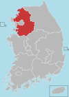
Paju is a city in Gyeonggi Province, South Korea. Paju was made a city in 1997; it had previously been a county (gun).[1]
The city is located just south of Panmunjeom on the 38th parallel. To defend the Korean capital, Seoul, many US and Korean army bases are set up in the city. In 2002, the northernmost Korean railway station, Dorasan, was opened. North Korean territory and Kaesong City can be seen from Mount Dora in the city. This city also includes such landmarks like the DMZ, the Jayuro Road of Freedom, the Tongilro Road of Unification or National Road No. 1. It is the city where the movie was taken by its name, starring by Lee Sun Gyun and Seo Woo.
Administrative divisions
Paju is divided as follows:
- Beobwon-eup (법원읍)
- Paju-eup (파주읍)
- Munsan-eup (문산읍)
- Jori-eup (조리읍)
- Wollong-myeon (월롱면)
- Papyeong-myeon (파평면)
- Jeokseong-myeon (적성면)
- Gwangtan-myeon (광탄면)
- Tanhyeon-myeon (탄현면)
- Gunnae-myeon (군내면)
- Jangdan-myeon (장단면)
- Jinseo-myeon (진서면)
- Jindong-myeon (진동면)
- Gyoha-dong (교하동)
- Geumchon1(il)-dong (금촌1동)
- Maekgeum-dong (맥금동)
- Yadong-dong (야동동)
- Geomsan-dong (검산동)
- Adong-dong (아동동)
- Geumchon-dong (금촌동 - 1)
- Geumchon2(ii)-dong (금촌2동)
- Geumneung-dong (금릉동)
- Geumchon-dong (금촌동 - 2)
US military bases
- Camp Bonifas & Camp Liberty-Bell (home to US/ROKA Joint Security Area)
- Multi-Purpose Live Fire Complex (MLFC), also called Rodriguez Range or Rodriguez Live Fire Complex
- Camp Edwards -closed
- Camp Garry Owen -closed
- Camp Giant -closed
- Camp Greaves -closed
- Camp Howze -closed
- Camp Semper Fidelis (home of 1st Provisional DMZ Police Co., 1st Marine Div. 1953-1956)
- Camp Stanton -closed
War Memorials
- Gloucester Valley Battle Monument ("Gloster Hill")
Prominent individuals
- Kim Young-moo, poet and scholar
- Ahn Jung-Hwan, professional footballer
- Kang Jiyoung, member of South Korea girl group Kara
- Kim Kwang Yeon, member of South Korean boy group LEDApple
Sister cities
Paju is twinned with the following places:[2]
- Coquitlam, Canada
- Cuenca, Spain
- Hadano, Japan
- Mudanjiang, China
- Pasadena, California
- Stellenbosch, South Africa
- Toowoomba, Australia
See also
References
- ^ Welcome to Paju City
- ^ "Sister cities of Paju". http://en.paju.go.kr. Retrieved 2 September 2010.
{{cite web}}: External link in|publisher=
External links
Wikimedia Commons has media related to Paju, Gyeonggi-do.

